Balcoon Wood

Wood, Forest in Ayrshire

Scotland

Balcoon Wood

River Stinchar Near Pinmore Bridge
River Stinchar Near Pinmore Bridge Credit: Iain Thompson

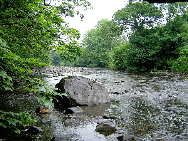
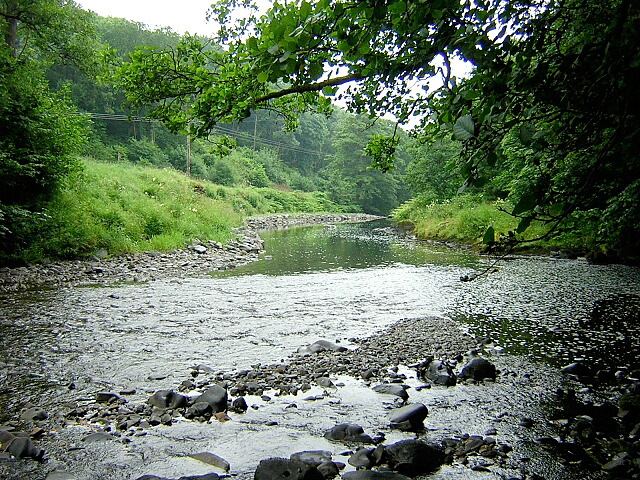
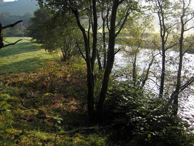
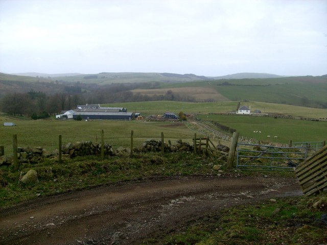
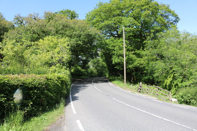
Balcoon Wood is a picturesque forest located in Ayrshire, Scotland. Spanning an area of approximately 100 acres, this enchanting wood is renowned for its natural beauty and diverse range of flora and fauna. Situated near the town of Ayr, Balcoon Wood serves as a popular destination for nature enthusiasts and hikers alike.

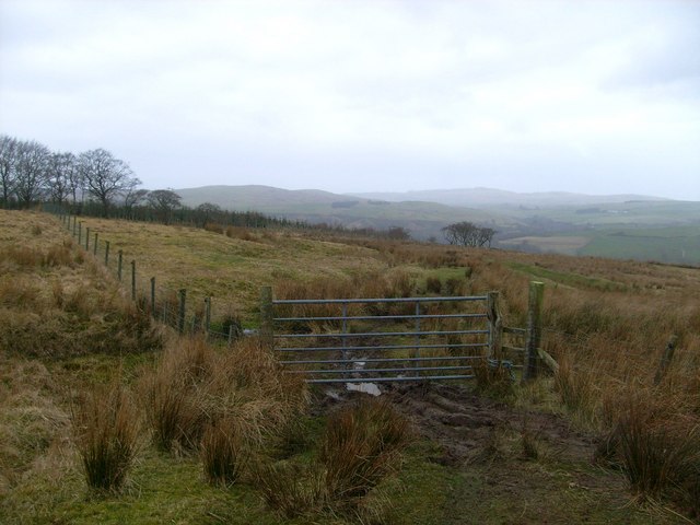
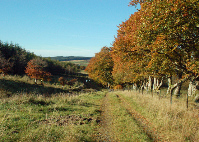
The wood features a well-maintained network of walking trails, allowing visitors to explore its lush greenery and discover its hidden treasures. The trails meander through ancient oak and beech trees, creating a serene and peaceful atmosphere. The wood is also home to a variety of wildlife, including deer, foxes, badgers, and a myriad of bird species, providing ample opportunities for wildlife spotting and birdwatching.

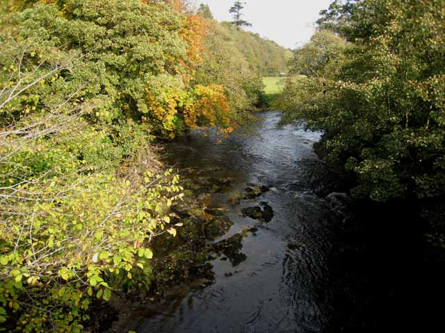
One of the highlights of Balcoon Wood is the presence of a small stream that runs through it. The babbling brook adds to the tranquility of the surroundings and provides a soothing soundtrack to accompany visitors on their walks. The wood is also known for its vibrant wildflower meadows, which burst into a riot of colors during the spring and summer months.

Balcoon Wood offers a welcome respite from the hustle and bustle of everyday life, providing a tranquil escape for those seeking solace in nature. Whether it's a leisurely stroll, a family picnic, or a more adventurous hike, this idyllic forest caters to a range of outdoor activities. With its natural charm and abundant wildlife, Balcoon Wood is a true gem of Ayrshire, inviting visitors to immerse themselves in its peaceful ambiance and discover the wonders of the natural world.

If you have any feedback on the listing, please let us know in the comments section below.

Balcoon Wood Images

Images are sourced within 2km of 55.178583/-4.8189763 or Grid Reference NX2090. Thanks to Geograph Open Source API. All images are credited.

River Stinchar Near Pinmore Bridge
By the banks of the River Stinchar, between Pinmore and Pinwherry
Viaduct at Holmhead, Pinmore On the Girvan to Stranraer railway. Seen from the A714 Girvan to Newton Stewart road.
Viaduct at Holmhead, Pinmore
On the Girvan to Stranraer railway. Seen from the A714 Girvan to Newton Stewart road.
River Stinchar from Pinmore Bridge
Pinmore Mains track
Pinmore Mains track
Gate above Pinmore Mains
Stinchar Valley Track A farm track at Pinmore Mains, viewed in late October with lovely autumn colours showing.
Stinchar Valley Track
A farm track at Pinmore Mains, viewed in late October with lovely autumn colours showing.
Entering High Glenbirnie Forest This track leaves Upper Glenburnie Wood and, according to the sign on the gate, enters High Glenbirnie Forest, which is shown on the Landranger Map but not the Explorer Map. The forest is on the right-hand side of this shot with the colourful beech trees giving some shelter to the fields.
Entering High Glenbirnie Forest
This track leaves Upper Glenburnie Wood and, according to the sign on the gate, enters High Glenbirnie Forest, which is shown on the Landranger Map but not the Explorer Map. The forest is on the right-hand side of this shot with the colourful beech trees giving some shelter to the fields.
Towards Upper Glenburnie Wood Upper Glenburnie Wood lies in the valley beyond the gate. High Glenbirnie Forest, which is shown on the Landranger Map but not the Explorer Map, is on the left-hand side of this shot with the colourful beech trees on the right giving some shelter to the fields.
Towards Upper Glenburnie Wood
Upper Glenburnie Wood lies in the valley beyond the gate. High Glenbirnie Forest, which is shown on the Landranger Map but not the Explorer Map, is on the left-hand side of this shot with the colourful beech trees on the right giving some shelter to the fields.
Old Milestone by the A714, north of Laggansarroch Bridge, Colmonell Parish By the A714, in parish of Colmonell (District), North of Daljarrock railway bridge, on straight opposite double metal field gate.

Inscription reads:- : GIRVAN / 7 : : BARRHILL / 5½ :

Surveyed

Milestone Society National ID: AYS_GVBH07
Old Milestone by the A714, north of Laggansarroch Bridge, Colmonell Parish
By the A714, in parish of Colmonell (District), North of Daljarrock railway bridge, on straight opposite double metal field gate. Inscription reads:- : GIRVAN / 7 : : BARRHILL / 5½ : Surveyed Milestone Society National ID: AYS_GVBH07
Pinmore Chapel Just off the A714.
Pinmore Chapel
Just off the A714.
Kinclair Viaduct, Pinmore At Holmhead, thanks to the Ayrshire Rivers Trust Website it's called Kinclair
Kinclair Viaduct, Pinmore
At Holmhead, thanks to the Ayrshire Rivers Trust Website it's called Kinclair
The A714 to Newton Stewart Via Pinwherry and Barrhill.
The A714 to Newton Stewart
Via Pinwherry and Barrhill.
The A714 to Girvan Via Pinmore, viewed from near Holmhead Farm.
The A714 to Girvan
Via Pinmore, viewed from near Holmhead Farm.
Pinmore Chapel Situated next to the A714.
Pinmore Chapel
Situated next to the A714.
Memorial at Pinmore Chapel Located just off the A714 at Holmhead Farm.
Memorial at Pinmore Chapel
Located just off the A714 at Holmhead Farm.
Pinmore Chapel Just off the A714 at Holmhead.
Pinmore Chapel
Just off the A714 at Holmhead.
Show me another place!

Balcoon Wood is located at Grid Ref: NX2090 (Lat: 55.178583, Lng: -4.8189763)

Unitary Authority: South Ayrshire

Police Authority: Ayrshire

What 3 Words

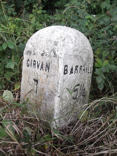
///students.drain.spouse. Near Girvan, South Ayrshire

Related Wikis

Pinmore railway station

Pinmore railway station served the hamlet of Pinmore, South Ayrshire, Scotland from 1877 to 1965 on the Girvan and Portpatrick Junction Railway. ��2�...

Pinwherry railway station

Pinwherry railway station served the village of Pinwherry, South Ayrshire, Scotland from 1887 to 1965 on the Girvan and Portpatrick Junction Railway....

Pinwherry

Pinwherry is a hamlet in the civil parish of Colmonell, in the council area of South Ayrshire, Scotland. It is 8 miles south of Girvan. In 1961 it had...

Ardmillan Castle

Ardmillan Castle is a ruinous Scottish castle dating from the late 16th century. It lies on the A77 on the edge of the Firth of Clyde south of Girvan....

Nearby Amenities

Located within 500m of 55.178583,-4.8189763
Power: pole
Lat/Long: 55.1745912/-4.8194973
Power: pole
Lat/Long: 55.1753403/-4.819775
Power: pole
Lat/Long: 55.1761158/-4.8200759
Power: pole
Lat/Long: 55.1771/-4.8204041
Power: pole
Lat/Long: 55.1780057/-4.820328
Power: pole
Lat/Long: 55.1786187/-4.8202719
Power: pole
Lat/Long: 55.1791608/-4.8195589
Power: pole
Lat/Long: 55.1798446/-4.8192866
Power: pole
Lat/Long: 55.1803135/-4.820348
Power: pole
Lat/Long: 55.1807778/-4.8214215
Power: pole
Lat/Long: 55.1812535/-4.8224709
Power: pole
Lat/Long: 55.1814982/-4.8230117
Power: pole
Lat/Long: 55.1819579/-4.8233361
Asselfoot
Place: locality
Lat/Long: 55.1774074/-4.8197944
Power: pole
Lat/Long: 55.1830303/-4.8185992
Power: pole
Lat/Long: 55.1824544/-4.8185057
Power: pole
Lat/Long: 55.1815534/-4.8184798
Power: pole
Lat/Long: 55.18069/-4.8184045
Power: pole
Lat/Long: 55.1770512/-4.8132509
Power: pole
Lat/Long: 55.1775428/-4.8138651
Power: pole
Lat/Long: 55.1780253/-4.814474
Power: pole
Lat/Long: 55.1791816/-4.8158875
Power: pole
Lat/Long: 55.1797361/-4.8165232
Power: pole
Lat/Long: 55.1801726/-4.8174432
Power: pole
Lat/Long: 55.1742857/-4.8193875
The data included in this document is from www.openstreetmap.org. The data is made available under ODbL.

Have you been to Balcoon Wood?

Leave your review of Balcoon Wood below (or comments, questions and feedback).