Commoncraig Plantation
Wood, Forest in Renfrewshire
Scotland
Commoncraig Plantation

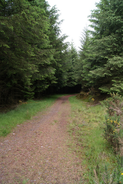
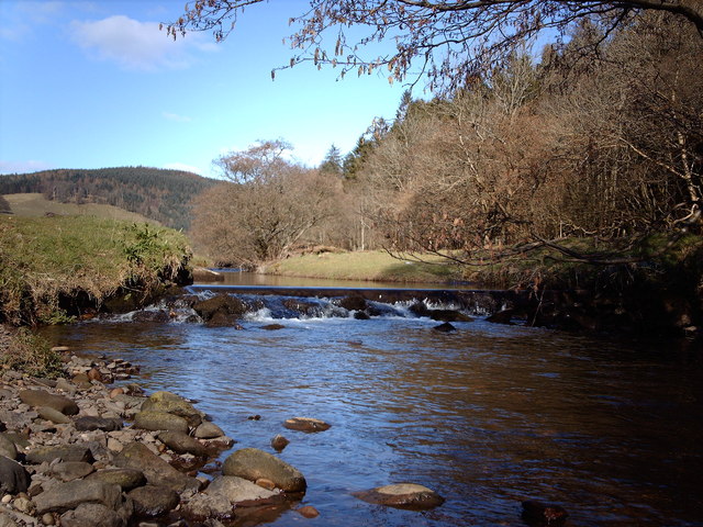
Commoncraig Plantation is a woodland area located in Renfrewshire, Scotland. Situated near the village of Bridge of Weir, it covers an extensive area of approximately 200 acres. The plantation is characterized by its diverse range of tree species, making it an important site for conservation and recreation.
The woodland is predominantly composed of native broadleaf trees such as oak, birch, and beech, which create a rich and vibrant habitat for a variety of wildlife. In addition to the native species, there are also sections of coniferous trees like Scots pine and Douglas fir, adding to the overall biodiversity of the plantation.
Commoncraig Plantation offers a range of recreational activities for visitors to enjoy. There are well-maintained footpaths that wind through the woodland, providing opportunities for walking, jogging, and cycling. The plantation is also a popular spot for birdwatching, as it attracts a wide array of bird species, including woodpeckers, owls, and various songbirds.
The woodland is managed by the local council in collaboration with community volunteers, who work together to preserve its natural beauty and protect its wildlife. Conservation efforts include regular tree planting initiatives and the removal of invasive species to maintain the ecological balance of the plantation.
Overall, Commoncraig Plantation in Renfrewshire is a cherished natural area that offers a peaceful and serene environment for both nature lovers and outdoor enthusiasts. Its diverse tree population, well-maintained paths, and abundant wildlife make it an ideal destination for individuals seeking a connection with nature.
If you have any feedback on the listing, please let us know in the comments section below.
Commoncraig Plantation Images
Images are sourced within 2km of 55.90413/-4.8781526 or Grid Reference NS2071. Thanks to Geograph Open Source API. All images are credited.


Commoncraig Plantation is located at Grid Ref: NS2071 (Lat: 55.90413, Lng: -4.8781526)
Unitary Authority: Inverclyde
Police Authority: Renfrewshire and Inverclyde
What 3 Words
///curls.kingdom.hounded. Near Inverkip, Inverclyde
Nearby Locations
Related Wikis

Inverkip railway station
Inverkip railway station is a railway station serving the village of Inverkip, Inverclyde, Scotland. The station is managed by ScotRail and is on the Inverclyde...
Kip Water, Inverclyde
Kip Water, also known as the River Kip, is a short river in Inverclyde, Scotland which gives the village of Inverkip its name (Inverkip = mouth of the...

Inverkip
Inverkip (; Scottish Gaelic: Inbhir Chip) is a village and parish in the Inverclyde council area and historic county of Renfrewshire in the west central...

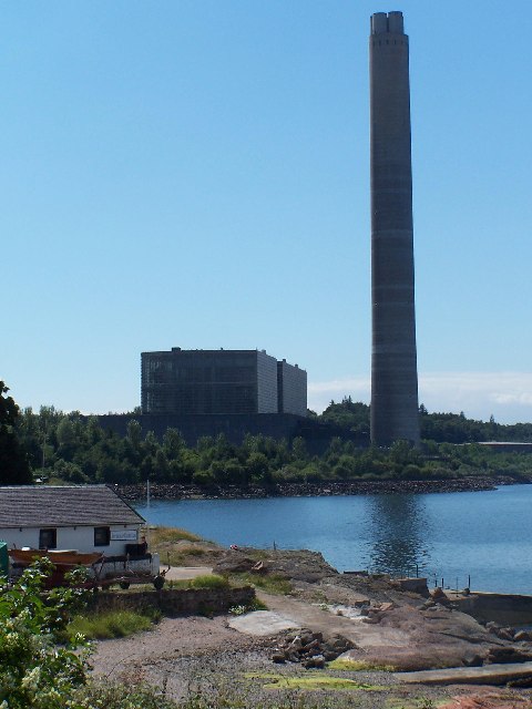
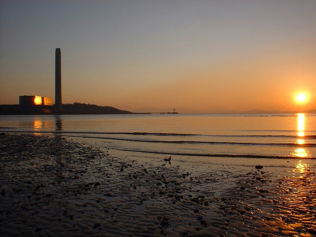
Inverkip power station
Inverkip power station was an oil-fired power station in Inverclyde, on the west coast of Scotland. It was closer to Wemyss Bay than Inverkip, and dominated...
Nearby Amenities
Located within 500m of 55.90413,-4.8781526Have you been to Commoncraig Plantation?
Leave your review of Commoncraig Plantation below (or comments, questions and feedback).