Doire Mhòr

Wood, Forest in Inverness-shire

Scotland

Doire Mhòr

A87 to Kyle of Lochalsh
A87 to Kyle of Lochalsh Credit: Steven Brown

Doire Mhòr is a picturesque woodland located in Inverness-shire, Scotland. With its Gaelic name translating to "Big Wood" or "Forest," this area is renowned for its stunning natural beauty and rich biodiversity.

Spanning over several hectares, Doire Mhòr is characterized by its dense and ancient trees, including native species such as oak, birch, and pine. The forest is a haven for wildlife, providing a habitat for various species of birds, mammals, and insects. It is not uncommon to spot red squirrels, roe deer, and a variety of bird species while exploring the woodland.

The forest is crisscrossed by a network of well-maintained trails, offering visitors the opportunity to explore its captivating features. These trails range in difficulty, catering to both casual strollers and experienced hikers. The serene atmosphere and tranquil surroundings make Doire Mhòr a popular destination for nature enthusiasts, photographers, and those seeking a peaceful retreat.

In addition to its natural allure, Doire Mhòr holds historical and cultural significance. It is believed to have played a role in Scotland's past, with remnants of ancient settlements and archaeological sites scattered throughout the forest. Visitors can immerse themselves in the area's rich history as they stumble upon ruins and artifacts.

Overall, Doire Mhòr in Inverness-shire is a captivating woodland that offers visitors a chance to connect with nature, explore its trails, and appreciate its historical heritage. Whether it's a leisurely stroll or an adventure-filled hike, this forest promises an unforgettable experience for all who venture into its depths.

If you have any feedback on the listing, please let us know in the comments section below.

Doire Mhòr Images

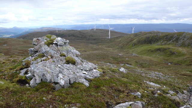
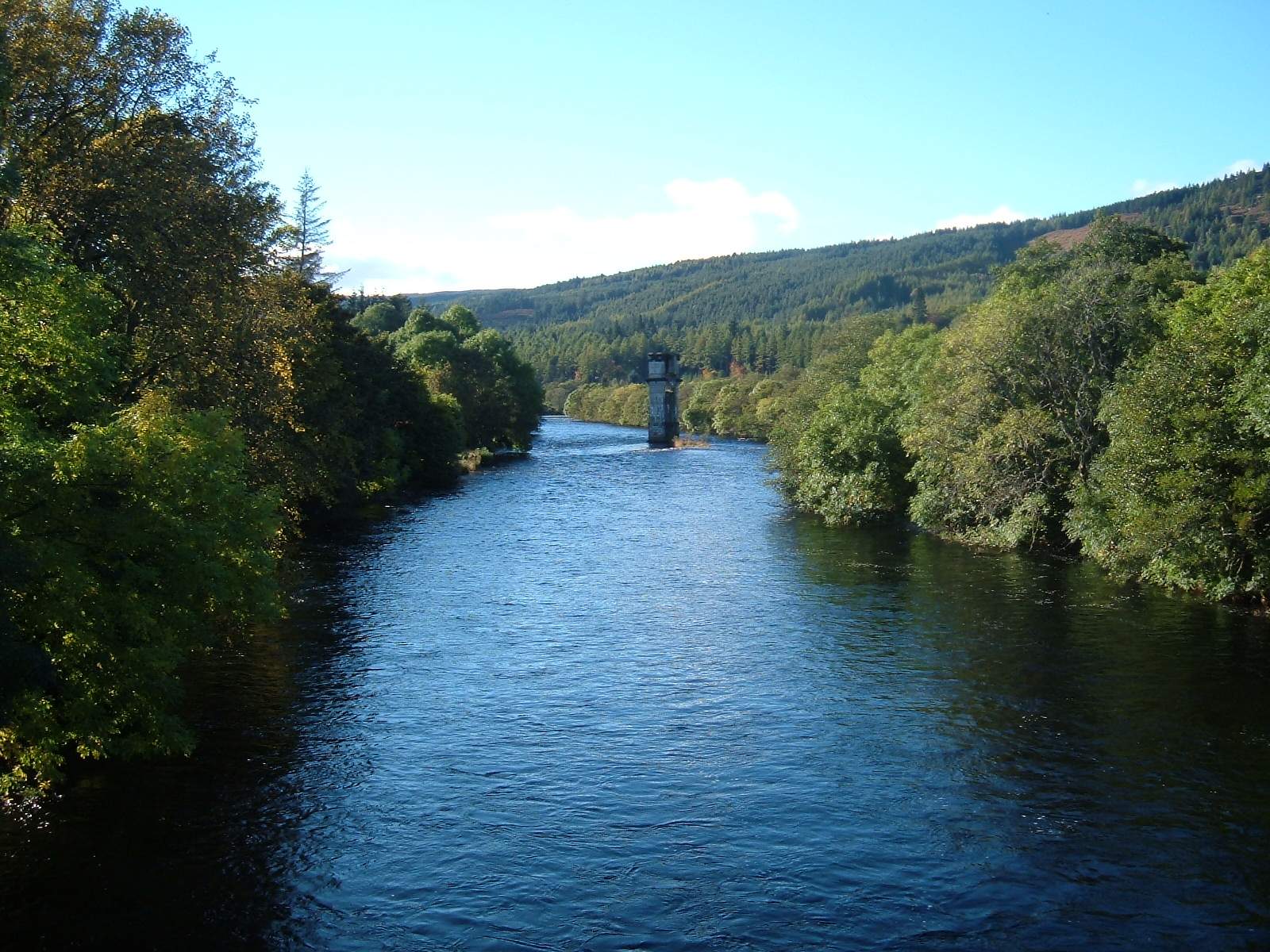
Images are sourced within 2km of 57.139812/-4.9774667 or Grid Reference NH1909. Thanks to Geograph Open Source API. All images are credited.

A87 to Kyle of Lochalsh
A887 Westbound near Bun Loyn The A887 is essentially a link road through Glen Moriston from the A82 to the A87 for traffic travelling between Inverness and Kyle of Lochalsh and the Isle of Skye. Although a trunk route, traffic volumes are relatively low.

The A887 runs for 14½ miles from a turning off the A82 at the small village of Invermoriston near the shore of Loch Ness to the A87 junction at Bunloyne. Traffic for Skye continues along the A87.
A887 Westbound near Bun Loyn
The A887 is essentially a link road through Glen Moriston from the A82 to the A87 for traffic travelling between Inverness and Kyle of Lochalsh and the Isle of Skye. Although a trunk route, traffic volumes are relatively low. The A887 runs for 14½ miles from a turning off the A82 at the small village of Invermoriston near the shore of Loch Ness to the A87 junction at Bunloyne. Traffic for Skye continues along the A87.
A87/A887 Junction, Moriston Bridge The A887 ends here as it merges with the A87. Most traffic continues straight ahead towards Kyle of Lochalsh and the Isle of Skye.
A87/A887 Junction, Moriston Bridge
The A887 ends here as it merges with the A87. Most traffic continues straight ahead towards Kyle of Lochalsh and the Isle of Skye.
Westbound A87 The A87 is a primary route  in the Highland region of Scotland. It runs west for 99 miles from its junction with the A82 at Invergarry, along the north shores of Loch Garry and Loch Cluanie, then through Glen Shiel and along Loch Duich to Kyle of Lochalsh before crossing the Skye Bridge to Kyleakin, Broadford, and Portree, before terminating at Uig in the north of the Isle of Skye.
Westbound A87
The A87 is a primary route in the Highland region of Scotland. It runs west for 99 miles from its junction with the A82 at Invergarry, along the north shores of Loch Garry and Loch Cluanie, then through Glen Shiel and along Loch Duich to Kyle of Lochalsh before crossing the Skye Bridge to Kyleakin, Broadford, and Portree, before terminating at Uig in the north of the Isle of Skye.
A87, eastbound The A87 runs 99 miles from Invergarry to Uig on the Isle of Skye <a href="https://www.geograph.org.uk/photo/7374675">NG3863 : End of the A87, Uig</a>.
<span class="nowrap"><a title="https://www.sabre-roads.org.uk/wiki/index.php?title=A87" rel="nofollow ugc noopener" href="https://www.sabre-roads.org.uk/wiki/index.php?title=A87">Link</a><img style="margin-left:2px;" alt="External link" title="External link - shift click to open in new window" src="https://s1.geograph.org.uk/img/external.png" width="10" height="10"/></span>
A87, eastbound
The A87 runs 99 miles from Invergarry to Uig on the Isle of Skye NG3863 : End of the A87, Uig. LinkExternal link
A87, A887 junction The A887 is essentially a link road through Glen Moriston from the A82 to the A87 for traffic travelling between Inverness and Kyle of Lochalsh and the Isle of Skye. Although a trunk route, traffic volumes are relatively low.

The A887 runs for 14½ miles from a turning off the A82 at the small village of Invermoriston near the shore of Loch Ness to the A87 junction at Bunloyne. Traffic for Skye continues along the A87.
A87, A887 junction
The A887 is essentially a link road through Glen Moriston from the A82 to the A87 for traffic travelling between Inverness and Kyle of Lochalsh and the Isle of Skye. Although a trunk route, traffic volumes are relatively low. The A887 runs for 14½ miles from a turning off the A82 at the small village of Invermoriston near the shore of Loch Ness to the A87 junction at Bunloyne. Traffic for Skye continues along the A87.
Access to the top of Cluanie Dam Looking southward.
Access to the top of Cluanie Dam
Looking southward.
Ordnance Survey Flush Bracket G4531 The bracket can be found on the wall of a building at Cluanie Dam.
This benchmark has a recorded height of 216.797 metres above sea level.
For more detail see : <span class="nowrap"><a title="https://www.bench-marks.org.uk/bm10302" rel="nofollow ugc noopener" href="https://www.bench-marks.org.uk/bm10302">Link</a><img style="margin-left:2px;" alt="External link" title="External link - shift click to open in new window" src="https://s1.geograph.org.uk/img/external.png" width="10" height="10"/></span>
Ordnance Survey Flush Bracket G4531
The bracket can be found on the wall of a building at Cluanie Dam. This benchmark has a recorded height of 216.797 metres above sea level. For more detail see : LinkExternal link
Hill track near Loch Cluanie
Lay-by on the A87 near Cluanie Dam
Logging Truck on the A87 near Loch Cluanie Harpers Loghaul DAF XF (SV16 HDC) carrying logs on its flatbed trailer.
Logging Truck on the A87 near Loch Cluanie
Harpers Loghaul DAF XF (SV16 HDC) carrying logs on its flatbed trailer.
A87 near Viewpoint for Cluanie Dam The A87 is a primary route  in the Highland region of Scotland. It runs west for 99 miles from its junction with the A82 at Invergarry, along the north shores of Loch Garry and Loch Cluanie, then through Glen Shiel and along Loch Duich to Kyle of Lochalsh before crossing the Skye Bridge to Kyleakin, Broadford, and Portree, before terminating at Uig in the north of the Isle of Skye.
A87 near Viewpoint for Cluanie Dam
The A87 is a primary route in the Highland region of Scotland. It runs west for 99 miles from its junction with the A82 at Invergarry, along the north shores of Loch Garry and Loch Cluanie, then through Glen Shiel and along Loch Duich to Kyle of Lochalsh before crossing the Skye Bridge to Kyleakin, Broadford, and Portree, before terminating at Uig in the north of the Isle of Skye.
Cluanie Dam The Loch Cluanie Dam is prominently sited adjacent to the A87 road to Kyle of Lochalsh and Skye forming a local landmark; it stretches an impressive 2,214 feet. Completed in 1957 as part of the North of Scotland Hydro-Electric Board's Glenmoriston project, Cluanie Dam is part of an elaborate network of hydroelectric schemes at the top of a cascade with water passing through Ceannacroc, Livishie and Glenmorriston power stations.
Cluanie Dam
The Loch Cluanie Dam is prominently sited adjacent to the A87 road to Kyle of Lochalsh and Skye forming a local landmark; it stretches an impressive 2,214 feet. Completed in 1957 as part of the North of Scotland Hydro-Electric Board's Glenmoriston project, Cluanie Dam is part of an elaborate network of hydroelectric schemes at the top of a cascade with water passing through Ceannacroc, Livishie and Glenmorriston power stations.
A87, eastbound The A87 runs 99 miles from Invergarry to Uig on the Isle of Skye <a href="https://www.geograph.org.uk/photo/7374675">NG3863 : End of the A87, Uig</a>.
<span class="nowrap"><a title="https://www.sabre-roads.org.uk/wiki/index.php?title=A87" rel="nofollow ugc noopener" href="https://www.sabre-roads.org.uk/wiki/index.php?title=A87">Link</a><img style="margin-left:2px;" alt="External link" title="External link - shift click to open in new window" src="https://s1.geograph.org.uk/img/external.png" width="10" height="10"/></span>
A87, eastbound
The A87 runs 99 miles from Invergarry to Uig on the Isle of Skye NG3863 : End of the A87, Uig. LinkExternal link
A87 down from the dam
Looking west along the river
River Moriston from the Bun Loyne bridge
Show me another place!

Doire Mhòr is located at Grid Ref: NH1909 (Lat: 57.139812, Lng: -4.9774667)

Unitary Authority: Highland

Police Authority: Highlands and Islands

What 3 Words

///supreme.honey.notifying. Near Gairlochy, Highland

Related Wikis

Meall Dubh

Meall Dubh (789 m) is a mountain in the Northwest Highlands, Scotland. Lying near the village of Fort Augustus, it is the highest peak between the valleys...

Loch Loyne

Loch Loyne is a loch in the Northwest Highlands of Scotland. Loch Loyne lies between Glen Garry and Glen Cluanie. The A87 road runs beside the eastern...

River Oich

The River Oich is a short river that flows through the Great Glen in Scotland. It carries water from Loch Oich (to the SW) to Loch Ness (to the NE) and...

Loch Cluanie

Loch Cluanie (Scottish Gaelic: Loch Cluanaidh) is a loch in the Northwest Highlands of Scotland at the south-east end of Glen Shiel. It is a reservoir...

Nearby Amenities

Located within 500m of 57.139812,-4.9774667
Created By: Merkaartor 0.11
Lat/Long: 57.1427127/-4.9790382
The data included in this document is from www.openstreetmap.org. The data is made available under ODbL.

Have you been to Doire Mhòr?

Leave your review of Doire Mhòr below (or comments, questions and feedback).