Cammachmore

Settlement in Kincardineshire

Scotland

Cammachmore

Portlethen from the A90
Portlethen from the A90 Credit: Mike Pennington

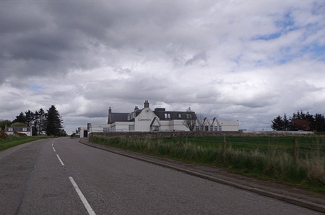
Cammachmore is a small village located in the county of Kincardineshire, Scotland. Situated about 5 miles south of the town of Stonehaven, it is nestled in the picturesque countryside near the North Sea coast. The village is part of the Mearns region, known for its stunning landscapes and rich history.

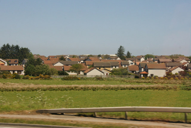
Cammachmore is characterized by its tranquility and natural beauty. Surrounded by rolling hills and farmland, it offers a peaceful retreat for residents and visitors alike. The village has a small population, with a close-knit community that prides itself on its strong sense of community spirit.

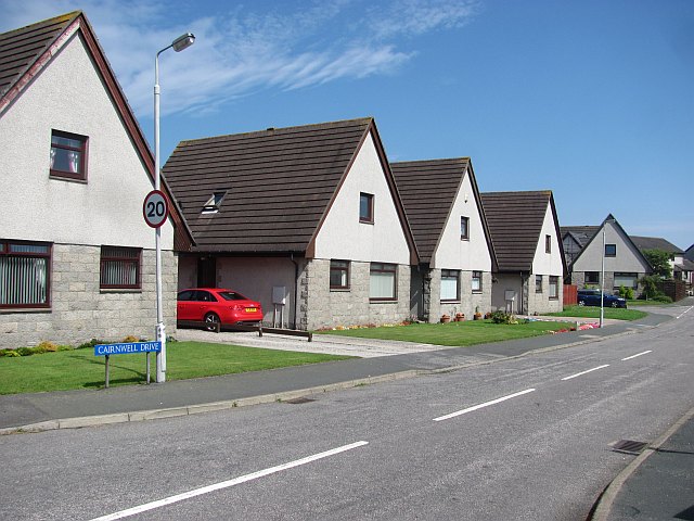
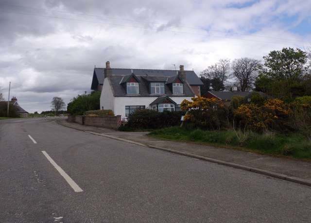
The architecture of Cammachmore reflects its rural charm, with traditional stone cottages and farmhouses dotting the landscape. The village also boasts a charming church, which serves as a gathering place for religious and community events.

While primarily a residential area, Cammachmore benefits from its proximity to Stonehaven. Residents have easy access to a range of amenities, including shops, supermarkets, schools, and healthcare facilities. Stonehaven is also home to a picturesque harbor, where visitors can enjoy fresh seafood and scenic views.

Nature enthusiasts will find plenty to explore in and around Cammachmore. The village is surrounded by stunning countryside, perfect for walking, hiking, and cycling. Within a short drive, there are also opportunities for birdwatching, fishing, and golfing.

Overall, Cammachmore offers a peaceful and idyllic setting, where residents can enjoy the tranquility of rural Scotland while still having access to nearby amenities and attractions.

If you have any feedback on the listing, please let us know in the comments section below.

Cammachmore Images

Images are sourced within 2km of 57.045483/-2.153868 or Grid Reference NO9094. Thanks to Geograph Open Source API. All images are credited.

Portlethen from the A90
House and fields north of Newtonhill
Quiet, but wide residential street Photographer is standing near the street edge
Quiet, but wide residential street
Photographer is standing near the street edge
Looking towards Cammachmore Bay Photographer is standing at the verge of the minor paved road.
Looking towards Cammachmore Bay
Photographer is standing at the verge of the minor paved road.
Cairnwell Drive Like almost all of Portlethen, new.
Cairnwell Drive
Like almost all of Portlethen, new.
Cammies Inn, Cammachmore Near Newtonhill, on the former main road from Stonehaven to Aberdeen (now bypassed by A90 dual carriageway).
Cammies Inn, Cammachmore
Near Newtonhill, on the former main road from Stonehaven to Aberdeen (now bypassed by A90 dual carriageway).
Bend in road, Cammachmore village
Access to Berryhill House A track off the public road.
Access to Berryhill House
A track off the public road.
Minor road from A90 (Portlethon) to Lairhillock Seen from outside the track to Berryhill House (off left).
Minor road from A90 (Portlethon) to Lairhillock
Seen from outside the track to Berryhill House (off left).
Portlethen Moss A fine display of flowering gorse.
Portlethen Moss
A fine display of flowering gorse.
Cattle in a field, Mill of Kingaussie, Portlethen
Road into Cammachmore, near Newtonhill
Old Bourtreebush Stone Circle (1) This circle was formerly thought to be a Recumbent Stone Circle, but current expert opinion now considers it to be a circle without a recumbent setting. It has four stones still standing, and several more either fallen or buried.  For more details see <span class="nowrap"><a title="http://canmore.org.uk/site/37197/old-bourtreebush#693374" rel="nofollow ugc noopener" href="http://canmore.org.uk/site/37197/old-bourtreebush#693374">Link</a><img style="margin-left:2px;" alt="External link" title="External link - shift click to open in new window" src="https://s1.geograph.org.uk/img/external.png" width="10" height="10"/></span>. <a href="https://www.geograph.org.uk/photo/4551778">NO9096 : Old Bourtreebush Stone Circle (2)</a>
Old Bourtreebush Stone Circle (1)
This circle was formerly thought to be a Recumbent Stone Circle, but current expert opinion now considers it to be a circle without a recumbent setting. It has four stones still standing, and several more either fallen or buried. For more details see LinkExternal link. NO9096 : Old Bourtreebush Stone Circle (2)
Old Bourtreebush Stone Circle (2) This circle was formerly thought to be a Recumbent Stone Circle, but current expert opinion now considers it to be a circle without a recumbent setting. It has four stones still standing, and several more either fallen or buried. For more details see <span class="nowrap"><a title="http://canmore.org.uk/site/37197/old-bourtreebush#693374" rel="nofollow ugc noopener" href="http://canmore.org.uk/site/37197/old-bourtreebush#693374">Link</a><img style="margin-left:2px;" alt="External link" title="External link - shift click to open in new window" src="https://s1.geograph.org.uk/img/external.png" width="10" height="10"/></span>.  <a href="https://www.geograph.org.uk/photo/4551835">NO9096 : Old Bourtreebush Stone Circle (3)</a>
Old Bourtreebush Stone Circle (2)
This circle was formerly thought to be a Recumbent Stone Circle, but current expert opinion now considers it to be a circle without a recumbent setting. It has four stones still standing, and several more either fallen or buried. For more details see LinkExternal link. NO9096 : Old Bourtreebush Stone Circle (3)
Aquhorthies Recumbent Stone Circle (1) This is one of the most complete and also most complex of the Recumbent Stone Circles. Most of the stones are still standing, and there are two rings. The recumbent setting, from which the east flanker is missing, is aligned with the inner circle, while the rest of the standing stones form the outer circle. This is the view as one approaches from the south-east.  For more information see <span class="nowrap"><a title="http://canmore.org.uk/site/37186/aquhorthies#694557" rel="nofollow ugc noopener" href="http://canmore.org.uk/site/37186/aquhorthies#694557">Link</a><img style="margin-left:2px;" alt="External link" title="External link - shift click to open in new window" src="https://s1.geograph.org.uk/img/external.png" width="10" height="10"/></span>.  <a href="https://www.geograph.org.uk/photo/4551789">NO9096 : Aquhorthies Recumbent Stone Circle (2)</a>
Aquhorthies Recumbent Stone Circle (1)
This is one of the most complete and also most complex of the Recumbent Stone Circles. Most of the stones are still standing, and there are two rings. The recumbent setting, from which the east flanker is missing, is aligned with the inner circle, while the rest of the standing stones form the outer circle. This is the view as one approaches from the south-east. For more information see LinkExternal link. NO9096 : Aquhorthies Recumbent Stone Circle (2)
Aquhorthies Recumbent Stone Circle (2) This is one of the most complete and also most complex of the Recumbent Stone Circles. Most of the stones are still standing, and there are two rings. The recumbent setting, from which the east flanker is missing, is aligned with the inner circle, while the rest of the standing stones form the outer circle. This is the view as one approaches from the south-east. This is the view from the north. The farm buildings of Aquhorthies are hidden by the trees in the background.  For more information see <span class="nowrap"><a title="http://canmore.org.uk/site/37186/aquhorthies#694557" rel="nofollow ugc noopener" href="http://canmore.org.uk/site/37186/aquhorthies#694557">Link</a><img style="margin-left:2px;" alt="External link" title="External link - shift click to open in new window" src="https://s1.geograph.org.uk/img/external.png" width="10" height="10"/></span>.  <a href="https://www.geograph.org.uk/photo/4551791">NO9096 : Aquhorthies Recumbent Stone Circle (3)</a>
Aquhorthies Recumbent Stone Circle (2)
This is one of the most complete and also most complex of the Recumbent Stone Circles. Most of the stones are still standing, and there are two rings. The recumbent setting, from which the east flanker is missing, is aligned with the inner circle, while the rest of the standing stones form the outer circle. This is the view as one approaches from the south-east. This is the view from the north. The farm buildings of Aquhorthies are hidden by the trees in the background. For more information see LinkExternal link. NO9096 : Aquhorthies Recumbent Stone Circle (3)
Aquhorthies Recumbent Stone Circle (3) This is one of the most complete and also most complex of the Recumbent Stone Circles. Most of the stones are still standing, and there are two rings. The recumbent setting, from which the east flanker is missing, is aligned with the inner circle, while the rest of the standing stones form the outer circle. This is the view as one approaches from the south-east. These are some of the stones on the south-west arc of the circle. For more information see <span class="nowrap"><a title="http://canmore.org.uk/site/37186/aquhorthies#694557" rel="nofollow ugc noopener" href="http://canmore.org.uk/site/37186/aquhorthies#694557">Link</a><img style="margin-left:2px;" alt="External link" title="External link - shift click to open in new window" src="https://s1.geograph.org.uk/img/external.png" width="10" height="10"/></span>.  <a href="https://www.geograph.org.uk/photo/4551800">NO9096 : Aquhorthies Recumbent Stone Circle (4)</a>
Aquhorthies Recumbent Stone Circle (3)
This is one of the most complete and also most complex of the Recumbent Stone Circles. Most of the stones are still standing, and there are two rings. The recumbent setting, from which the east flanker is missing, is aligned with the inner circle, while the rest of the standing stones form the outer circle. This is the view as one approaches from the south-east. These are some of the stones on the south-west arc of the circle. For more information see LinkExternal link. NO9096 : Aquhorthies Recumbent Stone Circle (4)
Aquhorthies Recumbent Stone Circle (4) This is one of the most complete and also most complex of the Recumbent Stone Circles. Most of the stones are still standing, and there are two rings. The recumbent setting, from which the east flanker is missing, is aligned with the inner circle, while the rest of the standing stones form the outer circle. This is the view as one approaches from the south-east. Looking east, with the sprawl of Portlethen in the distance. For more information see <span class="nowrap"><a title="http://canmore.org.uk/site/37186/aquhorthies#694557" rel="nofollow ugc noopener" href="http://canmore.org.uk/site/37186/aquhorthies#694557">Link</a><img style="margin-left:2px;" alt="External link" title="External link - shift click to open in new window" src="https://s1.geograph.org.uk/img/external.png" width="10" height="10"/></span>.   <a href="https://www.geograph.org.uk/photo/4551807">NO9096 : Aquhorthies Recumbent Stone Circle (5)</a>
Aquhorthies Recumbent Stone Circle (4)
This is one of the most complete and also most complex of the Recumbent Stone Circles. Most of the stones are still standing, and there are two rings. The recumbent setting, from which the east flanker is missing, is aligned with the inner circle, while the rest of the standing stones form the outer circle. This is the view as one approaches from the south-east. Looking east, with the sprawl of Portlethen in the distance. For more information see LinkExternal link. NO9096 : Aquhorthies Recumbent Stone Circle (5)
Show me another place!

Cammachmore is located at Grid Ref: NO9094 (Lat: 57.045483, Lng: -2.153868)

Unitary Authority: Aberdeenshire

Police Authority: North East

What 3 Words

///shallower.cornering.torso. Near Newtonhill, Aberdeenshire

Nearby Locations

Cammachmore

Related Wikis

Cammachmore

Cammachmore (Gaelic An Camach Mòr) is a hamlet in the coastal region near the North Sea in Aberdeenshire. It lies slightly west of the A92 road and the...

Causey Mounth

The Causey Mounth is an ancient drovers' road over the coastal fringe of the Grampian Mountains in Aberdeenshire, Scotland. This route was developed as...

Auld Bourtreebush

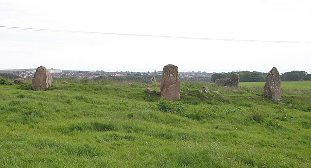
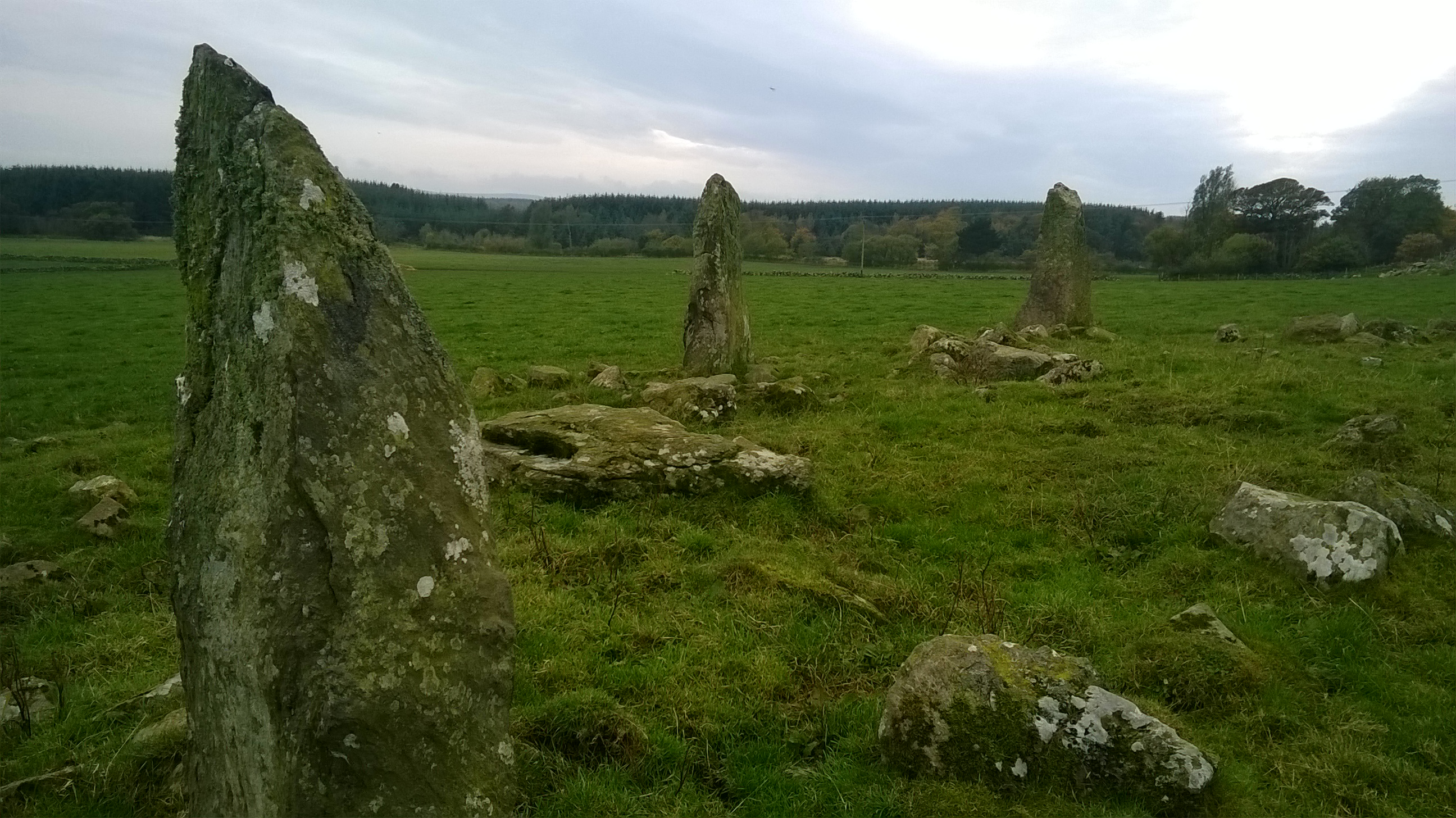
Auld Bourtreebush is a large Neolithic stone circle near Portlethen in Aberdeenshire, Scotland. It is also known as Old Bourtree Bush or Old Bourtreebush...

Portlethen Moss

The Portlethen Moss is an acidic bog nature reserve located to the west of the town of Portlethen, Aberdeenshire in Scotland. Like other mosses, this...

Nearby Amenities

Located within 500m of 57.045483,-2.153868
Crossing
Crossing: unmarked
Crossing Island: no
Crossing Markings: no
Kerb: lowered
Tactile Paving: no
Lat/Long: 57.0443993/-2.151602
Cammachmore
Name Gd: An Camach Mòr
Place: village
Wikidata: Q15059177
Wikipedia: en:Cammachmore
Lat/Long: 57.0442085/-2.1548384
Hilton of Cairngrassie standing stone
Archaeological Site: megalith
Historic: archaeological_site
Historic Civilization: prehistoric
Lat/Long: 57.0487774/-2.1568625
Generator Method: photovoltaic
Generator Output Electricity: yes
Generator Source: solar
Generator Type: solar_photovoltaic_panel
Location: roof
Power: generator
Lat/Long: 57.0436774/-2.1576668
Generator Method: photovoltaic
Generator Output Electricity: yes
Generator Source: solar
Generator Type: solar_photovoltaic_panel
Location: roof
Power: generator
Lat/Long: 57.0430762/-2.1576065
Generator Method: photovoltaic
Generator Output Electricity: yes
Generator Source: solar
Generator Type: solar_photovoltaic_panel
Location: roof
Power: generator
Lat/Long: 57.0447958/-2.1543751
Generator Method: photovoltaic
Generator Output Electricity: yes
Generator Source: solar
Generator Type: solar_photovoltaic_panel
Location: roof
Power: generator
Lat/Long: 57.0440775/-2.1536496
Generator Method: photovoltaic
Generator Output Electricity: yes
Generator Source: solar
Generator Type: solar_photovoltaic_panel
Location: roof
Power: generator
Lat/Long: 57.0437168/-2.154015
Generator Method: photovoltaic
Generator Output Electricity: yes
Generator Source: solar
Generator Type: solar_photovoltaic_panel
Location: roof
Power: generator
Lat/Long: 57.0450839/-2.1538299
Generator Method: photovoltaic
Generator Output Electricity: yes
Generator Source: solar
Generator Type: solar_photovoltaic_panel
Location: roof
Power: generator
Lat/Long: 57.0448228/-2.1527195
Generator Method: photovoltaic
Generator Output Electricity: yes
Generator Source: solar
Generator Type: solar_photovoltaic_panel
Location: roof
Power: generator
Lat/Long: 57.0446097/-2.1530789
Generator Method: photovoltaic
Generator Output Electricity: yes
Generator Source: solar
Generator Type: solar_photovoltaic_panel
Location: roof
Power: generator
Lat/Long: 57.0449424/-2.1529636
Generator Method: photovoltaic
Generator Output Electricity: yes
Generator Source: solar
Generator Type: solar_photovoltaic_panel
Location: roof
Power: generator
Lat/Long: 57.046276/-2.1518773
Power: pole
Lat/Long: 57.0470436/-2.1575518
Power: pole
Lat/Long: 57.0465602/-2.1577152
Power: pole
Lat/Long: 57.0460468/-2.1578848
Power: pole
Lat/Long: 57.0455184/-2.1580757
Power: pole
Lat/Long: 57.0452357/-2.1590853
Power: pole
Lat/Long: 57.0449473/-2.1601267
Power: pole
Lat/Long: 57.045035/-2.1611278
Power: pole
Lat/Long: 57.0465787/-2.1556069
Power: pole
Lat/Long: 57.0471094/-2.1557766
Power: pole
Lat/Long: 57.0476851/-2.155679
Power: pole
Lat/Long: 57.0482873/-2.1555624
Power: pole
Lat/Long: 57.0488456/-2.1554606
Power: pole
Lat/Long: 57.0494294/-2.1553694
Power: pole
Lat/Long: 57.0488664/-2.159255
Power: pole
Lat/Long: 57.0484372/-2.1590047
Power: pole
Lat/Long: 57.0480231/-2.158765
Power: pole
Lat/Long: 57.0475812/-2.1585169
Power: pole
Lat/Long: 57.0468163/-2.1566017
Power: pole
Lat/Long: 57.046326/-2.1545592
Power: pole
Lat/Long: 57.0460341/-2.1533735
Power: pole
Lat/Long: 57.0436077/-2.146561
Power: pole
Lat/Long: 57.0431485/-2.1472355
Power: pole
Lat/Long: 57.0427701/-2.1477869
Bus Stop
New Bourtreebush
Bench: yes
Bin: no
Bus: yes
Lit: yes
Naptan AtcoCode: 630040401
Naptan Bearing: N
Naptan CommonName: New Bourtreebush
Naptan Indicator: at
Naptan Landmark: New Bourtreebush
Naptan NaptanCode: 23628264
Naptan Street: A90
Public Transport: platform
Ref: 23628264
Shelter: yes
Tactile Paving: no
Lat/Long: 57.0494945/-2.1502245
Bus Stop
Cammachmore Bank Cottage
Bench: yes
Bin: no
Bus: yes
Lit: yes
Naptan AtcoCode: 630040362
Naptan Bearing: N
Naptan CommonName: Cammachmore Bank Cottage
Naptan Indicator: N-Bound
Naptan NaptanCode: 23626396
Naptan Street: A92
Naptan Verified: no
Public Transport: platform
Shelter: yes
Source: naptan;bing;naptan_compare_tool
Tactile Paving: no
Lat/Long: 57.0447509/-2.1520258
Bus Stop
Cammachmore Bank Cottage
Bench: yes
Bin: no
Bus: yes
Lit: yes
Naptan AtcoCode: 630040361
Naptan Bearing: S
Naptan CommonName: Cammachmore Bank Cottage
Naptan Indicator: S-Bound
Naptan NaptanCode: 23626397
Naptan Street: A92
Naptan Verified: no
Public Transport: platform
Shelter: yes
Source: naptan;bing;naptan_compare_tool
Tactile Paving: no
Lat/Long: 57.0440966/-2.1519045
The data included in this document is from www.openstreetmap.org. The data is made available under ODbL.

Have you been to Cammachmore?

Leave your review of Cammachmore below (or comments, questions and feedback).