Craig Wood

Wood, Forest in Ayrshire

Scotland

Craig Wood

Road to Colmonell Cemetery From the B734.
Road to Colmonell Cemetery Credit: Billy McCrorie

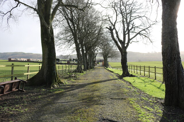
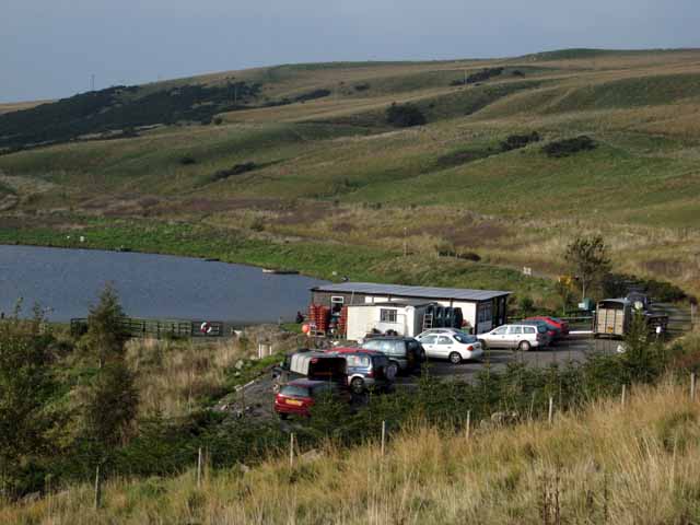
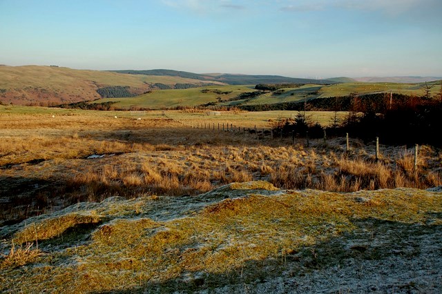
Craig Wood is a picturesque forest located in Ayrshire, Scotland. It is situated near the town of Craigie, just a few miles south of Kilmarnock. Covering an area of approximately 200 acres, this woodland offers a delightful escape for nature enthusiasts and hikers alike.

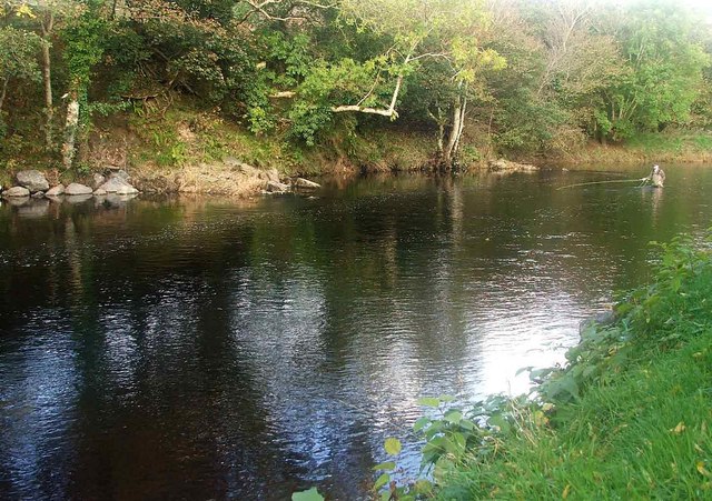
The forest is primarily composed of native trees such as oak, birch, and beech, but also features a variety of coniferous species like pine and spruce. This diverse mix of vegetation creates a rich and vibrant habitat for a wide range of wildlife. Visitors may come across various bird species, including woodpeckers, owls, and finches, as well as small mammals like red squirrels and rabbits. The forest floor is adorned with a colorful array of wildflowers during the spring and summer months.

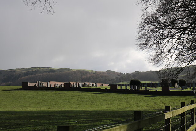
There are several well-maintained walking trails throughout the wood, catering to different levels of fitness and interest. These paths meander through the forest, offering peaceful and serene surroundings, with occasional viewpoints that provide stunning vistas of the surrounding countryside. The trails are suitable for both leisurely strolls and more challenging hikes, making Craig Wood an ideal destination for families and outdoor enthusiasts.

In addition to its natural beauty, Craig Wood also holds historical significance. The remnants of an old iron mine can be found within the forest, serving as a reminder of the area's industrial past. The mine shafts and tunnels are now sealed off for safety but add an intriguing element to the woodland's character.

Overall, Craig Wood is a captivating destination that combines natural beauty, wildlife, and a touch of history. It offers visitors a peaceful retreat where they can immerse themselves in the tranquility of nature while enjoying the stunning landscapes of Ayrshire.

If you have any feedback on the listing, please let us know in the comments section below.

Craig Wood Images

Images are sourced within 2km of 55.143898/-4.8725761 or Grid Reference NX1787. Thanks to Geograph Open Source API. All images are credited.

Road to Colmonell Cemetery From the B734.
Road to Colmonell Cemetery
From the B734.
Colmonell Cemetery From the road up to the Cemetery next to the B734.
Colmonell Cemetery
From the road up to the Cemetery next to the B734.
The B734 to Girvan From the entrance to Colmonell Cemetery. The B734 reaches the A714 then it's left for Girvan and right for Barrhill.
The B734 to Girvan
From the entrance to Colmonell Cemetery. The B734 reaches the A714 then it's left for Girvan and right for Barrhill.
Field gate near Craig Farm, Colmonell
Avenue of trees on the B734 near Colmonell Road from Pinwherry to Ballantrae
Avenue of trees on the B734 near Colmonell
Road from Pinwherry to Ballantrae
Poundland On the B734 from Pinwherry to Ballantrae
Poundland
On the B734 from Pinwherry to Ballantrae
Almont, near Pinwherry
Pinbraid Fishery (lower end) 9-acre loch with a good stock of fighting rainbow trout. <span class="nowrap"><a title="http://www.gallowayangling.co.uk/links.php?page=lochs" rel="nofollow ugc noopener" href="http://www.gallowayangling.co.uk/links.php?page=lochs">Link</a><img style="margin-left:2px;" alt="External link" title="External link - shift click to open in new window" src="https://s1.geograph.org.uk/img/external.png" width="10" height="10"/></span>
Pinbraid Fishery (lower end)
9-acre loch with a good stock of fighting rainbow trout. LinkExternal link
Craig Cottage On the B734. Shown as "Craig Farm" on the map.
Craig Cottage
On the B734. Shown as "Craig Farm" on the map.
Poundland House Craig Hill <a href="https://www.geograph.org.uk/gridref/NX1687">NX1687</a> in the background.
Poundland House
Craig Hill NX1687 in the background.
Stinchar Valley viewed from Almont
Stream below Pinbraid Loch
The River Stinchar, Late Autumn The houses in the background form the hamlet of Poundland. The river valley is fertile and supports livestock and arable farming. The hills above have large conifer plantations and above, open moorland.
The angler is playing a salmon that was later returned to the water unharmed.
The River Stinchar, Late Autumn
The houses in the background form the hamlet of Poundland. The river valley is fertile and supports livestock and arable farming. The hills above have large conifer plantations and above, open moorland. The angler is playing a salmon that was later returned to the water unharmed.
The Battery Pool. River Stinchar This picture shows an angler fishing the Battery Pool on the River Stinchar. This pool has been modified to improve the fishing and the boulders on the left of the photo have been placed there, to help stabilise the bankings and also to create favourable conditions for the salmon to remain in the pool for longer.
The Battery Pool. River Stinchar
This picture shows an angler fishing the Battery Pool on the River Stinchar. This pool has been modified to improve the fishing and the boulders on the left of the photo have been placed there, to help stabilise the bankings and also to create favourable conditions for the salmon to remain in the pool for longer.
The Gate at Dangart An interesting sign, originally belonging to a gate at a railway crossing on the London & North East Railway.  Forty shillings (£2) would have been a substantial fine when the original gate was in use on the railway.
The Gate at Dangart
An interesting sign, originally belonging to a gate at a railway crossing on the London & North East Railway. Forty shillings (£2) would have been a substantial fine when the original gate was in use on the railway.
Towards Dalreoch Burn Upland farming country, viewed on a frosty December morning.  The small valley of Dalreoch Burn, in the same square, is visible in the background of this shot.
Towards Dalreoch Burn
Upland farming country, viewed on a frosty December morning. The small valley of Dalreoch Burn, in the same square, is visible in the background of this shot.
Forest Track Between Breaker Hill & Glessal Hill Heading north towards Breaker Hill.  Viewed on a fine early-September morning.
Forest Track Between Breaker Hill & Glessal Hill
Heading north towards Breaker Hill. Viewed on a fine early-September morning.
On Craig Hill Hilly ground on the north side of the Stinchar Valley, near Colmonell.
On Craig Hill
Hilly ground on the north side of the Stinchar Valley, near Colmonell.
Show me another place!

Craig Wood is located at Grid Ref: NX1787 (Lat: 55.143898, Lng: -4.8725761)

Unitary Authority: South Ayrshire

Police Authority: Ayrshire

What 3 Words

///snuck.fears.firms. Near Girvan, South Ayrshire

Related Wikis

Pinwherry railway station

Pinwherry railway station served the village of Pinwherry, South Ayrshire, Scotland from 1887 to 1965 on the Girvan and Portpatrick Junction Railway....

Colmonell

Colmonell (Scottish Gaelic: Cill Cholmain Eala) (meaning the church of St. Colman of Lainn Eala - in Lynally, County Offaly, Ireland) is a small village...

Pinwherry

Pinwherry is a hamlet in the civil parish of Colmonell, in the council area of South Ayrshire, Scotland. It is 8 miles south of Girvan. In 1961 it had...

Dumbarton Collegiate Church

The Collegiate Church of St Mary, Dumbarton, Scotland, was founded in about 1453 by Isabella, Countess of Lennox and Duchess of Albany. During the medieval...

Lendalfoot

Lendalfoot is a small village located on Carleton Bay, parish of Colmonell in the old district of Carrick, now South Ayrshire, about six miles (ten kilometres...

Pinmore railway station

Pinmore railway station served the hamlet of Pinmore, South Ayrshire, Scotland from 1877 to 1965 on the Girvan and Portpatrick Junction Railway. ��2�...

Heronsford

Heronsford is a village located in South Ayrshire, South-West Scotland. == About == Heronsford is a hamlet located near Ballantrae that sits along the...

Russian cruiser Varyag (1899)

Varyag (Russian: Варя́г) sometimes also spelled Variag, was a Russian protected cruiser. Varyag became famous for her crew's stoicism at the Battle of...

Nearby Amenities

Located within 500m of 55.143898,-4.8725761
Power: pole
Lat/Long: 55.141436/-4.8752194
Power: pole
Lat/Long: 55.1421067/-4.8732299
Power: pole
Lat/Long: 55.1423407/-4.8716263
Power: pole
Lat/Long: 55.1426699/-4.8704172
Power: pole
Lat/Long: 55.1429817/-4.8692508
Power: pole
Lat/Long: 55.1433023/-4.8680425
Power: pole
Lat/Long: 55.1434531/-4.8674739
Power: pole
Lat/Long: 55.1437315/-4.8664247
Power: pole
Lat/Long: 55.1441565/-4.8648229
Power: pole
Lat/Long: 55.1417717/-4.8742236
Power: pole
Lat/Long: 55.1411081/-4.8762354
Power: pole
Lat/Long: 55.1407583/-4.8775624
The data included in this document is from www.openstreetmap.org. The data is made available under ODbL.

Have you been to Craig Wood?

Leave your review of Craig Wood below (or comments, questions and feedback).