Loch Etive Forest

Wood, Forest in Argyllshire

Scotland

Loch Etive Forest

Glen Etive from Ben Starav There are many mountains in this photograph but Stob Dubh lies more or less in the middle and to the right of Glen Etive. Directly beyond is Buachaille Etive Mor.
Glen Etive from Ben Starav Credit: Colin Park

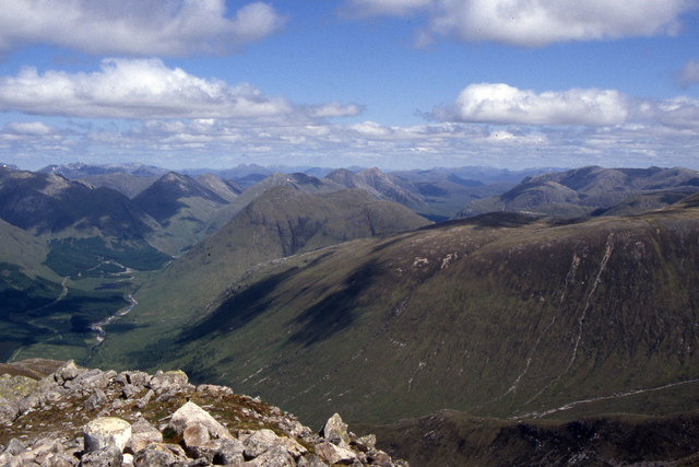
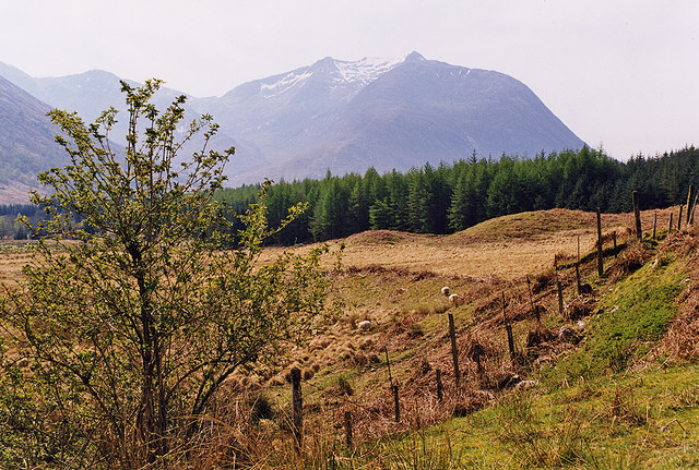
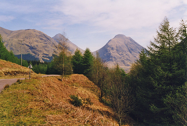
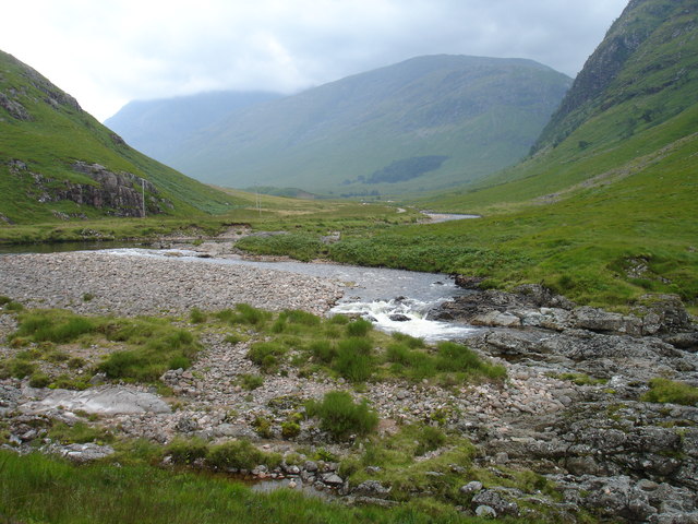
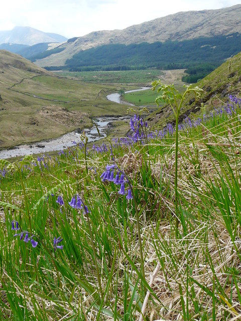
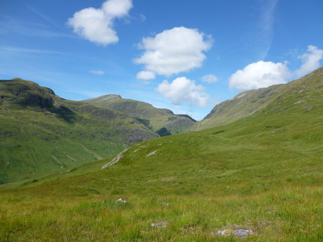
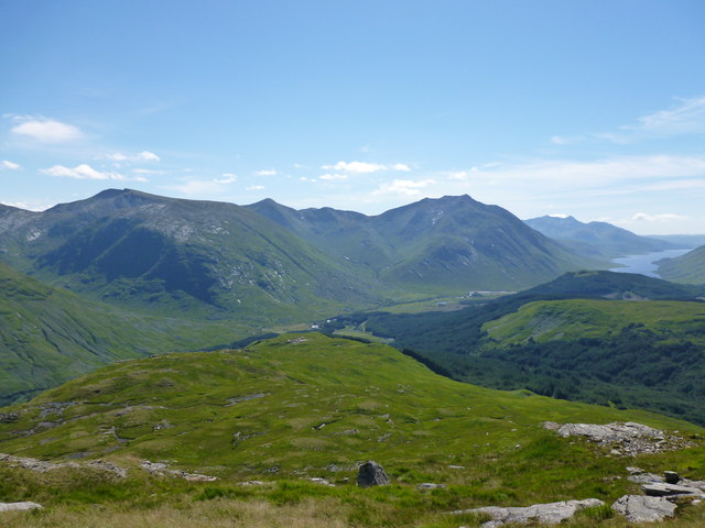
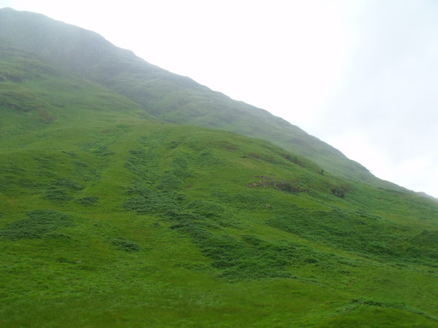
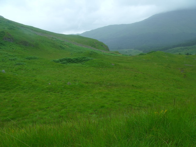
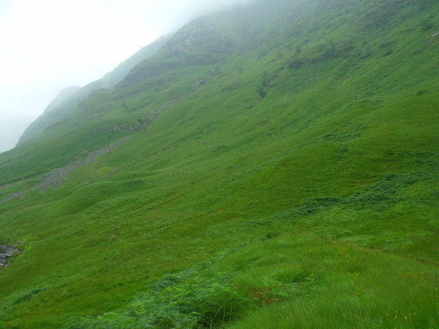
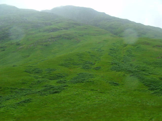
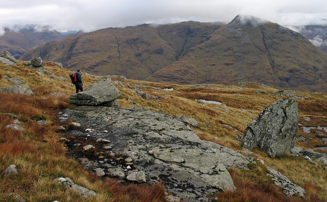
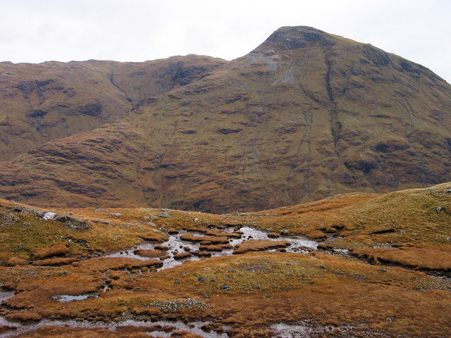
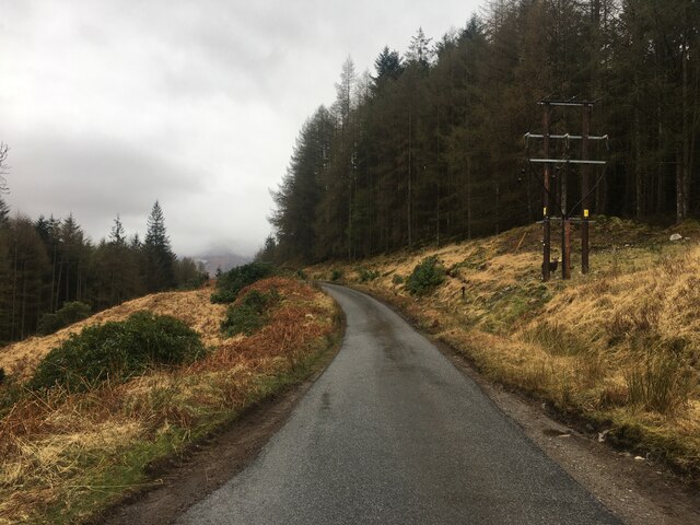
Loch Etive Forest is a picturesque woodland located in Argyllshire, Scotland. Situated along the shores of the stunning Loch Etive, this forest covers a vast area of approximately 3,000 hectares. It is a diverse and thriving ecosystem, home to a wide variety of flora and fauna.

The forest mainly consists of native tree species such as oak, birch, and rowan, creating a rich and vibrant landscape. The dense canopy provides shelter for numerous bird species, including the majestic golden eagle and the elusive pine martin. Red deer can also be spotted grazing in the forest, adding to its natural beauty.

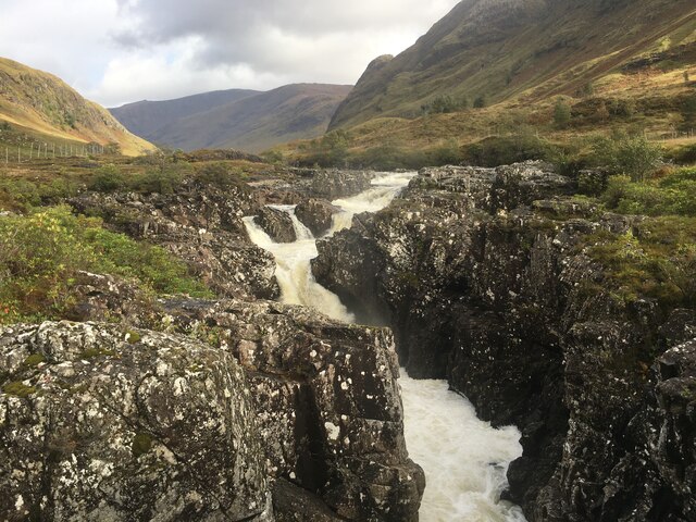
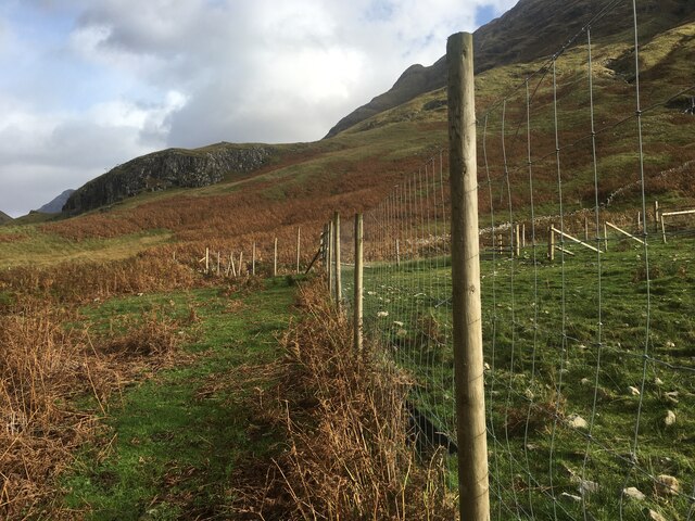
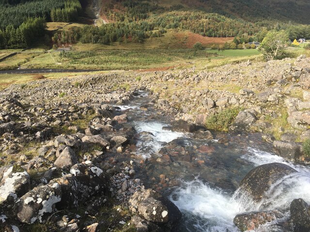
A well-maintained network of trails allows visitors to explore the forest and enjoy its tranquil ambiance. These paths wind through the woodland, offering breathtaking views of the surrounding mountains and the shimmering Loch Etive. The forest is particularly popular among hikers and nature enthusiasts, who can revel in the peaceful atmosphere and immerse themselves in the beauty of nature.

Loch Etive Forest is not only a place of natural beauty but also holds historical significance. The area is rich in archaeological sites, with remnants of ancient settlements and burial grounds scattered throughout the forest. These historical features provide a glimpse into the lives of the people who once inhabited this land.

Overall, Loch Etive Forest is a must-visit destination for those seeking a serene escape into nature. With its diverse wildlife, stunning views, and historical charm, it offers a truly unique experience for visitors of all ages.

If you have any feedback on the listing, please let us know in the comments section below.

Loch Etive Forest Images

Images are sourced within 2km of 56.610693/-4.9975399 or Grid Reference NN1650. Thanks to Geograph Open Source API. All images are credited.

Glen Etive from Ben Starav There are many mountains in this photograph but Stob Dubh lies more or less in the middle and to the right of Glen Etive. Directly beyond is Buachaille Etive Mor.
Glen Etive from Ben Starav
There are many mountains in this photograph but Stob Dubh lies more or less in the middle and to the right of Glen Etive. Directly beyond is Buachaille Etive Mor.
Fields near Dalness With a deer fence to keep deer from the grazing. Ben Starav forms the background.
Fields near Dalness
With a deer fence to keep deer from the grazing. Ben Starav forms the background.
Corner on the Glen Etive road south of Inbhir-fhaolain With the Buachaille Etive Beag and Buachaille Etive Mòr showing up in the distance.
Corner on the Glen Etive road south of Inbhir-fhaolain
With the Buachaille Etive Beag and Buachaille Etive Mòr showing up in the distance.
River Bends, Glen Etive Meanders on the river in Glen Etive showing summer water levels
River Bends, Glen Etive
Meanders on the river in Glen Etive showing summer water levels
Glen Etive near Dalness A view down Glen Etive towards Dalness from the north side of the glen.
Glen Etive near Dalness
A view down Glen Etive towards Dalness from the north side of the glen.
View towards Bealach Fhionnghaill The bealach is the notch in the distance here, separating Sgor na h-Ulaidh (left) from Beinn Maol Chaluim (right).  Meall a' Bhuiridh creeps into the left of the shot.
View towards Bealach Fhionnghaill
The bealach is the notch in the distance here, separating Sgor na h-Ulaidh (left) from Beinn Maol Chaluim (right). Meall a' Bhuiridh creeps into the left of the shot.
Southern spur of Beinn Maol Chaluim On the other side of Glen Etive the big bulky hillsides of Stob Coire an Albannaich, Glas Beinn Mor and Ben Starav are prominent, with Loch Etive and Ben Cruachan in the distance.
Southern spur of Beinn Maol Chaluim
On the other side of Glen Etive the big bulky hillsides of Stob Coire an Albannaich, Glas Beinn Mor and Ben Starav are prominent, with Loch Etive and Ben Cruachan in the distance.
Steep shoulder dropping north-west off Beinn Ceitlein in Glen Etive
At the foot of Beinn Ceitlein in Glen Etive
Steep slopes of Beinn Ceitlein above Glen Etive
Flanks of Beinn Ceitlein in Glen Etive This rather damp photo gives the clue as to how such a steep rocky slope can be so lushly fertile.
Flanks of Beinn Ceitlein in Glen Etive
This rather damp photo gives the clue as to how such a steep rocky slope can be so lushly fertile.
Rocks on declining slope of Beinn Maol Chaluim The summit ridge of Beinn Maol Chaluim is orientated north-west to south-east; at its southern end the ridge begins to lose its identity and slopes descend directly southwards into Glen Etive with outcrops of rock exposed. The view beyond is towards Beinn Ceitlein and Stob Dubh across Glen Etive.
Rocks on declining slope of Beinn Maol Chaluim
The summit ridge of Beinn Maol Chaluim is orientated north-west to south-east; at its southern end the ridge begins to lose its identity and slopes descend directly southwards into Glen Etive with outcrops of rock exposed. The view beyond is towards Beinn Ceitlein and Stob Dubh across Glen Etive.
Peat banks and bog on south ridge of Beinn Maol Chaluim The summit ridge of Beinn Maol Chaluim turns south rather losing its identity as it descends to Glen Etive but lower down it becomes more defined again. The boggy area is on that ridge with Beinn Ceitlein and Stob Dubh seen beyond, across Glen Etive.
Peat banks and bog on south ridge of Beinn Maol Chaluim
The summit ridge of Beinn Maol Chaluim turns south rather losing its identity as it descends to Glen Etive but lower down it becomes more defined again. The boggy area is on that ridge with Beinn Ceitlein and Stob Dubh seen beyond, across Glen Etive.
River Etive at Dalness
Fence line near Dalness
Hole in the wall near Dalness
Stream flowing down from Beinn Ceitlein
Minor road in Glen Etive
Show me another place!

Loch Etive Forest is located at Grid Ref: NN1650 (Lat: 56.610693, Lng: -4.9975399)

Unitary Authority: Highland

Police Authority: Highlands and Islands

What 3 Words

///spots.mice.regulator. Near Glencoe, Highland

Nearby Locations

Loch Etive Forest

Related Wikis

Glen Etive

Glen Etive (Scottish Gaelic: Gleann Èite) is a glen in the Highlands of Scotland. The River Etive (Scottish Gaelic: Abhainn Èite) rises on the peaks surrounding...

Ben Nevis and Glen Coe National Scenic Area

Ben Nevis and Glen Coe is a national scenic area (NSA) covering part of the Highlands of Scotland surrounding Ben Nevis and Glen Coe, in which certain...

Stob Dubh (Corbett)

Stob Dubh (880 m) is a mountain in the Grampian Mountains of Scotland, at the head of Loch Etive north of the village of Taynuilt. The mountain offers...

Stob Coire Sgreamhach

Stob Coire Sgreamhach (Scottish Gaelic for 'peak of the dreadful corrie') is a mountain in Lorn, south of Glen Coe in the Scottish Highlands. Its height...

Nearby Amenities

Located within 500m of 56.610693,-4.9975399
Passing Place
Lat/Long: 56.610842/-5.0050206
Passing Place
Lat/Long: 56.6118763/-5.0048109
Passing Place
Lat/Long: 56.6130945/-5.0040787
Passing Place
Lat/Long: 56.6119528/-5.0002388
Passing Place
Lat/Long: 56.6131644/-4.9958169
Passing Place
Lat/Long: 56.6133049/-4.9942985
Power: pole
Lat/Long: 56.6137211/-4.9931899
Power: pole
Lat/Long: 56.6132791/-4.9942656
Power: pole
Lat/Long: 56.6131825/-4.9950852
Power: pole
Lat/Long: 56.6130133/-4.9964811
Power: pole
Lat/Long: 56.6128694/-4.9977361
Power: pole
Lat/Long: 56.6124355/-4.9991485
Power: pole
Lat/Long: 56.6120871/-5.0002846
Power: pole
Lat/Long: 56.6121797/-5.0009835
Power: pole
Lat/Long: 56.6124868/-5.0016988
Power: pole
Lat/Long: 56.6123046/-5.0023867
Power: pole
Lat/Long: 56.6118727/-5.0040661
Power: pole
Lat/Long: 56.6112606/-5.0047211
Power: pole
Lat/Long: 56.6105951/-5.0054638
The data included in this document is from www.openstreetmap.org. The data is made available under ODbL.

Have you been to Loch Etive Forest?

Leave your review of Loch Etive Forest below (or comments, questions and feedback).