Camer's Green

Settlement in Worcestershire Malvern Hills

England

Camer's Green

A438 near Coombegreen Common
A438 near Coombegreen Common Credit: Peter Whatley

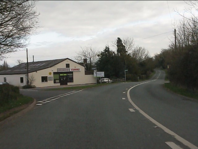
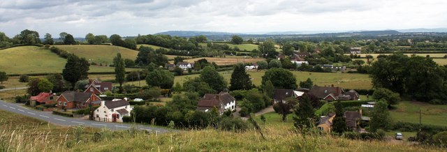
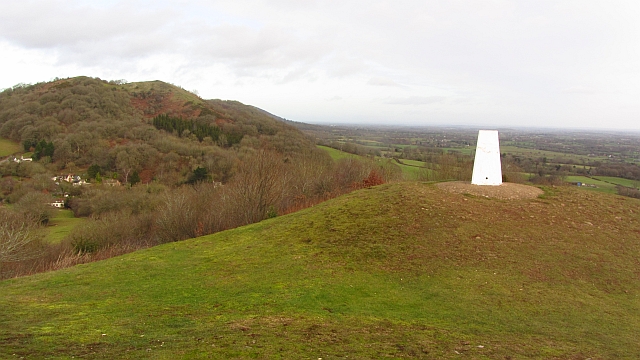
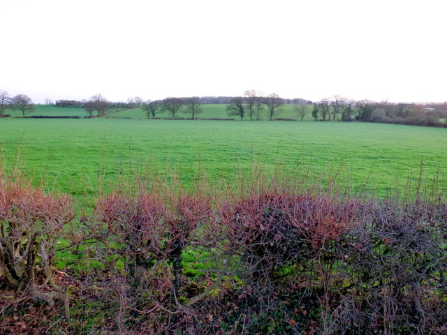
Camer's Green is a small village located in the county of Worcestershire, England. Situated in the heart of the countryside, it is known for its picturesque landscapes and tranquil atmosphere. The village is surrounded by lush green fields, rolling hills, and charming woodlands, making it an ideal destination for nature lovers and outdoor enthusiasts.

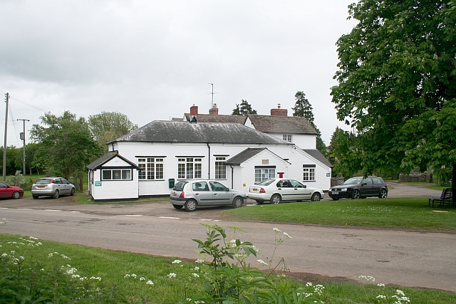
With a population of around 300 residents, Camer's Green maintains a close-knit community feel. The village is characterized by its traditional English cottages, many of which date back several centuries, adding to its rural charm. There is also a quaint village church, serving as a focal point for religious and community gatherings.

Despite its small size, Camer's Green is well-connected to nearby towns and cities. The village is located just a short drive away from the town of Kidderminster, where residents can find a wide range of amenities such as shops, schools, and healthcare facilities. Additionally, the city of Worcester is easily accessible, offering further opportunities for employment, education, and entertainment.

The natural beauty surrounding Camer's Green provides ample opportunities for outdoor activities. The nearby countryside offers scenic walking and cycling trails, allowing residents to explore the stunning landscapes and enjoy the fresh air. The village is also within reach of several nature reserves and parks, offering even more options for wildlife enthusiasts and nature lovers.

In summary, Camer's Green is a charming and idyllic village nestled in the picturesque Worcestershire countryside. With its stunning landscapes, close community, and easy access to amenities, it provides a peaceful and serene living environment for its residents.

If you have any feedback on the listing, please let us know in the comments section below.

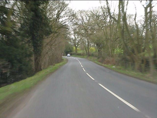
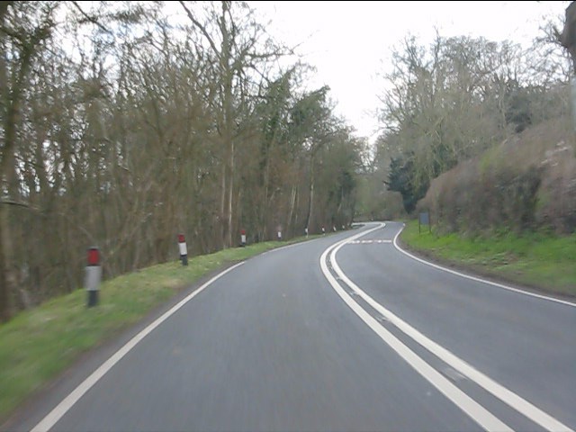
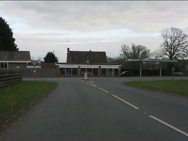
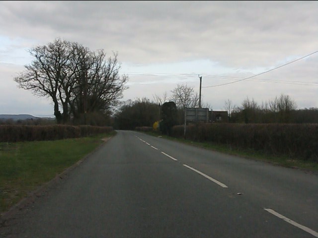
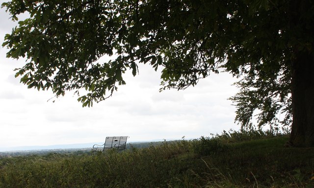
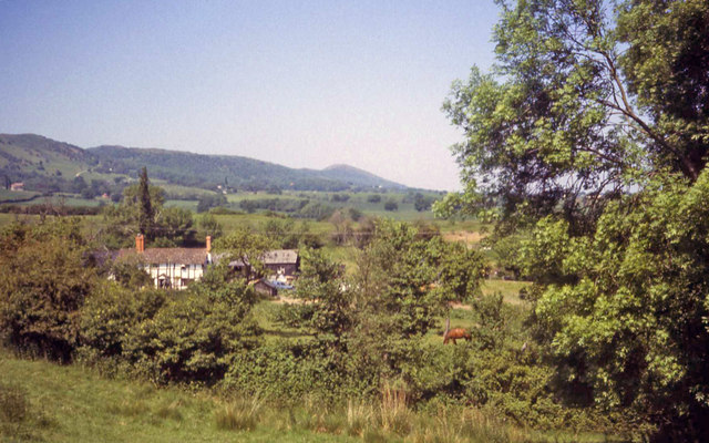
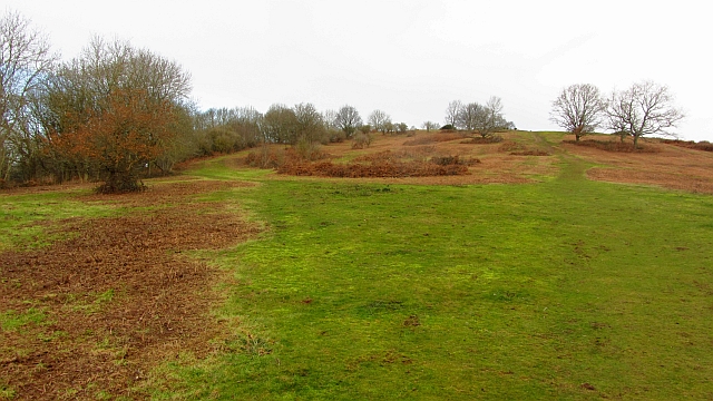
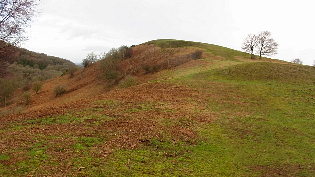
Camer's Green Images

Images are sourced within 2km of 52.013836/-2.326356 or Grid Reference SO7735. Thanks to Geograph Open Source API. All images are credited.

A438 near Coombegreen Common
A438 descends toward Rye Cross
A438 approaching Rye Cross The building houses G.Windle & Sons.  A filling station was also once operated here, but is now disused, though the canopy remains.
A438 approaching Rye Cross
The building houses G.Windle & Sons. A filling station was also once operated here, but is now disused, though the canopy remains.
A438 heading east from Rye Cross
A438 junction, Rye Street
The cyclist now departing... ...is heading for Berrow.
The cyclist now departing...
...is heading for Berrow.
House on the corner An isolated dwelling on the A483 near Berrow.
House on the corner
An isolated dwelling on the A483 near Berrow.
Coombegreen The view from Wendy Woodward's seat atop the hillock on Coombegreen Common.
Looking out to the houses on the B4208 and those on Birts Street.
<a href="https://www.geograph.org.uk/photo/2511815">SO7736 : Wendy Woodward's seat, Coombegreen Common</a>
Coombegreen
The view from Wendy Woodward's seat atop the hillock on Coombegreen Common. Looking out to the houses on the B4208 and those on Birts Street. SO7736 : Wendy Woodward's seat, Coombegreen Common
Wendy Woodward's seat, Coombegreen Common The seat is at the front of the hill overlooking the Severn Plain.
Behind are several commemorative trees including one dating back to 1937 for the King's Coronation.
<a href="https://www.geograph.org.uk/photo/2511845">SO7736 : Plaque on Wendy Woodward's seat, Coombe Green</a>
<a href="https://www.geograph.org.uk/photo/2511865">SO7736 : Wendy Woodward's seat, Coombe Green Common</a>
<a href="https://www.geograph.org.uk/photo/2511797">SO7736 : Coombegreen</a>
Wendy Woodward's seat, Coombegreen Common
The seat is at the front of the hill overlooking the Severn Plain. Behind are several commemorative trees including one dating back to 1937 for the King's Coronation. SO7736 : Plaque on Wendy Woodward's seat, Coombe Green SO7736 : Wendy Woodward's seat, Coombe Green Common SO7736 : Coombegreen
Plaque on Wendy Woodward's seat, Coombe Green In loving memory of
Wendy Woodward
Died 3 March 2004 aged 90 years
Enjoy the view as she did
<a href="https://www.geograph.org.uk/photo/2511815">SO7736 : Wendy Woodward's seat, Coombegreen Common</a>
Plaque on Wendy Woodward's seat, Coombe Green
In loving memory of Wendy Woodward Died 3 March 2004 aged 90 years Enjoy the view as she did SO7736 : Wendy Woodward's seat, Coombegreen Common
Wendy Woodward's seat, Coombe Green Common At the front of the hill overlooking the Severn Plain.
<a href="https://www.geograph.org.uk/photo/2511815">SO7736 : Wendy Woodward's seat, Coombegreen Common</a>
Wendy Woodward's seat, Coombe Green Common
At the front of the hill overlooking the Severn Plain. SO7736 : Wendy Woodward's seat, Coombegreen Common
Farmhouse at Golden Valley One of several timber-framed houses dotted around this part of the common. Beyond to the north is the ridge of the Malvern Hills.
Farmhouse at Golden Valley
One of several timber-framed houses dotted around this part of the common. Beyond to the north is the ridge of the Malvern Hills.
Chase End Hill Path junction on the southern end of the Malvern Hills. It is much quieter here than up at the Malvern end and the paths are grass or moss covered. The common is about to be grazed again and fencing has been put in to keep the stock in.
In 2001 the Malvern Hills was closed off as part of precautions against foot and mouth disease. I can remember the feeling of being conned when  I later found out that there was no livestock up at the Malvern end as the sheep kept getting out and trashing expensive gardens. There was of course no need whatsoever to close the place down and we were all caught admiring the King's dashing new threads.  
The cessation of grazing has encouraged sycamores as well as the more desirable succession woodlands. Chase End has been regularly mown.
Chase End Hill
Path junction on the southern end of the Malvern Hills. It is much quieter here than up at the Malvern end and the paths are grass or moss covered. The common is about to be grazed again and fencing has been put in to keep the stock in. In 2001 the Malvern Hills was closed off as part of precautions against foot and mouth disease. I can remember the feeling of being conned when I later found out that there was no livestock up at the Malvern end as the sheep kept getting out and trashing expensive gardens. There was of course no need whatsoever to close the place down and we were all caught admiring the King's dashing new threads. The cessation of grazing has encouraged sycamores as well as the more desirable succession woodlands. Chase End has been regularly mown.
Chase End Hill Southern terminus of the Malvern Hills and an Uriconian foothold in Gloucestershire. The march with Worcestershire runs along the ridge with this western side being in Gloucestershire. The common is grazed again after a long period of being left.
Chase End Hill
Southern terminus of the Malvern Hills and an Uriconian foothold in Gloucestershire. The march with Worcestershire runs along the ridge with this western side being in Gloucestershire. The common is grazed again after a long period of being left.
Chase End Hill The summit and triangulation pillar of the southernmost Malvern hill. View towards Raggedstone Hill. Very impressive scenery, great to see so much broadleaved woodland. The benchmark number is S5030.

I am standing just inside Gloucestershire and there is a very good view over the flat and low lying plain in Worcestershire, the flood plain of the Avon and Severn.
Chase End Hill
The summit and triangulation pillar of the southernmost Malvern hill. View towards Raggedstone Hill. Very impressive scenery, great to see so much broadleaved woodland. The benchmark number is S5030. I am standing just inside Gloucestershire and there is a very good view over the flat and low lying plain in Worcestershire, the flood plain of the Avon and Severn.
View towards Berrow Wood Shot at dawn; the pastoral landscape is typical of South Worcestershire.
View towards Berrow Wood
Shot at dawn; the pastoral landscape is typical of South Worcestershire.
Rye Street Well-kept council cottages in a small cul-de-sac to the left.
A nice willow in the front garden.
Rye Street
Well-kept council cottages in a small cul-de-sac to the left. A nice willow in the front garden.
Smallholding in Rye Street Well a few ducks and two ponies in a field with a public path heading north to Birtsmorton.
The Malvern Hills discernible in the distance.
Smallholding in Rye Street
Well a few ducks and two ponies in a field with a public path heading north to Birtsmorton. The Malvern Hills discernible in the distance.
Show me another place!

Camer's Green is located at Grid Ref: SO7735 (Lat: 52.013836, Lng: -2.326356)

Administrative County: Worcestershire

District: Malvern Hills

Police Authority: West Mercia

What 3 Words

///leap.decanter.boil. Near Donnington, Herefordshire

Related Wikis

Rye Cross

Rye Cross is a hamlet in south-west Worcestershire 1 mile west of Castlemorton, 0.5 miles east of Berrow and 1 mile south of Hollybush, near the borders...

Birts Street

Birts Street is a village in Worcestershire, England.

Whiteleaved Oak

Whiteleaved Oak is a hamlet in the English county of Herefordshire, lying in a valley at the southern end of the Malvern Hills between Raggedstone Hill...

Berrow, Worcestershire

Berrow is a village and civil parish in the Malvern Hills district of Worcestershire, England, about seven miles east of Ledbury. According to the 2021...

Hollybush, Worcestershire

Hollybush is a small village in Worcestershire at the southern end of the Malvern Hills and close to the borders of both Gloucestershire and Herefordshire...

Raggedstone Hill

Raggedstone Hill is situated on the range of Malvern Hills that runs approximately 13 kilometres (8 mi) north-south along the Herefordshire-Worcestershire...

Birtsmorton Court

Birtsmorton Court is a Grade I listed fortified medieval moated manor house near Malvern in Worcestershire, in the former woodlands of Malvern Chase.It...

Birtsmorton

Birtsmorton is a village and civil parish in the Malvern Hills of Worcestershire, England, which at the 2021 census had a population of 257. It is in...

Nearby Amenities

Located within 500m of 52.013836,-2.326356
Fixme: where does Public Footpath go from here?
Lat/Long: 52.0167503/-2.3221252
Post Box
Fixme: Need to do a proper site visit
Fixme2: ref is by conjecture.
Post Box Type: wall
Ref: WR13 121
Lat/Long: 52.0134145/-2.3291744
Power: pole
Lat/Long: 52.0144935/-2.3301661
Power: pole
Lat/Long: 52.0140742/-2.328149
Power: pole
Lat/Long: 52.0159086/-2.3201782
Power: pole
Lat/Long: 52.0153759/-2.3216715
Power: pole
Lat/Long: 52.014999/-2.3227209
Power: pole
Lat/Long: 52.0146111/-2.3237938
Power: pole
Lat/Long: 52.0137857/-2.3267684
Power: pole
Lat/Long: 52.014596/-2.3318723
Power: pole
Lat/Long: 52.0147099/-2.3334441
Power: pole
Lat/Long: 52.0124456/-2.3194252
Power: pole
Lat/Long: 52.0139083/-2.3210533
Power: pole
Lat/Long: 52.0146429/-2.3213644
Camer's Green
Place: hamlet
Source Name: OS_OpenData_StreetView
Lat/Long: 52.0136977/-2.3294455
Camers Green West
Power: pole
Transformer: distribution
Voltage Primary: 11000
Lat/Long: 52.0136782/-2.3303421
Power: pole
Lat/Long: 52.0142081/-2.3288253
Power: pole
Lat/Long: 52.0141693/-2.3286121
Power: pole
Lat/Long: 52.0141198/-2.3283707
Camers Green
Power: pole
Transformer: distribution
Voltage Primary: 11000
Lat/Long: 52.0139382/-2.3274949
Cockshoot
Power: pole
Transformer: distribution
Voltage Primary: 11000
Lat/Long: 52.01314/-2.3258936
Power: pole
Lat/Long: 52.0136311/-2.3260499
Power: pole
Lat/Long: 52.0131479/-2.320721
Rye Cross Police Station
Power: pole
Transformer: distribution
Voltage Primary: 11000
Lat/Long: 52.0170094/-2.3261109
Power: pole
Lat/Long: 52.0173825/-2.3258789
Power: pole
Lat/Long: 52.018082/-2.3250179
Power: pole
Lat/Long: 52.0142329/-2.3248543
The data included in this document is from www.openstreetmap.org. The data is made available under ODbL.

Have you been to Camer's Green?

Leave your review of Camer's Green below (or comments, questions and feedback).