Coille Sròn na Goibhre

Wood, Forest in Cromartyshire

Scotland

Coille Sròn na Goibhre

Lochivraon Bothy
Lochivraon Bothy Credit: Ibn Musa

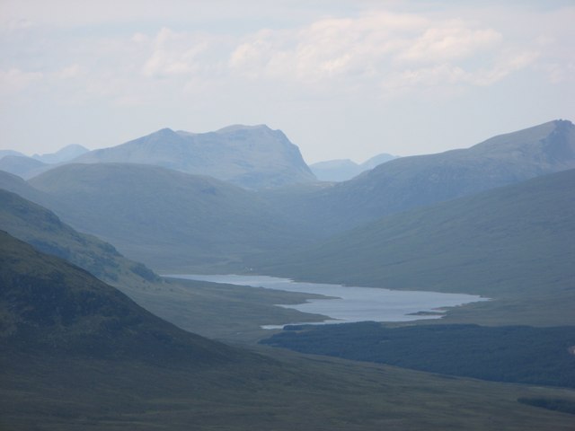
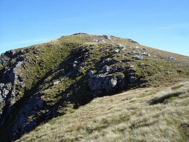
Coille Sròn na Goibhre, located in Cromartyshire, is a beautiful woodland area that spans over several acres. This enchanting forest is characterized by its diverse flora and fauna, making it a haven for nature enthusiasts and wildlife lovers alike.

The forest is primarily composed of native tree species, including oak, birch, and pine, which create a stunning green canopy that stretches as far as the eye can see. Walking through Coille Sròn na Goibhre, visitors can breathe in the fresh, earthy scent of the forest and listen to the soothing sounds of chirping birds and rustling leaves.

The forest is home to a wide variety of wildlife, including red squirrels, roe deer, and an array of bird species. It is not uncommon to spot these creatures while exploring the well-maintained trails that wind through the woodland. Birdwatchers will be delighted by the chance to observe species such as woodpeckers, tawny owls, and chaffinches in their natural habitat.

Coille Sròn na Goibhre also offers recreational activities for visitors. There are picnic areas scattered throughout the forest, providing a perfect spot for families and friends to enjoy a leisurely lunch surrounded by nature. Additionally, the forest is a popular destination for hiking and cycling, with trails suitable for all skill levels.

Overall, Coille Sròn na Goibhre is a picturesque woodland that offers a serene escape from the hustle and bustle of everyday life. Its natural beauty, diverse wildlife, and recreational opportunities make it a must-visit destination for anyone seeking tranquility and an immersive nature experience.

If you have any feedback on the listing, please let us know in the comments section below.

Coille Sròn na Goibhre Images

Images are sourced within 2km of 57.708356/-5.1384772 or Grid Reference NH1373. Thanks to Geograph Open Source API. All images are credited.

Lochivraon Bothy
Lochivraon Bothy
Loch a' Bhraoin View from the slopes of Creag Rainich.
Loch a' Bhraoin
View from the slopes of Creag Rainich.
Loch a' Bhraoin Before the road went in, there was a very rough path which used the beaches along the loch.
Loch a' Bhraoin
Before the road went in, there was a very rough path which used the beaches along the loch.
Lochivraon in 1993 The building in the image appears in this item - <span class="nowrap"><a title="https://ancoisnamara.blog/2017/01/09/a-walk-to-loch-abhraoin-bothy/#jp-carousel-1698" rel="nofollow ugc noopener" href="https://ancoisnamara.blog/2017/01/09/a-walk-to-loch-abhraoin-bothy/#jp-carousel-1698">Link</a><img style="margin-left:2px;" alt="External link" title="External link - shift click to open in new window" src="https://s1.geograph.org.uk/img/external.png" width="10" height="10"/></span> - to have been renovated but on the visit in April 1993 Lochivraon was in a poor state inside and out. A diary entry records that the upper floor was sealed off by a steel plate. At the far left side of the image and more distantly is a building which seems to be in use as a bothy, but not one maintained by the MBA.
Lochivraon in 1993
The building in the image appears in this item - LinkExternal link - to have been renovated but on the visit in April 1993 Lochivraon was in a poor state inside and out. A diary entry records that the upper floor was sealed off by a steel plate. At the far left side of the image and more distantly is a building which seems to be in use as a bothy, but not one maintained by the MBA.
North ridge of A' Chailleach The ridge extends to reach a minor rise named Sròn na Goibhre. Loch a' Bhraoin can be seen beyond the sunlit col and past the rainbow. The summit of A' Chailleach of course rises to the left.
North ridge of A' Chailleach
The ridge extends to reach a minor rise named Sròn na Goibhre. Loch a' Bhraoin can be seen beyond the sunlit col and past the rainbow. The summit of A' Chailleach of course rises to the left.
Slope descending towards Nest of Fannich The slope is descending from high on the Munro, A' Chailleach, towards the Nest of Fannich which is the unusual name given to the valley of the Abhainn Nid.
The Abhainn Nid can be seen to flow into Loch Fannich.
Slope descending towards Nest of Fannich
The slope is descending from high on the Munro, A' Chailleach, towards the Nest of Fannich which is the unusual name given to the valley of the Abhainn Nid. The Abhainn Nid can be seen to flow into Loch Fannich.
Another view of the A'Chailleach landslip
Glas Leathad a'Chaillich Slope profile
Glas Leathad a'Chaillich
Slope profile
Spring on the slope Typical grassy hillside with numerous watercourses too small to be marked on the maps.
Spring on the slope
Typical grassy hillside with numerous watercourses too small to be marked on the maps.
Downy birch by the stream Wish I had GPS on my camera for places like this. Definitely in this square, almost definitely this stream.
Downy birch by the stream
Wish I had GPS on my camera for places like this. Definitely in this square, almost definitely this stream.
Snow cornice on A' Chailleach
View across north ridge of A' Chailleach towards An Teallach
View from A' Chailleach Looking out across the Fannichs
View from A' Chailleach
Looking out across the Fannichs
View from A' Chailleach Looking towards the Torridon hills & Slioch
View from A' Chailleach
Looking towards the Torridon hills & Slioch
A' Chailleach summit cairn View towards An Teallach
A' Chailleach summit cairn
View towards An Teallach
View south west from A' Chailleach Looking down the south west ridge to the lochan-speckled rough moorland of the Kinlochewe Forest. Glen Torridon can be seen in the distance, with the peaks of the Coulin Forest to the left, Beinn Eighe and others to the right, and Beinn Damh central in the far distance.
View south west from A' Chailleach
Looking down the south west ridge to the lochan-speckled rough moorland of the Kinlochewe Forest. Glen Torridon can be seen in the distance, with the peaks of the Coulin Forest to the left, Beinn Eighe and others to the right, and Beinn Damh central in the far distance.
View north east from A' Chailleach Looking towards the Beinn Dearg range, with the A832 approaching the Corrieshalloch gorge down on the left.
View north east from A' Chailleach
Looking towards the Beinn Dearg range, with the A832 approaching the Corrieshalloch gorge down on the left.
Show me another place!

Coille Sròn na Goibhre is located at Grid Ref: NH1373 (Lat: 57.708356, Lng: -5.1384772)

Unitary Authority: Highland

Police Authority: Highlands and Islands

What 3 Words

///holly.marathons.punctuate. Near Achnasheen, Highland

Nearby Locations

Coille Sròn na Goibhre

Related Wikis

Loch a' Bhraoin

Loch a' Bhraoin, Loch Broom (Scottish Gaelic: Loch of showers or drizzling rain), is a freshwater loch, located in Wester Ross, in Ross-shire, on the west...

A' Chailleach (Fannichs)

A' Chailleach (Scottish Gaelic for 'the old woman or Cailleach') is a mountain in the Northwest Highlands of Scotland. It lies in the Fannichs of Wester...

Sgùrr Breac

Sgùrr Breac is a mountain with a height of 999 metres (3,278 ft) in Wester Ross in the Northwest Highlands of Scotland. A remote mountain, Sgùrr Breac...

Creag Rainich

Creag Rainich (807 m) is a remote mountain in the Northwest Highlands, Scotland, southwest of Ullapool. An isolated peak, its position provides fine views...

Nearby Amenities

Located within 500m of 57.708356,-5.1384772
The data included in this document is from www.openstreetmap.org. The data is made available under ODbL.

Have you been to Coille Sròn na Goibhre?

Leave your review of Coille Sròn na Goibhre below (or comments, questions and feedback).