Paddy's Plantation

Wood, Forest in Wigtownshire

Scotland

Paddy's Plantation

End of Clifftop Walk from Port Logan It is rare to see a yellow waymarker pointing straight down.  This one means 'turn back'.
There is no easy way beyond this point.
End of Clifftop Walk from Port Logan Credit: Rose and Trev Clough

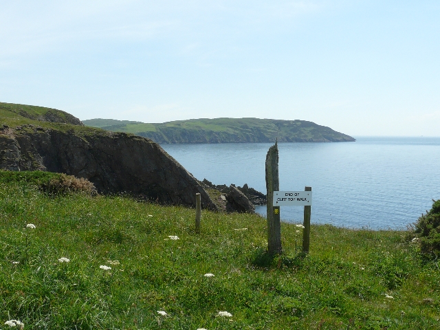
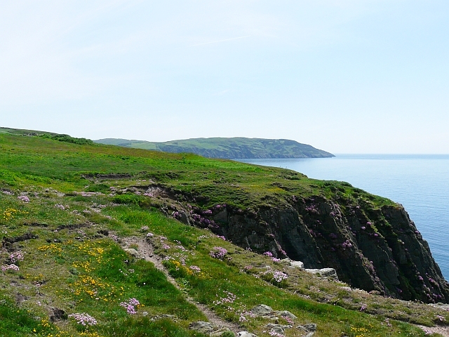
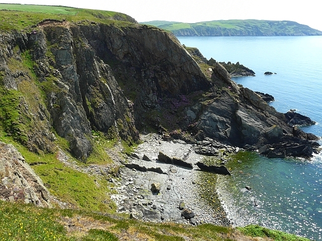
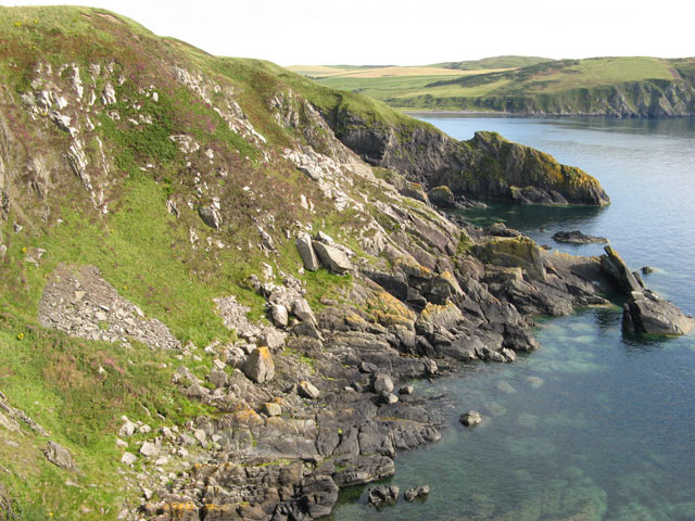
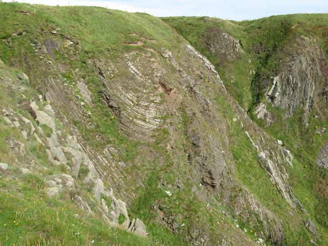
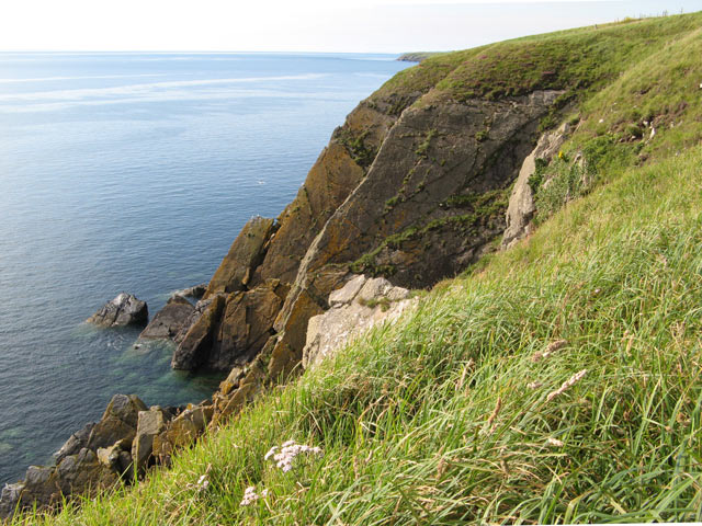
Paddy's Plantation is a sprawling wood or forest located in Wigtownshire, Scotland. It is known for its lush greenery, diverse flora, and serene atmosphere. Covering an area of approximately 500 acres, Paddy's Plantation is a popular destination for nature enthusiasts, hikers, and wildlife photographers.

The wood is predominantly composed of native trees such as oak, beech, and birch, providing a rich habitat for various species of birds, mammals, and insects. The dense foliage and well-maintained pathways create an enchanting environment for visitors to explore and immerse themselves in nature.

Paddy's Plantation offers a range of walking trails, catering to both casual walkers and experienced hikers. The trails wind through the wood, offering stunning views of the surrounding landscape and glimpses of wildlife along the way. Visitors can also find several designated picnic areas, providing an ideal spot to relax and enjoy the tranquil surroundings.

The plantation is open to the public year-round, with different seasons offering unique experiences. In the spring, the wood comes alive with vibrant wildflowers and the songs of migratory birds. Summer brings canopy-covered paths and cool, shaded areas to escape the heat. In autumn, the wood transforms into a colorful spectacle as the leaves change, creating a picturesque setting. And in winter, the plantation is transformed into a peaceful wonderland, with snow-covered trees and a serene ambiance.

Overall, Paddy's Plantation in Wigtownshire is a natural treasure, offering visitors an opportunity to connect with nature, explore diverse ecosystems, and enjoy the tranquility of a well-preserved wood.

If you have any feedback on the listing, please let us know in the comments section below.

Paddy's Plantation Images

Images are sourced within 2km of 54.722467/-4.9438301 or Grid Reference NX1040. Thanks to Geograph Open Source API. All images are credited.

End of Clifftop Walk from Port Logan It is rare to see a yellow waymarker pointing straight down.  This one means 'turn back'.
There is no easy way beyond this point.
End of Clifftop Walk from Port Logan
It is rare to see a yellow waymarker pointing straight down. This one means 'turn back'. There is no easy way beyond this point.
Path from Cairnywellan Head An unofficial footpath that comes to an abrupt halt a little further south <a href="https://www.geograph.org.uk/photo/838279">NX0939 : End of Clifftop Walk from Port Logan</a> .
Path from Cairnywellan Head
An unofficial footpath that comes to an abrupt halt a little further south NX0939 : End of Clifftop Walk from Port Logan .
Cliffs overlooking Slate Heugh Bay The rock is greywacke of Early Silurian age.
Cliffs overlooking Slate Heugh Bay
The rock is greywacke of Early Silurian age.
Slate Heugh Bay The cliffs here are composed of greywacke, a sedimentary rock, laid down in the Early Silurian period. In the bay a jagged line of upstanding rock crosses the shore from the sea, and appears to continue as a white line all the way up the cliff. This is a later intrusion of hard igneous rock, and is mentioned in the British Geological Survey's excursion guide to the area <span class="nowrap"><a title="http://shop.bgs.ac.uk/Bookshop/product.cfm?p_id=GSWS" rel="nofollow ugc noopener" href="http://shop.bgs.ac.uk/Bookshop/product.cfm?p_id=GSWS">Link</a><img style="margin-left:2px;" alt="External link" title="External link - shift click to open in new window" src="https://s1.geograph.org.uk/img/external.png" width="10" height="10"/></span> as "a cross-cutting, Tertiary dolerite dyke".
Slate Heugh Bay
The cliffs here are composed of greywacke, a sedimentary rock, laid down in the Early Silurian period. In the bay a jagged line of upstanding rock crosses the shore from the sea, and appears to continue as a white line all the way up the cliff. This is a later intrusion of hard igneous rock, and is mentioned in the British Geological Survey's excursion guide to the area LinkExternal link as "a cross-cutting, Tertiary dolerite dyke".
Farm quarry A convenient source of easily-worked stone. This band of slatey rock, part of the Silurian Gala Group of greywackes, runs across the Rhins and is worked in several places. See <a href="https://www.geograph.org.uk/photo/3141425">NX1139 : Quarry lakes</a> for another. In this image the bedding of the rocks is very clear, steep and northerly, and that is a regional trend reflecting the collision of continents in the Caledonian orogeny.
Farm quarry
A convenient source of easily-worked stone. This band of slatey rock, part of the Silurian Gala Group of greywackes, runs across the Rhins and is worked in several places. See NX1139 : Quarry lakes for another. In this image the bedding of the rocks is very clear, steep and northerly, and that is a regional trend reflecting the collision of continents in the Caledonian orogeny.
Please shut the gate An excellent reminder in colloqial Scots that closing the gate behind you is important under all circumstances. The animals that occasion the reminder are clustered on the hill overlooking Port Logan.
Please shut the gate
An excellent reminder in colloqial Scots that closing the gate behind you is important under all circumstances. The animals that occasion the reminder are clustered on the hill overlooking Port Logan.
Junction of the tracks The way-marked track from Port Logan comes in from the left here, and is signposted towards Cowans. Behind the camera stretches the route to Clanyard and Inshanks, which is the old road.
Junction of the tracks
The way-marked track from Port Logan comes in from the left here, and is signposted towards Cowans. Behind the camera stretches the route to Clanyard and Inshanks, which is the old road.
Track to Clanyard Beyond the limit of fields belonging to Cowans, the track sees little use, but it is a fine walking route. Barncorkrie Moor and Cairn Fell make the far horizon.
Track to Clanyard
Beyond the limit of fields belonging to Cowans, the track sees little use, but it is a fine walking route. Barncorkrie Moor and Cairn Fell make the far horizon.
Track to Port Logan Looking towards Port Logan on the waymarked track that is the old road from Inshanks and Clanyard. Here it just clips the corner of another square as it makes its lonely way through the fields.
Track to Port Logan
Looking towards Port Logan on the waymarked track that is the old road from Inshanks and Clanyard. Here it just clips the corner of another square as it makes its lonely way through the fields.
Heathery slope A wonderful patchwork of colours, with heather blooming among dead bracken fronds and dried grasses.
Heathery slope
A wonderful patchwork of colours, with heather blooming among dead bracken fronds and dried grasses.
Strones Bay Patches of rockfall, scree and huge boulders of probable glacial origin make a superb rocky ensemble, with Clanyard Bay to the south.
Strones Bay
Patches of rockfall, scree and huge boulders of probable glacial origin make a superb rocky ensemble, with Clanyard Bay to the south.
Folded strata Within the Silurian Gala Group greywackes there are some sections of thinly-bedded strata which show very clearly the pervasive and severe deformation experienced during the Caledonian orogeny. The cliffs here show how tight folding has resulted in detachment and faulting of these incompetent strata. Deep gullies have been eroded by streams descending from the undulating terrain above the cliffs.
Folded strata
Within the Silurian Gala Group greywackes there are some sections of thinly-bedded strata which show very clearly the pervasive and severe deformation experienced during the Caledonian orogeny. The cliffs here show how tight folding has resulted in detachment and faulting of these incompetent strata. Deep gullies have been eroded by streams descending from the undulating terrain above the cliffs.
Tilted strata In contrast with the folding demonstrated by the section above Strones Bay (<a href="https://www.geograph.org.uk/photo/3153076">NX0938 : Folded strata</a>) The Lennans demonstrate competent strata that are steeply tilted, but flat. Complete beds have simply spalled away to leave clean bedding surfaces, and gaps between the flat slabs give rise to the caves marked on the map, but not visible from above.
Tilted strata
In contrast with the folding demonstrated by the section above Strones Bay (NX0938 : Folded strata) The Lennans demonstrate competent strata that are steeply tilted, but flat. Complete beds have simply spalled away to leave clean bedding surfaces, and gaps between the flat slabs give rise to the caves marked on the map, but not visible from above.
Cliff fall The disposition of the strata here show great confusion, and the rock is seriously fractured. It is no surprise to see a fresh rock fall on the north side of Slouchnamorroch Bay. The Mull of Logan juts out in the far distance.
Cliff fall
The disposition of the strata here show great confusion, and the rock is seriously fractured. It is no surprise to see a fresh rock fall on the north side of Slouchnamorroch Bay. The Mull of Logan juts out in the far distance.
Igneous intrusion Looking across Slouchnamorroch Bay the rock strata appear to tilt in different directions. Thinly-bedded formation in the distance presents a huge bedding plane to the camera, while nearer at hand a tabular feature dips steeply out to sea, casting a deep shadow. This appears to be a dyke which has resisted erosion and stands proud of weaker sedimentary strata. Difficult to prove without venturing closer, but the online geological map confirms the hypothesis if the location is correct. The dyke is associated with magmatism during the Caledonian orogeny, and there are many small features in the Rhins as well as the larger intrusion of Portencorkrie (<a href="https://www.geograph.org.uk/photo/3079211">NX0835 : Granite scenery</a>).
Igneous intrusion
Looking across Slouchnamorroch Bay the rock strata appear to tilt in different directions. Thinly-bedded formation in the distance presents a huge bedding plane to the camera, while nearer at hand a tabular feature dips steeply out to sea, casting a deep shadow. This appears to be a dyke which has resisted erosion and stands proud of weaker sedimentary strata. Difficult to prove without venturing closer, but the online geological map confirms the hypothesis if the location is correct. The dyke is associated with magmatism during the Caledonian orogeny, and there are many small features in the Rhins as well as the larger intrusion of Portencorkrie (NX0835 : Granite scenery).
Track to Port Logan
Track to Port Logan
Track to Castle Clanyard
Cattle near Mugloch Hill
Show me another place!

Paddy's Plantation is located at Grid Ref: NX1040 (Lat: 54.722467, Lng: -4.9438301)

Unitary Authority: Dumfries and Galloway

Police Authority: Dumfries and Galloway

What 3 Words

///mermaids.grazed.swerving. Near Drummore, Dumfries & Galloway

Related Wikis

Port Logan

Port Logan, formerly Port Nessock, is a small village in the parish of Kirkmaiden in the Rhins of Galloway in Wigtownshire. The Gaelic name is Port Neasaig...

Logan Botanic Garden

Logan Botanic Garden is a botanical garden near Port Logan on the Rhins of Galloway, at the south-western tip of Scotland. The Botanic Garden was established...

Kirkmaiden

Kirkmaiden is a parish in the Rhins of Galloway, the most southerly in Scotland; the present Church of Scotland parish has the same name as and is approximately...

Kirkmaiden (village)

Kirkmaiden (sometimes Maidenkirk; Scottish Gaelic: Cill M'Eudan) is a small settlement in Galloway, Scotland, located approximately 17 miles (27 km) south...

Nearby Amenities

Located within 500m of 54.722467,-4.9438301
Power: pole
Lat/Long: 54.7238099/-4.9364515
Power: pole
Lat/Long: 54.7237393/-4.937668
Power: pole
Lat/Long: 54.7236541/-4.9390067
Power: pole
Lat/Long: 54.7239802/-4.9379881
Power: pole
Lat/Long: 54.7238592/-4.9383393
Power: pole
Lat/Long: 54.723774/-4.9400893
Power: pole
Lat/Long: 54.7238681/-4.9409507
Power: pole
Lat/Long: 54.7231824/-4.9513268
Power: pole
Lat/Long: 54.7225896/-4.9509776
Power: pole
Lat/Long: 54.7219969/-4.9506284
Power: pole
Lat/Long: 54.7213559/-4.95025
Power: pole
Lat/Long: 54.7207015/-4.9498717
Power: pole
Lat/Long: 54.7200852/-4.9495147
Power: pole
Lat/Long: 54.7193949/-4.9486707
Power: pole
Lat/Long: 54.7186687/-4.9477879
The data included in this document is from www.openstreetmap.org. The data is made available under ODbL.

Have you been to Paddy's Plantation?

Leave your review of Paddy's Plantation below (or comments, questions and feedback).