Coille Mhoruisge

Wood, Forest in Ross-shire

Scotland

Coille Mhoruisge

The upper edge of Coille Mhoruisge
The upper edge of Coille Mhoruisge Credit: Alan Reid

The requested URL returned error: 429 Too Many Requests

If you have any feedback on the listing, please let us know in the comments section below.

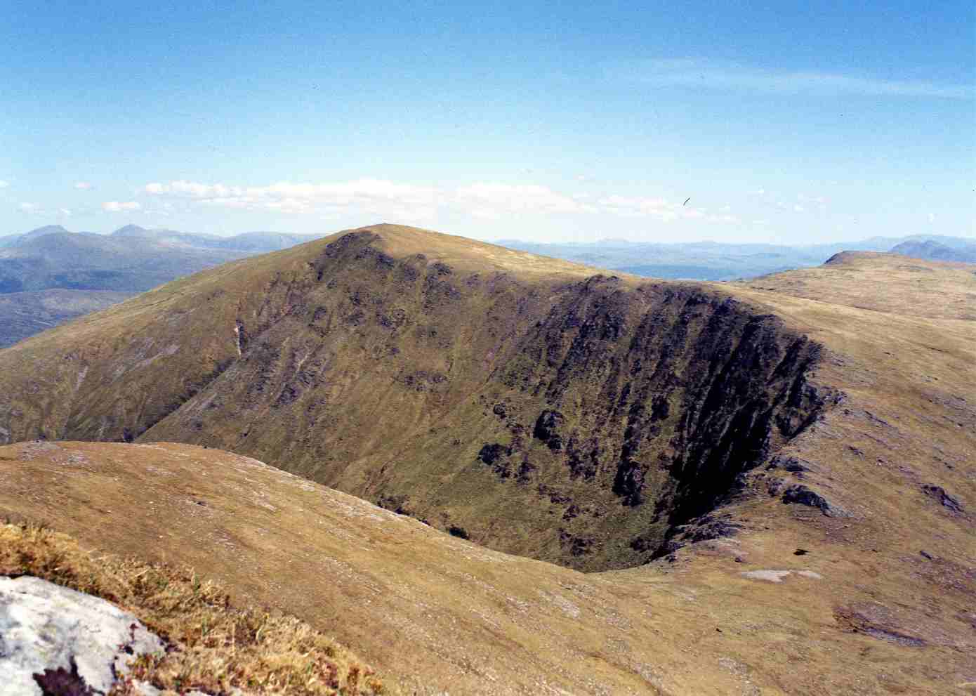
Coille Mhoruisge Images

Images are sourced within 2km of 57.523819/-5.1662982 or Grid Reference NH1052. Thanks to Geograph Open Source API. All images are credited.

The upper edge of Coille Mhoruisge
A890 road, through Glen Carron A long straight on the A890 road, heading towards Achnasheen. A fairly wide road, but not much traffic.
A sign on the left warns of deer.
A890 road, through Glen Carron
A long straight on the A890 road, heading towards Achnasheen. A fairly wide road, but not much traffic. A sign on the left warns of deer.
Loch Cnoc na Mòinteich
Old fence by Loch Cnoc na Mòinteich
Slope of Coire na Glas-lic The name Coire na Glas-lic means the Corry of the Grey Slab and refers to the prominent rock slabs in the background to this picture.
Slope of Coire na Glas-lic
The name Coire na Glas-lic means the Corry of the Grey Slab and refers to the prominent rock slabs in the background to this picture.
Derelict building, Loch Sgamhain The wooden former fish farm building becomes ever more derelict.
Derelict building, Loch Sgamhain
The wooden former fish farm building becomes ever more derelict.
Jetty on Loch Sgamhain The concrete jetty was built to serve a former fish farm. It looks like the jetty will survive longer than the nearby wooden boat house, that is now becoming very derelict. (See <a href="https://www.geograph.org.uk/photo/6090619">NH1053 : Derelict building, Loch Sgamhain</a>).
Jetty on Loch Sgamhain
The concrete jetty was built to serve a former fish farm. It looks like the jetty will survive longer than the nearby wooden boat house, that is now becoming very derelict. (See NH1053 : Derelict building, Loch Sgamhain).
Shore of Loch Sgamhain Looking east from close to the former fish farm jetty.
Shore of Loch Sgamhain
Looking east from close to the former fish farm jetty.
Road (A890) approaching Loch Sgamhain Looking south-westward.
Road (A890) approaching Loch Sgamhain
Looking south-westward.
Road (A890) in Glen Carron Looking north-eastward in the direction of Achnasheen.
Road (A890) in Glen Carron
Looking north-eastward in the direction of Achnasheen.
Loch Sgamhain Although you might expect a deep loch between the mountains, contour maps show this is a fairly flat bottomed valley and the loch is less than 30m deep.
Loch Sgamhain
Although you might expect a deep loch between the mountains, contour maps show this is a fairly flat bottomed valley and the loch is less than 30m deep.
A890 near to Loch Sgamhain The A890 is a non-primary cross-country route in sparsely populated, mountainous terrain from Lochalsh and Skye on the west coast of the Highlands to Achnasheen where it joins the A832 to Inverness. Like many Highland roads, the A890 was entirely single track until the 1960s, but road improvements in recent years (along with improvements on the A832) have made it increasingly popular as an alternative route between Inverness and the Isle of Skye, avoiding the A82 along Loch Ness. It is also an important route for residents of the Lochalsh, Applecross and Strathcarron areas, connecting them to the services of  Kyle of Lochalsh , as well as the High School in Plockton.
A890 near to Loch Sgamhain
The A890 is a non-primary cross-country route in sparsely populated, mountainous terrain from Lochalsh and Skye on the west coast of the Highlands to Achnasheen where it joins the A832 to Inverness. Like many Highland roads, the A890 was entirely single track until the 1960s, but road improvements in recent years (along with improvements on the A832) have made it increasingly popular as an alternative route between Inverness and the Isle of Skye, avoiding the A82 along Loch Ness. It is also an important route for residents of the Lochalsh, Applecross and Strathcarron areas, connecting them to the services of Kyle of Lochalsh , as well as the High School in Plockton.
A890, Glen Carron The A890 is a non-primary cross-country route in sparsely populated, mountainous terrain from Lochalsh and Skye on the west coast of the Highlands to Achnasheen where it joins the A832 to Inverness. Like many Highland roads, the A890 was entirely single track until the 1960s, but road improvements in recent years (along with improvements on the A832) have made it increasingly popular as an alternative route between Inverness and the Isle of Skye, avoiding the A82 along Loch Ness. It is also an important route for residents of the Lochalsh, Applecross and Strathcarron areas, connecting them to the services of  Kyle of Lochalsh , as well as the High School in Plockton.
A890, Glen Carron
The A890 is a non-primary cross-country route in sparsely populated, mountainous terrain from Lochalsh and Skye on the west coast of the Highlands to Achnasheen where it joins the A832 to Inverness. Like many Highland roads, the A890 was entirely single track until the 1960s, but road improvements in recent years (along with improvements on the A832) have made it increasingly popular as an alternative route between Inverness and the Isle of Skye, avoiding the A82 along Loch Ness. It is also an important route for residents of the Lochalsh, Applecross and Strathcarron areas, connecting them to the services of Kyle of Lochalsh , as well as the High School in Plockton.
A890, Glen Carron The A890 runs 32 miles from Achnasheen to Auchtertyre.
<span class="nowrap"><a title="https://www.sabre-roads.org.uk/wiki/index.php?title=A890" rel="nofollow ugc noopener" href="https://www.sabre-roads.org.uk/wiki/index.php?title=A890">Link</a><img style="margin-left:2px;" alt="External link" title="External link - shift click to open in new window" src="https://s1.geograph.org.uk/img/external.png" width="10" height="10"/></span>
A890, Glen Carron
The A890 runs 32 miles from Achnasheen to Auchtertyre. LinkExternal link
Loch Sgamhain The train bound for Kyle of Lochalsh approaches the shore of Loch Sgamhain along which it runs.
Loch Sgamhain
The train bound for Kyle of Lochalsh approaches the shore of Loch Sgamhain along which it runs.
A890 near Loch Sgamhain The A890 is a non-primary cross-country route in sparsely populated, mountainous terrain from Lochalsh and Skye on the west coast of the Highlands to Achnasheen where it joins the A832 to Inverness. Like many Highland roads, the A890 was entirely single track until the 1960s, but road improvements in recent years (along with improvements on the A832) have made it increasingly popular as an alternative route between Inverness and the Isle of Skye, avoiding the A82 along Loch Ness. It is also an important route for residents of the Lochalsh, Applecross and Strathcarron areas, connecting them to the services of  Kyle of Lochalsh , as well as the High School in Plockton.
A890 near Loch Sgamhain
The A890 is a non-primary cross-country route in sparsely populated, mountainous terrain from Lochalsh and Skye on the west coast of the Highlands to Achnasheen where it joins the A832 to Inverness. Like many Highland roads, the A890 was entirely single track until the 1960s, but road improvements in recent years (along with improvements on the A832) have made it increasingly popular as an alternative route between Inverness and the Isle of Skye, avoiding the A82 along Loch Ness. It is also an important route for residents of the Lochalsh, Applecross and Strathcarron areas, connecting them to the services of Kyle of Lochalsh , as well as the High School in Plockton.
A890, westbound The A890 runs 32 miles from Achnasheen to Auchtertyre.
<span class="nowrap"><a title="https://www.sabre-roads.org.uk/wiki/index.php?title=A890" rel="nofollow ugc noopener" href="https://www.sabre-roads.org.uk/wiki/index.php?title=A890">Link</a><img style="margin-left:2px;" alt="External link" title="External link - shift click to open in new window" src="https://s1.geograph.org.uk/img/external.png" width="10" height="10"/></span>
A890, westbound
The A890 runs 32 miles from Achnasheen to Auchtertyre. LinkExternal link
A890 towards Achnasheen
Show me another place!

Coille Mhoruisge is located at Grid Ref: NH1052 (Lat: 57.523819, Lng: -5.1662982)

Unitary Authority: Highland

Police Authority: Highlands and Islands

What 3 Words

///outfitter.verdict.fluid. Near Achnasheen, Highland

Nearby Locations

Coille Mhoruisge

Related Wikis

Loch Scaven

Loch Scaven (Scottish Gaelic: Loch Sgamhain) is a small freshwater loch at the head of Glen Carron near the source of the River Carron, Wester Ross, Scotland...

Mòruisg

Mòruisg is a Scottish mountain situated in the Glencarron and Glenuig Forest, 10 kilometres south west of the village of Achnasheen in the Highland council...

Ledgowan Forest

Ledgowan Forest is a deer forest in the Northwest Highlands of Scotland. It stands in Wester Ross to the southwest of Achnasheen. Ledgowan Forest is the...

Glencarron Estate

The Glencarron Estate is a 12,000 acre highland estate in Wester Ross. It provides sports facilities for fishing (river and loch) and grouse shooting....

Nearby Amenities

Located within 500m of 57.523819,-5.1662982
The data included in this document is from www.openstreetmap.org. The data is made available under ODbL.

Have you been to Coille Mhoruisge?

Leave your review of Coille Mhoruisge below (or comments, questions and feedback).