Back Plantation

Wood, Forest in Wigtownshire

Scotland

Back Plantation

Snow on the shore and lying on the sea at Sandhead A heavy snow shower fell on the sand when the tide was out. The incoming tide lifted the snow on top of the water. A rare sight for somewhere that gets snow about once every two or three years.
Snow on the shore and lying on the sea at Sandhead Credit: Colin McDonald

Back Plantation is a picturesque woodland located in Wigtownshire, a region in the southwest of Scotland. The plantation covers an area of approximately 50 acres and is known for its diverse and lush forest ecosystem.

The woodland is primarily composed of native tree species such as oak, beech, and birch, which create a dense and vibrant canopy overhead. The forest floor is adorned with a variety of wildflowers and ferns, adding to the area's natural beauty. The presence of these flora also attracts a wide range of bird species, making it a popular spot for birdwatching enthusiasts.

Back Plantation offers numerous walking trails, allowing visitors to explore the woodland and immerse themselves in its tranquil ambiance. The paths wind through the trees, offering glimpses of wildlife and providing ample opportunities for nature photography. The plantation is also home to several species of mammals, including red squirrels and deer, providing an additional element of wildlife viewing for visitors.

In addition to its natural attractions, Back Plantation boasts a rich cultural history. The woodland is believed to have been part of a larger estate in the 18th century, and remnants of old stone walls and structures can still be found scattered throughout the area. These historical features add a sense of mystery and intrigue to the woodland, making it a fascinating destination for history enthusiasts.

Overall, Back Plantation is a captivating woodland that offers a peaceful retreat for nature lovers and history buffs alike. Its diverse ecosystem, scenic beauty, and cultural significance make it a must-visit destination in Wigtownshire.

If you have any feedback on the listing, please let us know in the comments section below.

Back Plantation Images

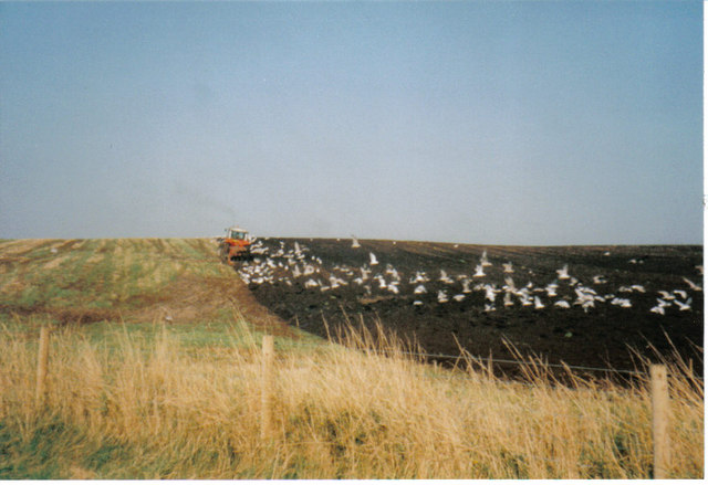
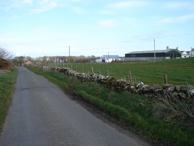
Images are sourced within 2km of 54.808339/-4.974995 or Grid Reference NX0850. Thanks to Geograph Open Source API. All images are credited.

Snow on the shore and lying on the sea at Sandhead A heavy snow shower fell on the sand when the tide was out. The incoming tide lifted the snow on top of the water. A rare sight for somewhere that gets snow about once every two or three years.
Snow on the shore and lying on the sea at Sandhead
A heavy snow shower fell on the sand when the tide was out. The incoming tide lifted the snow on top of the water. A rare sight for somewhere that gets snow about once every two or three years.
Shoreline, Sandhead bay This shore is at the south end of Sandhead Bay - part of Luce Bay
Shoreline, Sandhead bay
This shore is at the south end of Sandhead Bay - part of Luce Bay
Kirkmadrine Church (disused) This disused church is only just in this square located at NX080484. Housed in the old entrance to the church are some of the earliest Christian sculptured stones some of which date back to the 5th century.
Kirkmadrine Church (disused)
This disused church is only just in this square located at NX080484. Housed in the old entrance to the church are some of the earliest Christian sculptured stones some of which date back to the 5th century.
Sandhead Village, about 8 miles South of Stranraer The village of Sandhead photographed on a dull Autumn day from the beach at low tide.
Sandhead Village, about 8 miles South of Stranraer
The village of Sandhead photographed on a dull Autumn day from the beach at low tide.
Kirkmadrine Church Probably the site of a monastery in the early Christian period and later of a medieval parish church, built as a burial chapel in the late 19th Century by Lady McTaggart Stewart of Ardwell.
Kirkmadrine Church
Probably the site of a monastery in the early Christian period and later of a medieval parish church, built as a burial chapel in the late 19th Century by Lady McTaggart Stewart of Ardwell.
Cross in Kirkmadrine Churchyard
Sandhead beach Looking north east.
Sandhead beach
Looking north east.
Sandhead beach Looking south.
Sandhead beach
Looking south.
Kirkmadrine Church This is no longer used as a church but it is the site of an early Christian community. The Kirkmadrine Stones are fine sculptured stones from the 5th century. They are displayed in a glass-fronted porch at the west of the church.
Kirkmadrine Church
This is no longer used as a church but it is the site of an early Christian community. The Kirkmadrine Stones are fine sculptured stones from the 5th century. They are displayed in a glass-fronted porch at the west of the church.
Church Porch, Kirkmadrine This is a glassed porch which contains early Christian stones [5th century]
Church Porch, Kirkmadrine
This is a glassed porch which contains early Christian stones [5th century]
Field -gulls following the plough After harvesting, the stubble is being ploughed in. This is on an unclassified road near Sandhead, between Balgreggan and Cairngarroch farms.
Field -gulls following the plough
After harvesting, the stubble is being ploughed in. This is on an unclassified road near Sandhead, between Balgreggan and Cairngarroch farms.
Playground at Sandhead The main part of the village is on a raised beach. The old sea cliff can be seen behind.
Playground at Sandhead
The main part of the village is on a raised beach. The old sea cliff can be seen behind.
Stoneykirk Old Manse, Sandhead Old manse for the now disused Stoneykirk Free Church (in trees behind manse); both date from 1844. The buildings actually stand to the south of Sandhead at Lake Cottage junction.
Stoneykirk Old Manse, Sandhead
Old manse for the now disused Stoneykirk Free Church (in trees behind manse); both date from 1844. The buildings actually stand to the south of Sandhead at Lake Cottage junction.
Kirkmadrine Stones The 5th century Kirkmadrine Christian sculptured stones are displayed in the glass-fronted west porch of Kirkmadrine Church; they are under the care of Historic Scotland.
Kirkmadrine Stones
The 5th century Kirkmadrine Christian sculptured stones are displayed in the glass-fronted west porch of Kirkmadrine Church; they are under the care of Historic Scotland.
Toskerton Kirk Road Upper part of track (former Kirk Road) that originally led to the medieval Toskerton Parish Church, it was rebuilt on by Kirkmadrine Church <a href="https://www.geograph.org.uk/gridref/NX0848">NX0848</a>.
Toskerton Kirk Road
Upper part of track (former Kirk Road) that originally led to the medieval Toskerton Parish Church, it was rebuilt on by Kirkmadrine Church NX0848.
Moorpark Farm, Balgreggan Moorpark Farm situated on the Sandhead-Cairngarroch road.
Moorpark Farm, Balgreggan
Moorpark Farm situated on the Sandhead-Cairngarroch road.
Parking area on the sea front at Sandhead
Track at Kirkmadrine Church The track at Kirkmadrine Church as seen from the entrance to the kirk yard.
Track at Kirkmadrine Church
The track at Kirkmadrine Church as seen from the entrance to the kirk yard.
Show me another place!

Back Plantation is located at Grid Ref: NX0850 (Lat: 54.808339, Lng: -4.974995)

Unitary Authority: Dumfries and Galloway

Police Authority: Dumfries and Galloway

What 3 Words

///seating.screeches.this. Near Stranraer, Dumfries & Galloway

Related Wikis

Sandhead

Sandhead is a small village in Dumfries and Galloway, south west Scotland. It overlooks Luce Bay, 7 miles south of Stranraer. The old main road, named...

Stoneykirk

Stoneykirk (Scottish Gaelic: Eaglais Steafain) is an area and a village in the heart of the Rhins of Galloway, Wigtownshire, in the administrative council...

Clachanmore

Clachanmore is a village in the South Rhins of Galloway near Ardwell in the south west of Scotland. It has also been known as Low Ardwell. The name of...

Ardwell

Ardwell (from Gaelic Àrd Bhaile meaning "high town", pronounced as "Ardwell") is a village in the Scottish unitary council area of Dumfries and Galloway...

Nearby Amenities

Located within 500m of 54.808339,-4.974995
Mains of Balreggan
Place: farm
Lat/Long: 54.8105172/-4.9781059
Power: pole
Lat/Long: 54.8044525/-4.9725607
Power: pole
Lat/Long: 54.8051327/-4.9716568
Power: pole
Lat/Long: 54.80568/-4.9709165
Power: pole
Lat/Long: 54.8062859/-4.9704552
Power: pole
Lat/Long: 54.8068811/-4.9700126
Power: pole
Lat/Long: 54.8077159/-4.9693313
Power: pole
Lat/Long: 54.808243/-4.9689075
Power: pole
Lat/Long: 54.8086913/-4.9685589
Power: pole
Lat/Long: 54.8094317/-4.9679714
Power: pole
Lat/Long: 54.8098367/-4.9676925
Balgreggan
Place: locality
Lat/Long: 54.8093885/-4.9753998
Power: pole
Lat/Long: 54.8122067/-4.9711598
Power: pole
Lat/Long: 54.8121256/-4.9719462
Power: pole
Lat/Long: 54.8120268/-4.9728548
Power: pole
Lat/Long: 54.811947/-4.9736975
Power: pole
Lat/Long: 54.8118902/-4.975146
Power: pole
Lat/Long: 54.8118577/-4.9761344
Power: pole
Lat/Long: 54.8115384/-4.9771908
Power: pole
Lat/Long: 54.8112259/-4.9782097
Power: pole
Lat/Long: 54.810935/-4.9792403
Power: pole
Lat/Long: 54.8106239/-4.9803249
Power: pole
Lat/Long: 54.8103154/-4.9813625
Power: pole
Lat/Long: 54.8099675/-4.9821489
Power: pole
Lat/Long: 54.8094036/-4.9813226
Power: pole
Lat/Long: 54.8089882/-4.980731
Power: pole
Lat/Long: 54.8084944/-4.9799798
The data included in this document is from www.openstreetmap.org. The data is made available under ODbL.

Have you been to Back Plantation?

Leave your review of Back Plantation below (or comments, questions and feedback).