Ballochalee Plantation

Wood, Forest in Wigtownshire

Scotland

Ballochalee Plantation

Snow on the shore and lying on the sea at Sandhead A heavy snow shower fell on the sand when the tide was out. The incoming tide lifted the snow on top of the water. A rare sight for somewhere that gets snow about once every two or three years.
Snow on the shore and lying on the sea at Sandhead Credit: Colin McDonald

Ballochalee Plantation is a picturesque woodland area located in Wigtownshire, Scotland. The plantation covers an expansive area of land, providing a haven for nature enthusiasts and outdoor lovers. It is situated near the small village of Ballochalee, offering convenient access to visitors.

The plantation boasts a diverse range of tree species, including oak, beech, and pine, creating a lush and vibrant forest environment. The trees are meticulously maintained and managed, ensuring their health and longevity. The woodland's rich biodiversity supports a wide array of wildlife, with various bird species, mammals, and insects calling the area home.

Walking and hiking trails crisscross the plantation, allowing visitors to explore the enchanting woodland at their own pace. These paths provide an opportunity to immerse oneself in the natural beauty of the area while enjoying the tranquility and serenity it offers. Along the way, visitors may encounter stunning viewpoints, babbling brooks, and vibrant wildflowers, enhancing the overall experience.

Ballochalee Plantation is also a popular destination for outdoor recreational activities. It offers opportunities for cycling, picnicking, and even orienteering, making it an ideal spot for a day out with family or friends. The well-maintained amenities and facilities within the plantation ensure visitors' comfort and convenience.

Overall, Ballochalee Plantation in Wigtownshire is a captivating woodland retreat that provides a perfect escape from the hustle and bustle of daily life. Its natural beauty, diverse wildlife, and recreational opportunities make it a must-visit destination for those seeking solace in nature.

If you have any feedback on the listing, please let us know in the comments section below.

Ballochalee Plantation Images

Images are sourced within 2km of 54.815218/-4.9760147 or Grid Reference NX0850. Thanks to Geograph Open Source API. All images are credited.

Snow on the shore and lying on the sea at Sandhead A heavy snow shower fell on the sand when the tide was out. The incoming tide lifted the snow on top of the water. A rare sight for somewhere that gets snow about once every two or three years.
Snow on the shore and lying on the sea at Sandhead
A heavy snow shower fell on the sand when the tide was out. The incoming tide lifted the snow on top of the water. A rare sight for somewhere that gets snow about once every two or three years.
Sandhead Village, about 8 miles South of Stranraer The village of Sandhead photographed on a dull Autumn day from the beach at low tide.
Sandhead Village, about 8 miles South of Stranraer
The village of Sandhead photographed on a dull Autumn day from the beach at low tide.
Sandhead beach Looking north east.
Sandhead beach
Looking north east.
Sandhead beach Looking south.
Sandhead beach
Looking south.
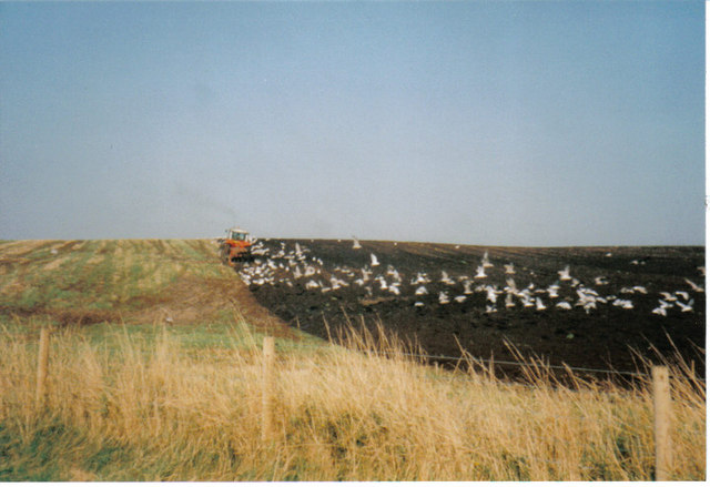
Field -gulls following the plough After harvesting, the stubble is being ploughed in. This is on an unclassified road near Sandhead, between Balgreggan and Cairngarroch farms.
Field -gulls following the plough
After harvesting, the stubble is being ploughed in. This is on an unclassified road near Sandhead, between Balgreggan and Cairngarroch farms.
Playground at Sandhead The main part of the village is on a raised beach. The old sea cliff can be seen behind.
Playground at Sandhead
The main part of the village is on a raised beach. The old sea cliff can be seen behind.
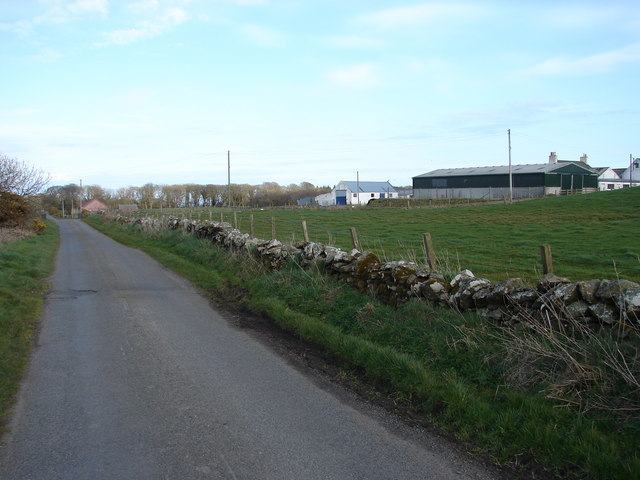
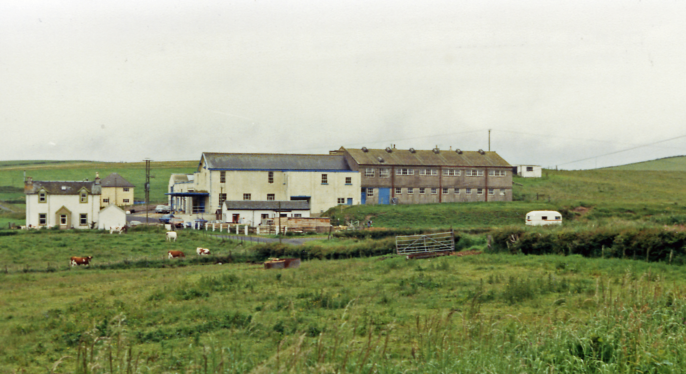
Moorpark Farm, Balgreggan Moorpark Farm situated on the Sandhead-Cairngarroch road.
Moorpark Farm, Balgreggan
Moorpark Farm situated on the Sandhead-Cairngarroch road.
Parking area on the sea front at Sandhead
View from picnic site at Sandhead Bay Taken from the southern end of long parking area just above the sandy beach.
View from picnic site at Sandhead Bay
Taken from the southern end of long parking area just above the sandy beach.
High tide at Sandhead, looking north
High tide at Sandhead, looking southeast Purdie's Point is across the bay.  The Isle of Man can be seen on the horizon.
High tide at Sandhead, looking southeast
Purdie's Point is across the bay. The Isle of Man can be seen on the horizon.
Parking area by the beach at Sandhead
Public toilets, Sandhead
Children's play area overlooking Luce Bay There is a parking area beyond the playing area, right on the edge of the beach.
Children's play area overlooking Luce Bay
There is a parking area beyond the playing area, right on the edge of the beach.
Luce Bay View, Sandhead
McKenzie's shop, Sandhead This village shop stands at the junction of Main Street and Luce Bay View.
McKenzie's shop, Sandhead
This village shop stands at the junction of Main Street and Luce Bay View.
Tigh-Na-Mara Hotel This hotel is on Main Street.
Tigh-Na-Mara Hotel
This hotel is on Main Street.
Sandhead Bay in Spring Looking across Sandwell Bay to north end of Luce Bay.  The whiffs of grey smoke (visible above and to right of the heads of couple with white dog in right foreground) are from an ignited demolition charge used during training at MOD West Freugh range.
Sandhead Bay in Spring
Looking across Sandwell Bay to north end of Luce Bay. The whiffs of grey smoke (visible above and to right of the heads of couple with white dog in right foreground) are from an ignited demolition charge used during training at MOD West Freugh range.
Show me another place!

Ballochalee Plantation is located at Grid Ref: NX0850 (Lat: 54.815218, Lng: -4.9760147)

Unitary Authority: Dumfries and Galloway

Police Authority: Dumfries and Galloway

What 3 Words

///wove.coconuts.angers. Near Stranraer, Dumfries & Galloway

Related Wikis

Sandhead

Sandhead is a small village in Dumfries and Galloway, south west Scotland. It overlooks Luce Bay, 7 miles south of Stranraer. The old main road, named...

Stoneykirk

Stoneykirk (Scottish Gaelic: Eaglais Steafain) is an area and a village in the heart of the Rhins of Galloway, Wigtownshire, in the administrative council...

RAF West Freugh

RAF West Freugh is a former Royal Air Force station located in Wigtownshire, 5 miles (8 km) south east of Stranraer, Dumfries and Galloway, Scotland. It...

Clachanmore

Clachanmore is a village in the South Rhins of Galloway near Ardwell in the south west of Scotland. It has also been known as Low Ardwell.The name of the...

Garthland Castle

Garthland Castle was a castle that was located near Garthland Mains, Dumfries and Galloway, Scotland.The castle was possibly built in 1211, as a datestone...

Ardwell

Ardwell (from Gaelic Àrd Bhaile meaning "high town", pronounced as "Ardwell") is a village in the Scottish unitary council area of Dumfries and Galloway...

Lochans, Dumfries and Galloway

Lochans is a small village around 2.5 miles (4.0 km) south of Stranraer, in Dumfries and Galloway in south-west Scotland. In 1971 it had a population of...

Colfin railway station

Colfin railway station, located in Wigtownshire, Scotland, between Portpatrick and Stranraer, was a station on the Portpatrick and Wigtownshire Joint Railway...

Nearby Amenities

Located within 500m of 54.815218,-4.9760147
Power: pole
Lat/Long: 54.8174946/-4.9698874
Power: pole
Lat/Long: 54.8166803/-4.9698005
Power: pole
Lat/Long: 54.8158538/-4.969728
Power: pole
Lat/Long: 54.8152343/-4.9696737
Power: pole
Lat/Long: 54.8144767/-4.969439
Power: pole
Lat/Long: 54.813822/-4.9692206
Power: pole
Lat/Long: 54.8122067/-4.9711598
Power: pole
Lat/Long: 54.8121256/-4.9719462
Power: pole
Lat/Long: 54.8120268/-4.9728548
Power: pole
Lat/Long: 54.811947/-4.9736975
Power: pole
Lat/Long: 54.8118902/-4.975146
Power: pole
Lat/Long: 54.8118577/-4.9761344
Power: pole
Lat/Long: 54.8115384/-4.9771908
Power: pole
Lat/Long: 54.8112259/-4.9782097
Power: pole
Lat/Long: 54.815567/-4.9712584
Power: pole
Lat/Long: 54.8154642/-4.9717983
Power: pole
Lat/Long: 54.8156617/-4.9727092
Power: pole
Lat/Long: 54.8160297/-4.9733266
Power: pole
Lat/Long: 54.8163841/-4.9739323
Power: pole
Lat/Long: 54.8167493/-4.9745849
Power: pole
Lat/Long: 54.8171429/-4.9753033
Dalvadie
Place: farm
Lat/Long: 54.8179662/-4.9759373
The data included in this document is from www.openstreetmap.org. The data is made available under ODbL.

Have you been to Ballochalee Plantation?

Leave your review of Ballochalee Plantation below (or comments, questions and feedback).