Birch Wood

Wood, Forest in Argyllshire

Scotland

Birch Wood

Invervegain Glen A clear felled area at the head of the glen. This is near the end of the logging road. The surrounding forest has some windthrow damage.
Invervegain Glen Credit: Richard Webb

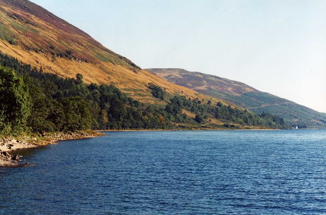
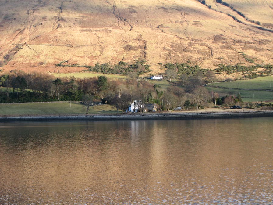
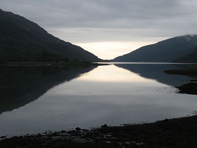
Birch Wood is a picturesque forest located in Argyllshire, Scotland. Situated amidst the stunning landscape of the Argyll and Bute region, the wood offers a peaceful retreat for nature enthusiasts and hikers alike.

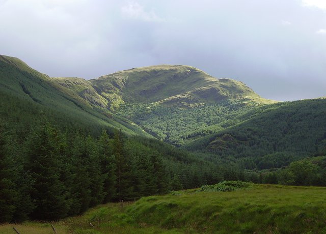
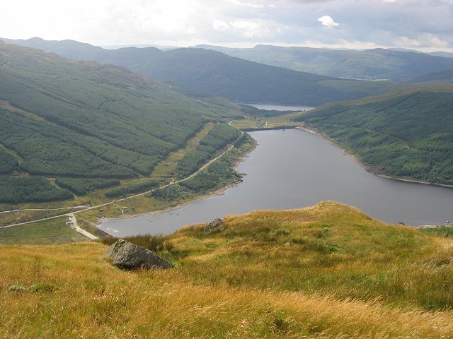
Covering an area of approximately 100 acres, Birch Wood is predominantly composed of native birch trees, which lend their name to the forest. These elegant trees provide a beautiful backdrop and create a serene atmosphere throughout the wood. The dense foliage of the birch trees not only provides shade but also attracts a variety of wildlife, making it a haven for birdwatchers and nature photographers.

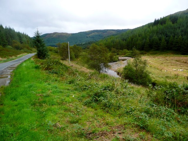
The forest boasts an extensive network of walking trails, allowing visitors to explore its natural beauty at their own pace. The paths wind through the wood, taking hikers on a journey through vibrant greenery and offering glimpses of the surrounding hills and valleys. Along the way, one can encounter a diverse range of flora and fauna, including wildflowers, mosses, ferns, and small mammals.

Birch Wood is also home to a small river that meanders through its heart, adding to the tranquility and charm of the surroundings. The gentle babbling of the water provides a soothing soundtrack to the woodland experience.

For those seeking a longer stay, there are camping facilities available nearby, allowing visitors to immerse themselves fully in the natural beauty of the area. The wood is easily accessible by car and is a popular destination for day trips and weekend getaways.

In conclusion, Birch Wood in Argyllshire, Scotland, offers a serene and picturesque setting for nature lovers to explore. With its native birch trees, scenic walking trails, and abundant wildlife, it is a must-visit destination for those seeking a peaceful retreat in the heart of nature.

If you have any feedback on the listing, please let us know in the comments section below.

Birch Wood Images

Images are sourced within 2km of 55.964044/-5.0859483 or Grid Reference NS0778. Thanks to Geograph Open Source API. All images are credited.

Invervegain Glen A clear felled area at the head of the glen. This is near the end of the logging road. The surrounding forest has some windthrow damage.
Invervegain Glen
A clear felled area at the head of the glen. This is near the end of the logging road. The surrounding forest has some windthrow damage.
Invervegain Glen A recently clear felled area at the upper end of the glen. Steep slopes rise to the mist covered Cruach nan Capull.
Invervegain Glen
A recently clear felled area at the upper end of the glen. Steep slopes rise to the mist covered Cruach nan Capull.
Ride, Cruach na Maoile A rare escape route from the conifers of the Invervegain Glen, the ride is blocked with windthrown trees.
Ride, Cruach na Maoile
A rare escape route from the conifers of the Invervegain Glen, the ride is blocked with windthrown trees.
Burn near Bot nan Creagan
Birch and bracken by Loch Striven
End of the public road
Allt na Fearna burn starts its descent to Loch Striven The small hill loch shown on the O.S. map is just a huge bog with a couple of small pools.
Allt na Fearna burn starts its descent to Loch Striven
The small hill loch shown on the O.S. map is just a huge bog with a couple of small pools.
View from Pier Cottage, Glen Striven Pier Cottage is a part of the Loch Striven estate, and at the time the picture was taken was one of number of self catering cottages.
View from Pier Cottage, Glen Striven
Pier Cottage is a part of the Loch Striven estate, and at the time the picture was taken was one of number of self catering cottages.
Glenstriven Almost all of this picture is in the next grid square south (The few rocks bottom left qualify - I think).  However the pier where this is taken is in the grid.  So please take this as a supplemental.
Glenstriven
Almost all of this picture is in the next grid square south (The few rocks bottom left qualify - I think). However the pier where this is taken is in the grid. So please take this as a supplemental.
End of the road Loch Striven The public road ends at Glenstriven Lodge (Kings landing jetty).
End of the road Loch Striven
The public road ends at Glenstriven Lodge (Kings landing jetty).
Loch Striven from Cruach nan Capull. The joy of hills in fjord country, sea views in nearly all directions.
Loch Striven from Cruach nan Capull.
The joy of hills in fjord country, sea views in nearly all directions.
Cruach nan Capull The long, almost level, south ridge. Looking towards the summit.
Cruach nan Capull
The long, almost level, south ridge. Looking towards the summit.
Cruach nan Capull The forestry on the Invervegain Glen side of Cruach nan Capull
Cruach nan Capull
The forestry on the Invervegain Glen side of Cruach nan Capull
Glen Striven, another view from Pier Cottage
Glen Striven , Cottage
Pier Cottage from the jetty ,Loch Striven
Weir on Invervegain Burn Where the burn flows into Loch Striven
Weir on Invervegain Burn
Where the burn flows into Loch Striven
Telephone kiosk, Kings Landing At the end of the public road
Telephone kiosk, Kings Landing
At the end of the public road
Show me another place!

Birch Wood is located at Grid Ref: NS0778 (Lat: 55.964044, Lng: -5.0859483)

Unitary Authority: Argyll and Bute

Police Authority: Argyll and West Dunbartonshire

What 3 Words

///compiled.destroyer.ambient. Near Sandbank, Argyll & Bute

Related Wikis

Cruach nan Capull

Cruach nan Capull is a mountain within the Arrochar Alps, near Loch Fyne, in Argyll and Bute, Scotland. It stands on the southern side of Hell's Glen and...

Inverchaolain

Inverchaolain is a hamlet on the Cowal peninsula, Argyll and Bute, Scotland. It lies on the east shore of Loch Striven, to the south of Glenstriven and...

Inverchaolain Church

Inverchaolain Church is a former Church of Scotland church building in Inverchaolain, Argyll and Bute, Scotland. Located on the eastern shores of Loch...

Little Eachaig River

The Little Eachaig River is a watercourse in Argyll and Bute, Scotland. It is sourced in the hills near Glen Lean and largely runs parallel to the B836...

Loch Striven

Loch Striven (Scottish Gaelic: Loch Sroigheann) is a sea loch extending off the Firth of Clyde, and forms part of the Cowal peninsula coast, in Argyll...

Ardtaraig

Ardtaraig is a hamlet lying at the head of Loch Striven on the Cowal peninsula, Argyll and Bute, West of Scotland. The hamlet is on the single track B836...

Glen Lean

Glen Lean, in Argyll and Bute, Scotland, is an glacial-formed glen, with near vertical sides along part of the landform. It runs from the head of the Holy...

Loch Tarsan

Loch Tarsan; is a freshwater loch and impounding reservoir located 13 kilometres Northwest of Dunoon, on the Cowal peninsula in Argyll and Bute, Scotland...

Nearby Amenities

Located within 500m of 55.964044,-5.0859483
Source: PGS
Lat/Long: 55.9640809/-5.0939231
Source: PGS
Lat/Long: 55.9641031/-5.0935
Source: PGS
Lat/Long: 55.9642469/-5.0932588
Source: PGS
Lat/Long: 55.9642779/-5.0927922
Source: PGS
Lat/Long: 55.9641252/-5.0925352
Source: PGS
Lat/Long: 55.9639968/-5.0925273
Source: PGS
Lat/Long: 55.9639924/-5.0902417
Source: PGS
Lat/Long: 55.9633262/-5.0883001
Source: PGS
Lat/Long: 55.9630208/-5.0877267
Source: PGS
Lat/Long: 55.962826/-5.087276
Source: PGS
Lat/Long: 55.9628083/-5.0867184
Source: PGS
Lat/Long: 55.962697/-5.0858416
Source: PGS
Lat/Long: 55.9625819/-5.0856597
Source: PGS
Lat/Long: 55.9624226/-5.0855648
Source: PGS
Lat/Long: 55.9622876/-5.0853275
Source: PGS
Lat/Long: 55.9621282/-5.0845248
Source: PGS
Lat/Long: 55.9619489/-5.0840305
Source: PGS
Lat/Long: 55.9618006/-5.0836549
Source: PGS
Lat/Long: 55.9615815/-5.0833741
Source: PGS
Lat/Long: 55.9613934/-5.0828561
Source: PGS
Lat/Long: 55.9611454/-5.0823855
Source: PGS
Lat/Long: 55.9608643/-5.0821839
Source: PGS
Lat/Long: 55.9607492/-5.081911
Source: PGS
Lat/Long: 55.9606408/-5.0815868
Power: pole
Lat/Long: 55.9649402/-5.0924464
The data included in this document is from www.openstreetmap.org. The data is made available under ODbL.

Have you been to Birch Wood?

Leave your review of Birch Wood below (or comments, questions and feedback).