Blackpark Plantation

Wood, Forest in Wigtownshire

Scotland

Blackpark Plantation

Pond on the road to Larbrax Shore
Pond on the road to Larbrax Shore Credit: Oliver Dixon

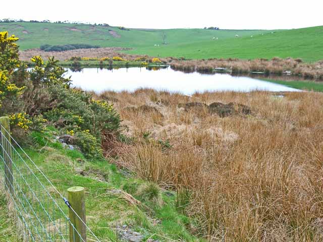
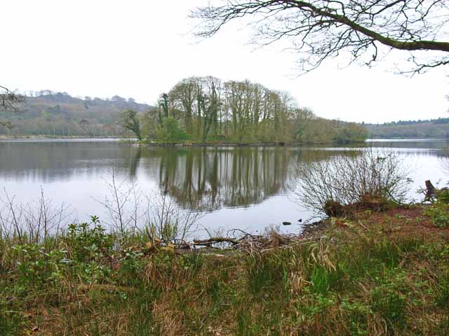
Blackpark Plantation is a picturesque woodland located in Wigtownshire, Scotland. Covering an area of approximately 200 hectares, it is known for its diverse range of trees and abundant wildlife. The plantation is situated near the town of Stranraer and is easily accessible for nature enthusiasts and hikers.

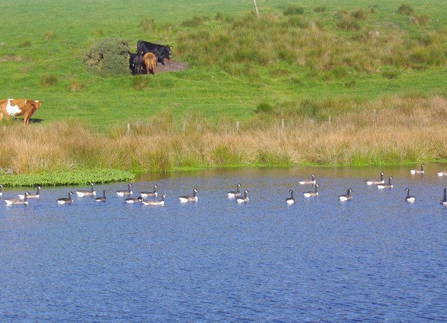
The woodland is primarily made up of a mix of broadleaved and coniferous trees, including oak, beech, and spruce. This variety of tree species provides a rich habitat for numerous bird species, such as woodpeckers, owls, and various songbirds. Additionally, mammals like red squirrels, badgers, and roe deer can be spotted within the plantation.

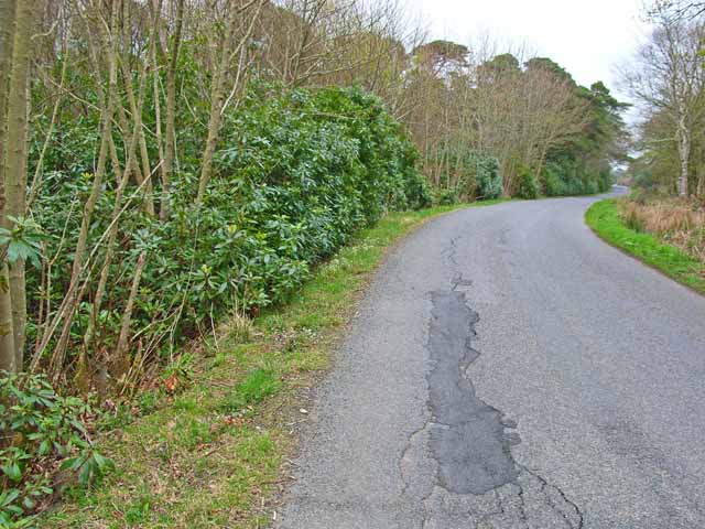
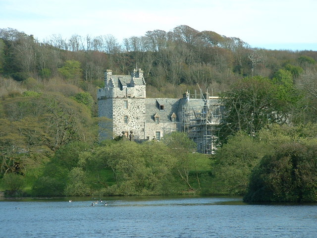
Blackpark Plantation offers visitors a network of well-maintained paths and trails, allowing for pleasant walks and exploration of the woodland. The paths are suitable for all levels of fitness and are wheelchair accessible in certain areas. Along the way, visitors can enjoy beautiful views of the surrounding countryside and the nearby Lochnaw Castle.

For those interested in outdoor activities, Blackpark Plantation provides opportunities for camping, picnicking, and birdwatching. The forest is also a popular spot for nature photography, with its enchanting atmosphere and stunning vistas.

Managed by the Forestry Commission, Blackpark Plantation contributes to the local economy through sustainable timber production and supports the conservation of biodiversity in the region. It serves as a valuable resource for education and research, offering insights into woodland management and the importance of preserving natural habitats.

Overall, Blackpark Plantation is a captivating woodland retreat, offering visitors a tranquil and immersive experience in the heart of Wigtownshire's natural beauty.

If you have any feedback on the listing, please let us know in the comments section below.

Blackpark Plantation Images

Images are sourced within 2km of 54.906767/-5.1298029 or Grid Reference NW9961. Thanks to Geograph Open Source API. All images are credited.

Pond on the road to Larbrax Shore
Rhododendrons along the B738 The "main" road up the west side of the North Rhinns of Galloway. Out-of-control rhododendron is a feature of big country estates, such as this, the Larbrax estate.
Rhododendrons along the B738
The "main" road up the west side of the North Rhinns of Galloway. Out-of-control rhododendron is a feature of big country estates, such as this, the Larbrax estate.
Storm damage to wood, North Rhins On the B738
Storm damage to wood, North Rhins
On the B738
Larbrax Lodge, North Rhins
Pond by the B738
Pond by the B738
Loch Naw An 11th century castle once stood on the island in the middle of the loch. The current 16th century Lochnaw Castle, ancestral home of the Agnew clan, lies directly beyond the island on the far shore.
Loch Naw
An 11th century castle once stood on the island in the middle of the loch. The current 16th century Lochnaw Castle, ancestral home of the Agnew clan, lies directly beyond the island on the far shore.
Entrance to Drumlochart Caravan Park The caravan park is set in attractive surroundings near Lochnaw Castle. <span class="nowrap"><a title="http://www.drumlochart.co.uk/" rel="nofollow ugc noopener" href="http://www.drumlochart.co.uk/">Link</a><img style="margin-left:2px;" alt="External link" title="External link - shift click to open in new window" src="https://s1.geograph.org.uk/img/external.png" width="10" height="10"/></span>
Entrance to Drumlochart Caravan Park
The caravan park is set in attractive surroundings near Lochnaw Castle. LinkExternal link
Blackpark Moss Taken in the gateway by near to the Green Burn in Glenstockadale looking towards Blackpark Moss
Blackpark Moss
Taken in the gateway by near to the Green Burn in Glenstockadale looking towards Blackpark Moss
Lochnaw Castle Lochnaw Castle (in the pouring rain), home (once upon a time) of the Agnew family.  The oldest bit is the tall tower, which is 16th century.  It was an hotel for a while, but had stopped being so when I arrived there to stay recently!  It is now a private home again (with a very long and muddy drive!).
Lochnaw Castle
Lochnaw Castle (in the pouring rain), home (once upon a time) of the Agnew family. The oldest bit is the tall tower, which is 16th century. It was an hotel for a while, but had stopped being so when I arrived there to stay recently! It is now a private home again (with a very long and muddy drive!).
Locknaw Castle Picture taken during restoration
Locknaw Castle
Picture taken during restoration
The road to Ochnotteroch One of the maze of 'yellow' roads on the Rhinns of Galloway.
The road to Ochnotteroch
One of the maze of 'yellow' roads on the Rhinns of Galloway.
Auchnotteroch farm
Auchnotteroch farm
Lochan on the track to Larbrax Bay This little lochan is beside the track which leads from the B738 to the shore at Larbrax Bay.
Lochan on the track to Larbrax Bay
This little lochan is beside the track which leads from the B738 to the shore at Larbrax Bay.
Lochnaw Loch Looking across a large raft of aquatic vegetation towards Lochnaw Castle on the far shore.
Lochnaw Loch
Looking across a large raft of aquatic vegetation towards Lochnaw Castle on the far shore.
Passing Lochnaw Cottage on the B738
Approaching Larbrax Lodge on the B738
The track to Meikle Larbrax This track also leads to Beach Lodge and Shore Cottage.
The track to Meikle Larbrax
This track also leads to Beach Lodge and Shore Cottage.
The entrance to Larbrax School House
Show me another place!

Blackpark Plantation is located at Grid Ref: NW9961 (Lat: 54.906767, Lng: -5.1298029)

Unitary Authority: Dumfries and Galloway

Police Authority: Dumfries and Galloway

What 3 Words

///backpacks.senses.restored. Near Stranraer, Dumfries & Galloway

Related Wikis

Galdenoch Castle

Galdenoch Castle is a tower house near the Scottish village of Leswalt in the Council Area Dumfries and Galloway . The ruin is listed as a Scheduled Monument...

Leswalt

Leswalt (Scottish Gaelic: Lios Uillt) is a village and civil parish in Dumfries and Galloway, south-west Scotland. It lies between Portpatrick and Stranraer...

Killantringan Lighthouse

Killantringan Lighthouse is a lighthouse located near Portpatrick in Dumfries and Galloway, south-west Scotland. The light came into operation in 1900...

MV Craigantlet

MV Craigantlet was a German-owned, Cyprus-registered container ship operated on time-charter by Cawoods Containers Ltd of Belfast. She ran aground on 26...

Ervie

Ervie is a small village in Dumfries and Galloway, Scotland, in the Rhins of Galloway, just outside Stranraer.

Old Town Hall, Stranraer

The Old Town Hall is a municipal structure in George Street, Stranraer, Dumfries and Galloway, Scotland. The structure, which is used as a local history...

Stranraer Sheriff Court

Stranraer Sheriff Court is a judicial building in Lewis Street, Stranraer, Dumfries and Galloway, Scotland. The building, which continues to be used as...

Stranraer

Stranraer (UK: stran-RAR, in Scotland also strən-; Scottish Gaelic: An t-Sròn Reamhar [ən̪ˠ t̪ʰɾɔːn ˈɾãũ.əɾ]), also known as The Toon, is a town in Dumfries...

Nearby Amenities

Located within 500m of 54.906767,-5.1298029
Power: pole
Lat/Long: 54.9104084/-5.1338479
Power: pole
Lat/Long: 54.9100872/-5.1340333
Power: pole
Lat/Long: 54.909349/-5.1344935
Power: pole
Lat/Long: 54.9087416/-5.1348808
Power: pole
Lat/Long: 54.9081613/-5.1352236
Power: pole
Lat/Long: 54.9071666/-5.1358386
Power: pole
Lat/Long: 54.9065269/-5.1362565
Power: pole
Lat/Long: 54.9057603/-5.1367566
The data included in this document is from www.openstreetmap.org. The data is made available under ODbL.

Have you been to Blackpark Plantation?

Leave your review of Blackpark Plantation below (or comments, questions and feedback).