Calverton

Settlement in Buckinghamshire

England

Calverton

Paddling bench by the Great Ouse Taken on New Year's Day 2024 within half an hour of midday
Paddling bench by the Great Ouse Credit: Philip Jeffrey

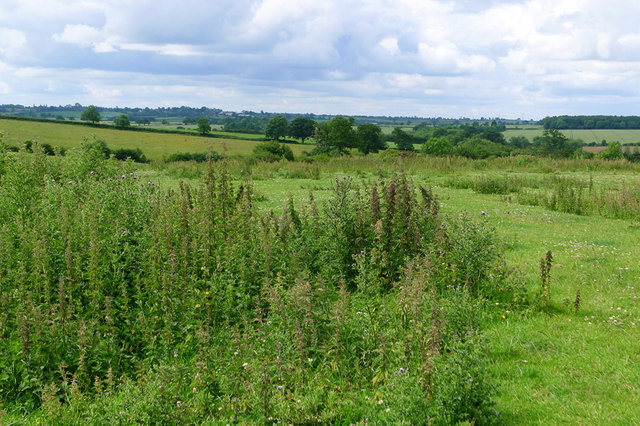
Calverton is a small village located in the Aylesbury Vale district of Buckinghamshire, England. Situated about 4 miles northwest of Milton Keynes, it is nestled within a rural setting with picturesque views of the surrounding countryside. The village is part of the civil parish of Great Linford, and the historic town of Newport Pagnell is only a short distance away.

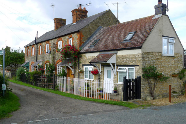
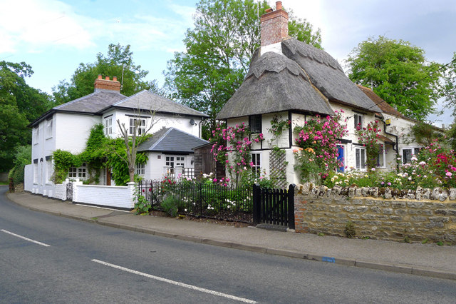
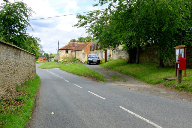
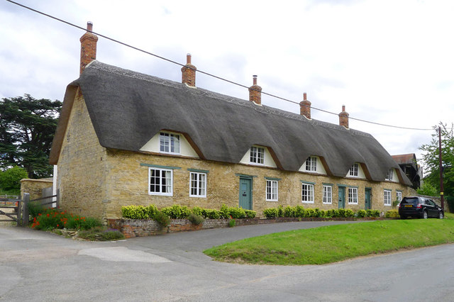
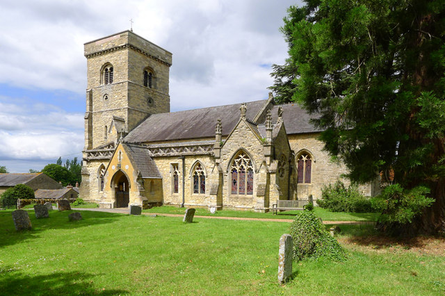
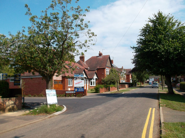
Calverton is known for its charming character and traditional English village atmosphere. It features a mix of old and new buildings, including several historic cottages and farms that add to its quintessential charm. The village is primarily residential, with a tight-knit community that fosters a strong sense of community spirit.

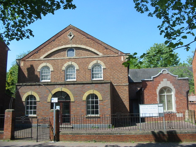
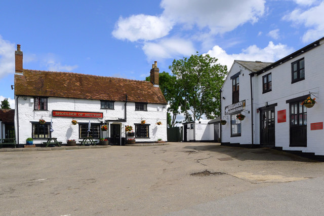
Despite its small size, Calverton offers a range of amenities to its residents. These include a village hall, a local pub, and a post office. The village also benefits from being in close proximity to larger towns and cities, providing easy access to a wider range of services and facilities.

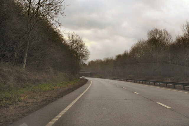
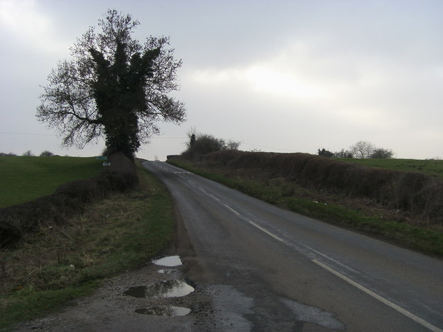
The surrounding countryside provides ample opportunities for outdoor activities, with numerous footpaths and bridleways for walking, cycling, and horse riding. Calverton is also conveniently located near the Grand Union Canal, offering further recreational possibilities.

Overall, Calverton is a peaceful and idyllic village that offers a tranquil rural lifestyle while still being within reach of urban conveniences. Its beautiful surroundings and strong community make it an attractive place to live for those seeking a quiet and close-knit community atmosphere.

If you have any feedback on the listing, please let us know in the comments section below.

Calverton Images

Images are sourced within 2km of 52.038796/-0.840918 or Grid Reference SP7938. Thanks to Geograph Open Source API. All images are credited.

Paddling bench by the Great Ouse Taken on New Year's Day 2024 within half an hour of midday
Paddling bench by the Great Ouse
Taken on New Year's Day 2024 within half an hour of midday
The A5  on a dull morning Returning to Milton Keynes after the Christmas Day park run.
The A5 on a dull morning
Returning to Milton Keynes after the Christmas Day park run.
Baptist Church
Baptist Church
Edward Swinfen Harris Former Church of England school built by Edward Swinfen Harris the architect between 1871-3, now The Plough Inn.
Edward Swinfen Harris
Former Church of England school built by Edward Swinfen Harris the architect between 1871-3, now The Plough Inn.
Tucked away View of the rear of the High Street and Swinfen's Yard showing a lovely atrium.
The old maps show a church symbol here - was this originally part of a church or chapel ?
Tucked away
View of the rear of the High Street and Swinfen's Yard showing a lovely atrium. The old maps show a church symbol here - was this originally part of a church or chapel ?
The Plough Public House
Row of houses in Horsefair Green, Stony Stratford
Horsefair Green, Stony Stratford
Middle Weald, Calverton, Bucks
Lower Weald, Calverton, Bucks
Cottages, Lower Weald, Calverton, Bucks
Open fields around Upper Weald, Calverton
The Shoulder of Mutton, Calverton, Bucks
All Saints Church, Lower Weald, Calverton, Bucks
Blenheim Avenue, Stony Stratford An area of suburban housing dating mainly from the 1920s and 30s.
Blenheim Avenue, Stony Stratford
An area of suburban housing dating mainly from the 1920s and 30s.
Road to Beachampton Road to Beachampton where footpath to Calverton Place leaves
Road to Beachampton
Road to Beachampton where footpath to Calverton Place leaves
Path into Stony Stratford by the town sign
Show me another place!

Calverton is located at Grid Ref: SP7938 (Lat: 52.038796, Lng: -0.840918)

Unitary Authority: Milton Keynes

Police Authority: Thames Valley

What 3 Words

///depended.splat.nuzzling. Near Calverton, Buckinghamshire

Related Wikis

Fairfields

Fairfields is a neighbourhood and civil parish that covers a large new development area on the western flank of Milton Keynes, Buckinghamshire, England...

Calverton, Buckinghamshire

Calverton is a civil parish in the unitary authority area of the City of Milton Keynes, Buckinghamshire, England and just outside the Milton Keynes urban...

Watling Academy

Watling Academy is a coeducational secondary school located in the Whitehouse area of Milton Keynes, in the English county of Buckinghamshire. == History... ==

Whitehouse, Milton Keynes

Whitehouse is a neighbourhood and civil parish that covers a large new development area on the western flank of Milton Keynes, Buckinghamshire, England...

Nearby Amenities

Located within 500m of 52.038796,-0.840918
Middle Weald
Place: hamlet
Population: 50
Lat/Long: 52.0390061/-0.8434308
Barrier: stile
Lat/Long: 52.0386347/-0.8436051
Barrier: stile
Lat/Long: 52.0362948/-0.8405073
Power: tower
Lat/Long: 52.0371279/-0.8363684
Power: tower
Lat/Long: 52.0345522/-0.8424417
Power: tower
Lat/Long: 52.0361461/-0.8394295
Power: pole
Lat/Long: 52.0393701/-0.8361988
Power: pole
Lat/Long: 52.0357262/-0.8418341
Power: pole
Lat/Long: 52.0399797/-0.8351876
Power: pole
Lat/Long: 52.0375783/-0.839215
Power: pole
Lat/Long: 52.0387679/-0.83721
Power: pole
Lat/Long: 52.0350839/-0.8424858
Power: pole
Lat/Long: 52.0364109/-0.8411314
Power: pole
Lat/Long: 52.0381657/-0.8382199
Power: pole
Lat/Long: 52.0369818/-0.8402087
Power: pole
Lat/Long: 52.0353327/-0.8427434
Power: pole
Lat/Long: 52.036948/-0.8461952
Power: pole
Lat/Long: 52.0357452/-0.8436017
Power: pole
Lat/Long: 52.036307/-0.8447926
Power: pole
Lat/Long: 52.0375742/-0.8475177
Power: pole
Lat/Long: 52.0346009/-0.8411301
Power: pole
Lat/Long: 52.0382143/-0.8438069
Power: pole
Lat/Long: 52.0376439/-0.8448864
Power: pole
Lat/Long: 52.0369777/-0.8461377
Post Box
Brand: Royal Mail
Brand Wikidata: Q638098
Brand Wikipedia: en:Royal Mail
Collection Times: Mo-Fr 16:30; Sa 08:30
Operator: Royal Mail
Operator Wikidata: Q638098
Post Box Type: lamp
Ref: MK19 83
Royal Cypher: EIIR
Royal Cypher Wikidata: Q33102113
Source: survey
Survey Date: 2015-04-19
Lat/Long: 52.0389091/-0.8438097
Direction: 230
Generator Method: photovoltaic
Generator Output Electricity: yes
Generator Solar Modules: 18
Generator Source: solar
Generator Type: solar_photovoltaic_panel
Location: roof
Power: generator
Lat/Long: 52.0384059/-0.8450164
The data included in this document is from www.openstreetmap.org. The data is made available under ODbL.

Have you been to Calverton?

Leave your review of Calverton below (or comments, questions and feedback).