Pien Plantation

Wood, Forest in Buteshire

Scotland

Pien Plantation

Torbeg Farm - Isle of Arran Torbeg Farm
Torbeg Farm - Isle of Arran Credit: Raibeart MacAoidh

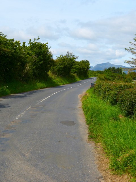
Pien Plantation is a sprawling wood and forest located in the region of Buteshire, Scotland. Covering a vast area of land, this plantation is known for its dense foliage and diverse ecosystem. The plantation is situated near the village of Pien and is easily accessible by road.

Pien Plantation is characterized by its rich variety of tree species, including oak, birch, beech, and pine. The trees tower over the landscape, forming a canopy that provides shade and shelter for numerous wildlife species. The forest floor is covered in a lush carpet of mosses, ferns, and wildflowers, creating a picturesque and tranquil environment.

The plantation is a haven for wildlife enthusiasts and nature lovers. It is home to a wide range of animals, including deer, foxes, badgers, and various bird species. The forest's natural beauty and abundance of food sources attract a diverse array of migratory birds as well.

Visitors to Pien Plantation can explore its network of walking trails and enjoy the serenity of the woodland. The plantation offers opportunities for outdoor activities such as hiking, birdwatching, and photography. The forest is also a popular spot for picnics and family outings, with designated picnic areas available.

Pien Plantation is not only a recreational destination but also plays a vital role in maintaining the region's ecological balance. It acts as a carbon sink, absorbing carbon dioxide from the atmosphere and helping combat climate change. The plantation is also managed sustainably, ensuring the preservation of its natural beauty for future generations to enjoy.

If you have any feedback on the listing, please let us know in the comments section below.

Pien Plantation Images

Images are sourced within 2km of 55.522981/-5.3097443 or Grid Reference NR9130. Thanks to Geograph Open Source API. All images are credited.

Torbeg Farm - Isle of Arran Torbeg Farm
Torbeg Farm - Isle of Arran
Torbeg Farm
Braeside Cottage, by Blackwaterfoot
Torbeg Farm View of the farm to the north of Blackwaterfoot.
Torbeg Farm
View of the farm to the north of Blackwaterfoot.
Torbeg View across grazing fields towards Balgowan.
Torbeg
View across grazing fields towards Balgowan.
Torbeg Looking north along the A841.
Torbeg
Looking north along the A841.
Crochandoon - Isle of Arran Crocnandoon
Crochandoon - Isle of Arran
Crocnandoon
Crocosmia, Brambles and honeysuckle by the road near Torbeg
Entrance to car park for the walk to the King's Cave
Old Milestone by the A841, south of Crochandoon, Arran Milestone on Arran by the A841, in parish of Kilmory (Arran District), just past crest of hill, on verge 2m from East side of road.

Inscription reads:-
28
(To Brodick Old Quay)

Surveyed

Milestone Society National ID: AYN_ARR28
Old Milestone by the A841, south of Crochandoon, Arran
Milestone on Arran by the A841, in parish of Kilmory (Arran District), just past crest of hill, on verge 2m from East side of road. Inscription reads:- 28 (To Brodick Old Quay) Surveyed Milestone Society National ID: AYN_ARR28
Shiskine memorial For further information see <span class="nowrap"><a title="https://canmore.org.uk/site/39772" rel="nofollow ugc noopener" href="https://canmore.org.uk/site/39772">Link</a><img style="margin-left:2px;" alt="External link" title="External link - shift click to open in new window" src="https://s1.geograph.org.uk/img/external.png" width="10" height="10"/></span>
Shiskine memorial
For further information see LinkExternal link
Machrie Moor 5 Stone Circle, Arran Machrie Moor 5 is also known as "Suidh Coire Fhionn" or "Fingal's Cauldron Seat".
Machrie Moor 5 Stone Circle, Arran
Machrie Moor 5 is also known as "Suidh Coire Fhionn" or "Fingal's Cauldron Seat".
Moss Farm, Machrie Moor, Arran
Machrie Moor 5 Stone Circle, Arran Machrie Moor 5 is also known as "Suidh Coire Fhionn" or "Fingal's Cauldron Seat".
Machrie Moor 5 Stone Circle, Arran
Machrie Moor 5 is also known as "Suidh Coire Fhionn" or "Fingal's Cauldron Seat".
Machrie Moor 2 Stone Circle, Arran Machrie Moor Stone Circles are six stone circles visible to the east of the derelict Moss Farm on Machrie Moor, Arran. Some of the circles have standing sandstone pillars and some are formed from granite boulders. They date to around 2000BC and stand in a landscape covered in prehistoric remains.
Machrie Moor 2 Stone Circle, Arran
Machrie Moor Stone Circles are six stone circles visible to the east of the derelict Moss Farm on Machrie Moor, Arran. Some of the circles have standing sandstone pillars and some are formed from granite boulders. They date to around 2000BC and stand in a landscape covered in prehistoric remains.
One of the standing stones, Machrie Moor 2 Stone Circle, Arran Machrie Moor Stone Circles are six stone circles visible to the east of the derelict Moss Farm on Machrie Moor, Arran. Some of the circles have standing sandstone pillars and some are formed from granite boulders. They date to around 2000BC and stand in a landscape covered in prehistoric remains.
One of the standing stones, Machrie Moor 2 Stone Circle, Arran
Machrie Moor Stone Circles are six stone circles visible to the east of the derelict Moss Farm on Machrie Moor, Arran. Some of the circles have standing sandstone pillars and some are formed from granite boulders. They date to around 2000BC and stand in a landscape covered in prehistoric remains.
Show me another place!

Pien Plantation is located at Grid Ref: NR9130 (Lat: 55.522981, Lng: -5.3097443)

Unitary Authority: North Ayrshire

Police Authority: Ayrshire

What 3 Words

///cashew.patrolled.haggis. Near Blackwaterfoot, North Ayrshire

Nearby Locations

Pien Pien Plantation

Related Wikis

Shiskine

Shiskine (Scottish Gaelic: An t-Seasgann) is a small village on the Isle of Arran in the Firth of Clyde, Scotland. The village is within the parish of...

Torbeg

Torbeg (Scottish Gaelic: An Tòrr Beag) is a village on the Isle of Arran in the Firth of Clyde, Scotland. == References ==

Machrie Moor Stone Circles

Machrie Moor Stone Circles is the collective name for six stone circles visible on Machrie Moor near the settlement of Machrie on the Isle of Arran, Scotland...

Moss Farm Road Stone Circle

Moss Farm Road Stone Circle (or Machrie Moor 10) is the remains of a Bronze Age burial cairn, surrounded by a circle of stones. It is located near Machrie...

Nearby Amenities

Located within 500m of 55.522981,-5.3097443
Hamilton Cottages
Addr City: Isle of Arran
Addr Housename: Hamilton House
Addr Postcode: KA27 8EW
Addr Suburb: Shiskine
Phone: +44 1770 860711
Tourism: chalet
Website: https://www.hamiltoncottages.co.uk/
Wheelchair: yes
Lat/Long: 55.5204651/-5.3058921
Isle of Arran Art
Addr City: Isle of Arran
Addr Housename: Hamilton House
Addr Postcode: KA27 8EW
Addr Street: Shedog
Note: Studio and art gallery
Phone: +44 1770 860711
Shop: art
Website: www.isleofarranart.co.uk
Wheelchair: yes
Lat/Long: 55.5203297/-5.3056659
Hamilton Cottages
Addr City: Shedog
Addr Housename: Hamilton House,
Addr Postcode: KA27 8EW
Phone: +44 1770 860711
Website: https://www.hamiltoncottages.co.uk/
Wheelchair: yes
Lat/Long: 55.520283/-5.305597
Shiskine
Name Gd: An Seasgainn
Place: village
Lat/Long: 55.5190284/-5.3072065
Shedog
Place: hamlet
Lat/Long: 55.5204791/-5.3040081
The data included in this document is from www.openstreetmap.org. The data is made available under ODbL.

Have you been to Pien Plantation?

Leave your review of Pien Plantation below (or comments, questions and feedback).