Coille a' Chùirn Mhòir

Wood, Forest in Inverness-shire

Scotland

Coille a' Chùirn Mhòir

The foot of Coire Bhuraich Sheep fold, beach and burns.
The foot of Coire Bhuraich Credit: Luke Oldale

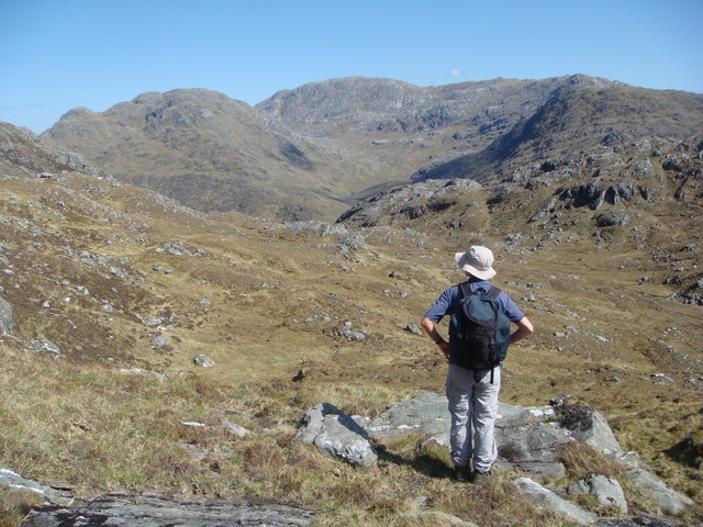
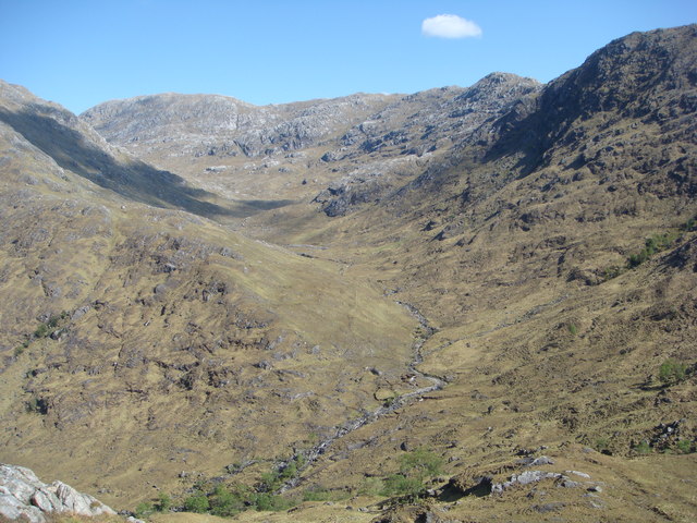
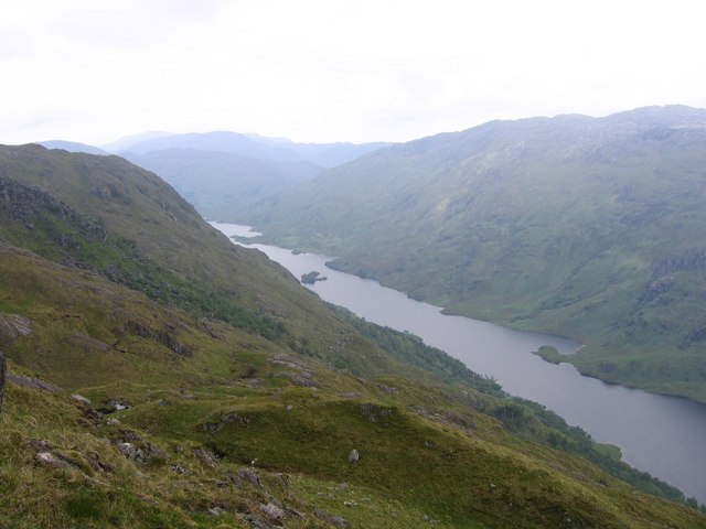
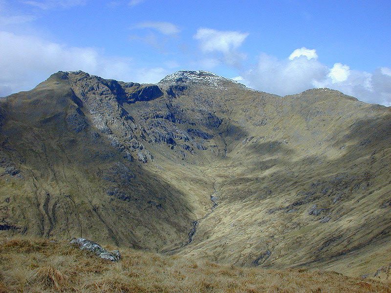
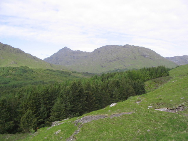
Coille a' Chùirn Mhòir, located in Inverness-shire, Scotland, is a stunning wood and forest area renowned for its natural beauty and diverse wildlife. Covering a vast expanse of approximately 10,000 acres, it is a haven for nature enthusiasts and outdoor adventurers.

The woodland at Coille a' Chùirn Mhòir is predominantly made up of native species, including oak, birch, and pine trees, creating a rich and diverse habitat for various plant and animal species. The forest floor is adorned with a vibrant carpet of wildflowers, ferns, and mosses, adding to the area's enchanting appeal.

The wood is crisscrossed with a network of well-maintained trails, offering visitors the opportunity to explore its hidden corners and enjoy the tranquility of nature. These paths are suitable for walking, hiking, and cycling, catering to individuals of different fitness levels and interests.

The forest is home to a wide array of wildlife, including deer, red squirrels, and a variety of bird species. Birdwatchers can spot birds such as buzzards, owls, and woodpeckers, while lucky visitors may even catch a glimpse of elusive creatures like the pine marten or the Scottish wildcat.

Coille a' Chùirn Mhòir is not only a recreational area but also plays a vital role in the conservation of the local ecosystem. The forest management team actively works to preserve the woodland's natural balance and protect its inhabitants.

Overall, Coille a' Chùirn Mhòir is a picturesque woodland and forest destination that offers visitors a chance to immerse themselves in the beauty of nature while providing a vital habitat for a diverse range of plant and animal species.

If you have any feedback on the listing, please let us know in the comments section below.

Coille a' Chùirn Mhòir Images

Images are sourced within 2km of 56.943202/-5.53972 or Grid Reference NM8489. Thanks to Geograph Open Source API. All images are credited.

The foot of Coire Bhuraich Sheep fold, beach and burns.
The foot of Coire Bhuraich
Sheep fold, beach and burns.
Pier, Oban Looking towards the rocky Sròn a' Choin ridge at the head of Loch Morar.  The gap in the hills on the right is the pass through to Glen Pean.
Pier, Oban
Looking towards the rocky Sròn a' Choin ridge at the head of Loch Morar. The gap in the hills on the right is the pass through to Glen Pean.
Oban Bothy This remote bothy is now maintained as a shelter by the Mountain Bothies Association. It is kept locked during the stalking season from mid August to late October but otherwise is open for all to use. Located at the E end of Loch Morar access is either by boat or walking through Gleann Pean. This photograph was taken before maintenance had started.
Oban Bothy
This remote bothy is now maintained as a shelter by the Mountain Bothies Association. It is kept locked during the stalking season from mid August to late October but otherwise is open for all to use. Located at the E end of Loch Morar access is either by boat or walking through Gleann Pean. This photograph was taken before maintenance had started.
Shore of Loch Morar
Shore of Loch Morar
Lochan a' Bhrodain and Lochan Tain Mhic Dhugaill Two lochans lying on the pass between Loch Morar and Loch Beoraid. Sorry about the reflections - G-CFVR has no DV panel so I had to shoot through the canopy.
Lochan a' Bhrodain and Lochan Tain Mhic Dhugaill
Two lochans lying on the pass between Loch Morar and Loch Beoraid. Sorry about the reflections - G-CFVR has no DV panel so I had to shoot through the canopy.
Allt a' Bhearraidh from Loch Morar
Shore of Loch Morar
Shore of Loch Morar
Shore of Loch Morar
Shore of Loch Morar
Oban bothy A well kept MBA bothy in a spectacular location at the head of Loch Morar
Oban bothy
A well kept MBA bothy in a spectacular location at the head of Loch Morar
Oban Bothy This remote bothy is now maintained as a shelter by the Mountain Bothies Association.It is kept locked during the stalking season from mid August to late October but otherwise is open for all to use. Located at the E end of Loch Morar access is either by boat or walking through Gleann Pean, the most rugged of highland glens. In the 1891 census there were 8 people living here. The loch, the deepest in Scotland at 1,077 feet is 11 miles in length and reputed to be the home of Morag, a rival monster to Nessie!
Oban Bothy
This remote bothy is now maintained as a shelter by the Mountain Bothies Association.It is kept locked during the stalking season from mid August to late October but otherwise is open for all to use. Located at the E end of Loch Morar access is either by boat or walking through Gleann Pean, the most rugged of highland glens. In the 1891 census there were 8 people living here. The loch, the deepest in Scotland at 1,077 feet is 11 miles in length and reputed to be the home of Morag, a rival monster to Nessie!
Loch Morar Island not shown on my 1:50000 OS map, but is visible on the 1:25000.
Loch Morar
Island not shown on my 1:50000 OS map, but is visible on the 1:25000.
Oban Sailed up Loch Morar to climb An Stac and visited the bothy on my return. Took out rubbish and picked up another hillwalker and took him back to Morar, he was delighted.
Oban
Sailed up Loch Morar to climb An Stac and visited the bothy on my return. Took out rubbish and picked up another hillwalker and took him back to Morar, he was delighted.
April Sunbeam Sunset from Oban Bothy with smokey mountains on the Northern shores of Loch Morar
April Sunbeam
Sunset from Oban Bothy with smokey mountains on the Northern shores of Loch Morar
Oban bothy Looking very smart inside and out.
Oban bothy
Looking very smart inside and out.
View from Druim a Chuirn over Loch Morar
Looking into Gleann Cul an Staca Beinn Garbh in centre of the skyline
Looking into Gleann Cul an Staca
Beinn Garbh in centre of the skyline
Gleann Cul an Staca Beinn Garbh on the skyline
Gleann Cul an Staca
Beinn Garbh on the skyline
Show me another place!

Coille a' Chùirn Mhòir is located at Grid Ref: NM8489 (Lat: 56.943202, Lng: -5.53972)

Unitary Authority: Highland

Police Authority: Highlands and Islands

What 3 Words

///prompt.unhappy.sinkhole. Near Arisaig, Highland

Related Wikis

Loch Beoraid

Loch Beoraid is a long linear narrow and deepwater freshwater loch, orientated on west to east axis, that is located 8.5 miles east of Arisaig, in South...

Bidein a' Chabair

Bidein a' Chabair (867 m) is a mountain in the Knoydart peninsula, Lochaber, on the west coast of Scotland. It is part of the Northwest Highlands. A conical...

Sgurr nan Coireachan (Glenfinnan)

Sgurr nan Coireachan (956 m) is a mountain in the Northwest Highlands, Scotland. It lies north of Glenfinnan in Lochaber. One of a pair of neighbouring...

Càrn Mòr

Càrn Mòr is a mountain on the edge of the Rough Bounds of Knoydart in the Northwest Highlands of Scotland. At a height of 829 metres (2,720 ft) it is classified...

Have you been to Coille a' Chùirn Mhòir?

Leave your review of Coille a' Chùirn Mhòir below (or comments, questions and feedback).