Coill' an Dorchaid

Wood, Forest in Ross-shire

Scotland

Coill' an Dorchaid

Trigpoint, Meall na h-Airde Looking north-east towards Gairloch
Trigpoint, Meall na h-Airde Credit: Becky Williamson

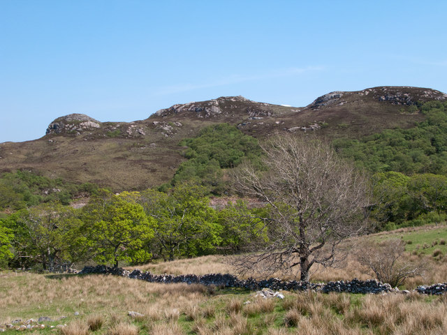
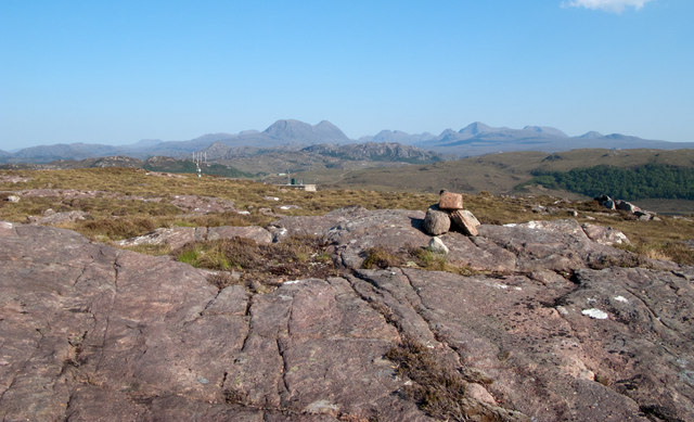
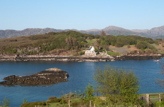
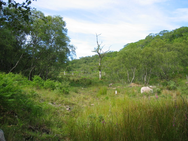
Coill' an Dorchaid, located in Ross-shire, Scotland, is a picturesque woodland area renowned for its natural beauty and diverse wildlife. Spanning over several acres, this ancient forest is nestled amidst the scenic Scottish Highlands, offering visitors a tranquil and immersive experience in nature.

The woodland consists primarily of native Scottish tree species, including oak, birch, and pine trees, which create a dense canopy overhead. The forest floor is carpeted with a rich assortment of mosses, ferns, and wildflowers, making it a haven for botanists and nature enthusiasts.

Coill' an Dorchaid is home to a wide range of wildlife, with various species of birds, mammals, and insects inhabiting the area. Birdwatchers can spot buzzards, woodpeckers, and owls soaring through the treetops, while red squirrels and pine martens scurry about on the forest floor. Rare and endangered species, such as the Scottish wildcat and the capercaillie, have also been sighted in this woodland paradise.

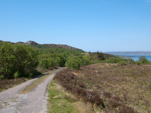
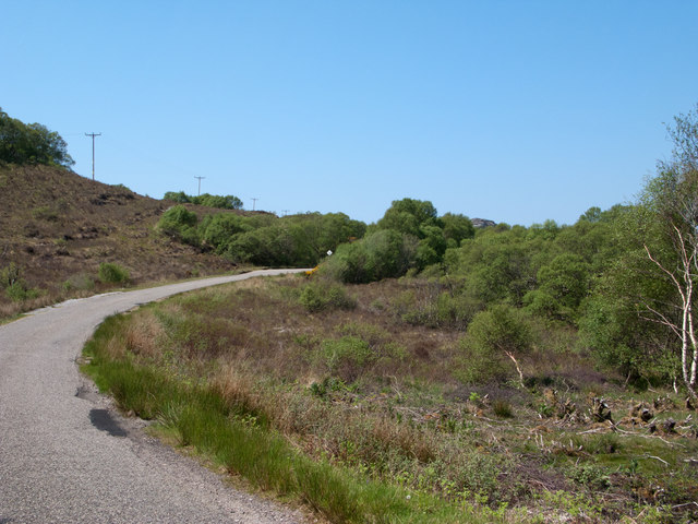
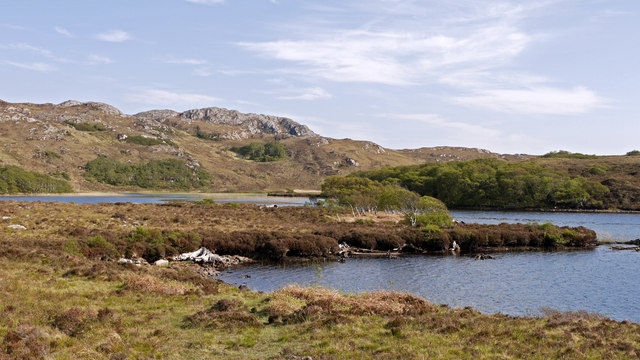
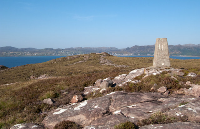
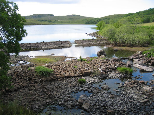
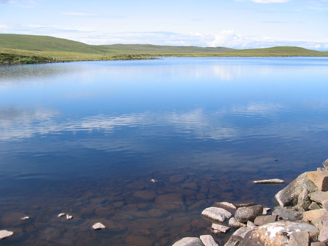
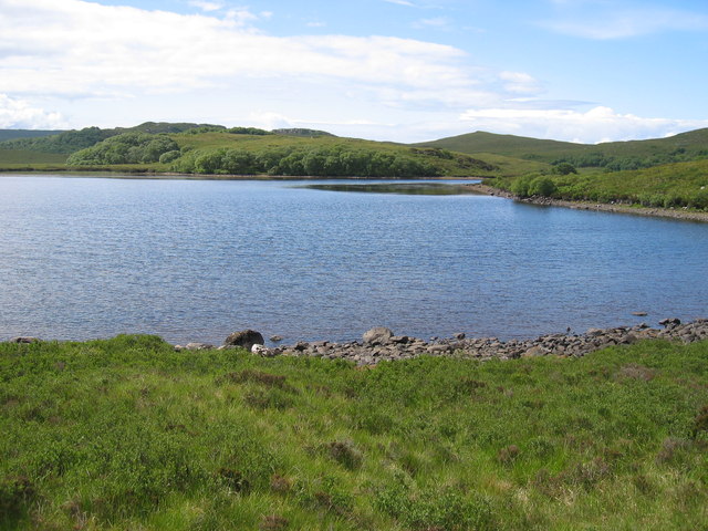
Visitors can explore Coill' an Dorchaid through a network of well-maintained walking trails that wind through the forest. These paths offer breathtaking views of the surrounding countryside, with occasional glimpses of nearby lochs and mountains. The forest is also a popular spot for camping and picnicking, providing a peaceful retreat for those seeking solace in nature.

Coill' an Dorchaid is not only a natural wonder but also an important ecological site. It serves as a vital habitat for many species and plays a crucial role in maintaining the delicate balance of Scotland's diverse ecosystem. It is a must-visit destination for anyone looking to immerse themselves in the beauty and tranquility of the Scottish Highlands.

If you have any feedback on the listing, please let us know in the comments section below.

Coill' an Dorchaid Images

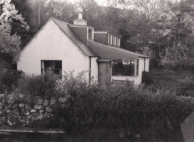
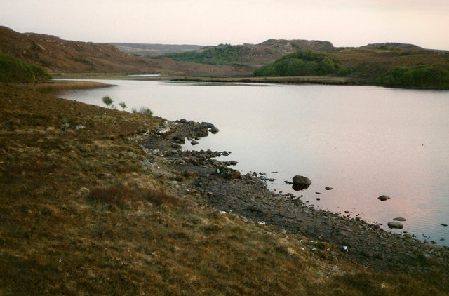
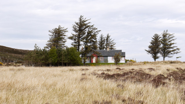
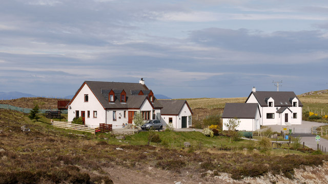
Images are sourced within 2km of 57.69581/-5.723167 or Grid Reference NG7873. Thanks to Geograph Open Source API. All images are credited.

Trigpoint, Meall na h-Airde Looking north-east towards Gairloch
Trigpoint, Meall na h-Airde
Looking north-east towards Gairloch
Aird Cottage
Aird Cottage
Loch Bad a' Chrotha
Loch Bad a' Chrotha
Park Cottage Park Cottage is part of the crofting community of Port Henderson, near to Gairloch.
Park Cottage
Park Cottage is part of the crofting community of Port Henderson, near to Gairloch.
New housing at Badachro Badachro is a small village on the south side of Loch Gairloch. The detached houses seen in this image are part of the Coille Dhorch development on what was until recently, moorland.
New housing at Badachro
Badachro is a small village on the south side of Loch Gairloch. The detached houses seen in this image are part of the Coille Dhorch development on what was until recently, moorland.
An Torr An Torr is a minor hill rising to just 96m, lying east of the village of Badachro.
An Torr
An Torr is a minor hill rising to just 96m, lying east of the village of Badachro.
Road descending to Camas na h-Airigh The road leaves the B8056 near to Badachro giving access to the few homes above the bay. Loch Gairloch lies in the distance.
Road descending to Camas na h-Airigh
The road leaves the B8056 near to Badachro giving access to the few homes above the bay. Loch Gairloch lies in the distance.
B8056 above Leacnasaide Leacnasaide is a small community above Loch Shieldaig; the B8056 is seen here passing above it on its way to Red Point.
B8056 above Leacnasaide
Leacnasaide is a small community above Loch Shieldaig; the B8056 is seen here passing above it on its way to Red Point.
Loch Bad a' Chròtha Loch Bad a' Chròtha as seen from close to the B8032. A promontory bearing a few trees juts into the water; seen at its base are the remains of ancient trees preserved in peat bog and now exposed again.
Loch Bad a' Chròtha
Loch Bad a' Chròtha as seen from close to the B8032. A promontory bearing a few trees juts into the water; seen at its base are the remains of ancient trees preserved in peat bog and now exposed again.
Sandstone slab with cairn on Meall na h-Airde Meall na h-Airde is a low hill on the south side of Loch Gairloch. Baosbheinn is the distant, prominent mountain at the left side of the image; the Torridon mountains lie to the right of it.
Sandstone slab with cairn on Meall na h-Airde
Meall na h-Airde is a low hill on the south side of Loch Gairloch. Baosbheinn is the distant, prominent mountain at the left side of the image; the Torridon mountains lie to the right of it.
Trig point of Meall na h-Airde Meall na h-Airde is a low hill on the south side of Loch Gairloch. Sandstone ribs run away from the pillar towards the loch.
Trig point of Meall na h-Airde
Meall na h-Airde is a low hill on the south side of Loch Gairloch. Sandstone ribs run away from the pillar towards the loch.
Eilean Horrisdale Eilean Horrisdale as seen from Aird, to the west.
Eilean Horrisdale
Eilean Horrisdale as seen from Aird, to the west.
Woodland above Leacnasaide
Scrubland near Leacnasaide
Weir at Loch Bad a' Chrotha
Loch Bad na h-Achlaise
Park Cottage near Port Henderson
Loch Bad a' Chrotha
Loch Bad a' Chrotha
Show me another place!

Coill' an Dorchaid is located at Grid Ref: NG7873 (Lat: 57.69581, Lng: -5.723167)

Unitary Authority: Highland

Police Authority: Highlands and Islands

What 3 Words

///sweeping.reference.free. Near Gairloch, Highland

Related Wikis

Badachro

Badachro (Scottish Gaelic: Bad a' Chrò) is a former fishing village, in the northwest Highlands of Scotland. == Geography == Badachro sits about 3 km south...

Eilean Horrisdale

Eilean Horrisdale is an uninhabited island in Loch Gairloch in Wester Ross, Scotland. == Geography == Eilean Horrisdale is the largest island in Loch Gairloch...

Broadford Beds Formation

The Broadford Beds Formation is a Sinemurian geologic formation in western Scotland. An indeterminate partial tibia of a theropod dinosaur are among the...

Port Henderson

Port Henderson (Scottish Gaelic: Portaigil) is a fishing village on the south west shore of the Gair Loch near the village of Gairloch, Ross-shire, Scottish...

Gair Loch

The Gair Loch is a sea loch on the North West coast of Highland, Scotland. In Scottish Gaelic it is an Geàrr Loch meaning 'the short loch'. Around 6 miles...

An Ard

An Ard (Scottish Gaelic: ) is a collection of small settlements on the A832 road, close to Charlestown, in Gairloch, Ross-shire, on the east shore of Gair...

Charlestown, Wester Ross

Charlestown is a small hamlet, making up one of the settlements which are collectively called Gairloch, and located directly south of the main village...

Loch Bràigh Horrisdale

Loch Bràigh Horrisdale is a small, irregular shaped, freshwater loch in Wester Ross, in the north west of Scotland. The loch lies approximately 2 mi (3...

Nearby Amenities

Located within 500m of 57.69581,-5.723167
Source: PGS
Lat/Long: 57.7000998/-5.7251253
Source: PGS
Lat/Long: 57.7000458/-5.7257932
Source: PGS
Lat/Long: 57.6997441/-5.7197366
Source: PGS
Lat/Long: 57.6995229/-5.7203565
Source: PGS
Lat/Long: 57.6993926/-5.7204993
Source: PGS
Lat/Long: 57.6990649/-5.7217291
Source: PGS
Lat/Long: 57.698832/-5.7222062
Source: PGS
Lat/Long: 57.6985214/-5.7230184
Source: PGS
Lat/Long: 57.6986148/-5.7236114
Source: PGS
Lat/Long: 57.6984394/-5.7256669
Source: PGS
Lat/Long: 57.698526/-5.7260658
Source: PGS
Lat/Long: 57.6985242/-5.7263433
Source: PGS
Lat/Long: 57.6984609/-5.7266425
Source: PGS
Lat/Long: 57.6983069/-5.7270538
Source: PGS
Lat/Long: 57.6982286/-5.7272909
Source: PGS
Lat/Long: 57.6981059/-5.7280864
Badachro
Alt Name Gd: Bad a' Chròtha
Name En: Badachro
Name Gd: Bad a' Chrò
Place: village
Wikidata: Q1834110
Wikipedia: en:Badachro
Lat/Long: 57.696936/-5.7248809
Bus Stop
Jetty Road End
Local Ref: AT
Naptan AtcoCode: 6700712401
Naptan Bearing: E
Naptan CommonName: Jetty Road End
Naptan Indicator: at
Naptan Landmark: Telephone Box
Naptan NaptanCode: 45327824
Naptan Street: B8056
Naptan Verified: no
Source: naptan_import
Lat/Long: 57.6973363/-5.7247024
Post Box
Post Box Type: lamp
Ref: IV21 233
Royal Cypher: scottish_crown
Source: survey
Lat/Long: 57.6973422/-5.7255297
Telephone
Booth: K6
Covered: booth
Phone: +44 1445 741200
Source: survey
Lat/Long: 57.6973026/-5.7253611
Waterway: waterfall
Lat/Long: 57.6973956/-5.7221755
Defibrillator
Emergency: defibrillator
Indoor: no
Operator: Lucky2BHere
Lat/Long: 57.6974035/-5.7268535
Power: pole
Lat/Long: 57.6965063/-5.7309634
Power: pole
Lat/Long: 57.6963288/-5.7303507
Power: pole
Lat/Long: 57.6959545/-5.7291215
Power: pole
Lat/Long: 57.695677/-5.7281862
Power: pole
Lat/Long: 57.6956617/-5.7272299
Power: pole
Lat/Long: 57.6956485/-5.7263347
Power: pole
Lat/Long: 57.6953343/-5.7250043
Power: pole
Lat/Long: 57.6951456/-5.7242427
Power: pole
Lat/Long: 57.6947406/-5.7236109
Power: pole
Lat/Long: 57.6944182/-5.7231108
Power: pole
Lat/Long: 57.6939632/-5.7224141
Power: pole
Lat/Long: 57.693442/-5.720658
Power: pole
Lat/Long: 57.6931675/-5.7196254
Power: pole
Lat/Long: 57.692937/-5.7187932
Power: pole
Lat/Long: 57.6931267/-5.7175448
Power: pole
Lat/Long: 57.6932563/-5.7163518
The data included in this document is from www.openstreetmap.org. The data is made available under ODbL.

Have you been to Coill' an Dorchaid?

Leave your review of Coill' an Dorchaid below (or comments, questions and feedback).