Coille Chill' a' Mhoraire
Wood, Forest in Argyllshire
Scotland
Coille Chill' a' Mhoraire

Coille Chill' a' Mhoraire, located in Argyllshire, Scotland, is a picturesque forest encompassing an area of approximately [insert size]. The name translates to "Wood of the Church of the Moraire." This ancient woodland boasts a rich history and offers visitors a tranquil escape into nature.
Covered in a dense canopy of trees, Coille Chill' a' Mhoraire is primarily composed of native species such as oak, birch, and rowan. The forest floor is carpeted with a diverse range of flora, including ferns, bluebells, and wild garlic, creating a vibrant and colorful tapestry throughout the seasons.
The forest is home to a variety of wildlife, including red squirrels, roe deer, and numerous bird species such as the great spotted woodpecker and the tawny owl. Visitors may be lucky enough to catch a glimpse of these creatures as they explore the forest's network of trails.
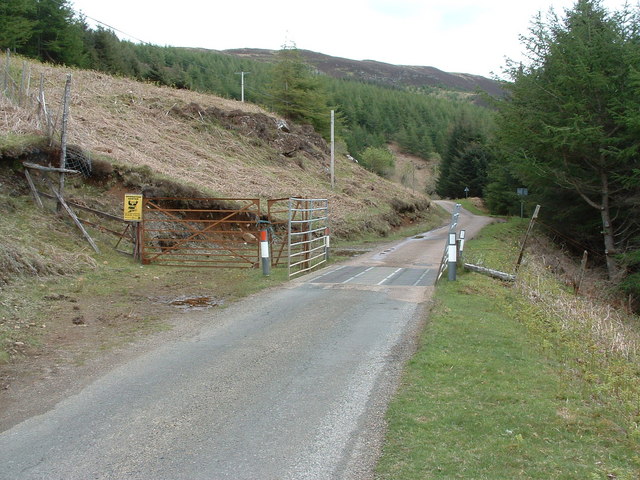
Speaking of trails, Coille Chill' a' Mhoraire offers a well-maintained network of paths that wind through the woods, catering to both leisurely strolls and more adventurous hikes. These trails provide opportunities for visitors to enjoy the natural beauty of the forest, discover hidden waterfalls, and observe the flora and fauna up close.
Aside from its natural beauty, Coille Chill' a' Mhoraire also holds cultural significance. The remains of an old church, dating back to the 13th century, can be found within the forest. This historical site adds an extra layer of intrigue and allure to the already captivating woodland.
Overall, Coille Chill' a' Mhoraire is a must-visit destination for nature enthusiasts and history buffs alike. Its stunning scenery, diverse wildlife, and cultural heritage make it a truly enchanting place to explore.
If you have any feedback on the listing, please let us know in the comments section below.
Coille Chill' a' Mhoraire Images
Images are sourced within 2km of 56.552975/-6.1630276 or Grid Reference NM4447. Thanks to Geograph Open Source API. All images are credited.


Coille Chill' a' Mhoraire is located at Grid Ref: NM4447 (Lat: 56.552975, Lng: -6.1630276)
Unitary Authority: Argyll and Bute
Police Authority: Argyll and West Dunbartonshire
What 3 Words
///dull.subway.valid. Near Dervaig, Argyll & Bute
Nearby Locations
Related Wikis

Eas Fors
Eas Fors is a waterfall on the island of Mull in Scotland. It is situated on the Ardow Burn south of Dervaig. There is another Eas Fors on the Allt an...
Torloisk House
Torloisk House (sometimes referred to as Torluck House in 19th century references) on the Isle of Mull, Argyll in Scotland was the family seat held by...

Dervaig
Dervaig (Scottish Gaelic: Dearbhaig) is a small village on the Isle of Mull off the west coast of Scotland. The village is within the parish of Kilninian...

Loch Frisa
Loch Frisa (Scottish Gaelic: Loch Friosa) is a loch on the Isle of Mull, Inner Hebrides, Scotland. It falls within the Argyll and Bute unitary authority...
Have you been to Coille Chill' a' Mhoraire?
Leave your review of Coille Chill' a' Mhoraire below (or comments, questions and feedback).