Bishop's Barnets Wood

Wood, Forest in Monmouthshire

Wales

Bishop's Barnets Wood

B4235 near Coppice Mawr
B4235 near Coppice Mawr Credit: Colin Pyle

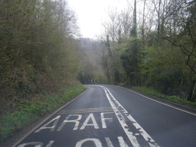
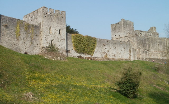
Bishop's Barnets Wood, located in Monmouthshire, Wales, is a charming woodland area renowned for its natural beauty and serene atmosphere. It covers a vast expanse of approximately 100 acres, making it a popular destination for nature enthusiasts and outdoor adventurers alike.

The wood is primarily composed of a mixture of broadleaf trees, including oak, birch, beech, and ash, creating a diverse and vibrant ecosystem. It is home to a variety of wildlife, such as deer, badgers, foxes, and numerous bird species, making it a haven for wildlife enthusiasts and birdwatchers.

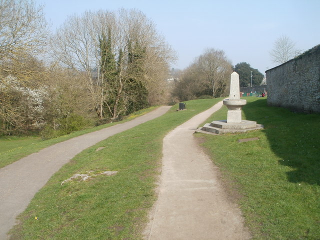
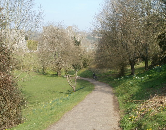
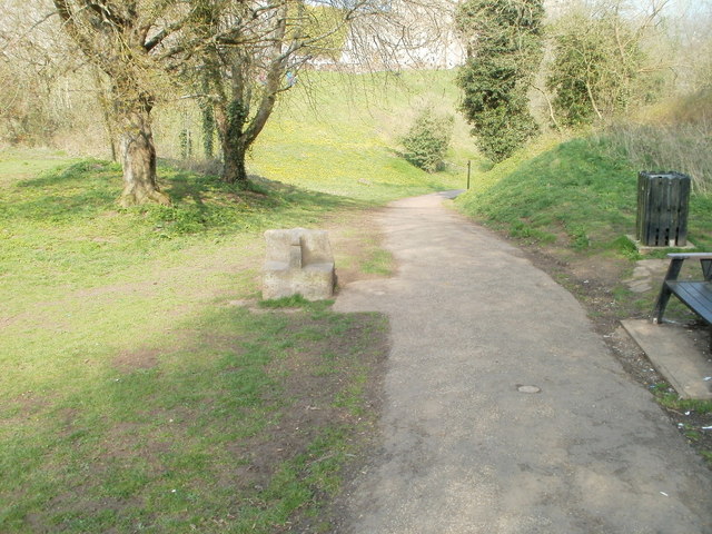
Visitors to Bishop's Barnets Wood can explore the network of well-maintained footpaths that wind through the woodland, offering breathtaking views and opportunities to connect with nature. The wood is particularly picturesque during spring, when an array of wildflowers bloom, adding bursts of color to the landscape.

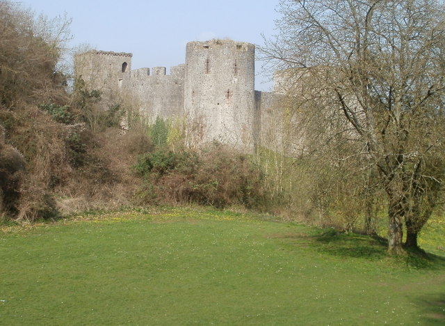
Bishop's Barnets Wood also holds historical significance, as it is believed to have been part of a medieval deer park. The remnants of ancient earthworks and boundaries can still be seen today, adding an element of intrigue and heritage to the wood.

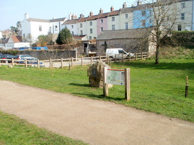
The wood is managed by local authorities who work diligently to preserve its natural beauty and protect its flora and fauna. Facilities within the wood include parking areas, picnic spots, and benches for visitors to relax and immerse themselves in the tranquility of the surroundings.

Overall, Bishop's Barnets Wood offers a captivating blend of natural beauty, wildlife, and history, providing an idyllic escape from the hustle and bustle of everyday life.

If you have any feedback on the listing, please let us know in the comments section below.

Bishop's Barnets Wood Images

Images are sourced within 2km of 51.644394/-2.6981837 or Grid Reference ST5194. Thanks to Geograph Open Source API. All images are credited.

B4235 near Coppice Mawr
View from The Alcove in Alcove Wood This is another welcome viewpoint on the Wye Valley Walk, just outside Chepstow and offers an excellent perspective on the castle, River Wye and the Lancaut peninsula.
View from The Alcove in Alcove Wood
This is another welcome viewpoint on the Wye Valley Walk, just outside Chepstow and offers an excellent perspective on the castle, River Wye and the Lancaut peninsula.
Chepstow Castle entrance A very impressive statement of Norman power and a great feature in Chepstow town.
Chepstow Castle entrance
A very impressive statement of Norman power and a great feature in Chepstow town.
Reaching the Winning Post, Chepstow Racecourse
General view, Chepstow Racecourse
Two paths through Castle Dell, Chepstow Viewed from the Welsh Street side. Castle Dell is a parklike area adjacent to Chepstow Castle on the south bank of the River Wye. On the right is a drinking fountain. <a title="https://www.geograph.org.uk/photo/545582" href="https://www.geograph.org.uk/photo/545582">Link</a>
Two paths through Castle Dell, Chepstow
Viewed from the Welsh Street side. Castle Dell is a parklike area adjacent to Chepstow Castle on the south bank of the River Wye. On the right is a drinking fountain. Link
Path through Castle Dell, Chepstow This is the central section of Castle Dell, which was opened to the public in 1886 when the Duke of Beaufort leased it to the town for one shilling a year.
Faintly visible in the background is Chepstow Castle, on the south bank of the River Wye.
Path through Castle Dell, Chepstow
This is the central section of Castle Dell, which was opened to the public in 1886 when the Duke of Beaufort leased it to the town for one shilling a year. Faintly visible in the background is Chepstow Castle, on the south bank of the River Wye.
SW corner of Chepstow Castle Viewed from Castle Dell.
SW corner of Chepstow Castle
Viewed from Castle Dell.
Southern wall of Chepstow Castle Part of the long southern wall, viewed from Castle Dell.
Southern wall of Chepstow Castle
Part of the long southern wall, viewed from Castle Dell.
Stone seat, Castle Dell, Chepstow On the left side of the path through Castle Dell is a stone seat made by stonemason John Hobbs to mark the diamond jubilee of Queen Victoria in 1897.
Stone seat, Castle Dell, Chepstow
On the left side of the path through Castle Dell is a stone seat made by stonemason John Hobbs to mark the diamond jubilee of Queen Victoria in 1897.
Southern end of Wye Valley Walk, Chepstow The large stone <a title="https://www.geograph.org.uk/photo/2365731" href="https://www.geograph.org.uk/photo/2365731">Link</a> next to an information board in Castle Dell marks the southern end of the 136 mile Wye Valley Walk.
Southern end of Wye Valley Walk, Chepstow
The large stone Link next to an information board in Castle Dell marks the southern end of the 136 mile Wye Valley Walk.
Plaque on stone at southern end of Wye Valley Walk, Chepstow The plaque, in Welsh and English, records that the stone <a title="https://www.geograph.org.uk/photo/2365712" href="https://www.geograph.org.uk/photo/2365712">Link</a> to which it is fixed, is from Plynlimon, near the source of the River Wye. It marks the southern end of the 136 mile (219 km) Wye Valley Walk. The Wye empties into the Severn at Beachley Point, about 4 kilometres to the SSE.
Plaque on stone at southern end of Wye Valley Walk, Chepstow
The plaque, in Welsh and English, records that the stone Link to which it is fixed, is from Plynlimon, near the source of the River Wye. It marks the southern end of the 136 mile (219 km) Wye Valley Walk. The Wye empties into the Severn at Beachley Point, about 4 kilometres to the SSE.
Former Chepstow Board School Set back from the east side of Bridge Street is the former Chepstow Board School which opened in 1878. The school, for girls and infants, was constructed by local builder Cuthbert Whalley for Chepstow School Board.
The Elementary Education Act of 1870 required the provision of a school place for every child aged from 5 to 12. Locally elected committees (School Boards) were empowered to build additional schools if needed.
Former Chepstow Board School
Set back from the east side of Bridge Street is the former Chepstow Board School which opened in 1878. The school, for girls and infants, was constructed by local builder Cuthbert Whalley for Chepstow School Board. The Elementary Education Act of 1870 required the provision of a school place for every child aged from 5 to 12. Locally elected committees (School Boards) were empowered to build additional schools if needed.
Former Glance Back shop, Chepstow Located on the corner of Middle Street and Upper Church Street, viewed from Bridge Street. The shop closed on October 31st 2004, when the owners decided to focus entirely on an Internet presence. Glance Back had opened here in 1983, dealing in antiquarian and secondhand books, and a variety of collectables such as stamps, banknotes, coins, tokens, medals and badges.
Former Glance Back shop, Chepstow
Located on the corner of Middle Street and Upper Church Street, viewed from Bridge Street. The shop closed on October 31st 2004, when the owners decided to focus entirely on an Internet presence. Glance Back had opened here in 1983, dealing in antiquarian and secondhand books, and a variety of collectables such as stamps, banknotes, coins, tokens, medals and badges.
Late Georgian houses, Bridge Street, Chepstow The houses at the SW end of Bridge Street date from about 1800. The white building was formerly The Vicarage.
Late Georgian houses, Bridge Street, Chepstow
The houses at the SW end of Bridge Street date from about 1800. The white building was formerly The Vicarage.
Chepstow bandstand decked out for the wedding of Prince William and Kate Middleton
Road Bridge over the River Wye, Chepstow Wales left bank .  England right bank
Road Bridge over the River Wye, Chepstow
Wales left bank . England right bank
Restway Wall, Garden City Way, Chepstow Part of a complex of retirement properties.
Restway Wall, Garden City Way, Chepstow
Part of a complex of retirement properties.
Show me another place!

Bishop's Barnets Wood is located at Grid Ref: ST5194 (Lat: 51.644394, Lng: -2.6981837)

Unitary Authority: Monmouthshire

Police Authority: Gwent

What 3 Words

///carry.suits.scoots. Near Chepstow, Monmouthshire

Related Wikis

St Lawrence Hospital, Chepstow

St Lawrence Hospital (Welsh: Ysbyty St Lawrence) was a specialist plastic surgery and burns hospital on the west side of St Lawrence Road in Chepstow,...
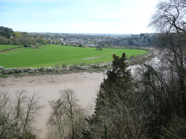
Mounton

Mounton is a hamlet in Monmouthshire, south east Wales, United Kingdom, located two miles west of Chepstow in a rural setting. The parish was originally...

Mounton House

Mounton House, Mounton, Monmouthshire, Wales, is the last major country house built in the county, constructed between 1910 and 1912 by the architect and...

Chepstow Community Hospital

Chepstow Community Hospital (Welsh: Ysbyty Cymunedol Cas-gwent) is a community hospital located on the east side of St Lawrence Road in Chepstow, Monmouthshire...
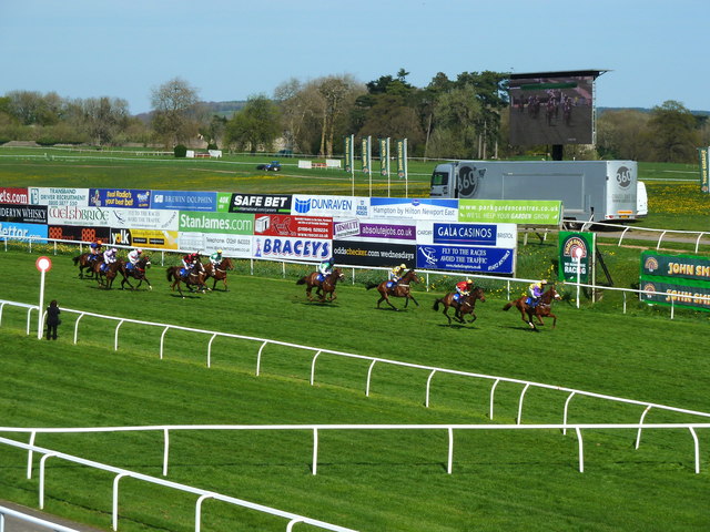
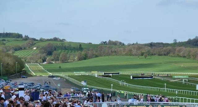
Chepstow Racecourse

Chepstow Racecourse is a thoroughbred horse racing course located just north of the town of Chepstow in Monmouthshire, Wales, near the southern end of...

Chepstow Town F.C.

Chepstow Town Football Club are a Welsh football club based in Chepstow, South East Wales and founded in 1878. The team play in the Ardal Leagues South...

Chepstow Rural District

Chepstow Rural District was a rural district in the administrative county of Monmouthshire, Wales. It was established under the Local Government Act 1894...
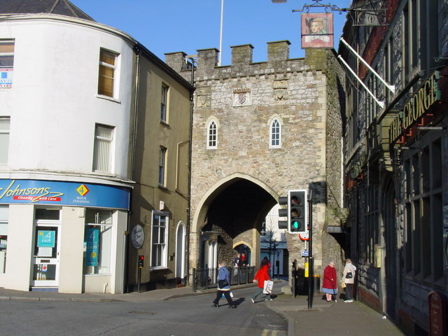
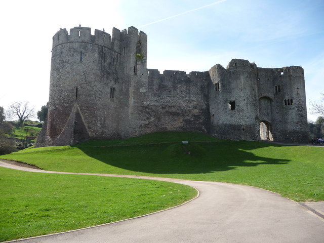
Chepstow Town Gate

The Town Gate at Chepstow, Monmouthshire, Wales, known locally as the Town Arch, was historically the only landward entrance to the town through the Port...

Nearby Amenities

Located within 500m of 51.644394,-2.6981837
Direction: SW
Generator Method: photovoltaic
Generator Output Electricity: yes
Generator Solar Modules: 16
Generator Source: solar
Generator Type: solar_photovoltaic_panel
Location: roof
Power: generator
Lat/Long: 51.6406819/-2.6950373
The data included in this document is from www.openstreetmap.org. The data is made available under ODbL.

Have you been to Bishop's Barnets Wood?

Leave your review of Bishop's Barnets Wood below (or comments, questions and feedback).