Mere Coppice

Wood, Forest in Flintshire

Wales

Mere Coppice

Brook Lane On the Llwybr Maelor between Hanmer and Penley.
Brook Lane Credit: John H Darch

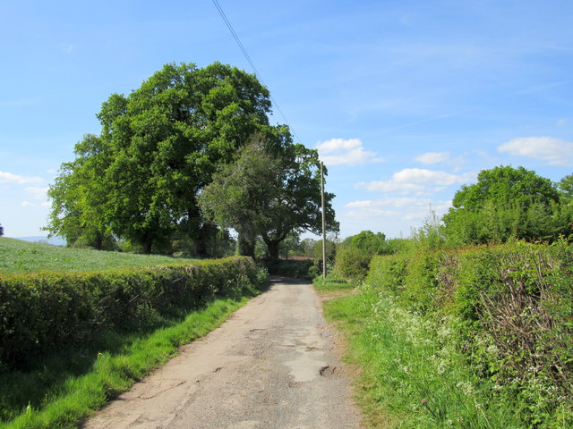
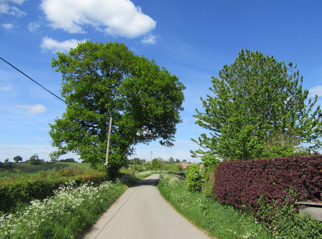
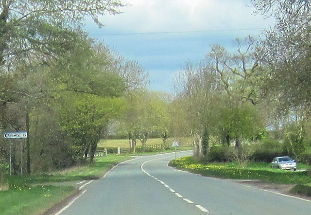
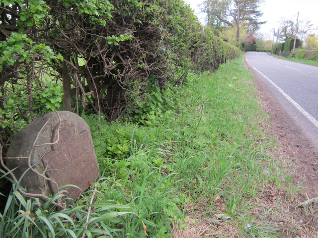
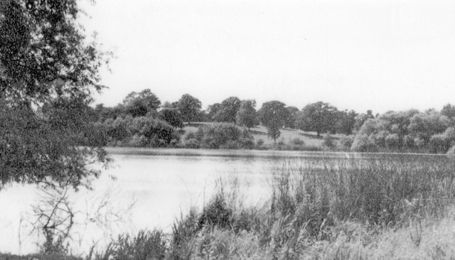
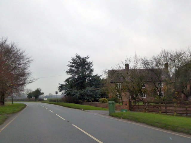
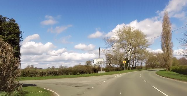
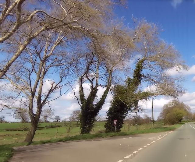
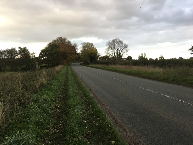
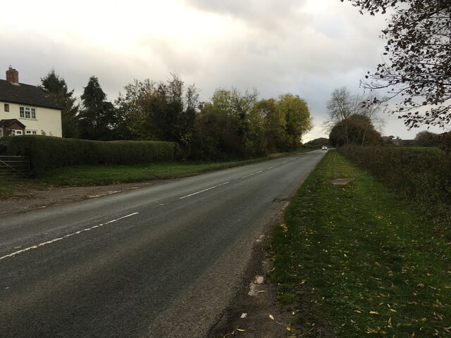
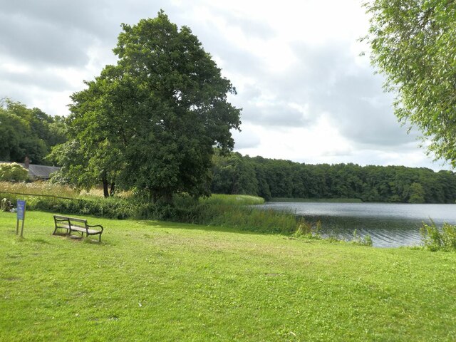
Mere Coppice is a charming woodland area located in Flintshire, a county in northeast Wales. Spanning over a vast area, the coppice is a haven for nature lovers and outdoor enthusiasts alike. Comprising predominantly deciduous trees such as oak, birch, and beech, the forest boasts a rich variety of flora and fauna.

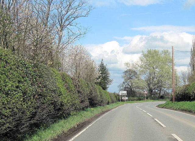
The woodland is known for its serene and tranquil ambiance, making it a popular spot for those seeking solace in nature. The well-preserved pathways winding through the forest offer a perfect opportunity for leisurely walks, jogging, or simply enjoying the fresh air. As visitors explore the area, they may stumble upon picturesque clearings and small ponds that add to the beauty and diversity of the landscape.

Mere Coppice is also home to an array of wildlife. Birdwatchers can delight in spotting various species such as woodpeckers, finches, and owls among the dense canopy. Squirrels, foxes, and rabbits are frequently seen darting through the undergrowth, adding to the natural charm of the woodland.

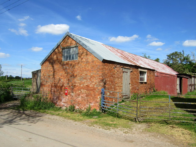
The coppice is managed by local authorities and conservation organizations, ensuring its preservation and protection. Educational programs and guided tours are occasionally offered to promote awareness and understanding of the woodland's importance in the ecosystem.

Overall, Mere Coppice is a hidden gem nestled in the heart of Flintshire, offering a serene retreat for nature enthusiasts and a valuable habitat for a wide range of plant and animal species.

If you have any feedback on the listing, please let us know in the comments section below.
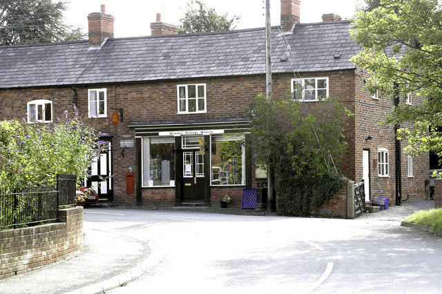
Mere Coppice Images

Images are sourced within 2km of 52.948116/-2.811958 or Grid Reference SJ4539. Thanks to Geograph Open Source API. All images are credited.

Brook Lane On the Llwybr Maelor between Hanmer and Penley.
Brook Lane
On the Llwybr Maelor between Hanmer and Penley.
Barn at Platt House
Barn at Platt House
Country lane north of Little Arowry
New Lane junction with A495 From eastbound A495
New Lane junction with A495
From eastbound A495
Holebrook farm entrance from Moss lane junction A495 eastbound
Holebrook farm entrance from Moss lane junction
A495 eastbound
Bench mark on Hanmer Church This bench mark is on the south west buttress of St Chad's church tower, Hanmer. See also <a href="https://www.geograph.org.uk/photo/3455060">SJ4539 : The west face of St Chad's church tower, Hanmer</a>
Bench mark on Hanmer Church
This bench mark is on the south west buttress of St Chad's church tower, Hanmer. See also SJ4539 : The west face of St Chad's church tower, Hanmer
The west face of St Chad's church tower, Hanmer Looking across the west face of the church tower, with an Ordnance Survey bench mark at the bottom of nearest buttress - see <a href="https://www.geograph.org.uk/photo/3455056">SJ4539 : Bench mark on Hanmer Church</a>
The west face of St Chad's church tower, Hanmer
Looking across the west face of the church tower, with an Ordnance Survey bench mark at the bottom of nearest buttress - see SJ4539 : Bench mark on Hanmer Church
Milestone at Cumber's Bank, near Hanmer This old milestone is on the south west side of the A539 at Cumber's Bank, west of Hanmer. A milestone is recorded at this location on Ordnance Survey maps from 1873, and a bench mark was also indicated up to 1954, but I couldn't see one today - it may be below ground level? The inscription on the plate is Whitchurch 7 Rhuabon 10, which is an unusual spelling of the more usual Ruabon. See also <a href="https://www.geograph.org.uk/photo/3455532">SJ4439 : Milestone at Cumber's Bank, and the A539</a>
Milestone at Cumber's Bank, near Hanmer
This old milestone is on the south west side of the A539 at Cumber's Bank, west of Hanmer. A milestone is recorded at this location on Ordnance Survey maps from 1873, and a bench mark was also indicated up to 1954, but I couldn't see one today - it may be below ground level? The inscription on the plate is Whitchurch 7 Rhuabon 10, which is an unusual spelling of the more usual Ruabon. See also SJ4439 : Milestone at Cumber's Bank, and the A539
Milestone at Cumber's Bank, and the A539 This old milestone is alongside the A539 at Cumber's Bank. The inscription is Whitchurch 7 Rhuabon 10, which is an unusual spelling of Ruabon. For a close up of the plate see <a href="https://www.geograph.org.uk/photo/3455507">SJ4439 : Milestone at Cumber's Bank, near Hanmer</a>
Milestone at Cumber's Bank, and the A539
This old milestone is alongside the A539 at Cumber's Bank. The inscription is Whitchurch 7 Rhuabon 10, which is an unusual spelling of Ruabon. For a close up of the plate see SJ4439 : Milestone at Cumber's Bank, near Hanmer
Hanmer Lake, 1951 View SE near the village, which is off to the right. (Cf. <a href="https://www.geograph.org.uk/photo/223695">SJ4539 : Hanmer Mere</a>).
Hanmer Lake, 1951
View SE near the village, which is off to the right. (Cf. SJ4539 : Hanmer Mere).
Lane Farm by the A495
Junction near Lane Farm
Moss Lane junction
Moss Lane junction
Road junction near Smithy Farm
A495 Ellesmere Road towards Bronington
A495 towards Welshampton
Minor road towards Eglwys Cross
Open area at the northern end of  Hanmer Mere
Open area at the northern end of Hanmer Mere
Show me another place!

Mere Coppice is located at Grid Ref: SJ4539 (Lat: 52.948116, Lng: -2.811958)

Unitary Authority: Wrexham

Police Authority: North Wales

What 3 Words

///exhaled.rudder.regrowth. Near Ellesmere, Shropshire

Related Wikis

Hanmer Mere

Hanmer Mere (Welsh: Llyn Hanmer) is a natural lake and Site of Special Scientific Interest in Wrexham County Borough, Wales. The village of Hanmer is at...

Arowry

Arowry (Welsh: Yr Owredd) is a village in the community of Hanmer in the rural south-east of Wrexham County Borough, Wales, near the border with England...

Hanmer, Wrexham

Hanmer is a village and community in Wrexham County Borough, Wales. At the 2001 Census the population of the Hanmer community area, which includes Hanmer...

Llyn Bedydd

Llyn Bedydd is a small lake in Wrexham County Borough, in northeastern Wales, near the border with England. It is 7 kilometres (4.3 mi) south west of...

Horseman's Green

Horseman's Green is a village in Wrexham County Borough, Wales. Located in the rural southeast of the county borough, it is close to the Wales-England...

Bronington

Bronington is a village and community in Wrexham County Borough, Wales, forming a large part of the Maelor Saesneg. Within the boundaries of the historic...

Breaden Heath

Breaden Heath is a small village in Shropshire, England. It lies right on the border with Wales.

Halghton

Halghton (Welsh: Halchdyn) is a dispersed settlement and former civil parish in the east of Wrexham County Borough, Wales. It is part of the community...

Nearby Amenities

Located within 500m of 52.948116,-2.811958
Hanmer
Name Cy: Hanmer
Place: village
Wikidata: Q5648626
Wikipedia: en:Hanmer, Wrexham
Lat/Long: 52.9522812/-2.8128367
Arowry
Alt Name: Big Arowry
Alt Name Cy: Big Arowry;Arowry
Alt Name En: Big Arowry
Name Cy: Yr Owredd
Name En: Arowry
Place: village
Wikidata: Q4795672
Wikipedia: en:Arowry
Lat/Long: 52.9470071/-2.8080503
Barrier: stile
Foot: yes
Lat/Long: 52.9504429/-2.8095436
Barrier: stile
Foot: yes
Lat/Long: 52.9517482/-2.8148811
Barrier: stile
Foot: yes
Lat/Long: 52.9498468/-2.8052069
Barrier: stile
Foot: yes
Lat/Long: 52.9497633/-2.8076205
J Roberts
Addr City: Hanmer
Addr Postcode: SY13 3DE
Fhrs Id: 1039716
Shop: butcher
Lat/Long: 52.9523233/-2.8121674
Post Office
Hanmer Post Office
Addr Country: GB
Addr Postcode: SY13 3DE
Brand: Post Office
Brand Wikidata: Q1783168
Check Date: 2022-05-27
Check Date Opening Hours: 2022-05-27
Contact Website: https://www.postoffice.co.uk/branch-finder/214641x/hanmer
Opening Hours: Mo,Tu,Th,Fr 08:00-17:30; We 08:00-13:00; Sa 08:30-13:00; Su 08:30-10:30
Ref Pol Id: 7848
Lat/Long: 52.9511315/-2.8123686
Direction: 165
Generator Method: photovoltaic
Generator Output Electricity: yes
Generator Solar Modules: 8
Generator Source: solar
Generator Type: solar_photovoltaic_panel
Location: roof
Power: generator
Lat/Long: 52.9471963/-2.8074655
Give Way
Direction: forward
Lat/Long: 52.9509848/-2.812644
Give Way
Direction: backward
Lat/Long: 52.9511459/-2.8129185
Give Way
Direction: backward
Lat/Long: 52.9511396/-2.8125598
Bench
Lat/Long: 52.9515154/-2.8136785
Waste Basket
Lat/Long: 52.9515738/-2.8139645
Waste Basket
Lat/Long: 52.9510305/-2.8128517
Waste Basket
Lat/Long: 52.9515479/-2.8135658
Bench
Lat/Long: 52.9515385/-2.8135489
Bench
Lat/Long: 52.9515636/-2.8139219
Waste Basket
Lat/Long: 52.951424/-2.8132944
Waste Basket
Lat/Long: 52.9515006/-2.8136446
Bench
Lat/Long: 52.9521135/-2.813217
Bench
Lat/Long: 52.9520718/-2.8134487
War memorial
Historic: memorial
Lat/Long: 52.9515466/-2.8138098
Bench
Lat/Long: 52.950977/-2.8130481
The data included in this document is from www.openstreetmap.org. The data is made available under ODbL.

Have you been to Mere Coppice?

Leave your review of Mere Coppice below (or comments, questions and feedback).