Calderwood

Settlement in Lanarkshire

Scotland

Calderwood

Nerston Industrial Estate Home Store More, Carpet Right and Benson for Beds.  B&Q is behind the photographer.
Nerston Industrial Estate Credit: Gordon Brown

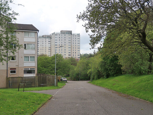
Calderwood is a residential area located in East Kilbride, South Lanarkshire, Scotland. It is situated approximately 10 miles southeast of Glasgow city center. The area is known for its peaceful atmosphere and beautiful surroundings, making it an ideal place for families and individuals seeking a tranquil setting.

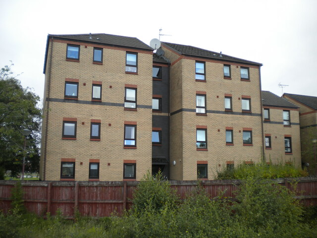
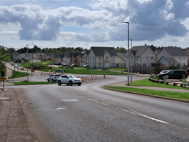
Calderwood is characterized by its well-maintained properties, consisting mainly of detached and semi-detached houses. The architecture varies, with a mix of traditional and modern designs that cater to different tastes and preferences. The neighborhood also benefits from ample green spaces and parks, providing residents with opportunities for outdoor activities and leisurely walks.

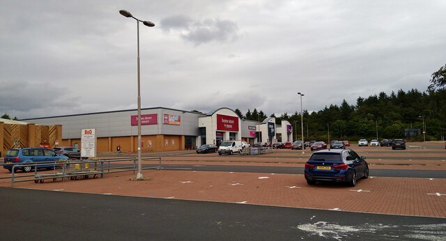
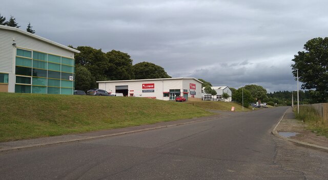
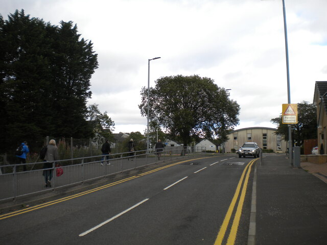
The area is well-served by local amenities and facilities, including schools, shops, and healthcare services. Calderwood Primary School is situated within the neighborhood, ensuring convenient access to education for local families. Additionally, Calderwood has excellent transport links, with regular bus services connecting it to East Kilbride town center and nearby areas.

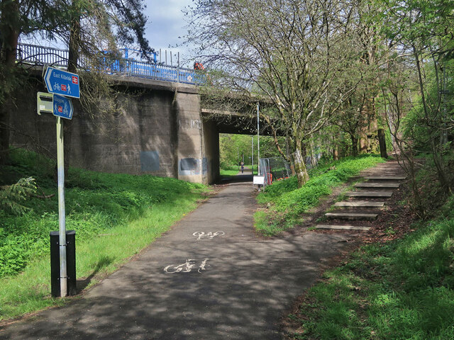
For recreational activities, Calderwood offers various options. Calderglen Country Park, located nearby, is a popular attraction, featuring picturesque walking trails, a children's zoo, and a golf course. The park's tranquil environment provides an excellent escape from the hustle and bustle of city life.

Overall, Calderwood in Lanarkshire offers a peaceful and family-friendly environment with a range of amenities and easy access to both natural and urban attractions. Its proximity to Glasgow city center, combined with its serene atmosphere, makes it an attractive place to live for those seeking a balance between convenience and tranquility.

If you have any feedback on the listing, please let us know in the comments section below.

Calderwood Images

Images are sourced within 2km of 55.76944/-4.1534755 or Grid Reference NS6555. Thanks to Geograph Open Source API. All images are credited.

Nerston Industrial Estate Home Store More, Carpet Right and Benson for Beds.  B&Q is behind the photographer.
Nerston Industrial Estate
Home Store More, Carpet Right and Benson for Beds. B&Q is behind the photographer.
Law Place, Nerston, East Kilbride
Streetview car Filling up at Sainsbury's, Nerston
Streetview car
Filling up at Sainsbury's, Nerston
Streetview camera
Streetview camera
Torrance Road, East Kilbride Approaching West Mains Road.
Torrance Road, East Kilbride
Approaching West Mains Road.
Low rise flats, Kirkton Gate, East Kilbride The rear elevation, seen from the railway station.
Low rise flats, Kirkton Gate, East Kilbride
The rear elevation, seen from the railway station.
Farmland at Letterickhills With East Kilbride multi-storeys in the background
Farmland at Letterickhills
With East Kilbride multi-storeys in the background
Lee's Burn A tributary of the Rotten Calder
Lee's Burn
A tributary of the Rotten Calder
Mavor Avenue, East Kilbride The houses are on the site of the old Rolls-Royce Aero-Engine Works which opened in 1953 and closed in 2019. The new streets Avon Drive and Dart Avenue are named after some of the engines associated with the works.
The Mavor and Coulson Mining Equipment works was on the left side of the road and was built around 1930. This site has also been re-developed with new housing. See,  <span class="nowrap"><a title="https://maps.nls.uk/geo/explore/#zoom=15.8&lat=55.77874&lon=-4.16692&layers=170&b=1" rel="nofollow ugc noopener" href="https://maps.nls.uk/geo/explore/#zoom=15.8&lat=55.77874&lon=-4.16692&layers=170&b=1">Link</a><img style="margin-left:2px;" alt="External link" title="External link - shift click to open in new window" src="https://s1.geograph.org.uk/img/external.png" width="10" height="10"/></span>
Mavor Avenue, East Kilbride
The houses are on the site of the old Rolls-Royce Aero-Engine Works which opened in 1953 and closed in 2019. The new streets Avon Drive and Dart Avenue are named after some of the engines associated with the works. The Mavor and Coulson Mining Equipment works was on the left side of the road and was built around 1930. This site has also been re-developed with new housing. See, LinkExternal link
East Kilbride Cemetery The cemetery dates from around 1910 and is still in use.
East Kilbride Cemetery
The cemetery dates from around 1910 and is still in use.
National Cycle Route 756 in East Kilbride The route runs for 8 miles from Kelvindale in Glasgow to East Kilbride railway station. Here it follows the course of the old East Kilbride to Hamilton railway under East Mains Road. The line to Hamilton was closed in 1935 but this section remained open till 1966 to connect to the nearby Mavor and Coulson Mining Equipment works.
National Cycle Route 756 in East Kilbride
The route runs for 8 miles from Kelvindale in Glasgow to East Kilbride railway station. Here it follows the course of the old East Kilbride to Hamilton railway under East Mains Road. The line to Hamilton was closed in 1935 but this section remained open till 1966 to connect to the nearby Mavor and Coulson Mining Equipment works.
National Cycle Route 756 near East Kilbride railway station The route runs for 8 miles from Kelvindale in Glasgow to East Kilbride railway station.
National Cycle Route 756 near East Kilbride railway station
The route runs for 8 miles from Kelvindale in Glasgow to East Kilbride railway station.
Underpass below the Kingsway, East Kilbride The Kingsway is the main north-south road and the Queensway is the main east-west road.
Underpass below the Kingsway, East Kilbride
The Kingsway is the main north-south road and the Queensway is the main east-west road.
St Leonards Road, East Kilbride One of the original parts of the new town where pedestrians are kept separate from the main roads.
St Leonards Road, East Kilbride
One of the original parts of the new town where pedestrians are kept separate from the main roads.
Glen Esk Urban Greenspace, East Kilbride Located in a former landfill site and funded via the Scottish Government Vacant Derelict Land Fund. The site includes footpaths, artworks, an outdoor classroom and a junior bike track. See, 
<span class="nowrap"><a title="https://www.covanburn.com/covanburn-projects/glen-esk-urban-greenspace/" rel="nofollow ugc noopener" href="https://www.covanburn.com/covanburn-projects/glen-esk-urban-greenspace/">Link</a><img style="margin-left:2px;" alt="External link" title="External link - shift click to open in new window" src="https://s1.geograph.org.uk/img/external.png" width="10" height="10"/></span>
Glen Esk Urban Greenspace, East Kilbride
Located in a former landfill site and funded via the Scottish Government Vacant Derelict Land Fund. The site includes footpaths, artworks, an outdoor classroom and a junior bike track. See, LinkExternal link
Barrie Road, East Kilbride A 4 storey block of flats on the left and looking towards the 15 storey tower blocks.
Barrie Road, East Kilbride
A 4 storey block of flats on the left and looking towards the 15 storey tower blocks.
Blocked road to Edge Farm The farm is unoccupied.
Blocked road to Edge Farm
The farm is unoccupied.
Field beside Calderside Road Like most fields in the area it has a metal gate that is padlocked when it is closed. A high viewpoint to the tower blocks in East Kilbride and the distant Ben Lomond with Dumgoyne and the Campsies on the right.
Field beside Calderside Road
Like most fields in the area it has a metal gate that is padlocked when it is closed. A high viewpoint to the tower blocks in East Kilbride and the distant Ben Lomond with Dumgoyne and the Campsies on the right.
Show me another place!

Calderwood is located at Grid Ref: NS6555 (Lat: 55.76944, Lng: -4.1534755)

Unitary Authority: South Lanarkshire

Police Authority: Lanarkshire

What 3 Words

///puzzle.oils.natively. Near East Kilbride, South Lanarkshire

Nearby Locations

Calderwood

Related Wikis

Calderwood, East Kilbride

Calderwood is a neighbourhood of the Scottish new town of East Kilbride, in South Lanarkshire. It lies on its north-east edge and is one of the largest...

Hunter House Museum

Hunter House Museum was a museum in Calderwood, East Kilbride, South Lanarkshire, Scotland. == Description == Hunter House forms part of the original Long...

St Leonards, East Kilbride

St Leonards is an area of the Scottish new town East Kilbride, in South Lanarkshire. St Leonards is a residential area on the east side of the town. The...

Gilbertfield Castle

Gilbertfield Castle is a ruined 17th-century castle in South Lanarkshire, Scotland. It is located at NS652587, on the north slope of Dechmont Hill, just...

Calderglen High School

Calderglen High School (Scottish Gaelic: Àrd-sgoil Ghlinn Challdair) is a state-run secondary school in the St Leonards area of the Scottish new town East...

Sanderson High School, East Kilbride

Sanderson High School is a non-denominational secondary school in East Kilbride, South Lanarkshire, Scotland for pupils with additional support needs....

East Mains, East Kilbride

East Mains is an area of the Scottish new town East Kilbride, in South Lanarkshire. It lies to the north of the town centre and the Village, between West...

St Andrew's and St Bride's High School

St Andrew's and St Bride's High School is a Roman Catholic school in East Kilbride, Scotland. The current head teacher is Fiona Mullen. The school opened...

Nearby Amenities

Located within 500m of 55.76944,-4.1534755
Traffic Signals
Source: survey
Lat/Long: 55.7728669/-4.1567744
Fast Food
Marinis
Lat/Long: 55.7719061/-4.1562545
Bus Stop
Carlyle Drive
Naptan AtcoCode: 6150755
Naptan Bearing: SW
Naptan CommonName: Carlyle Drive
Naptan Indicator: Opp Carlyle Drive
Naptan Landmark: Carlyle Drive
Naptan NaptanCode: 75234823
Naptan Street: Calderwood Road
Naptan Verified: no
Source: naptan_import
Lat/Long: 55.7677004/-4.1589667
Bus Stop
Carlyle Terrace
Naptan AtcoCode: 6150756
Naptan Bearing: NE
Naptan CommonName: Carlyle Terrace
Naptan Indicator: At Carlyle Terrace
Naptan Landmark: Carlyle Terrace
Naptan NaptanCode: 75234783
Naptan Street: Calderwood Road
Naptan Verified: no
Source: naptan_import
Lat/Long: 55.7679347/-4.1589319
Bus Stop
Alison Lea Health Centre
Naptan AtcoCode: 6150759
Naptan Bearing: SE
Naptan CommonName: Alison Lea Health Centre
Naptan Indicator: at Health Centre
Naptan Landmark: Alison Lea
Naptan NaptanCode: 75234535
Naptan Street: Calderwood Road
Naptan Verified: no
Source: naptan_import
Lat/Long: 55.7711802/-4.1542644
Bus Stop
Alison Lea Health Centre
Naptan AtcoCode: 6150760
Naptan Bearing: NW
Naptan CommonName: Alison Lea Health Centre
Naptan Indicator: opp Health Centre
Naptan Landmark: Alison Lea
Naptan NaptanCode: 75232647
Naptan Street: Calderwood Road
Naptan Verified: no
Source: naptan_import
Lat/Long: 55.7713876/-4.1547382
Bus Stop
Calderwood Square
Naptan AtcoCode: 6150761
Naptan Bearing: SE
Naptan CommonName: Calderwood Square
Naptan Indicator: opp shops
Naptan Landmark: Maxwellton Road
Naptan NaptanCode: 75234682
Naptan Notes: citylink stop
Naptan Street: Calderwood Road
Naptan Verified: no
Source: naptan_import
Lat/Long: 55.7725227/-4.1561242
Bus Stop
Calderwood Square
Naptan AtcoCode: 6150762
Naptan Bearing: NW
Naptan CommonName: Calderwood Square
Naptan Indicator: at shops
Naptan Landmark: Maxwellton Road
Naptan NaptanCode: 75235237
Naptan Notes: citylink stop
Naptan Street: Calderwood Road
Naptan Verified: no
Source: naptan_import
Lat/Long: 55.7724652/-4.1563283
Bus Stop
Melville Park
Naptan AtcoCode: 6150770
Naptan Bearing: SW
Naptan CommonName: Melville Park
Naptan Indicator: opp Church
Naptan Landmark: Melville Park
Naptan NaptanCode: 75235969
Naptan Street: Maxwellton Road
Naptan Verified: no
Source: naptan_import
Lat/Long: 55.7732865/-4.1561345
Crossing
Crossing: uncontrolled
Crossing Island: yes
Crossing Markings: no
Tactile Paving: yes
Lat/Long: 55.7693104/-4.1550354
Laurieston Lime Craig exposures
Natural: cliff
Lat/Long: 55.7715922/-4.1486825
Graham of Capelrig Monument
Historic: monument
Lat/Long: 55.7694061/-4.1607121
Turning Circle
Lat/Long: 55.7734758/-4.1506283
Crossing
Lat/Long: 55.7723572/-4.1564052
William Hill
Brand: William Hill
Brand Wikidata: Q4053147
Brand Wikipedia: en:William Hill (bookmaker)
Shop: bookmaker
Lat/Long: 55.7717919/-4.1561333
Crossing
Bicycle: yes
Crossing: traffic_signals
Kerb: lowered
Tactile Paving: yes
Lat/Long: 55.7698111/-4.1543729
Barrier: bollard
Lat/Long: 55.7736829/-4.1520446
Noexit: yes
Lat/Long: 55.7674377/-4.1526163
Brancumhall Amenity Woodland (South)
Natural: wood
Lat/Long: 55.7708319/-4.1488505
Barrier: yes
Lat/Long: 55.7682428/-4.1551921
Entrance: yes
Lat/Long: 55.765187/-4.151427
Entrance: yes
Lat/Long: 55.7652861/-4.1508949
Entrance: yes
Lat/Long: 55.7653804/-4.1503659
Entrance: yes
Lat/Long: 55.7654787/-4.1498485
Post Box
Lat/Long: 55.765641/-4.1517446
Entrance: yes
Lat/Long: 55.7654885/-4.1516779
Entrance: yes
Lat/Long: 55.7650908/-4.1519471
Rig & Furrow
Historic: archaeological_site
Lat/Long: 55.7658907/-4.1570391
Fast Food
Manhatten Fish & Chicken
Cuisine: fish_and_chips;pizza;ice_cream;regional
Lat/Long: 55.7727274/-4.1569215
Scotmid
Addr Postcode: G74 3BQ
Brand: Scotmid
Brand Wikidata: Q7435719
Brand Wikipedia: en:Scotmid
Shop: supermarket
Website: https://scotmid.coop/store/calderwood/
Lat/Long: 55.7722492/-4.1567295
Post Office
Calderwood Post Office
Addr Postcode: G74 3BQ
Brand: Post Office
Brand Wikidata: Q1783168
Ref Pol Id: 11549
Lat/Long: 55.7722375/-4.1567751
Atm
Lat/Long: 55.772273/-4.1566946
Lauriestoun Hill
Natural: peak
Lat/Long: 55.7710594/-4.1506848
Anne Kneilands Cairn Memorial
Historic: memorial
Lat/Long: 55.7679333/-4.1548409
Crossing
Crossing: uncontrolled
Crossing Island: yes
Crossing Markings: no
Tactile Paving: yes
Lat/Long: 55.7687583/-4.1569166
Bus Stop
Bus: yes
Public Transport: platform
Lat/Long: 55.7689504/-4.1559273
Bus Stop
Bus: yes
Public Transport: platform
Lat/Long: 55.7692209/-4.1555665
The data included in this document is from www.openstreetmap.org. The data is made available under ODbL.

Have you been to Calderwood?

Leave your review of Calderwood below (or comments, questions and feedback).