Crwys Wood

Wood, Forest in Monmouthshire

Wales

Crwys Wood

New use for a red box, Newcastle, Monmouthshire Viewed in January 2022. The former red phonebox alongside the B4347 contains a defibrillator box. <a title="https://www.geograph.org.uk/photo/7067226" href="https://www.geograph.org.uk/photo/7067226">Link</a>
New use for a red box, Newcastle, Monmouthshire Credit: Jaggery

Crwys Wood, located in Monmouthshire, is a picturesque forest known for its natural beauty and diverse range of flora and fauna. Spanning an area of approximately 500 acres, this woodland is a haven for nature enthusiasts and hikers alike.

The wood is primarily composed of mixed deciduous trees, including oak, beech, ash, and birch, which create a vibrant and verdant canopy during the summer months. This lush environment provides a habitat for numerous species of birds, mammals, and insects, making it a popular spot for wildlife observation.

Crwys Wood offers several walking trails, varying in length and difficulty, allowing visitors to explore the forest at their own pace. The paths wind through the ancient woodland, revealing hidden streams, moss-covered rocks, and enchanting wildflower meadows. The serene atmosphere and peaceful surroundings make it an ideal location for those seeking tranquility and a connection with nature.

The forest is also home to a diverse range of plant species, including bluebells, wood anemones, and wild garlic, which create a breathtaking display of colors and scents during the springtime. As visitors explore the wood, they may also come across remnants of old stone structures and ancient boundary walls, adding an intriguing historical element to the area.

Crwys Wood is easily accessible, with parking facilities available nearby, and is a popular destination for families, dog walkers, and nature enthusiasts. Whether it's a leisurely stroll or an immersive nature experience, this woodland provides a truly enchanting escape from the hustle and bustle of everyday life.

If you have any feedback on the listing, please let us know in the comments section below.
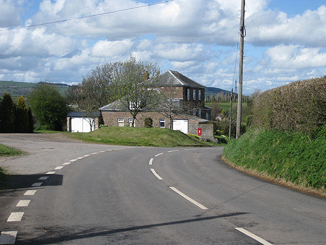
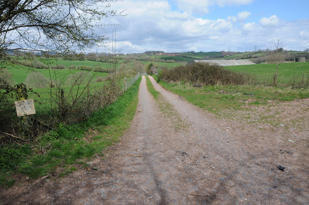
Crwys Wood Images

Images are sourced within 2km of 51.841295/-2.8217456 or Grid Reference SO4316. Thanks to Geograph Open Source API. All images are credited.

New use for a red box, Newcastle, Monmouthshire Viewed in January 2022. The former red phonebox alongside the B4347 contains a defibrillator box. <a title="https://www.geograph.org.uk/photo/7067226" href="https://www.geograph.org.uk/photo/7067226">Link</a>
New use for a red box, Newcastle, Monmouthshire
Viewed in January 2022. The former red phonebox alongside the B4347 contains a defibrillator box. Link
Inside a former red phonebox, Newcastle, Monmouthshire This <a title="https://www.geograph.org.uk/photo/7067219" href="https://www.geograph.org.uk/photo/7067219">Link</a> red box contains a defibrillator box in January 2022.
Inside a former red phonebox, Newcastle, Monmouthshire
This Link red box contains a defibrillator box in January 2022.
Stone bus shelter, Newcastle, Monmouthshire Alongside the B4347 near Newcastle Farm.
Stone bus shelter, Newcastle, Monmouthshire
Alongside the B4347 near Newcastle Farm.
SE along the B4347, Newcastle, Monmouthshire This way for the B4233.
SE along the B4347, Newcastle, Monmouthshire
This way for the B4233.
Newcastle Farm, Newcastle, Monmouthshire Set back from the B4347 in rural NE Monmouthshire.
Newcastle Farm, Newcastle, Monmouthshire
Set back from the B4347 in rural NE Monmouthshire.
Molehills on a grassy mound, Newcastle, Monmouthshire Many molehills are in view in January 2022. The B4347 is on the right.
Molehills on a grassy mound, Newcastle, Monmouthshire
Many molehills are in view in January 2022. The B4347 is on the right.
North along the B4347, Newcastle, Monmouthshire In rural NE Monmouthshire.
North along the B4347, Newcastle, Monmouthshire
In rural NE Monmouthshire.
Dead-end side road, Newcastle, Monmouthshire Looking to the SW from the corner of the B4347 on a foggy day in January 2022.
Dead-end side road, Newcastle, Monmouthshire
Looking to the SW from the corner of the B4347 on a foggy day in January 2022.
Poor visibility on the B4347, Newcastle, Monmouthshire Viewed on a day of patchy fog in January 2022.
Poor visibility on the B4347, Newcastle, Monmouthshire
Viewed on a day of patchy fog in January 2022.
Wooden bench, Newcastle, Monmouthshire On the corner of the B4347 and this <a title="https://www.geograph.org.uk/photo/7073086" href="https://www.geograph.org.uk/photo/7073086">Link</a> side road viewed in January 2022. The bench is not in a June 2011 Google Street View.
Wooden bench, Newcastle, Monmouthshire
On the corner of the B4347 and this Link side road viewed in January 2022. The bench is not in a June 2011 Google Street View.
Onen boundary sign, Monmouthshire Hamlet name sign below a warning sign alongside the B4233 in rural Monmouthshire.
Onen boundary sign, Monmouthshire
Hamlet name sign below a warning sign alongside the B4233 in rural Monmouthshire.
Tractor leaving Onen, Monmouthshire Travelling east on the B4233 in January 2022. 
An Onen boundary sign <a title="https://www.geograph.org.uk/photo/7081697" href="https://www.geograph.org.uk/photo/7081697">Link</a> is behind the camera.
Tractor leaving Onen, Monmouthshire
Travelling east on the B4233 in January 2022. An Onen boundary sign Link is behind the camera.
Junction in Onen, Monmouthshire Viewed along the B4233. Take the left fork for the unclassified road to Llanvihangel-Ystern-Llewern.
Junction in Onen, Monmouthshire
Viewed along the B4233. Take the left fork for the unclassified road to Llanvihangel-Ystern-Llewern.
East side of Onen House, Onen, Monmouthshire Large house on the north side of the B4233 in rural Monmouthshire.
East side of Onen House, Onen, Monmouthshire
Large house on the north side of the B4233 in rural Monmouthshire.
Metal field gate, Onen, Monmouthshire Set back from the south side of the B4233 in rural Monmouthshire.
Metal field gate, Onen, Monmouthshire
Set back from the south side of the B4233 in rural Monmouthshire.
View from a gate, Onen, Monmouthshire Viewed from this <a title="https://www.geograph.org.uk/photo/7081718" href="https://www.geograph.org.uk/photo/7081718">Link</a> gate in January 2022.
View from a gate, Onen, Monmouthshire
Viewed from this Link gate in January 2022.
Onen House, Onen, Monmouthshire Viewed across the B4233 in rural Monmouthshire.
Onen House, Onen, Monmouthshire
Viewed across the B4233 in rural Monmouthshire.
Grass triangle in Onen, Monmouthshire At the junction of the B4233 (on the right) and a minor road.
Grass triangle in Onen, Monmouthshire
At the junction of the B4233 (on the right) and a minor road.
Show me another place!

Crwys Wood is located at Grid Ref: SO4316 (Lat: 51.841295, Lng: -2.8217456)

Unitary Authority: Monmouthshire

Police Authority: Gwent

What 3 Words

///regretted.pops.fights. Near Llanrothal, Herefordshire

Related Wikis

Maerdy Farmhouse, Llanvihangel-Ystern-Llewern

Maerdy Farmhouse (The Maerdy), Llanvihangel-Ystern-Llewern, Monmouthshire is a farmhouse dating from about 1700. Extended later in the 18th century, it...

Tal-y-coed Court

Tal-y-coed Court,, Llanvihangel-Ystern-Llewern, Monmouthshire, Wales, is a Victorian country house. Constructed in 1881–1883, it was built for the Monmouthshire...

Newcastle, Monmouthshire

Newcastle (Welsh: Castell-newydd) is a small village in Monmouthshire, south east Wales, United Kingdom. It is located in quiet rolling countryside 6...

Grange Farmhouse farm buildings, Newcastle, Monmouthshire

The farmstead complex of Grange Farmhouse, Newcastle, Monmouthshire is a grouping of early 18th farm buildings. It comprises a stable, two barns, two cow...

Have you been to Crwys Wood?

Leave your review of Crwys Wood below (or comments, questions and feedback).