Park Wood

Wood, Forest in Monmouthshire

Wales

Park Wood

The Rock and Fountain Inn, Penhow Beside the A48.
The Rock and Fountain Inn, Penhow Credit: Eirian Evans

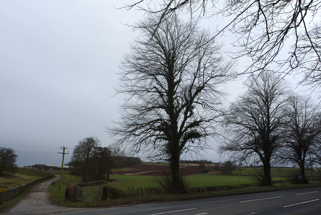
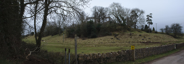
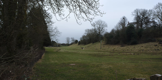
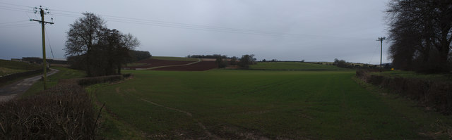
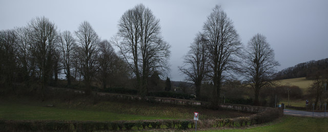
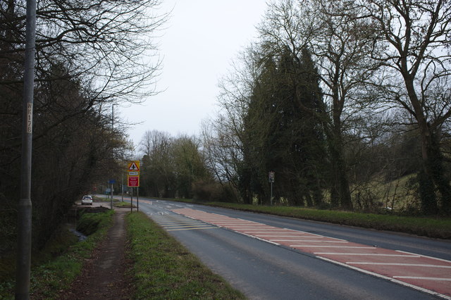
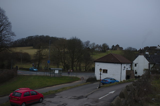
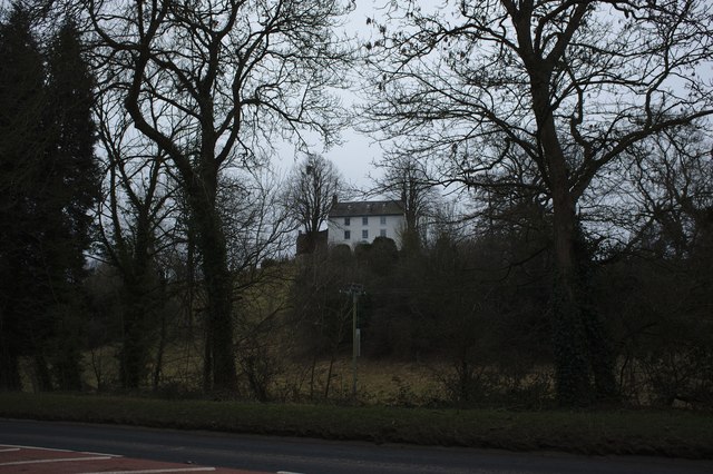
Park Wood is a picturesque woodland located in Monmouthshire, Wales. Covering an area of approximately 50 acres, it is known for its natural beauty and diverse range of flora and fauna. The wood is situated on the outskirts of a small village, surrounded by rolling hills and meadows.

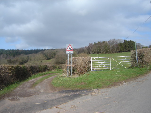
The woodland is predominantly made up of broadleaf trees, including oak, beech, and ash, which create a dense canopy overhead. The forest floor is carpeted with a variety of wildflowers, ferns, and mosses, adding to its enchanting atmosphere. The wood is crisscrossed with well-maintained walking paths, allowing visitors to explore its hidden corners and discover its hidden treasures.

Park Wood is a haven for wildlife, providing a habitat for numerous species. Birdwatchers can spot a wide range of birds, including woodpeckers, bullfinches, and nuthatches. The wood is also home to mammals such as badgers, foxes, and deer, which can often be seen grazing or foraging for food.

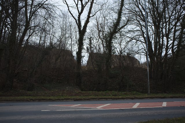
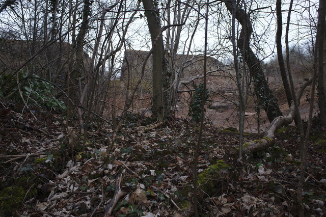
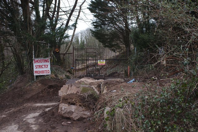
In addition to its natural beauty, Park Wood also has a rich history. It was once part of a larger estate and has remnants of old stone walls and ruins scattered throughout. These ruins offer a glimpse into the area's past, adding an intriguing element to the wood's charm.

Whether you are seeking a peaceful stroll, a chance to connect with nature, or an opportunity to explore history, Park Wood in Monmouthshire provides a tranquil and captivating experience for visitors of all ages.

If you have any feedback on the listing, please let us know in the comments section below.

Park Wood Images

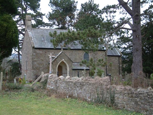
Images are sourced within 2km of 51.622303/-2.8519309 or Grid Reference ST4191. Thanks to Geograph Open Source API. All images are credited.

The Rock and Fountain Inn, Penhow Beside the A48.
The Rock and Fountain Inn, Penhow
Beside the A48.
The track to Castle Farm
The house on the hill A 17th century house on the site of Penhow Castle
<span class="nowrap"><a title="http://map.coflein.gov.uk/index.php?action=do_details&numlink=221292" rel="nofollow ugc noopener" href="http://map.coflein.gov.uk/index.php?action=do_details&numlink=221292">Link</a><img style="margin-left:2px;" alt="External link" title="External link - shift click to open in new window" src="https://s1.geograph.org.uk/img/external.png" width="10" height="10"/></span>
The house on the hill
A 17th century house on the site of Penhow Castle LinkExternal link
A natural moat l land below Penhow Castle the natural plain and its little stream forms a natural barrier
A natural moat
l land below Penhow Castle the natural plain and its little stream forms a natural barrier
Field at Penhow
Field at Penhow
Row of trees
Row of trees
Quarry wall A curious ring wall left around a quarry, and then breached.
Quarry wall
A curious ring wall left around a quarry, and then breached.
Disused Quarry Another view of <a href="https://www.geograph.org.uk/photo/5703090">ST4291 : Quarry wall</a>
Disused Quarry
Another view of ST4291 : Quarry wall
Quarry entrance a series of stern warnings
Quarry entrance
a series of stern warnings
The A48 The A48 runs 119 miles from Gloucester to Carmarthen across South Wales. <span class="nowrap"><a title="http://www.sabre-roads.org.uk/wiki/index.php?title=A48" rel="nofollow ugc noopener" href="http://www.sabre-roads.org.uk/wiki/index.php?title=A48">Link</a><img style="margin-left:2px;" alt="External link" title="External link - shift click to open in new window" src="https://s1.geograph.org.uk/img/external.png" width="10" height="10"/></span>
The A48
The A48 runs 119 miles from Gloucester to Carmarthen across South Wales. LinkExternal link
A48 The A48 runs 119 miles from Gloucester to Carmarthen across South Wales. <span class="nowrap"><a title="http://www.sabre-roads.org.uk/wiki/index.php?title=A48" rel="nofollow ugc noopener" href="http://www.sabre-roads.org.uk/wiki/index.php?title=A48">Link</a><img style="margin-left:2px;" alt="External link" title="External link - shift click to open in new window" src="https://s1.geograph.org.uk/img/external.png" width="10" height="10"/></span>
A48
The A48 runs 119 miles from Gloucester to Carmarthen across South Wales. LinkExternal link
Barn at the Rock and Fountain Inn This is an ancient monument, a 17th century barn and stable
<span class="nowrap"><a title="http://map.coflein.gov.uk/index.php?action=do_details&numlink=43361" rel="nofollow ugc noopener" href="http://map.coflein.gov.uk/index.php?action=do_details&numlink=43361">Link</a><img style="margin-left:2px;" alt="External link" title="External link - shift click to open in new window" src="https://s1.geograph.org.uk/img/external.png" width="10" height="10"/></span>
Barn at the Rock and Fountain Inn
This is an ancient monument, a 17th century barn and stable LinkExternal link
Penhow Castle Grade II* Listed Penhow was developed from a heavily-built keep and was the first castle with a stone keep to be built in Britain by the conquering Normans in 1070 and has claims to be the oldest inhabited castle in Wales. Less than a century after the keep tower was built the larger area of the inner bailey was enclosed within a thick stone curtain wall. By the 14th century Penhow was quite a stronghold. The drawbridge was operated by counterweights of stone rediscovered in 1979. Above the lower hall, the Great Hall achieved its present shape in the late 1480s. The Lewis family converted Penhow from an old-fashioned castle to a modern house shortly after 1674. Thomas Lewis' son Thomas was High Sheriff of the county. Stephen Weeks bought the Norman stronghold in 1973 and rebuilt the ruins into an award-winning attraction that opened to the public in 1978. Penhow Castle was sold to a London businessman and closed to the public on 29th December 2002. The important thing about the house is that it was home to the famous Seymour family which eventually produced a King and Queen of England in Jane Seymour and Edward VI.
Penhow Castle
Grade II* Listed Penhow was developed from a heavily-built keep and was the first castle with a stone keep to be built in Britain by the conquering Normans in 1070 and has claims to be the oldest inhabited castle in Wales. Less than a century after the keep tower was built the larger area of the inner bailey was enclosed within a thick stone curtain wall. By the 14th century Penhow was quite a stronghold. The drawbridge was operated by counterweights of stone rediscovered in 1979. Above the lower hall, the Great Hall achieved its present shape in the late 1480s. The Lewis family converted Penhow from an old-fashioned castle to a modern house shortly after 1674. Thomas Lewis' son Thomas was High Sheriff of the county. Stephen Weeks bought the Norman stronghold in 1973 and rebuilt the ruins into an award-winning attraction that opened to the public in 1978. Penhow Castle was sold to a London businessman and closed to the public on 29th December 2002. The important thing about the house is that it was home to the famous Seymour family which eventually produced a King and Queen of England in Jane Seymour and Edward VI.
A48 at Penhow, 1 A good view of the wooded hills of The Wentwood.
A48 at Penhow, 1
A good view of the wooded hills of The Wentwood.
A48 at Penhow, 2 Looking east towards Chepstow.
The No. 73 service to Newport is approaching.
A48 at Penhow, 2
Looking east towards Chepstow. The No. 73 service to Newport is approaching.
Grazing land south of Penhow, 1 Looking north-east towards the Wentwood Hills.
Grazing land south of Penhow, 1
Looking north-east towards the Wentwood Hills.
Grazing land south of Penhow, 2 Looking east across the gently rolling landscape of south Monmouthshire.
Grazing land south of Penhow, 2
Looking east across the gently rolling landscape of south Monmouthshire.
Farm buildings at Chapel Farm, Llandevaud Old stone buildings ripe for conversion?
Farm buildings at Chapel Farm, Llandevaud
Old stone buildings ripe for conversion?
Show me another place!

Park Wood is located at Grid Ref: ST4191 (Lat: 51.622303, Lng: -2.8519309)

Unitary Authority: Newport

Police Authority: Gwent

What 3 Words

///website.parsnip.fighters. Near Llanvaches, Newport

Related Wikis

Parc-Seymour

Parc-Seymour is a suburban hamlet on the northern edge of Penhow just off the A48 road.

Penhow

Penhow (Welsh: Pen-hŵ) is a small village and community (parish) just inside the eastern edge of the boundary of the city of Newport, South Wales, within...

Penhow Castle

Penhow Castle, Penhow, Newport dates from the early 12th century. Extended and reconstructed in almost every century since, it has been claimed to be the...

Llandevaud

Llandevaud is a small hamlet in east Newport, Wales with a church about a half mile from the village centre, going down towards The Foresters Oaks, a restaurant...

Nearby Amenities

Located within 500m of 51.622303,-2.8519309
Parc Seymour
Is In: Newport
Is In Historic County: Monmouthshire
Place: hamlet
Population: 744
Population Date: 2011
Source Population: https://www.nomisweb.co.uk
Wikidata: Q7136380
Lat/Long: 51.6213429/-2.8566772
Addr Postcode: NP26 3JF
Lat/Long: 51.6199443/-2.855765
Addr Postcode: NP26 3AG
Lat/Long: 51.6215934/-2.8546701
Addr Postcode: NP26 3AE
Lat/Long: 51.6229783/-2.8546352
Addr Postcode: NP26 3AF
Lat/Long: 51.6222029/-2.8561429
Addr Postcode: NP26 3AN
Lat/Long: 51.622055/-2.8582709
Addr Postcode: NP26 3AB
Lat/Long: 51.6208422/-2.8575704
Addr Postcode: NP26 3AQ
Lat/Long: 51.6202505/-2.8582852
Addr Postcode: NP26 3AH
Lat/Long: 51.6245064/-2.8513137
Direction: 170
Generator Method: photovoltaic
Generator Output Electricity: yes
Generator Solar Modules: 14
Generator Source: solar
Generator Type: solar_photovoltaic_panel
Location: roof
Power: generator
Lat/Long: 51.6202639/-2.8462569
Direction: 170
Generator Method: photovoltaic
Generator Output Electricity: yes
Generator Solar Modules: 7
Generator Source: solar
Generator Type: solar_photovoltaic_panel
Location: roof
Power: generator
Lat/Long: 51.6202456/-2.8465131
Direction: W
Generator Method: photovoltaic
Generator Output Electricity: yes
Generator Solar Modules: 6
Generator Source: solar
Generator Type: solar_photovoltaic_panel
Location: roof
Power: generator
Lat/Long: 51.6211678/-2.8567893
Direction: 255
Generator Method: photovoltaic
Generator Output Electricity: yes
Generator Solar Modules: 2
Generator Source: solar
Generator Type: solar_photovoltaic_panel
Location: roof
Power: generator
Lat/Long: 51.6226686/-2.8550519
Direction: S
Generator Method: photovoltaic
Generator Output Electricity: yes
Generator Solar Modules: 10
Generator Source: solar
Generator Type: solar_photovoltaic_panel
Location: roof
Power: generator
Lat/Long: 51.6201166/-2.8545919
Direction: S
Generator Method: photovoltaic
Generator Output Electricity: yes
Generator Solar Modules: 6
Generator Source: solar
Generator Type: solar_photovoltaic_panel
Location: roof
Power: generator
Lat/Long: 51.6201103/-2.8546563
Direction: S
Generator Method: photovoltaic
Generator Output Electricity: yes
Generator Solar Modules: 4
Generator Source: solar
Generator Type: solar_photovoltaic_panel
Location: roof
Power: generator
Lat/Long: 51.6201607/-2.8548977
Direction: S
Generator Method: photovoltaic
Generator Output Electricity: yes
Generator Solar Modules: 10
Generator Source: solar
Generator Type: solar_photovoltaic_panel
Location: roof
Power: generator
Lat/Long: 51.6201648/-2.8548172
Direction: SSE
Generator Method: photovoltaic
Generator Output Electricity: yes
Generator Solar Modules: 16
Generator Source: solar
Generator Type: solar_photovoltaic_panel
Location: roof
Power: generator
Lat/Long: 51.6207011/-2.8562871
Direction: S
Generator Method: photovoltaic
Generator Output Electricity: yes
Generator Solar Modules: 12
Generator Source: solar
Generator Type: solar_photovoltaic_panel
Location: roof
Power: generator
Lat/Long: 51.6212323/-2.8568785
Direction: 255
Generator Method: photovoltaic
Generator Output Electricity: yes
Generator Solar Modules: 8
Generator Source: solar
Generator Type: solar_photovoltaic_panel
Location: roof
Power: generator
Lat/Long: 51.6226944/-2.855064
Direction: 215
Generator Method: photovoltaic
Generator Output Electricity: yes
Generator Solar Modules: 10
Generator Source: solar
Generator Type: solar_photovoltaic_panel
Location: roof
Power: generator
Lat/Long: 51.6224263/-2.8566653
Direction: 170
Generator Method: photovoltaic
Generator Output Electricity: yes
Generator Solar Modules: 14
Generator Source: solar
Generator Type: solar_photovoltaic_panel
Location: roof
Power: generator
Lat/Long: 51.6220791/-2.8591034
Direction: 80
Generator Method: photovoltaic
Generator Output Electricity: yes
Generator Solar Modules: 10
Generator Source: solar
Generator Type: solar_photovoltaic_panel
Location: roof
Power: generator
Lat/Long: 51.6216053/-2.8588164
Direction: 260
Generator Method: photovoltaic
Generator Output Electricity: yes
Generator Solar Modules: 10
Generator Source: solar
Generator Type: solar_photovoltaic_panel
Location: roof
Power: generator
Lat/Long: 51.6215987/-2.858862
Direction: 175
Generator Method: photovoltaic
Generator Output Electricity: yes
Generator Solar Modules: 15
Generator Source: solar
Generator Type: solar_photovoltaic_panel
Location: roof
Power: generator
Lat/Long: 51.6212989/-2.8577757
Direction: 175
Generator Method: photovoltaic
Generator Output Electricity: yes
Generator Solar Modules: 2
Generator Source: solar
Generator Type: solar_photovoltaic_panel
Location: roof
Power: generator
Lat/Long: 51.6209858/-2.8575645
Direction: 265
Generator Method: photovoltaic
Generator Output Electricity: yes
Generator Solar Modules: 4
Generator Source: solar
Generator Type: solar_photovoltaic_panel
Location: roof
Power: generator
Lat/Long: 51.6210325/-2.8575611
Direction: 265
Generator Method: photovoltaic
Generator Output Electricity: yes
Generator Solar Modules: 3
Generator Source: solar
Generator Type: solar_photovoltaic_panel
Location: roof
Power: generator
Lat/Long: 51.6210791/-2.8575826
Direction: 175
Generator Method: photovoltaic
Generator Output Electricity: yes
Generator Solar Modules: 6
Generator Source: solar
Generator Type: solar_photovoltaic_panel
Location: roof
Power: generator
Lat/Long: 51.6210408/-2.8576268
Bus Stop
Parc Seymour
Bus: yes
Departures Board: no
Lit: yes
Naptan AtcoCode: 5310AWB32054
Network: Newport Bus
Operator: Newport Bus
Public Transport: platform
Ref: nwpmapa
Lat/Long: 51.6198468/-2.8576715
Bus Stop
Parc Seymour
Bus: yes
Departures Board: no
Lit: yes
Naptan AtcoCode: 5310AWB32053
Network: Newport Bus
Operator: Newport Bus
Public Transport: platform
Ref: nwpmamw
Lat/Long: 51.6213656/-2.8581757
Cafe
The Coffee Lodge
Addr City: Parc Seymour
Addr Postcode: NP26 3AB
Addr Street: Greenmeadow Drive
Alt Name: Coffee Lodge
Cuisine: coffee_shop
Email: enquiries@penhowvillage.shop
Opening Hours: Mo-Fr 09:00-13:00,15:30-17:30; Sa 09:00-13:00; Su 09:00-12:00
Outdoor Seating: yes
Phone: +44 7726 936 214
Start Date: 2022-04-04
Lat/Long: 51.6210326/-2.8575227
Penhow Village Shop
Addr City: Parc Seymour
Addr Postcode: NP26 3AB
Addr Street: Greenmeadow Drive
Email: enquiries@penhowvillage.shop
Opening Hours: Mo-Fr 09:00-13:00,15:30-17:30; Sa 09:00-13:00; Su 09:00-12:00
Phone: +44 7726 936 214
Shop: convenience
Lat/Long: 51.6210876/-2.8575415
The data included in this document is from www.openstreetmap.org. The data is made available under ODbL.

Have you been to Park Wood?

Leave your review of Park Wood below (or comments, questions and feedback).