Coed Du

Wood, Forest in Monmouthshire

Wales

Coed Du

National Speed Limit sign, Llanarth, Monmouthshire Viewed from the 30mph zone.
National Speed Limit sign, Llanarth, Monmouthshire Credit: Jaggery

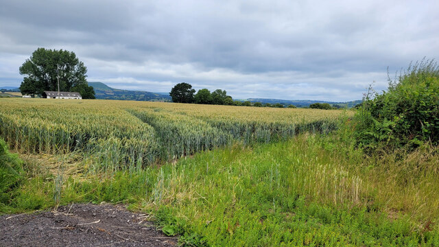
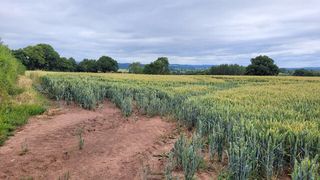
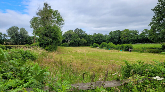
Coed Du is a picturesque woodland located in Monmouthshire, Wales. Spanning over a vast area, it is known for its lush greenery and diverse flora and fauna. The name "Coed Du" translates to "Black Wood" in English, which aptly describes the dense and dark appearance of the forest.

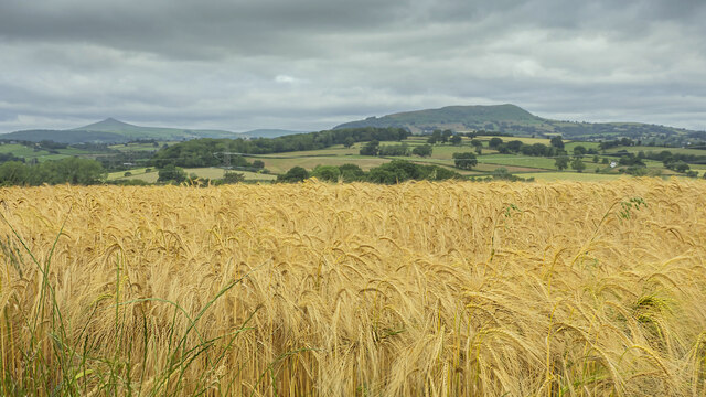
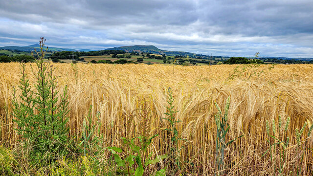
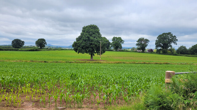
The woodland is situated in a hilly terrain, creating a scenic landscape with rolling hills and valleys. It is primarily composed of deciduous trees, such as oak, beech, and birch, which create a vibrant and colorful canopy during autumn. These trees provide a habitat for numerous bird species, including woodpeckers and owls, making it a haven for birdwatchers and nature enthusiasts.

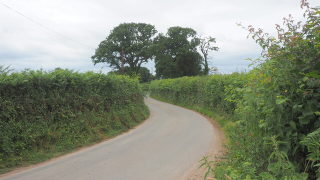
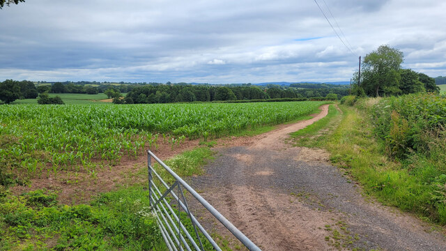
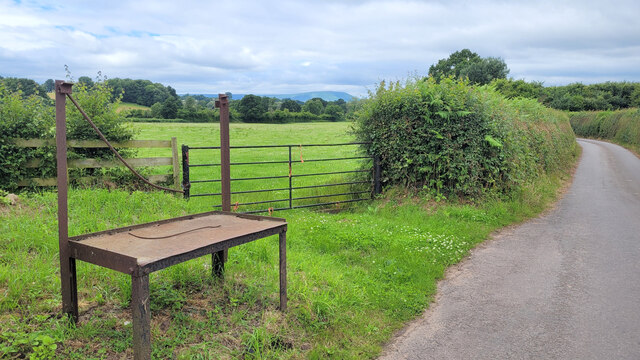
Coed Du also hosts a variety of wildlife, such as deer, foxes, and badgers, which can be spotted roaming freely within the forest. The woodland is crisscrossed by a network of walking trails, allowing visitors to explore its beauty and tranquility. These trails offer a chance to immerse oneself in nature, with the sound of rustling leaves and the scent of wildflowers filling the air.

Furthermore, Coed Du is a popular destination for outdoor activities like hiking, cycling, and picnicking. It offers a peaceful retreat from the hustle and bustle of city life, providing an opportunity to connect with nature and enjoy the serene surroundings.

Overall, Coed Du in Monmouthshire is a captivating woodland that showcases the beauty of nature. With its diverse ecosystem, scenic landscapes, and recreational activities, it offers a delightful experience for visitors seeking solace and adventure in the heart of Wales.

If you have any feedback on the listing, please let us know in the comments section below.

Coed Du Images

Images are sourced within 2km of 51.809559/-2.8952597 or Grid Reference SO3812. Thanks to Geograph Open Source API. All images are credited.

National Speed Limit sign, Llanarth, Monmouthshire Viewed from the 30mph zone.
National Speed Limit sign, Llanarth, Monmouthshire
Viewed from the 30mph zone.
Warning sign in a hedge, Llanarth, Monmouthshire  On the approach to a minor junction.
Warning sign in a hedge, Llanarth, Monmouthshire
On the approach to a minor junction.
Former church for sale in January 2022, Llanarth The former St Teilo's church in the Church in Wales Diocese of Monmouth was for sale when I was here in September 2020. It remains for sale on January 2nd 2022.
Former church for sale in January 2022, Llanarth
The former St Teilo's church in the Church in Wales Diocese of Monmouth was for sale when I was here in September 2020. It remains for sale on January 2nd 2022.
Deciduous trees in winter, Llanarth, Monmouthshire Leafless trees viewed on January 2nd 2022.
Deciduous trees in winter, Llanarth, Monmouthshire
Leafless trees viewed on January 2nd 2022.
Stile access to a public footpath, Llanarth Near the stile, a public footpath sign points towards this <a title="https://www.geograph.org.uk/photo/7060546" href="https://www.geograph.org.uk/photo/7060546">Link</a> field, muddy on January 2nd 2022.
Stile access to a public footpath, Llanarth
Near the stile, a public footpath sign points towards this Link field, muddy on January 2nd 2022.
Church For Sale board, January 2022, Llanarth The Hutchings & Thomas chartered surveyors board refers to the nearby former St Teilo's Church <a title="https://www.geograph.org.uk/photo/7060540" href="https://www.geograph.org.uk/photo/7060540">Link</a>. A Heritage Llanarth September 2021 Newsletter <a title="https://www.geograph.org.uk/photo/7060552" href="https://www.geograph.org.uk/photo/7060552">Link</a> is on the lower left corner of the board on January 2nd 2022.
Church For Sale board, January 2022, Llanarth
The Hutchings & Thomas chartered surveyors board refers to the nearby former St Teilo's Church Link. A Heritage Llanarth September 2021 Newsletter Link is on the lower left corner of the board on January 2nd 2022.
Heritage Llanarth September 2021 Newsletter  On this <a title="https://www.geograph.org.uk/photo/7060551" href="https://www.geograph.org.uk/photo/7060551">Link</a> Church For Sale board on January 2nd 2022.
Heritage Llanarth September 2021 Newsletter
On this Link Church For Sale board on January 2nd 2022.
Barley field and great view, 1 The ripening barley in early July with a view to Y Fal, Sugarloaf, left distance and Ysgyryd Fawr, The Skirrid, centre right.
See <a href="https://www.geograph.org.uk/photo/7226965">SO3612 : Barley field and great view, 2</a> for a focus on the barley crop.
Barley field and great view, 1
The ripening barley in early July with a view to Y Fal, Sugarloaf, left distance and Ysgyryd Fawr, The Skirrid, centre right. See SO3612 : Barley field and great view, 2 for a focus on the barley crop.
Road to Llandewi Rhydderch Looking west.
Road to Llandewi Rhydderch
Looking west.
Barley field and great view, 2 Focus on the crop rather than the hills, compared to <a href="https://www.geograph.org.uk/photo/7218735">SO3612 : Barley field and great view, 1</a>.
The hills in the distance are Sugarloaf, Y Fal, to the left and Ysgyryd Fawr, Skirrid, centre.

You'll remember me when the west wind moves
Upon the fields of barley
You'll forget the sun in his jealous sky
As we walk in fields of gold.

Sting - 'Fields of Gold'
Barley field and great view, 2
Focus on the crop rather than the hills, compared to SO3612 : Barley field and great view, 1. The hills in the distance are Sugarloaf, Y Fal, to the left and Ysgyryd Fawr, Skirrid, centre. You'll remember me when the west wind moves Upon the fields of barley You'll forget the sun in his jealous sky As we walk in fields of gold. Sting - 'Fields of Gold'
Wheat field opposite Cefn Cottage Distant view to Ysgyryd Fawr.
Wheat field opposite Cefn Cottage
Distant view to Ysgyryd Fawr.
Wheat field opposite Cefn Cottage Looking north-east.
Wheat field opposite Cefn Cottage
Looking north-east.
Monmouthshire wheat field To the north of Llanarth, looking north-west.
Monmouthshire wheat field
To the north of Llanarth, looking north-west.
Monmouthshire maize field To the north of Llanarth, looking north-east.
Monmouthshire maize field
To the north of Llanarth, looking north-east.
Maize crop Several oak trees dotted around and a view to Y Fal/Sugarloaf in the distance left.
Maize crop
Several oak trees dotted around and a view to Y Fal/Sugarloaf in the distance left.
Small field used as a paddock Flat land in the Trothy valley.
Small field used as a paddock
Flat land in the Trothy valley.
Metal churn stand Located at the end of the farm road to Croesygiach.
Metal churn stand
Located at the end of the farm road to Croesygiach.
Great Bottom Farm I'm surprised that I'm the first Geographer to visit this spot!
Great Bottom Farm
I'm surprised that I'm the first Geographer to visit this spot!
Show me another place!

Coed Du is located at Grid Ref: SO3812 (Lat: 51.809559, Lng: -2.8952597)

Unitary Authority: Monmouthshire

Police Authority: Gwent

What 3 Words

///disarmed.snowboard.undulation. Near Llanarth, Monmouthshire

Nearby Locations

Coed Du TydĂ» Wood

Related Wikis

Great Killough

Great Killough, Llantilio Crossenny, Monmouthshire is a substantial manor house of late medieval origins. The majority of the current structures date from...

Coed-y-gelli, Llanarth

Coed-y-gelli, Llanarth, Monmouthshire is a house dating from the late 16th or early 17th centuries. It is a Grade II* listed building. == History == The...

Llanarth, Monmouthshire

Llanarth is a privately owned estate village and community within a conservation area in the Welsh county of Monmouthshire. Llanarth is roughly six miles...

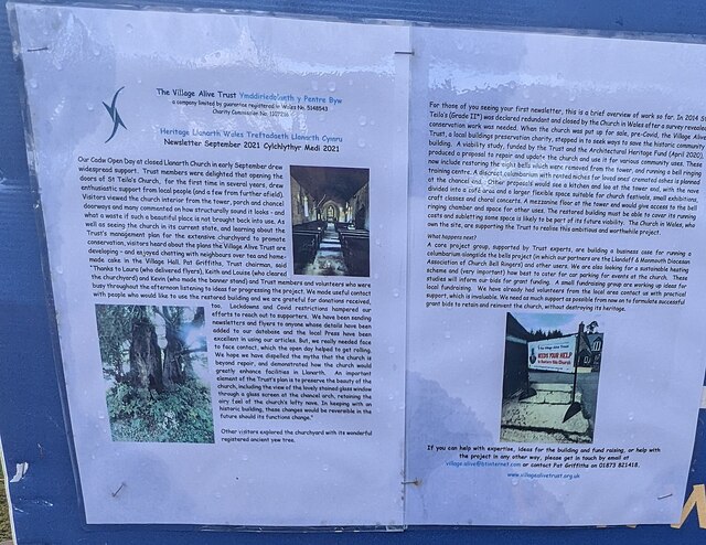
St Teilo's Church, Llanarth

The Church of St Teilo, Llanarth, Monmouthshire, Wales is a former parish church with its origins in the 15th century. Renovations took place in the 18th...

St Mapley's Church, Llanvapley

The Church of St Mapley, Llanvapley, Monmouthshire is a parish church with its origins in the 15th century. Dedicated to St Mable, variants of the dedication...

Church of St Mary and St Michael, Llanarth

The Church of St Mary and St Michael, Llanarth, Monmouthshire, was built as the family chapel for Llanarth Court. It was the first Roman Catholic church...
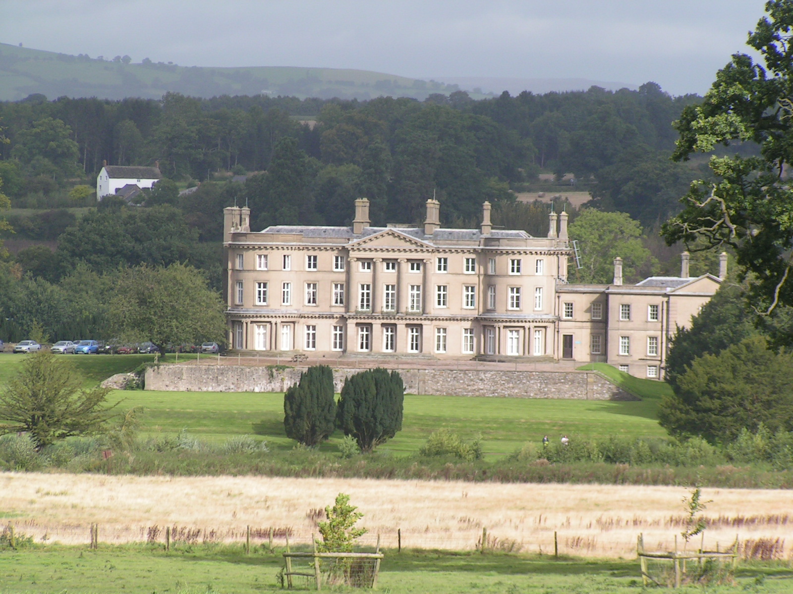
Llanarth Court

Llanarth Court is a late-18th-century country house with substantial 19th-century alterations in Llanarth, Monmouthshire, Wales. The court was built for...

Llantilio Crossenny

Llantilio Crossenny (Welsh: Llandeilo Gresynni) is a small village and much larger former community, now in the community of Whitecastle, in Monmouthshire...

Have you been to Coed Du?

Leave your review of Coed Du below (or comments, questions and feedback).