Dorlan Wood

Wood, Forest in Flintshire

Wales

Dorlan Wood

Barn at Cloy Hall
Barn at Cloy Hall Credit: John H Darch

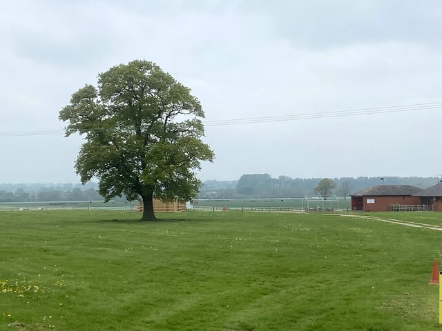
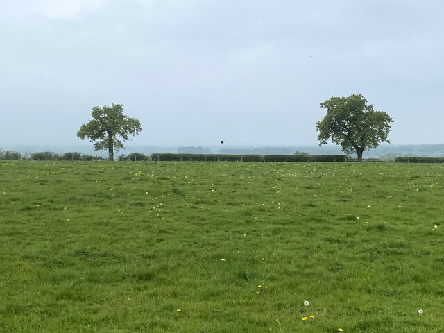
Dorlan Wood is a quaint woodland area located in Flintshire, Wales. Covering an area of approximately 40 hectares, this forest is known for its diverse range of flora and fauna, making it a popular destination for nature lovers and outdoor enthusiasts.

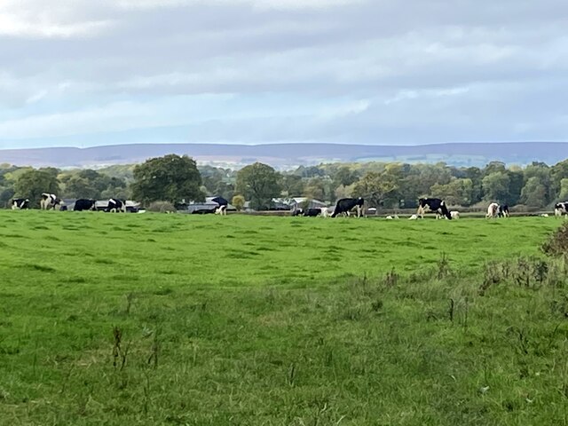
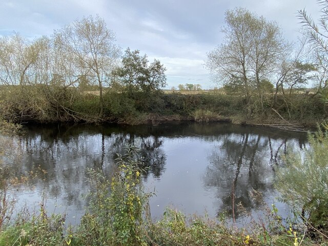
The wood is predominantly made up of native species such as oak, birch, and beech trees, providing a rich habitat for a variety of wildlife including birds, mammals, and insects. Visitors can enjoy leisurely walks along the well-maintained paths that wind through the woods, offering scenic views of the surrounding countryside.

Dorlan Wood is also home to a number of historic features, including remnants of ancient settlements and a network of old pathways that date back centuries. These elements add to the charm and character of the woodland, making it a fascinating place to explore for those interested in the area's past.

Overall, Dorlan Wood in Flintshire is a peaceful and picturesque natural space that offers a tranquil escape from the hustle and bustle of everyday life. Whether you're looking to go for a hike, birdwatch, or simply relax in nature, this woodland area has something to offer for everyone.

If you have any feedback on the listing, please let us know in the comments section below.
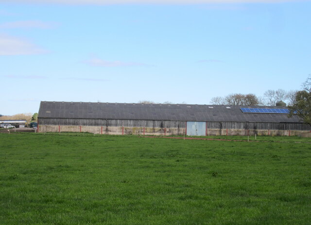
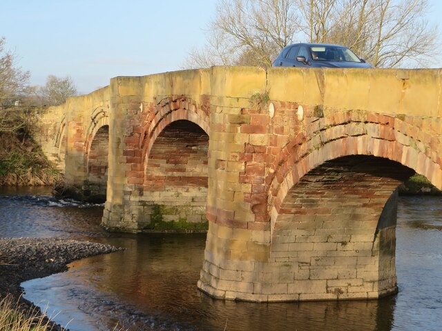
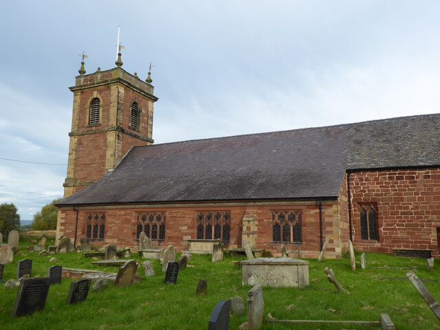
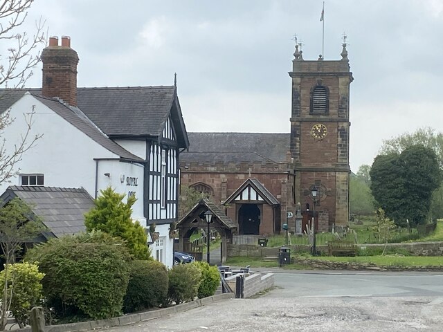
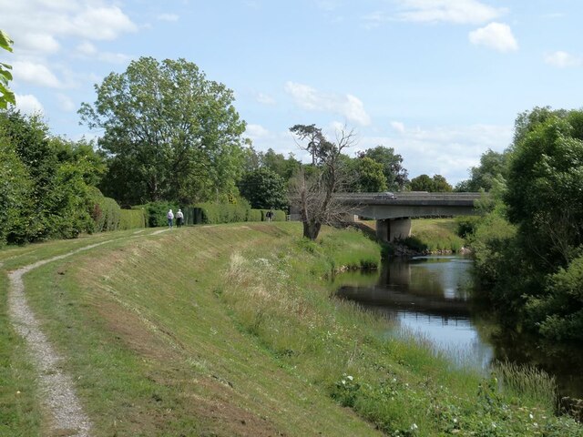
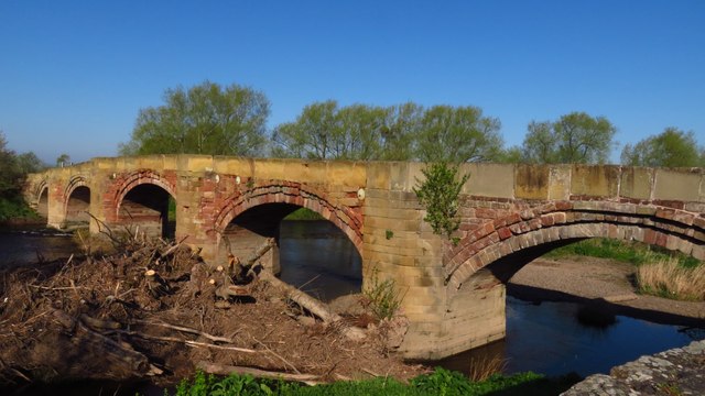
Dorlan Wood Images

Images are sourced within 2km of 52.987723/-2.9217144 or Grid Reference SJ3843. Thanks to Geograph Open Source API. All images are credited.

Barn at Cloy Hall
Barn at Cloy Hall
Pont Bangor-is-Coed Bangor-on-Dee bridge in the early morning spring sunshine.
Pont Bangor-is-Coed
Bangor-on-Dee bridge in the early morning spring sunshine.
Bangor on Dee, St Dunawd
Pub and church The Royal Oak and St Dunawd's Church in Bangor-is-y-Coed.
Pub and church
The Royal Oak and St Dunawd's Church in Bangor-is-y-Coed.
Bangor racecourse Viewed from the B5069.
Bangor racecourse
Viewed from the B5069.
Field with two trees At Cloy Farm.
Field with two trees
At Cloy Farm.
Cattle grazing in a field by the River Dee With a distant view of the Welsh hills.
Cattle grazing in a field by the River Dee
With a distant view of the Welsh hills.
Autumnal reflections In the River Dee.
Autumnal reflections
In the River Dee.
Bangor Bridge The original bridge over the Dee at Bangor-on-Dee/Bangor-is-y-Coed dates from Medieval times and is Grade I listed. Completely inadequate to cope with modern motor  traffic, it was replaced by the Bangor By-pass bridge just upstream in 1978. It still carries one-way light motor traffic from west to east. 

The Royal Oak public house stands on the east bank.
Bangor Bridge
The original bridge over the Dee at Bangor-on-Dee/Bangor-is-y-Coed dates from Medieval times and is Grade I listed. Completely inadequate to cope with modern motor traffic, it was replaced by the Bangor By-pass bridge just upstream in 1978. It still carries one-way light motor traffic from west to east. The Royal Oak public house stands on the east bank.
Kayakers come ashore on the River Dee An inflatable kayak coming in to land just upstream from the old Bangor Bridge.
Kayakers come ashore on the River Dee
An inflatable kayak coming in to land just upstream from the old Bangor Bridge.
Bangor Bridge The original bridge over the Dee at Bangor-on-Dee/Bangor-is-y-Coed dates from Medieval times and is Grade I listed. Completely inadequate to cope with modern motor  traffic, it was replaced by the Bangor By-pass bridge just upstream in 1978. It still carries one-way light motor traffic from west to east. 

Looking downstream; a large quantity of flotsam has accumulated against one of the bridge piers.
Bangor Bridge
The original bridge over the Dee at Bangor-on-Dee/Bangor-is-y-Coed dates from Medieval times and is Grade I listed. Completely inadequate to cope with modern motor traffic, it was replaced by the Bangor By-pass bridge just upstream in 1978. It still carries one-way light motor traffic from west to east. Looking downstream; a large quantity of flotsam has accumulated against one of the bridge piers.
St Dunawd's Church, Bangor-on-Dee/Bangor-is-y-Coed Grade II* listed church, part dating back to the 14th Century. St Dunawd was the abbot of the original monastery which stood on the site in the 6th Century. The flood bank of the River Dee can be seen to the right.
St Dunawd's Church, Bangor-on-Dee/Bangor-is-y-Coed
Grade II* listed church, part dating back to the 14th Century. St Dunawd was the abbot of the original monastery which stood on the site in the 6th Century. The flood bank of the River Dee can be seen to the right.
Churchyard of St Dunawd's Church In Bangor-on-Dee/Bangor-is-y-Coed. The Royal Oak public  house stands on the far side of the road.
Churchyard of St Dunawd's Church
In Bangor-on-Dee/Bangor-is-y-Coed. The Royal Oak public house stands on the far side of the road.
Floodbank on the River Dee Upstream from Bangor Bridge.
Floodbank on the River Dee
Upstream from Bangor Bridge.
Local map of  Bangor-on-Dee/Bangor-is-y-Coed Posted on the wall of the churchyard, this map was compiled from the drawings, memories and records of the people of the area.
Local map of Bangor-on-Dee/Bangor-is-y-Coed
Posted on the wall of the churchyard, this map was compiled from the drawings, memories and records of the people of the area.
Bangor By-pass Bridge The by-pass bridge oat Bangor-on-Dee/Bangor-is-y-Coed on the A525 was built in 1978 to relieve pressure on the original medieval bridge a short way downstream which was completely inadequate to cope with modern traffic.
Bangor By-pass Bridge
The by-pass bridge oat Bangor-on-Dee/Bangor-is-y-Coed on the A525 was built in 1978 to relieve pressure on the original medieval bridge a short way downstream which was completely inadequate to cope with modern traffic.
Bangor-on-Dee Bridge & log jam
Show me another place!

Dorlan Wood is located at Grid Ref: SJ3843 (Lat: 52.987723, Lng: -2.9217144)

Unitary Authority: Wrexham

Police Authority: North Wales

What 3 Words

///oaks.moguls.limits. Near Overton, Wrexham

Related Wikis

Bangor-on-Dee racecourse

Bangor-on-Dee Racecourse (Welsh: Cae Rasio Bangor-is-y-coed) is a thoroughbred horse racing venue located in Bangor-on-Dee near Wrexham, Wales, United...

Maelor

The Maelor is an area of north-east Wales along the border with England. It is now entirely part of Wrexham County Borough. The name Maelor is an old Welsh...
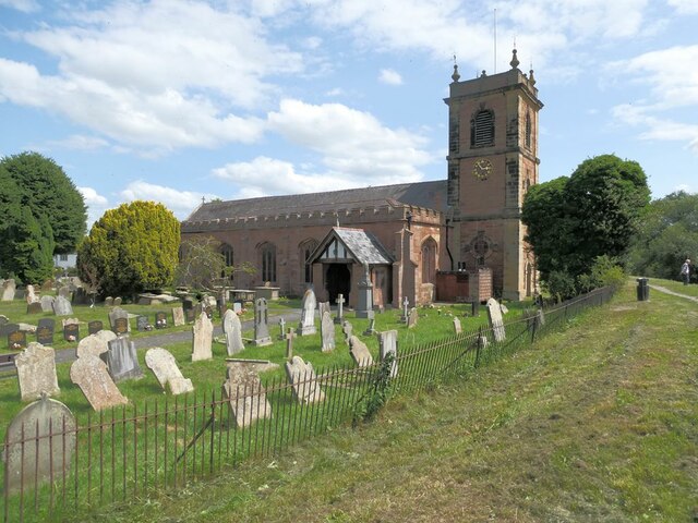
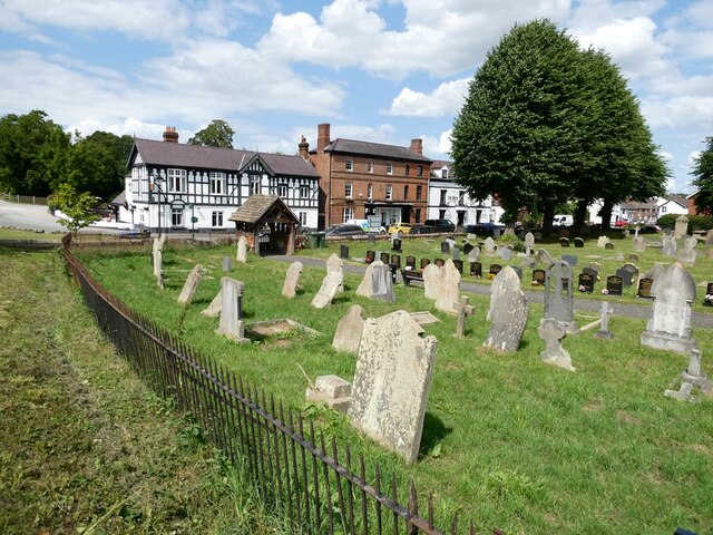
St Dunawd's Church

St Dunawd's Church, is in the village of Bangor-on-Dee, Wrexham County Borough, Wales. It is designated by Cadw as a Grade II* listed building. The church...
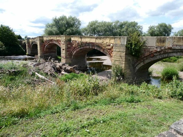
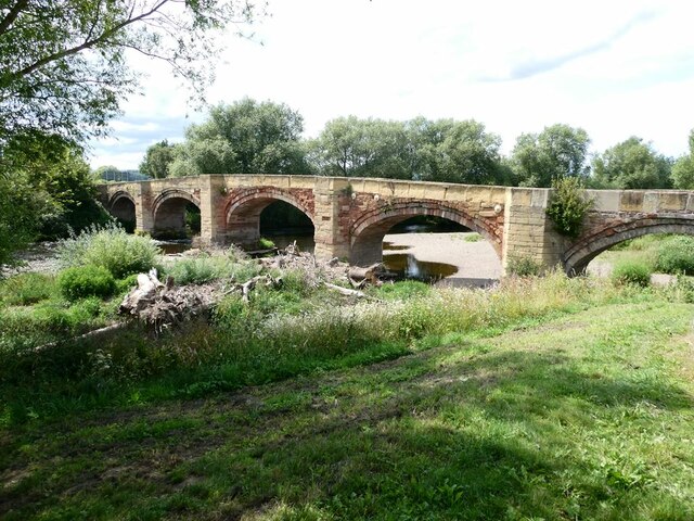
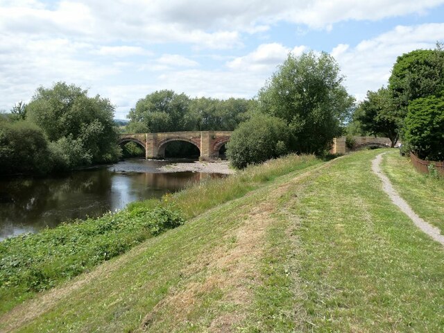
Bangor Bridge

Bangor Bridge (also known as the Bangor-on-Dee Bridge) is a Grade I listed bridge crossing the River Dee in Bangor-on-Dee, Wrexham County Borough, Wales...

Nearby Amenities

Located within 500m of 52.987723,-2.9217144
Source: npe
Lat/Long: 52.9838939/-2.9213517
Source: npe
Lat/Long: 52.9843515/-2.920861
Created By: POI Editor
Source: npe
Lat/Long: 52.9857934/-2.9241279
Source: npe
Lat/Long: 52.9857492/-2.9283162
Place: farm
Lat/Long: 52.9871923/-2.9178258
Brynhovah
Name Cy: Brynhovah
Name En: Brynhovah
Place: hamlet
Wikidata: Q107033203
Lat/Long: 52.9844279/-2.9171177
Barrier: bollard
Lat/Long: 52.9910962/-2.923082
The data included in this document is from www.openstreetmap.org. The data is made available under ODbL.

Have you been to Dorlan Wood?

Leave your review of Dorlan Wood below (or comments, questions and feedback).