Ty-newydd Wood

Wood, Forest in Monmouthshire

Wales

Ty-newydd Wood

National Speed Limit sign, Llanarth, Monmouthshire Viewed from the 30mph zone.
National Speed Limit sign, Llanarth, Monmouthshire Credit: Jaggery

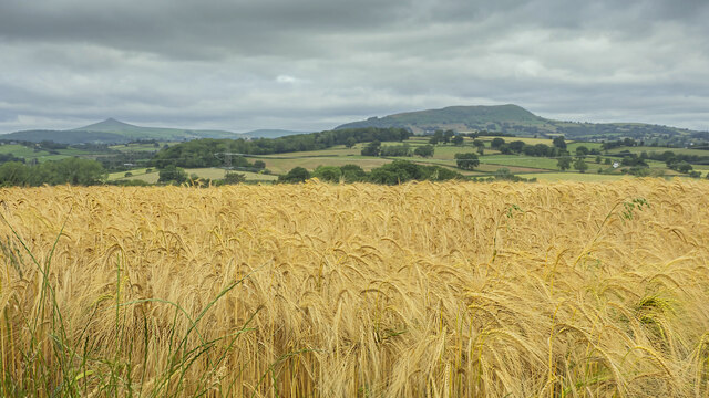
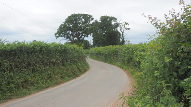
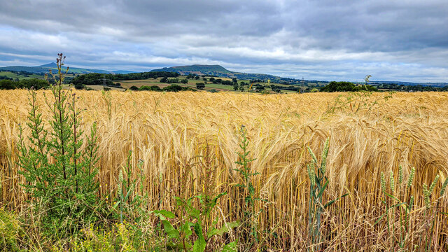
Ty-newydd Wood is a picturesque forest located in Monmouthshire, Wales. Covering an area of approximately 50 hectares, this woodland is a popular destination for nature enthusiasts, hikers, and wildlife lovers. The forest is primarily composed of a mix of broadleaf trees, including oak, beech, and birch, creating a diverse and vibrant ecosystem.

Visitors to Ty-newydd Wood can explore a network of well-maintained trails, offering opportunities to admire the natural beauty of the forest and spot a variety of plant and animal species. Birdwatchers may be rewarded with sightings of woodpeckers, nuthatches, and other woodland birds, while lucky visitors may even catch a glimpse of elusive wildlife such as deer and foxes.

In addition to its natural beauty, Ty-newydd Wood also holds historical significance, with remnants of ancient woodland management practices still visible in the form of old boundary walls and earthworks. The forest is managed by the local authorities to ensure the preservation of its ecological and cultural value for future generations to enjoy. Whether you are seeking a peaceful walk in nature or a chance to connect with the history of the land, Ty-newydd Wood offers a tranquil and enriching experience for all who visit.

If you have any feedback on the listing, please let us know in the comments section below.

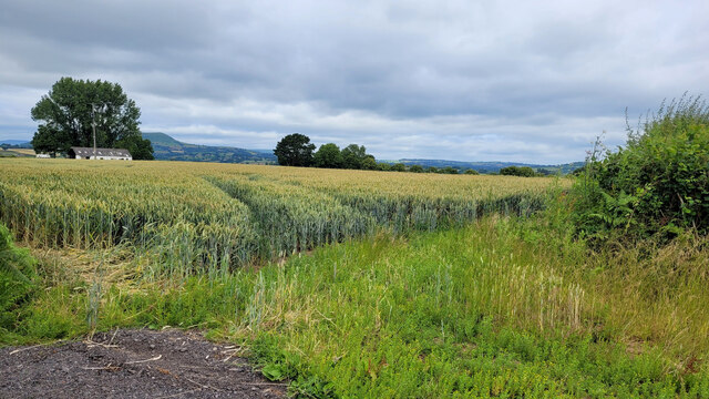
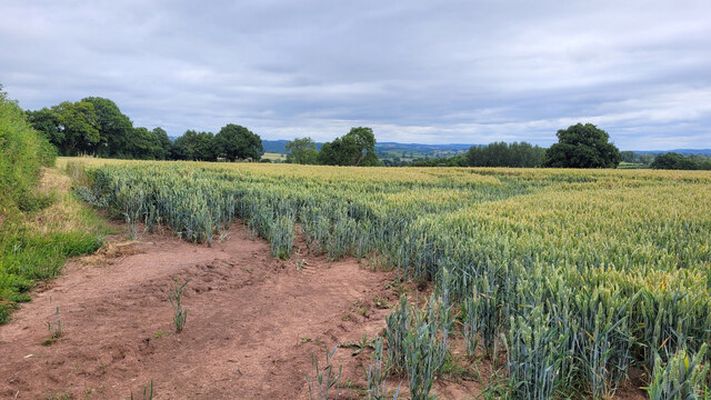
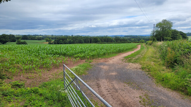
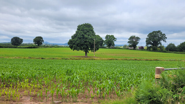
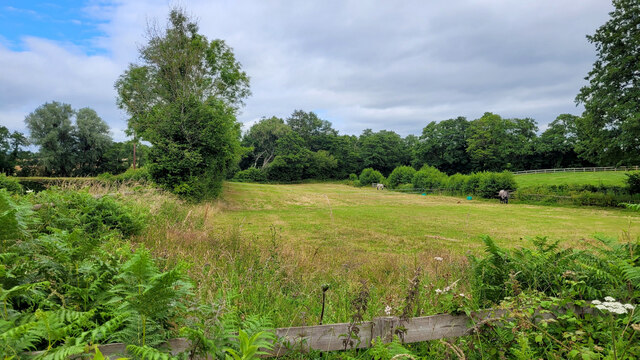
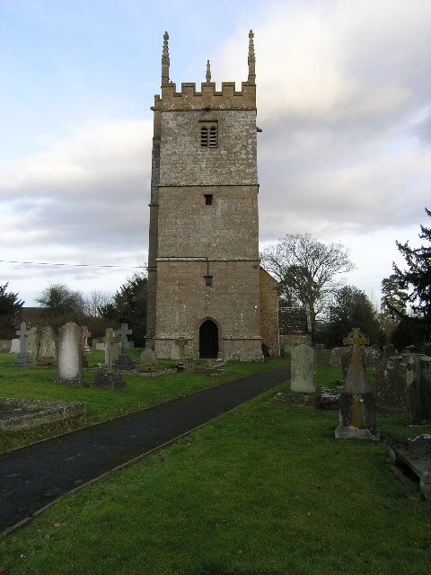
Ty-newydd Wood Images

Images are sourced within 2km of 51.799458/-2.8980615 or Grid Reference SO3811. Thanks to Geograph Open Source API. All images are credited.

National Speed Limit sign, Llanarth, Monmouthshire Viewed from the 30mph zone.
National Speed Limit sign, Llanarth, Monmouthshire
Viewed from the 30mph zone.
Towards road markings, Llanarth Looking towards broken white lines in the middle of a hedge-lined road in rural Monmouthshire.
Towards road markings, Llanarth
Looking towards broken white lines in the middle of a hedge-lined road in rural Monmouthshire.
Warning sign in a hedge, Llanarth, Monmouthshire  On the approach to a minor junction.
Warning sign in a hedge, Llanarth, Monmouthshire
On the approach to a minor junction.
Former church for sale in January 2022, Llanarth The former St Teilo's church in the Church in Wales Diocese of Monmouth was for sale when I was here in September 2020. It remains for sale on January 2nd 2022.
Former church for sale in January 2022, Llanarth
The former St Teilo's church in the Church in Wales Diocese of Monmouth was for sale when I was here in September 2020. It remains for sale on January 2nd 2022.
Deciduous trees in winter, Llanarth, Monmouthshire Leafless trees viewed on January 2nd 2022.
Deciduous trees in winter, Llanarth, Monmouthshire
Leafless trees viewed on January 2nd 2022.
Muddy field in winter, Llanarth, Monmouthshire Viewed on January 2nd 2022.
Muddy field in winter, Llanarth, Monmouthshire
Viewed on January 2nd 2022.
Stile access to a public footpath, Llanarth Near the stile, a public footpath sign points towards this <a title="https://www.geograph.org.uk/photo/7060546" href="https://www.geograph.org.uk/photo/7060546">Link</a> field, muddy on January 2nd 2022.
Stile access to a public footpath, Llanarth
Near the stile, a public footpath sign points towards this Link field, muddy on January 2nd 2022.
Church For Sale board, January 2022, Llanarth The Hutchings & Thomas chartered surveyors board refers to the nearby former St Teilo's Church <a title="https://www.geograph.org.uk/photo/7060540" href="https://www.geograph.org.uk/photo/7060540">Link</a>. A Heritage Llanarth September 2021 Newsletter <a title="https://www.geograph.org.uk/photo/7060552" href="https://www.geograph.org.uk/photo/7060552">Link</a> is on the lower left corner of the board on January 2nd 2022.
Church For Sale board, January 2022, Llanarth
The Hutchings & Thomas chartered surveyors board refers to the nearby former St Teilo's Church Link. A Heritage Llanarth September 2021 Newsletter Link is on the lower left corner of the board on January 2nd 2022.
Heritage Llanarth September 2021 Newsletter  On this <a title="https://www.geograph.org.uk/photo/7060551" href="https://www.geograph.org.uk/photo/7060551">Link</a> Church For Sale board on January 2nd 2022.
Heritage Llanarth September 2021 Newsletter
On this Link Church For Sale board on January 2nd 2022.
Barley field and great view, 1 The ripening barley in early July with a view to Y Fal, Sugarloaf, left distance and Ysgyryd Fawr, The Skirrid, centre right.
See <a href="https://www.geograph.org.uk/photo/7226965">SO3612 : Barley field and great view, 2</a> for a focus on the barley crop.
Barley field and great view, 1
The ripening barley in early July with a view to Y Fal, Sugarloaf, left distance and Ysgyryd Fawr, The Skirrid, centre right. See SO3612 : Barley field and great view, 2 for a focus on the barley crop.
Road to Llandewi Rhydderch Looking west.
Road to Llandewi Rhydderch
Looking west.
Barley field and great view, 2 Focus on the crop rather than the hills, compared to <a href="https://www.geograph.org.uk/photo/7218735">SO3612 : Barley field and great view, 1</a>.
The hills in the distance are Sugarloaf, Y Fal, to the left and Ysgyryd Fawr, Skirrid, centre.

You'll remember me when the west wind moves
Upon the fields of barley
You'll forget the sun in his jealous sky
As we walk in fields of gold.

Sting - 'Fields of Gold'
Barley field and great view, 2
Focus on the crop rather than the hills, compared to SO3612 : Barley field and great view, 1. The hills in the distance are Sugarloaf, Y Fal, to the left and Ysgyryd Fawr, Skirrid, centre. You'll remember me when the west wind moves Upon the fields of barley You'll forget the sun in his jealous sky As we walk in fields of gold. Sting - 'Fields of Gold'
Wheat field opposite Cefn Cottage Distant view to Ysgyryd Fawr.
Wheat field opposite Cefn Cottage
Distant view to Ysgyryd Fawr.
Wheat field opposite Cefn Cottage Looking north-east.
Wheat field opposite Cefn Cottage
Looking north-east.
Monmouthshire wheat field To the north of Llanarth, looking north-west.
Monmouthshire wheat field
To the north of Llanarth, looking north-west.
Monmouthshire maize field To the north of Llanarth, looking north-east.
Monmouthshire maize field
To the north of Llanarth, looking north-east.
Maize crop Several oak trees dotted around and a view to Y Fal/Sugarloaf in the distance left.
Maize crop
Several oak trees dotted around and a view to Y Fal/Sugarloaf in the distance left.
Small field used as a paddock Flat land in the Trothy valley.
Small field used as a paddock
Flat land in the Trothy valley.
Show me another place!

Ty-newydd Wood is located at Grid Ref: SO3811 (Lat: 51.799458, Lng: -2.8980615)

Unitary Authority: Monmouthshire

Police Authority: Gwent

What 3 Words

///tickets.interlude.defers. Near Llanarth, Monmouthshire

Related Wikis

Llanarth, Monmouthshire

Llanarth is a privately owned estate village and community within a conservation area in the Welsh county of Monmouthshire. Llanarth is roughly six miles...

St Teilo's Church, Llanarth

The Church of St Teilo, Llanarth, Monmouthshire, Wales is a former parish church with its origins in the 15th century. Renovations took place in the 18th...

Church of St Mary and St Michael, Llanarth

The Church of St Mary and St Michael, Llanarth, Monmouthshire, was built as the family chapel for Llanarth Court. It was the first Roman Catholic church...

Coed-y-gelli, Llanarth

Coed-y-gelli, Llanarth, Monmouthshire is a house dating from the late 16th or early 17th centuries. It is a Grade II* listed building. == History == The...

Nearby Amenities

Located within 500m of 51.799458,-2.8980615
The data included in this document is from www.openstreetmap.org. The data is made available under ODbL.

Have you been to Ty-newydd Wood?

Leave your review of Ty-newydd Wood below (or comments, questions and feedback).