Royton Wood

Wood, Forest in Denbighshire

Wales

Royton Wood

Cockbank Lane Looking North-northwest along Cockbank Lane towards Pentre Mailyn south of Wrexham.
Cockbank Lane Credit: Jeff Buck

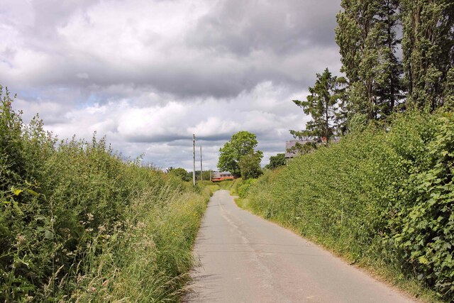
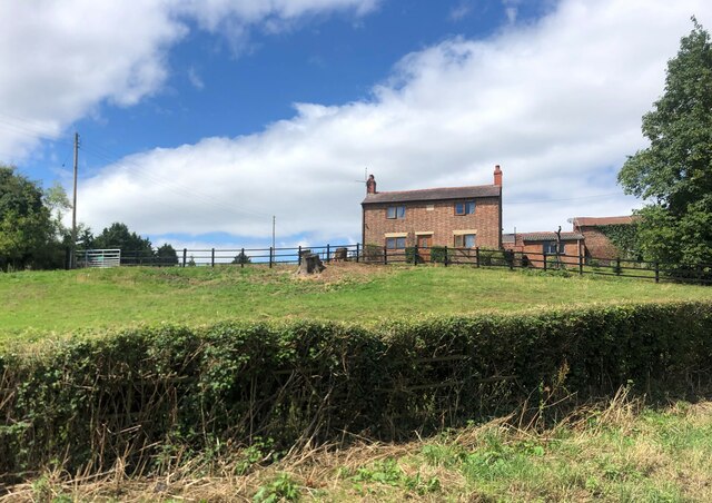
Royton Wood is a beautiful forest located in Denbighshire, Wales. Covering an area of approximately 50 acres, this woodland is a popular destination for nature lovers and outdoor enthusiasts. The forest is home to a variety of trees, including oak, beech, and birch, creating a diverse and picturesque landscape.

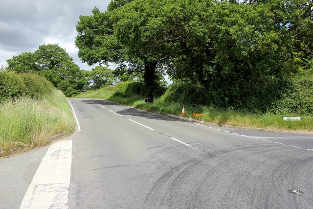
Visitors to Royton Wood can enjoy hiking and walking trails that wind through the forest, offering stunning views of the surrounding countryside. The peaceful atmosphere and tranquil surroundings make it a perfect place to escape the hustle and bustle of everyday life.

Wildlife is abundant in Royton Wood, with a range of bird species, small mammals, and insects calling the forest home. Birdwatchers will be delighted by the opportunity to spot various species of birds, while nature enthusiasts can explore the flora and fauna that thrive in this natural environment.

Overall, Royton Wood is a hidden gem in Denbighshire, offering a peaceful retreat for those seeking to connect with nature and enjoy the beauty of the Welsh countryside. Whether you're looking for a leisurely stroll or a more challenging hike, this forest has something to offer for everyone.

If you have any feedback on the listing, please let us know in the comments section below.

Royton Wood Images

Images are sourced within 2km of 53.00055/-2.9391686 or Grid Reference SJ3745. Thanks to Geograph Open Source API. All images are credited.

Cockbank Lane Looking North-northwest along Cockbank Lane towards Pentre Mailyn south of Wrexham.
Cockbank Lane
Looking North-northwest along Cockbank Lane towards Pentre Mailyn south of Wrexham.
The A528 (Overton Road) at Cock Bank Looking north along the A528 (Overton Road) at Cock Bank at the junction of Cockbank Lane and the B5130 (Pentre Nant Lane).
The A528 (Overton Road) at Cock Bank
Looking north along the A528 (Overton Road) at Cock Bank at the junction of Cockbank Lane and the B5130 (Pentre Nant Lane).
Pont Bangor-is-Coed Bangor-on-Dee bridge in the early morning spring sunshine.
Pont Bangor-is-Coed
Bangor-on-Dee bridge in the early morning spring sunshine.
Bangor on Dee, St Dunawd
Pub and church The Royal Oak and St Dunawd's Church in Bangor-is-y-Coed.
Pub and church
The Royal Oak and St Dunawd's Church in Bangor-is-y-Coed.
River Dee, upstream from Bangor
Bangor racecourse Viewed from the B5069.
Bangor racecourse
Viewed from the B5069.
Cattle grazing in a field by the River Dee With a distant view of the Welsh hills.
Cattle grazing in a field by the River Dee
With a distant view of the Welsh hills.
Farmhouse, Porthygan
Bangor Bridge The original bridge over the Dee at Bangor-on-Dee/Bangor-is-y-Coed dates from Medieval times and is Grade I listed. Completely inadequate to cope with modern motor  traffic, it was replaced by the Bangor By-pass bridge just upstream in 1978. It still carries one-way light motor traffic from west to east. 

The Royal Oak public house stands on the east bank.
Bangor Bridge
The original bridge over the Dee at Bangor-on-Dee/Bangor-is-y-Coed dates from Medieval times and is Grade I listed. Completely inadequate to cope with modern motor traffic, it was replaced by the Bangor By-pass bridge just upstream in 1978. It still carries one-way light motor traffic from west to east. The Royal Oak public house stands on the east bank.
Kayakers come ashore on the River Dee An inflatable kayak coming in to land just upstream from the old Bangor Bridge.
Kayakers come ashore on the River Dee
An inflatable kayak coming in to land just upstream from the old Bangor Bridge.
Bangor Bridge The original bridge over the Dee at Bangor-on-Dee/Bangor-is-y-Coed dates from Medieval times and is Grade I listed. Completely inadequate to cope with modern motor  traffic, it was replaced by the Bangor By-pass bridge just upstream in 1978. It still carries one-way light motor traffic from west to east. 

Looking downstream; a large quantity of flotsam has accumulated against one of the bridge piers.
Bangor Bridge
The original bridge over the Dee at Bangor-on-Dee/Bangor-is-y-Coed dates from Medieval times and is Grade I listed. Completely inadequate to cope with modern motor traffic, it was replaced by the Bangor By-pass bridge just upstream in 1978. It still carries one-way light motor traffic from west to east. Looking downstream; a large quantity of flotsam has accumulated against one of the bridge piers.
St Dunawd's Church, Bangor-on-Dee/Bangor-is-y-Coed Grade II* listed church, part dating back to the 14th Century. St Dunawd was the abbot of the original monastery which stood on the site in the 6th Century. The flood bank of the River Dee can be seen to the right.
St Dunawd's Church, Bangor-on-Dee/Bangor-is-y-Coed
Grade II* listed church, part dating back to the 14th Century. St Dunawd was the abbot of the original monastery which stood on the site in the 6th Century. The flood bank of the River Dee can be seen to the right.
Churchyard of St Dunawd's Church In Bangor-on-Dee/Bangor-is-y-Coed. The Royal Oak public  house stands on the far side of the road.
Churchyard of St Dunawd's Church
In Bangor-on-Dee/Bangor-is-y-Coed. The Royal Oak public house stands on the far side of the road.
Floodbank on the River Dee Upstream from Bangor Bridge.
Floodbank on the River Dee
Upstream from Bangor Bridge.
Local map of  Bangor-on-Dee/Bangor-is-y-Coed Posted on the wall of the churchyard, this map was compiled from the drawings, memories and records of the people of the area.
Local map of Bangor-on-Dee/Bangor-is-y-Coed
Posted on the wall of the churchyard, this map was compiled from the drawings, memories and records of the people of the area.
Bangor By-pass Bridge The by-pass bridge oat Bangor-on-Dee/Bangor-is-y-Coed on the A525 was built in 1978 to relieve pressure on the original medieval bridge a short way downstream which was completely inadequate to cope with modern traffic.
Bangor By-pass Bridge
The by-pass bridge oat Bangor-on-Dee/Bangor-is-y-Coed on the A525 was built in 1978 to relieve pressure on the original medieval bridge a short way downstream which was completely inadequate to cope with modern traffic.
Show me another place!

Royton Wood is located at Grid Ref: SJ3745 (Lat: 53.00055, Lng: -2.9391686)

Unitary Authority: Wrexham

Police Authority: North Wales

What 3 Words

///hamsters.blackbird.less. Near Marchwiel, Wrexham

Nearby Locations

Royton Wood Royton

Related Wikis

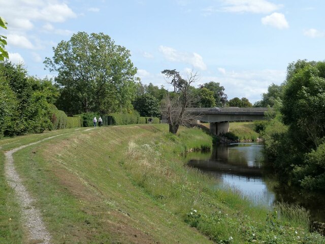
Bangor-on-Dee racecourse

Bangor-on-Dee Racecourse (Welsh: Cae Rasio Bangor-is-y-coed) is a thoroughbred horse racing venue located in Bangor-on-Dee near Wrexham, Wales, United...
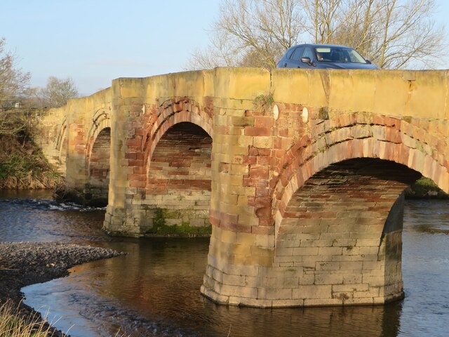
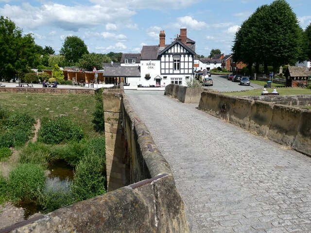
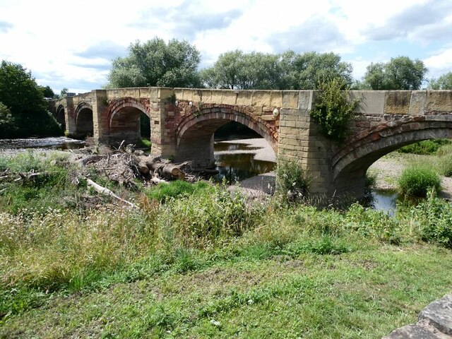
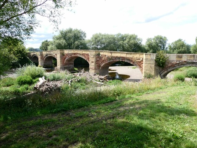
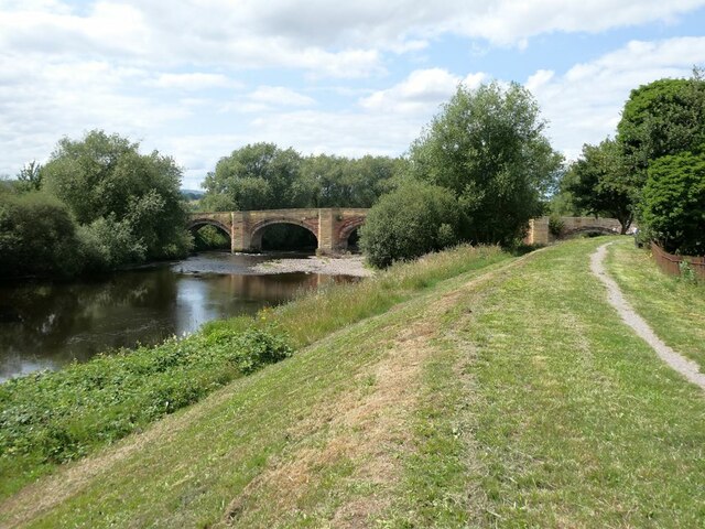
Bangor Bridge

Bangor Bridge (also known as the Bangor-on-Dee Bridge) is a Grade I listed bridge crossing the River Dee in Bangor-on-Dee, Wrexham County Borough, Wales...
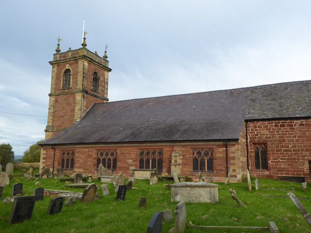
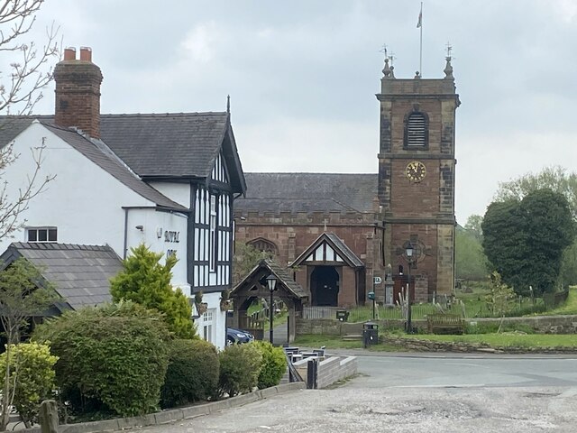
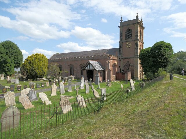
St Dunawd's Church

St Dunawd's Church, is in the village of Bangor-on-Dee, Wrexham County Borough, Wales. It is designated by Cadw as a Grade II* listed building. The church...
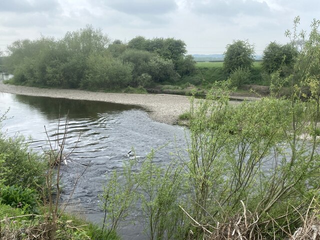
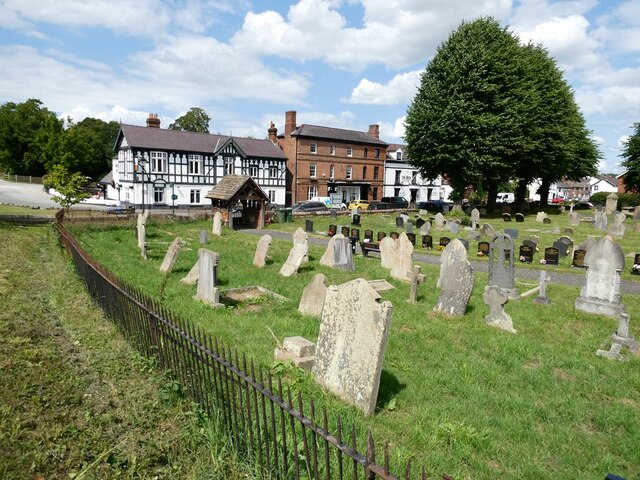
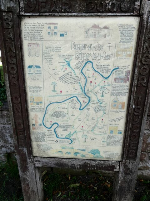
Bangor-on-Dee

Bangor-on-Dee (Welsh: Bangor-is-y-coed or standardised Bangor Is-coed) is a village and community in Wrexham County Borough, Wales, on the banks of the...

Nearby Amenities

Located within 500m of 53.00055,-2.9391686
Created By: POI Editor
Source: npe
Lat/Long: 52.9985983/-2.9334289
Building: yes
Lat/Long: 52.9988035/-2.9441329
Barrier: cattle_grid
Lat/Long: 53.0009931/-2.9433057
The data included in this document is from www.openstreetmap.org. The data is made available under ODbL.

Have you been to Royton Wood?

Leave your review of Royton Wood below (or comments, questions and feedback).