Coed Cefn-cawdel

Wood, Forest in Monmouthshire

Wales

Coed Cefn-cawdel

Small haylage field Some bales and a substantial area of uncultivated in the foreground.
Cereal crop beyond.
Small haylage field Credit: Jonathan Billinger

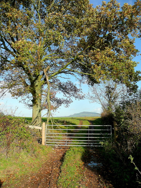
Coed Cefn-cawdel is a stunning woodland located in Monmouthshire, Wales. Covering an area of approximately 500 hectares, it is known for its diverse range of tree species and abundant wildlife. The woodland is situated on the slopes of the beautiful Usk Valley, providing visitors with breathtaking views of the surrounding countryside.

The woodland consists of a mixture of broadleaf and coniferous trees, including oak, beech, birch, and spruce. This variety of tree species creates a rich and vibrant ecosystem, supporting a wide range of flora and fauna. Rare and protected species can be found here, including the lesser horseshoe bat and the pied flycatcher.

Coed Cefn-cawdel is a popular destination for nature enthusiasts and hikers due to its extensive network of walking trails. Visitors can explore the woodland on foot, taking in the serene atmosphere and enjoying the peaceful sounds of nature. The well-maintained paths offer varying levels of difficulty, catering to both casual walkers and experienced hikers.

In addition to its natural beauty, Coed Cefn-cawdel also has historical significance. The woodland was once part of a larger estate and is home to the remains of an Iron Age hillfort. This archaeological site provides a glimpse into the area's ancient past and adds an extra layer of intrigue for visitors.

Overall, Coed Cefn-cawdel in Monmouthshire is a captivating woodland that offers a perfect escape from the hustle and bustle of everyday life. Its breathtaking scenery, diverse wildlife, and rich history make it a must-visit destination for nature lovers and history enthusiasts alike.

If you have any feedback on the listing, please let us know in the comments section below.

Coed Cefn-cawdel Images

Images are sourced within 2km of 51.843458/-2.9421075 or Grid Reference SO3516. Thanks to Geograph Open Source API. All images are credited.

Small haylage field Some bales and a substantial area of uncultivated in the foreground.
Cereal crop beyond.
Small haylage field
Some bales and a substantial area of uncultivated in the foreground. Cereal crop beyond.
Lane near Llandwr Looking west.
Lane near Llandwr
Looking west.
Corrugated Village Hall, Llanddewi Skirrid, Monmouthshire Llanddewi Skirrid Village Hall is a corrugated iron sheeting building dating from the 1880s. It was Grade II listed in 1998 as a rare example of a well designed and largely unaltered late 19th century prefabricated iron hall.
Corrugated Village Hall, Llanddewi Skirrid, Monmouthshire
Llanddewi Skirrid Village Hall is a corrugated iron sheeting building dating from the 1880s. It was Grade II listed in 1998 as a rare example of a well designed and largely unaltered late 19th century prefabricated iron hall.
Llanddewi Skirrid Village Hall noticeboard, Monmouthshire In July 2022, during the Russian invasion of Ukraine, the board includes a depiction of the blue and yellow National Flag of Ukraine. The board shows LLANDEWI whereas most references to the village show Llanddewi.
Llanddewi Skirrid Village Hall noticeboard, Monmouthshire
In July 2022, during the Russian invasion of Ukraine, the board includes a depiction of the blue and yellow National Flag of Ukraine. The board shows LLANDEWI whereas most references to the village show Llanddewi.
Dead-end road, Llanddewi Skirrid, Monmouthshire Descending from the B4521 Old Ross Road.
Dead-end road, Llanddewi Skirrid, Monmouthshire
Descending from the B4521 Old Ross Road.
Old Ross Road, Llanddewi Skirrid, Monmouthshire Looking to the SE up the B4521 Old Ross Road.
Old Ross Road, Llanddewi Skirrid, Monmouthshire
Looking to the SE up the B4521 Old Ross Road.
West along the B4521, Llanddewi Skirrid, Monmouthshire Ahead on the B4521 Old Ross Road for Abergavenny.
West along the B4521, Llanddewi Skirrid, Monmouthshire
Ahead on the B4521 Old Ross Road for Abergavenny.
Road towards St David's Church, Llanddewi Skirrid, Monmouthshire Ahead for this <a title="https://www.geograph.org.uk/photo/5563467" href="https://www.geograph.org.uk/photo/5563467">Link</a> church in the Church in Wales Diocese of Monmouth.
Road towards St David's Church, Llanddewi Skirrid, Monmouthshire
Ahead for this Link church in the Church in Wales Diocese of Monmouth.
Forge House
Forge House
Lanes Garage
Lanes Garage
Village Hall, Llandewi Skirrid
Pentre Farm
Pentre Farm
The Walnut Tree
The Walnut Tree
Grassland of the Trothy valley In the distance is Edmund's Tump.
Grassland of the Trothy valley
In the distance is Edmund's Tump.
Field entrance opposite Crossways The eye is drawn to Edmund's Tump beyond.
Field entrance opposite Crossways
The eye is drawn to Edmund's Tump beyond.
Lane and The Skirrid The distinctive upturned-boat shape of the hill viewed along a lane near Great Blaen-coed.
Lane and The Skirrid
The distinctive upturned-boat shape of the hill viewed along a lane near Great Blaen-coed.
Church of St James the Elder, Llanvetherine
Church of St. James the Elder at Llanvetherine Taken from the Old Ross Road. The church has a tall tower in a style that is not common around here.
Church of St. James the Elder at Llanvetherine
Taken from the Old Ross Road. The church has a tall tower in a style that is not common around here.
Show me another place!

Coed Cefn-cawdel is located at Grid Ref: SO3516 (Lat: 51.843458, Lng: -2.9421075)

Unitary Authority: Monmouthshire

Police Authority: Gwent

What 3 Words

///kilt.lightbulb.extremely. Near Abergavenny, Monmouthshire

Nearby Locations

Coed Cefn-cawdel

Related Wikis

Gelli Farmhouse, Llanvetherine

Gelli Farmhouse, Llanvetherine, Monmouthshire, is a farmhouse dating from the early 17th century. The settlement at Gelli-wig has a recorded history dating...

St David's Church, Llanddewi Skirrid

The Church of St David stands in the parish of Llanddewi Skirrid, Monmouthshire, Wales. The church was Grade II listed in 1956 as an example of John Prichard...

Llanddewi Skirrid

Llanddewi Skirrid (Welsh: Llanddewi Ysgyryd) is a village in Monmouthshire, south east Wales, United Kingdom. == Location == Llanddewi Skirrid is located...

Llanvetherine

Llanvetherine (Welsh: Llanwytherin) is a village in the community of Skenfrith, Monmouthshire, Wales. It is located five miles north east of Abergavenny...

Newhouse Farmhouse, Llanvetherine

Newhouse Farmhouse, Llanvetherine, Monmouthshire is a farmhouse dating from the late-16th century. It is a Grade II* listed building. Its associated barns...

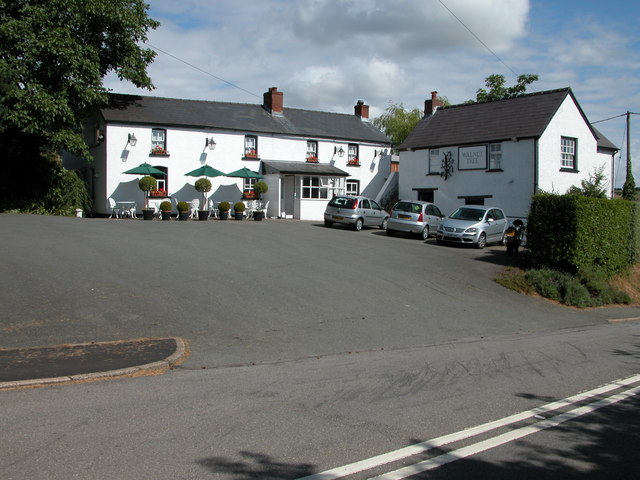
The Walnut Tree (restaurant)

The Walnut Tree is a restaurant in Llanddewi Skirrid, Monmouthshire, Wales. It is run by chef Shaun Hill and holds a Michelin star. It was previously owned...

Skirrid Fawr

Skirrid Fawr (Welsh: Ysgyryd Fawr , Welsh pronunciation: [ɐsˈɡɐɾɪd ˈvæuɾ]), often referred to as just the Skirrid, is an easterly outlier of the Black...

Llanvapley

Llanvapley (Welsh: Llanfable) is a village in the community of Gobion Fawr, in Monmouthshire, south east Wales, United Kingdom. Llan has replaced the...

Nearby Amenities

Located within 500m of 51.843458,-2.9421075
Direction: 185
Generator Method: photovoltaic
Generator Output Electricity: yes
Generator Solar Modules: 16
Generator Source: solar
Generator Type: solar_photovoltaic_panel
Location: roof
Power: generator
Lat/Long: 51.8393225/-2.940951
The data included in this document is from www.openstreetmap.org. The data is made available under ODbL.

Have you been to Coed Cefn-cawdel?

Leave your review of Coed Cefn-cawdel below (or comments, questions and feedback).