Well Brake

Wood, Forest in Monmouthshire

Wales

Well Brake

Cattle in summer pasture Jersey? Guernsey? Something else? Either way the animals look very content on this pasture land.
Cattle in summer pasture Credit: Jonathan Billinger

The requested URL returned error: 429 Too Many Requests

If you have any feedback on the listing, please let us know in the comments section below.
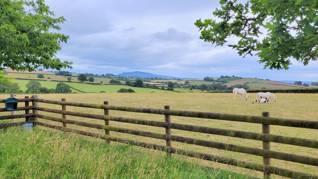
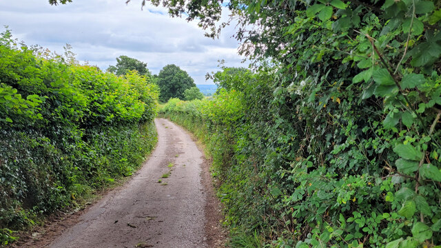
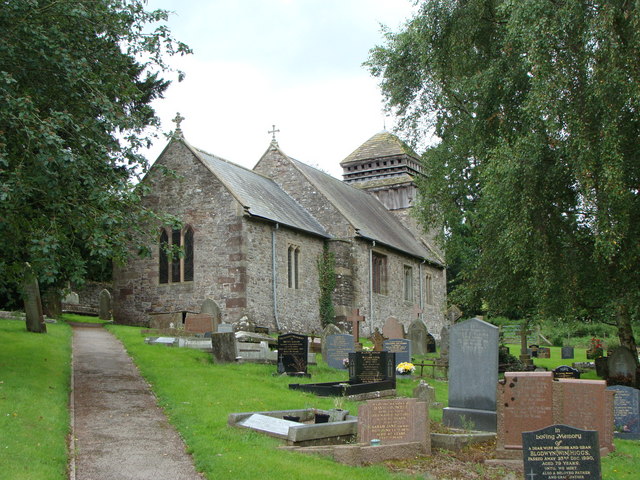
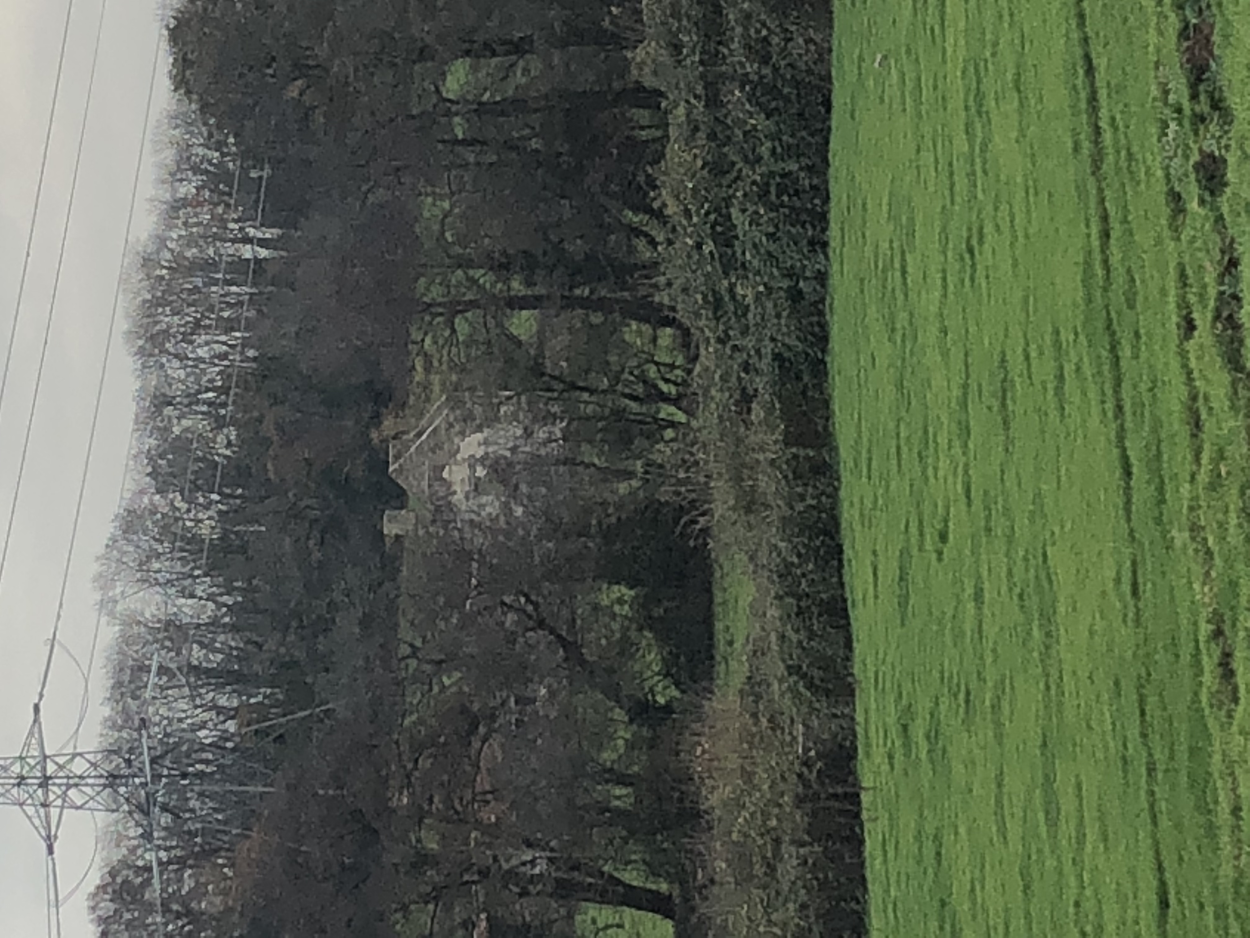
Well Brake Images

Images are sourced within 2km of 51.82273/-2.9492633 or Grid Reference SO3414. Thanks to Geograph Open Source API. All images are credited.

Cattle in summer pasture Jersey? Guernsey? Something else? Either way the animals look very content on this pasture land.
Cattle in summer pasture
Jersey? Guernsey? Something else? Either way the animals look very content on this pasture land.
Entrance to Werngochlyn Farm The cone of Y Fal, Sugarloaf, in the distance.
Entrance to Werngochlyn Farm
The cone of Y Fal, Sugarloaf, in the distance.
Pasture land Blorenge in the distance, right.
Pasture land
Blorenge in the distance, right.
Small haylage field Some bales and a substantial area of uncultivated in the foreground.
Cereal crop beyond.
Small haylage field
Some bales and a substantial area of uncultivated in the foreground. Cereal crop beyond.
Lane near Llandwr Looking west.
Lane near Llandwr
Looking west.
Grassland at The Tump The view south-west towards Mynachdy Farm
Grassland at The Tump
The view south-west towards Mynachdy Farm
Narrow lane Emmasfield Farm is by the bend at the bottom of the road.
Narrow lane
Emmasfield Farm is by the bend at the bottom of the road.
B4233 towards Abergavenny Looking west past the former White Swan pub.
B4233 towards Abergavenny
Looking west past the former White Swan pub.
Horse pasture Adjacent to the B4233 and Oak Meadows.
Horse pasture
Adjacent to the B4233 and Oak Meadows.
The B4233 west towards Abergavenny In the distance is the cone of Y Fal, Sugarloaf.
The B4233 west towards Abergavenny
In the distance is the cone of Y Fal, Sugarloaf.
Lane with a view to Ysgyryd Fawr Looking north.
Lane with a view to Ysgyryd Fawr
Looking north.
Lane and cottage The building is Ffawydden Cottage and is undergoing renovations.
Lane and cottage
The building is Ffawydden Cottage and is undergoing renovations.
Lane to Llanddewi Rhydderch The lane ahead passes through about 15m of the south west corner of the gridsquare.
Lane to Llanddewi Rhydderch
The lane ahead passes through about 15m of the south west corner of the gridsquare.
Cattle in summer pasture, 2 Wide angle shot of the same field and animals as <a href="https://www.geograph.org.uk/photo/7218726">SO3412 : Cattle in summer pasture</a>.
Cattle in summer pasture, 2
Wide angle shot of the same field and animals as SO3412 : Cattle in summer pasture.
Church Lane, Llanddewi Rhydderch The church is situated in the adjacent gridsquare to the west.
Church Lane, Llanddewi Rhydderch
The church is situated in the adjacent gridsquare to the west.
Llandewi Rhydderch Picture of the village centre.
Llandewi Rhydderch
Picture of the village centre.
Lane north to Galchen Photo taken from the bridge over the Pant Brook.
Lane north to Galchen
Photo taken from the bridge over the Pant Brook.
Grassland near Ton Uchaf Farm Most likely ready for cutting soon.
Grassland near Ton Uchaf Farm
Most likely ready for cutting soon.
Show me another place!

Well Brake is located at Grid Ref: SO3414 (Lat: 51.82273, Lng: -2.9492633)

Unitary Authority: Monmouthshire

Police Authority: Gwent

What 3 Words

///poets.souk.piglets. Near Abergavenny, Monmouthshire

Nearby Locations

Well Brake Quarry Brake

Related Wikis

Llanddewi Rhydderch

Llanddewi Rhydderch is a village in Monmouthshire, Wales at OS grid reference SO 351130. It is off the B4233 road, roughly five miles (8 km) southeast...

St David's Church, Llanddewi Rhydderch

The Church of St David, Llanddewi Rhydderch, Monmouthshire, Wales is a parish church with its origins in the 12th century. The tower base may date from...

Court Farmhouse, Llanover

Court Farmhouse and the attached Court Farm Cottage, Llanover, Monmouthshire is a country house dating from the early 16th century. Originally two houses...

Llanvapley

Llanvapley (Welsh: Llanfable) is a village in the community of Gobion Fawr, in Monmouthshire, south east Wales, United Kingdom. Llan has replaced the...

Nearby Amenities

Located within 500m of 51.82273,-2.9492633
Post Box
Post Box Type: lamp
Ref: NP7 139
Royal Cypher: EIIR
Royal Cypher Wikidata: Q33102113
Lat/Long: 51.823885/-2.9443695
The data included in this document is from www.openstreetmap.org. The data is made available under ODbL.

Have you been to Well Brake?

Leave your review of Well Brake below (or comments, questions and feedback).