Battery Plantation

Wood, Forest in Monmouthshire

Wales

Battery Plantation

View towards Skirrid Fawr Stud Farm lies behind the line of trees (poplars?)
View towards Skirrid Fawr Credit: M J Roscoe

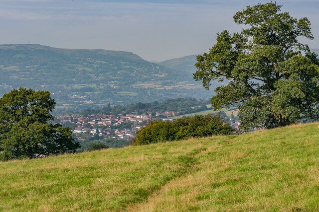
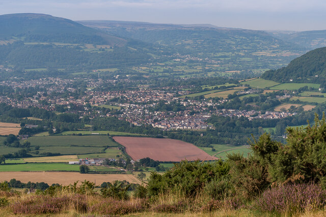
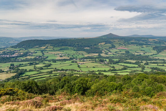
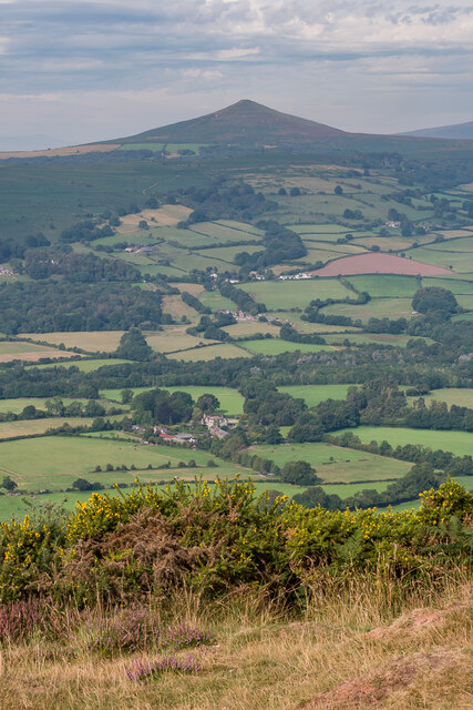
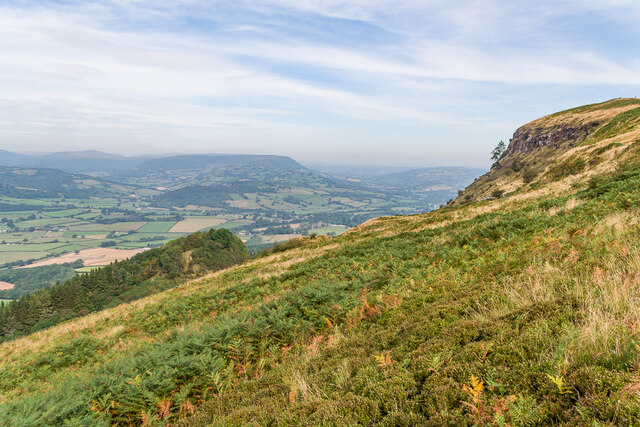
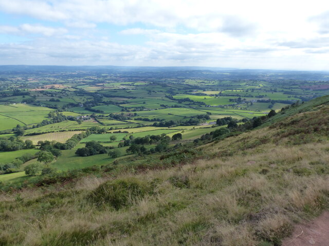
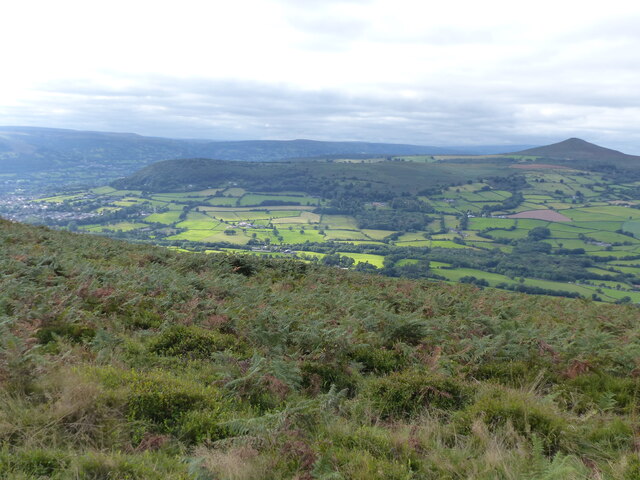
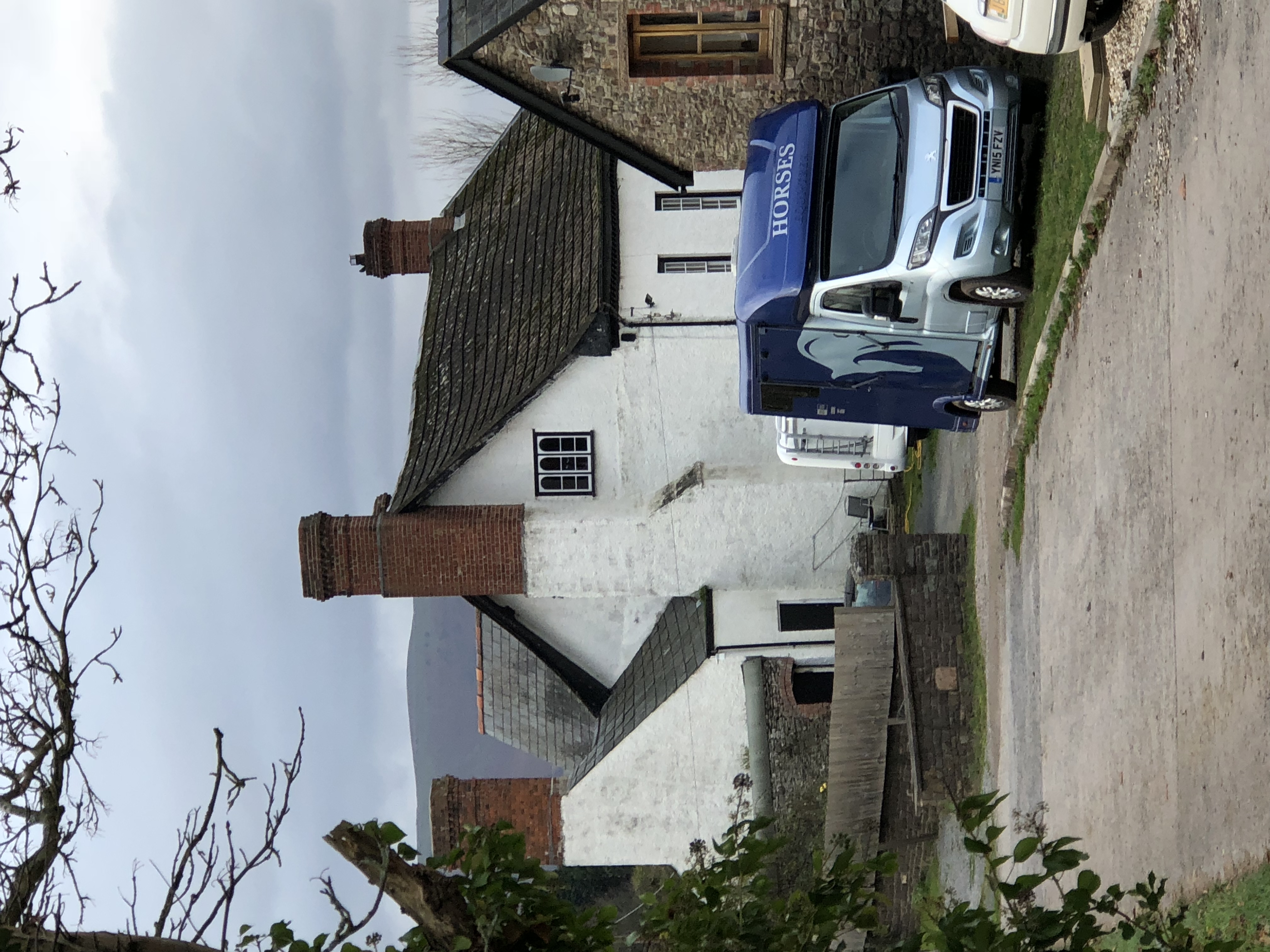
Battery Plantation is a serene woodland located in Monmouthshire, Wales. Covering an area of approximately 50 acres, it is a popular destination for nature enthusiasts and offers a peaceful retreat from the bustling city life. The plantation is situated near the village of Wood and is known for its diverse range of trees and wildlife.

The woodland is primarily composed of deciduous trees, including oak, beech, and ash, which provide a picturesque and vibrant landscape throughout the year. These trees offer a welcoming habitat for a variety of bird species, such as woodpeckers, nuthatches, and tawny owls, making it a haven for birdwatchers.

Battery Plantation also boasts an extensive network of walking trails, allowing visitors to explore the area at their leisure. The paths wind through the woodland, offering stunning views of the surrounding countryside and the nearby Usk Valley. Additionally, the plantation is equipped with picnic areas and benches, making it an ideal spot for a family outing or a peaceful picnic amidst nature.

The plantation holds historical significance as well. It was formerly used as a training ground during World War II, and remnants of the old military structures can still be found scattered throughout the area. These remnants serve as a reminder of the plantation's past and add an intriguing element to its natural charm.

Overall, Battery Plantation in Monmouthshire is a captivating woodland that offers a perfect blend of natural beauty, wildlife, and historical interest. It provides a tranquil escape for visitors seeking solace in nature and is a must-visit destination for outdoor enthusiasts.

If you have any feedback on the listing, please let us know in the comments section below.

Battery Plantation Images

Images are sourced within 2km of 51.839883/-2.9759105 or Grid Reference SO3216. Thanks to Geograph Open Source API. All images are credited.

View towards Skirrid Fawr Stud Farm lies behind the line of trees (poplars?)
View towards Skirrid Fawr
Stud Farm lies behind the line of trees (poplars?)
Fields near Llantilio Pertholey
Towards Abergavenny Looking towards Abergavenny from the base of The Skirrid.
Towards Abergavenny
Looking towards Abergavenny from the base of The Skirrid.
Towards Abergavenny Looking towards Abergavenny from the southern end of the summit ridge of The Skirrid.
Towards Abergavenny
Looking towards Abergavenny from the southern end of the summit ridge of The Skirrid.
Towards Sugar Loaf Looking towards Sugar Loaf from the southern end of the summit ridge of The Skirrid.
Towards Sugar Loaf
Looking towards Sugar Loaf from the southern end of the summit ridge of The Skirrid.
Towards Sugar Loaf Looking towards Sugar Loaf from the southern end of the summit ridge of The Skirrid.
Towards Sugar Loaf
Looking towards Sugar Loaf from the southern end of the summit ridge of The Skirrid.
Path on The Skirrid Path along the summit ridge of The Skirrid.
Path on The Skirrid
Path along the summit ridge of The Skirrid.
Path on The Skirrid Path along the summit ridge of The Skirrid, with the summit in the background.
Path on The Skirrid
Path along the summit ridge of The Skirrid, with the summit in the background.
The Skirrid The western slopes of The Skirrid, with the distinctive subpeak arising from an ice-age landslip seen on the left.
The Skirrid
The western slopes of The Skirrid, with the distinctive subpeak arising from an ice-age landslip seen on the left.
New Court Farm Farm house and outbuilding at New Court Farm, the latter now housing a craft  cooperative.
New Court Farm
Farm house and outbuilding at New Court Farm, the latter now housing a craft cooperative.
Looking south east from the top of the Skirrid
Dog walker on the Skirrid
Looking west from the top of the Skirrid
Looking towards Abergavenny from the top of the Skirrid
Willow Court, Mardy A Persimmon development.
Willow Court, Mardy
A Persimmon development.
Gate and seat Gate and seat at the entrance to Caer Wood on the path up The Skirrid.  For a close up of the seat see <a href="https://www.geograph.org.uk/photo/7071883">SO3216 : Seat</a>.
Gate and seat
Gate and seat at the entrance to Caer Wood on the path up The Skirrid. For a close up of the seat see SO3216 : Seat.
Seat Seat at the entrance to Caer Wood on the path up The Skirrid.  The inscription "Bethlehem 152 km" is a reference to Bethlehem near Llandeilo, at the other end of the Beacons Way, a long distance footpath through the Brecon Beacons which starts at Abergavenny railway station and passes here.  For a wider view see <a href="https://www.geograph.org.uk/photo/7071879">SO3216 : Gate and seat</a>.
Seat
Seat at the entrance to Caer Wood on the path up The Skirrid. The inscription "Bethlehem 152 km" is a reference to Bethlehem near Llandeilo, at the other end of the Beacons Way, a long distance footpath through the Brecon Beacons which starts at Abergavenny railway station and passes here. For a wider view see SO3216 : Gate and seat.
Path Footpath from the car park on the B4521 towards Caer Wood and then on up The Skirrid.
Path
Footpath from the car park on the B4521 towards Caer Wood and then on up The Skirrid.
Show me another place!

Battery Plantation is located at Grid Ref: SO3216 (Lat: 51.839883, Lng: -2.9759105)

Unitary Authority: Monmouthshire

Police Authority: Gwent

What 3 Words

///wicket.trusts.unclaimed. Near Abergavenny, Monmouthshire

Related Wikis

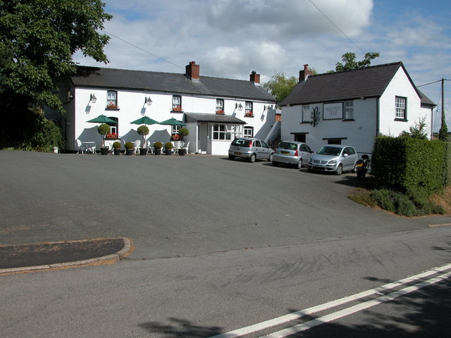
The Walnut Tree (restaurant)

The Walnut Tree is a restaurant in Llanddewi Skirrid, Monmouthshire, Wales. It is run by chef Shaun Hill and holds a Michelin star. It was previously owned...

Wern-ddu Farmhouse, Llantilio Pertholey

Wern-ddu farmhouse, Llantilio Pertholey, Monmouthshire is a farmhouse of 17th century origins. It has been significantly altered in the 18th, 19th and...

Llanddewi Skirrid

Llanddewi Skirrid (Welsh: Llanddewi Ysgyryd) is a village in Monmouthshire, south east Wales, United Kingdom. == Location == Llanddewi Skirrid is located...

Maindiff Court Hospital

Maindiff Court Hospital (Welsh: Ysbyty Maindiff Court) is a community hospital near Abergavenny, Monmouthshire. It is managed by the Aneurin Bevan University...

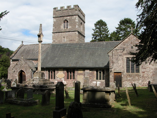
St David's Church, Llanddewi Skirrid

The Church of St David stands in the parish of Llanddewi Skirrid, Monmouthshire, Wales. The church was Grade II listed in 1956 as an example of John Prichard...

Llantilio Pertholey

Llantilio Pertholey (Welsh: Llandeilo Bertholau) is a small village and community (parish) in Monmouthshire, south east Wales. It is located 1.5 miles...
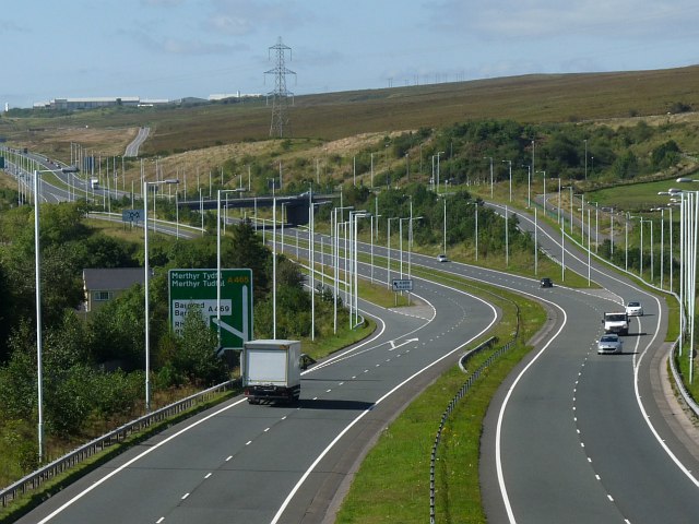
A465 road

The A465 is a trunk road that runs from Bromyard in Herefordshire, England to Llandarcy near Swansea in South Wales. The western half is known officially...

St Teilo's Church, Llantilio Pertholey

The Church of St Teilo is the parish church of Llantilio Pertholey, Monmouthshire, Wales. "An unusually large and varied church", it is a Grade I listed...

Nearby Amenities

Located within 500m of 51.839883,-2.9759105
Barrier: stile
Foot: yes
Lat/Long: 51.8439823/-2.9781306
Power: pole
Lat/Long: 51.8369908/-2.9709
Power: pole
Lat/Long: 51.837224/-2.9753708
Power: pole
Lat/Long: 51.837431/-2.976981
Power: pole
Lat/Long: 51.8376621/-2.9790975
Power: pole
Lat/Long: 51.837962/-2.9819405
Brynygwenin
Place: locality
Lat/Long: 51.839313/-2.969695
Man Made: water_well
Lat/Long: 51.8389087/-2.9821113
Direction: SSE
Generator Method: photovoltaic
Generator Output Electricity: yes
Generator Solar Modules: 8
Generator Source: solar
Generator Type: solar_photovoltaic_panel
Location: roof
Power: generator
Lat/Long: 51.8395129/-2.9698018
Direction: ENE
Generator Method: photovoltaic
Generator Output Electricity: yes
Generator Solar Modules: 8
Generator Source: solar
Generator Type: solar_photovoltaic_panel
Location: roof
Power: generator
Lat/Long: 51.8394816/-2.9698196
Direction: SW
Generator Method: photovoltaic
Generator Output Electricity: yes
Generator Solar Modules: 16
Generator Source: solar
Generator Type: solar_photovoltaic_panel
Location: roof
Power: generator
Lat/Long: 51.8395686/-2.969424
Direction: 145
Generator Method: photovoltaic
Generator Output Electricity: yes
Generator Solar Modules: 14
Generator Source: solar
Generator Type: solar_photovoltaic_panel
Location: roof
Power: generator
Lat/Long: 51.8398205/-2.9690807
The data included in this document is from www.openstreetmap.org. The data is made available under ODbL.

Have you been to Battery Plantation?

Leave your review of Battery Plantation below (or comments, questions and feedback).