Darran Plantation

Wood, Forest in Monmouthshire

Wales

Darran Plantation

Entrance to Greenmeadow Golf & Country Club, Croesyceiliog, Cwmbran Turn left here for the Golf & Country Club, and also for Cwmbran Tennis Club.
A few metres ahead, Tre-herbert road crosses from Torfaen into Monmouthshire.
Entrance to Greenmeadow Golf & Country Club, Croesyceiliog, Cwmbran Credit: Jaggery

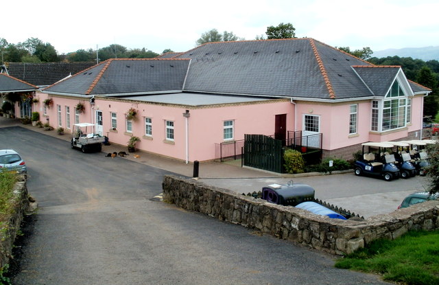
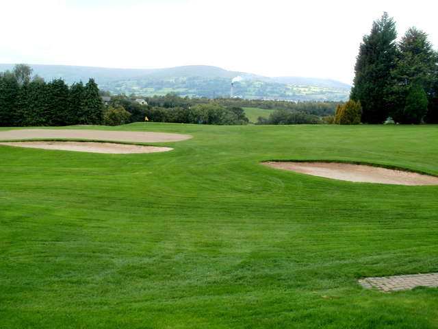
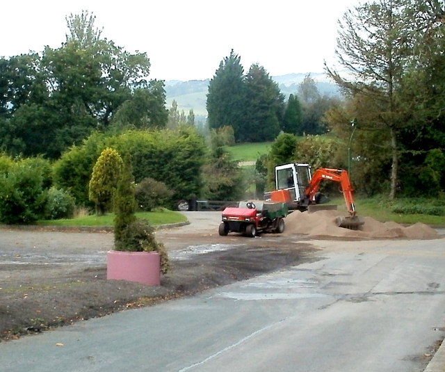
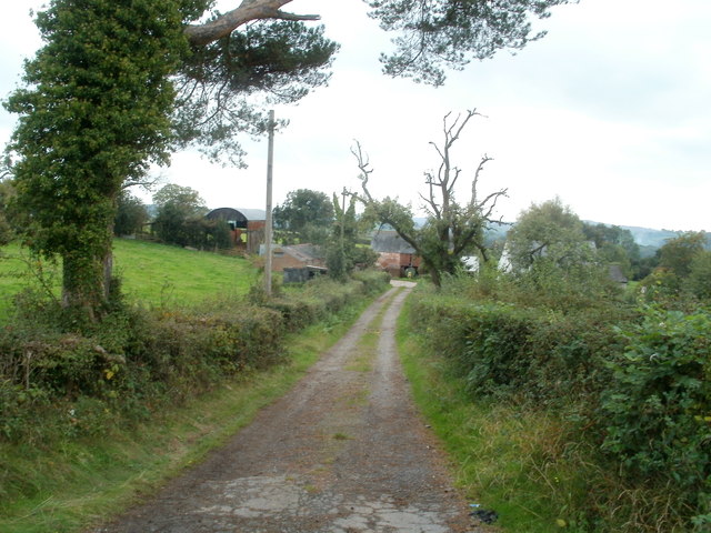
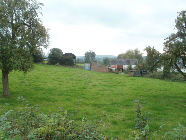
Darran Plantation, located in Monmouthshire, is an expansive woodland area that covers a significant portion of the region. With its lush greenery and diverse flora and fauna, it attracts nature enthusiasts, hikers, and photographers alike.

The plantation is known for its picturesque landscapes and serene atmosphere. It is home to a variety of tree species, including oak, beech, birch, and coniferous trees. These trees not only provide shelter to numerous bird species but also create a vibrant canopy that changes with the seasons, offering visitors a unique experience throughout the year.

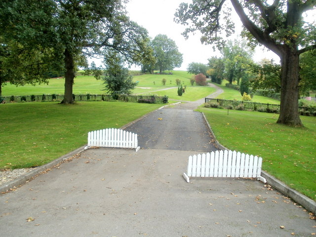
The woodland is crisscrossed by a network of well-maintained trails, making it accessible to visitors of all ages and abilities. These paths lead visitors through the heart of the plantation, offering breathtaking views of the surrounding countryside. Along the trails, one can spot an array of wildlife, including squirrels, rabbits, and various bird species.

Darran Plantation also boasts a rich history, with evidence of human presence dating back centuries. The remains of old buildings and structures can be found scattered throughout the woodland, providing glimpses into the past.

For those seeking a tranquil escape from the bustle of everyday life, Darran Plantation offers a perfect retreat. Its natural beauty, coupled with its accessibility and historical significance, makes it an ideal destination for nature lovers and history enthusiasts alike.

If you have any feedback on the listing, please let us know in the comments section below.

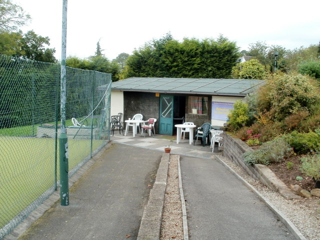
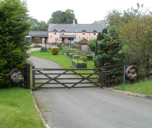
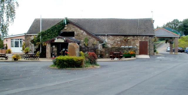
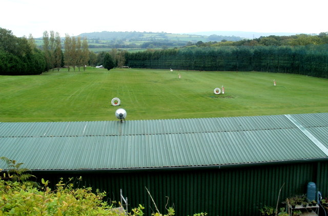
Darran Plantation Images

Images are sourced within 2km of 51.676354/-2.9761941 or Grid Reference ST3297. Thanks to Geograph Open Source API. All images are credited.

Entrance to Greenmeadow Golf & Country Club, Croesyceiliog, Cwmbran Turn left here for the Golf & Country Club, and also for Cwmbran Tennis Club.
A few metres ahead, Tre-herbert road crosses from Torfaen into Monmouthshire.
Entrance to Greenmeadow Golf & Country Club, Croesyceiliog, Cwmbran
Turn left here for the Golf & Country Club, and also for Cwmbran Tennis Club. A few metres ahead, Tre-herbert road crosses from Torfaen into Monmouthshire.
All-weather dome, Cwmbran Tennis Club The large structure unsuccessfully hiding behind a bush is a dome enclosing tennis courts. For the winter season 2011-2012, the dome was erected on Saturday September 24th 2011.
All-weather dome, Cwmbran Tennis Club
The large structure unsuccessfully hiding behind a bush is a dome enclosing tennis courts. For the winter season 2011-2012, the dome was erected on Saturday September 24th 2011.
Tennis courts and a dome, Cwmbran Tennis Club The all-weather dome <a title="https://www.geograph.org.uk/photo/2621778" href="https://www.geograph.org.uk/photo/2621778">Link</a> on the left was erected on Saturday September 24th 2011 to allow tennis to be played under cover during the upcoming winter.
Tennis courts and a dome, Cwmbran Tennis Club
The all-weather dome Link on the left was erected on Saturday September 24th 2011 to allow tennis to be played under cover during the upcoming winter.
All-weather dome and tennis courts, Cwmbran Tennis Club The dome was erected at the end of September 2011, allowing tennis to be played under cover during the upcoming winter.
All-weather dome and tennis courts, Cwmbran Tennis Club
The dome was erected at the end of September 2011, allowing tennis to be played under cover during the upcoming winter.
Refreshment hut, Cwmbran Tennis Club Located in the NE corner of the tennis courts. <a title="https://www.geograph.org.uk/photo/2621787" href="https://www.geograph.org.uk/photo/2621787">Link</a>
Refreshment hut, Cwmbran Tennis Club
Located in the NE corner of the tennis courts. Link
Greenmeadow Farm House, Croesyceiliog, Cwmbran Viewed from a footpath from Tre-herbert Road to Greenmeadow Golf & Country Club.
The sign on the right states PRIVATE ROAD DOGS LOOSE but the effect is diminished somewhat by the addition of a cartoon-style dog who looks more welcoming than fierce.
Greenmeadow Farm House, Croesyceiliog, Cwmbran
Viewed from a footpath from Tre-herbert Road to Greenmeadow Golf & Country Club. The sign on the right states PRIVATE ROAD DOGS LOOSE but the effect is diminished somewhat by the addition of a cartoon-style dog who looks more welcoming than fierce.
Entrance to public bar and restaurant, Greenmeadow Golf & Country Club, Cwmbran Located about 350 metres from the edge <a title="https://www.geograph.org.uk/photo/2621759" href="https://www.geograph.org.uk/photo/2621759">Link</a> of the entrance drive from Tre-herbert Road.
Entrance to public bar and restaurant, Greenmeadow Golf & Country Club, Cwmbran
Located about 350 metres from the edge Link of the entrance drive from Tre-herbert Road.
Greenmeadow Golf & Country Club driving range building The 70-metre long corrugated metal building is at the western edge of a 250-metre long field. Markers are set out in the field <a title="https://www.geograph.org.uk/photo/2621857" href="https://www.geograph.org.uk/photo/2621857">Link</a> at various distances from the building, which has bays for up to 26 golfers driving at the same time.
Greenmeadow Golf & Country Club driving range building
The 70-metre long corrugated metal building is at the western edge of a 250-metre long field. Markers are set out in the field Link at various distances from the building, which has bays for up to 26 golfers driving at the same time.
Driving range, Greenmeadow Golf & Country Club, Cwmbran Viewed over the building <a title="https://www.geograph.org.uk/photo/2621852" href="https://www.geograph.org.uk/photo/2621852">Link</a> housing 26 driving bays. Golfers can practice their golf drive here. Markers in the 250-metre long field show various distances.
Driving range, Greenmeadow Golf & Country Club, Cwmbran
Viewed over the building Link housing 26 driving bays. Golfers can practice their golf drive here. Markers in the 250-metre long field show various distances.
Pink club house, Greenmeadow Golf & Country Club, Croesyceiliog, Cwmbran Viewed from the NE, from the edge of the driving range building. <a title="https://www.geograph.org.uk/photo/2621852" href="https://www.geograph.org.uk/photo/2621852">Link</a>
The clubhouse contains a restaurant and bar that are open to the public.
Pink club house, Greenmeadow Golf & Country Club, Croesyceiliog, Cwmbran
Viewed from the NE, from the edge of the driving range building. Link The clubhouse contains a restaurant and bar that are open to the public.
Golf buggy storage area, Greenmeadow Golf & Country Club, Croesyceiliog, Cwmbran Located to the north of the club house. <a title="https://www.geograph.org.uk/photo/2621871" href="https://www.geograph.org.uk/photo/2621871">Link</a>
Golf buggy storage area, Greenmeadow Golf & Country Club, Croesyceiliog, Cwmbran
Located to the north of the club house. Link
Golf hole, Greenmeadow Golf & Country Club, Cwmbran This hole, with bunkers (sand traps) near the green, is immediately to the west of the club house. <a title="https://www.geograph.org.uk/photo/2621871" href="https://www.geograph.org.uk/photo/2621871">Link</a>
Golf hole, Greenmeadow Golf & Country Club, Cwmbran
This hole, with bunkers (sand traps) near the green, is immediately to the west of the club house. Link
Row of dark blue golf buggies, Greenmeadow Golf & Country Club, Croesyceiliog The buggies, lined up along the northern edge of the club house <a title="https://www.geograph.org.uk/photo/2621871" href="https://www.geograph.org.uk/photo/2621871">Link</a> each have 'Club Car' on the front of the vehicle.
Row of dark blue golf buggies, Greenmeadow Golf & Country Club, Croesyceiliog
The buggies, lined up along the northern edge of the club house Link each have 'Club Car' on the front of the vehicle.
Path through the eastern side of  Greenmeadow golf course, Cwmbran Viewed from the drive connecting the club house <a title="https://www.geograph.org.uk/photo/2621871" href="https://www.geograph.org.uk/photo/2621871">Link</a> with Tre-herbert Road.
Path through the eastern side of Greenmeadow golf course, Cwmbran
Viewed from the drive connecting the club house Link with Tre-herbert Road.
Sand to replenish the Greenmeadow golf club bunkers, Cwmbran Sand is being loaded onto a vehicle from a mound alongside the driveway from Tre-herbert Road to the Greenmeadow club house. <a title="https://www.geograph.org.uk/photo/2621871" href="https://www.geograph.org.uk/photo/2621871">Link</a> When the vehicle is full, it will be driven onto the adjacent golf course <a title="https://www.geograph.org.uk/photo/2621918" href="https://www.geograph.org.uk/photo/2621918">Link</a> to replenish bunkers (sand traps)
Sand to replenish the Greenmeadow golf club bunkers, Cwmbran
Sand is being loaded onto a vehicle from a mound alongside the driveway from Tre-herbert Road to the Greenmeadow club house. Link When the vehicle is full, it will be driven onto the adjacent golf course Link to replenish bunkers (sand traps)
From Torfaen into Monmouthshire near Croesyceiliog, Cwmbran Viewed from near the entrance <a title="https://www.geograph.org.uk/photo/2621759" href="https://www.geograph.org.uk/photo/2621759">Link</a> to Greenmeadow Golf & Country Club. Tre-herbert Road leaves Torfaen and enters Monmouthshire.
From Torfaen into Monmouthshire near Croesyceiliog, Cwmbran
Viewed from near the entrance Link to Greenmeadow Golf & Country Club. Tre-herbert Road leaves Torfaen and enters Monmouthshire.
Access lane to Croeswen Farm east of Croesyceiliog Viewed from Tre-herbert Road.
Access lane to Croeswen Farm east of Croesyceiliog
Viewed from Tre-herbert Road.
Croeswen Farm buildings east of Croesyceiliog Viewed from Tre-herbert Road.
Croeswen Farm buildings east of Croesyceiliog
Viewed from Tre-herbert Road.
Show me another place!

Darran Plantation is located at Grid Ref: ST3297 (Lat: 51.676354, Lng: -2.9761941)

Unitary Authority: Monmouthshire

Police Authority: Gwent

What 3 Words

///scale.sunbeam.canyons. Near New Inn, Torfaen

Nearby Locations

Darran Plantation

Related Wikis

Llanddewi Court

Llanddewi Court, Llanddewi Skirrid, Monmouthshire, Wales, is a Grade II* listed house dating from the late 16th century. It is an example of a "double...

Coed-y-paen

Coed-y-paen is a village in South Wales, situated at the south-eastern end of Llandegfedd Reservoir, 2.5 miles (4 km) north-west of Llangybi. HM Prison...

District of Monmouth

Monmouth District (Welsh: Trefynwy) was one of five local government districts in the county of Gwent in Wales between 1974 and 1996. In 1988 the district...

Monmouthshire (historic)

Monmouthshire (), also known as the County of Monmouth (; Welsh: Sir Fynwy), is one of thirteen historic counties of Wales and a former administrative...

Diocese of Monmouth

The Diocese of Monmouth is a diocese of the Church in Wales. Despite the name, its cathedral is located not in Monmouth but in Newport — the Cathedral...

Croesyceiliog

Croesyceiliog (Welsh: [ˌkrɔɨs ə ˈkɛiljɔɡ], Cockerel's Cross) is a suburb of Cwmbran, Wales. == Housing == Croesyceiliog is primarily a residential district...

HM Prison Prescoed

HM Prison Prescoed (Welsh: Carchar Prescoed EF) is a Category D men's open prison, located in Coed-y-paen, three miles from Usk in Monmouthshire, Wales...

Llandegfedd Reservoir

Llandegfedd Reservoir (also known as Llandegveth Reservoir) is a large 174 hectare water supply reservoir and is eight miles (13 km) north of Newport...

Nearby Amenities

Located within 500m of 51.676354,-2.9761941
Power: pole
Lat/Long: 51.6722225/-2.9738107
Power: pole
Lat/Long: 51.6726217/-2.9767826
Power: pole
Lat/Long: 51.6732022/-2.9812861
The data included in this document is from www.openstreetmap.org. The data is made available under ODbL.

Have you been to Darran Plantation?

Leave your review of Darran Plantation below (or comments, questions and feedback).