Belan Wood

Wood, Forest in Denbighshire

Wales

Belan Wood

The Wynnstay Arms Hotel in the centre of Ruabon.
The Wynnstay Arms Credit: John H Darch

Belan Wood, located in Denbighshire, is a picturesque forest that captivates visitors with its natural beauty and tranquil atmosphere. Covering an area of approximately 300 acres, it is a significant woodland in the region. The wood is nestled within the Clwydian Range, an Area of Outstanding Natural Beauty in North Wales.

Belan Wood boasts a diverse range of tree species, including oak, beech, birch, and conifers, which create a rich tapestry of colors throughout the year. The forest floor is adorned with a carpet of bluebells in the spring, providing a breathtaking sight for nature enthusiasts. Wildlife thrives in the wood, with various bird species, squirrels, and deer frequently spotted by visitors.

The forest is crisscrossed by well-maintained trails, allowing visitors to explore its beauty at their own pace. These trails cater to different abilities, making the wood accessible to all. As visitors meander through the forest, they can enjoy the soothing sounds of birdsong and the gentle rustling of leaves.

Belan Wood is not only a haven for nature lovers but also a popular destination for outdoor activities. It offers opportunities for hiking, cycling, and horse riding, with designated paths and tracks available for each activity. The wood also has picnic areas and barbecue spots, ideal for family outings or gatherings with friends.

In conclusion, Belan Wood in Denbighshire is a stunning forest that offers a peaceful retreat and an abundance of natural beauty. Whether one seeks a serene walk in nature, a thrilling adventure, or a picnic in a tranquil setting, Belan Wood caters to a wide range of outdoor pursuits.

If you have any feedback on the listing, please let us know in the comments section below.

Belan Wood Images

Images are sourced within 2km of 52.971909/-3.0250957 or Grid Reference SJ3142. Thanks to Geograph Open Source API. All images are credited.

The Wynnstay Arms Hotel in the centre of Ruabon.
The Wynnstay Arms
Hotel in the centre of Ruabon.
Stryt Fawr, Rhiwabon Ruabon's High Street, once the very busy main A483, now something of a backwater.
Stryt Fawr, Rhiwabon
Ruabon's High Street, once the very busy main A483, now something of a backwater.
Wynnstay Hall drive Spring is springing on the main approach to Wynnstay Hall, now divided into apartments.
Wynnstay Hall drive
Spring is springing on the main approach to Wynnstay Hall, now divided into apartments.
Old avenue from Wynnstay Hall to Ruabon An avenue connecting Wynnstay and its estate village of Ruabon was planted c.1777. After the Williams-Wynn family left the house in 1948, the avenue was increasingly neglected, and in the late 1980s was severed by the new A483 Wrexham/Ruabon by-pass.
Old avenue from Wynnstay Hall to Ruabon
An avenue connecting Wynnstay and its estate village of Ruabon was planted c.1777. After the Williams-Wynn family left the house in 1948, the avenue was increasingly neglected, and in the late 1980s was severed by the new A483 Wrexham/Ruabon by-pass.
Old estate gates at Wynnstay The gates are blocked, and there is no visible track leading into the estate. They've not been used in a very long time.
Old estate gates at Wynnstay
The gates are blocked, and there is no visible track leading into the estate. They've not been used in a very long time.
Wynnstay walls The old Wynnstay estate wall, and another of silage bales behind it.
Wynnstay walls
The old Wynnstay estate wall, and another of silage bales behind it.
Plas Wynnstay Wynnstay Hall, now developed into apartments, from the Wat's Dyke Way footpath. According to Pevsner, the house, which was redeveloped after a fire in 1858, is "a High Victorian version of [the] French Renaissance" with "much of the coarseness and little of the gusto associated with the genre". I'm with Pevsner on that.
Plas Wynnstay
Wynnstay Hall, now developed into apartments, from the Wat's Dyke Way footpath. According to Pevsner, the house, which was redeveloped after a fire in 1858, is "a High Victorian version of [the] French Renaissance" with "much of the coarseness and little of the gusto associated with the genre". I'm with Pevsner on that.
Wal y stad Wynnstay The eastern wall of the Wynnstay estate, on the lane to Rhosymadoc. School Lodge is the near building on the left.
Wal y stad Wynnstay
The eastern wall of the Wynnstay estate, on the lane to Rhosymadoc. School Lodge is the near building on the left.
Old circular AA sign in the Bridge End, Ruabon Old AA Sign located in the Bridge End PH on the northwest side of the B5605 Bridge Street, Ruabon. Ruabon community.

This is the Circular, village name on black band, no Motor Union symbol or name type, dating from 1923 showing distances Wrexham 5¼ Llangollen 6 London 180. 

There were five series of AA signs, mostly dating from 1923 and made by Francis & Co / Franco in Deptford, London. The village name and distance to London or Dublin were normally displayed.

Milestone Society National ID: DEN-RUABON
Old circular AA sign in the Bridge End, Ruabon
Old AA Sign located in the Bridge End PH on the northwest side of the B5605 Bridge Street, Ruabon. Ruabon community. This is the Circular, village name on black band, no Motor Union symbol or name type, dating from 1923 showing distances Wrexham 5¼ Llangollen 6 London 180. There were five series of AA signs, mostly dating from 1923 and made by Francis & Co / Franco in Deptford, London. The village name and distance to London or Dublin were normally displayed. Milestone Society National ID: DEN-RUABON
A483 near Ruabon The A483 is a major north-south trunk road in Wales, running for 149 miles between Chester and Junction 42 of the M4 motorway just east of Swansea.
<span class="nowrap"><a title="http://www.sabre-roads.org.uk/wiki/index.php?title=A483" rel="nofollow ugc noopener" href="http://www.sabre-roads.org.uk/wiki/index.php?title=A483">Link</a><img style="margin-left:2px;" alt="External link" title="External link - shift click to open in new window" src="https://s1.geograph.org.uk/img/external.png" width="10" height="10"/></span>  SABRE
<span class="nowrap"><a title="https://en.wikipedia.org/wiki/A483_road" rel="nofollow ugc noopener" href="https://en.wikipedia.org/wiki/A483_road">Link</a><img style="margin-left:2px;" alt="External link" title="External link - shift click to open in new window" src="https://s1.geograph.org.uk/img/external.png" width="10" height="10"/></span>  Wikipedia
A483 near Ruabon
The A483 is a major north-south trunk road in Wales, running for 149 miles between Chester and Junction 42 of the M4 motorway just east of Swansea. LinkExternal link SABRE LinkExternal link Wikipedia
Bridge over the A483 at Ruabon The A483 is a major north-south trunk road in Wales, running for 149 miles between Chester and Junction 42 of the M4 motorway just east of Swansea.
<span class="nowrap"><a title="http://www.sabre-roads.org.uk/wiki/index.php?title=A483" rel="nofollow ugc noopener" href="http://www.sabre-roads.org.uk/wiki/index.php?title=A483">Link</a><img style="margin-left:2px;" alt="External link" title="External link - shift click to open in new window" src="https://s1.geograph.org.uk/img/external.png" width="10" height="10"/></span>  SABRE
<span class="nowrap"><a title="https://en.wikipedia.org/wiki/A483_road" rel="nofollow ugc noopener" href="https://en.wikipedia.org/wiki/A483_road">Link</a><img style="margin-left:2px;" alt="External link" title="External link - shift click to open in new window" src="https://s1.geograph.org.uk/img/external.png" width="10" height="10"/></span>  Wikipedia
Bridge over the A483 at Ruabon
The A483 is a major north-south trunk road in Wales, running for 149 miles between Chester and Junction 42 of the M4 motorway just east of Swansea. LinkExternal link SABRE LinkExternal link Wikipedia
A539 looking west from A483 slip road The slip road leaves the A438 here at the Ruabon junction.
A539 looking west from A483 slip road
The slip road leaves the A438 here at the Ruabon junction.
Exit from James Farm caravan site At junction with A539
Exit from James Farm caravan site
At junction with A539
1GL bench mark and bolt on St Mary's tower This bench mark and bolt is on the west face of St Mary's tower on the north side of the west door. The mark is No.86 on the Newtown to Chester survey line, which was carried out in 1857. The mark was levelled at 390.5260 feet. See also <a href="https://www.geograph.org.uk/photo/2595798">SJ3043 : St Mary's church tower</a>
1GL bench mark and bolt on St Mary's tower
This bench mark and bolt is on the west face of St Mary's tower on the north side of the west door. The mark is No.86 on the Newtown to Chester survey line, which was carried out in 1857. The mark was levelled at 390.5260 feet. See also SJ3043 : St Mary's church tower
St Mary's church tower Tower of St Mary's is at the west end of the church. There is a 1GL bench mark and bolt to the left of the west door and before the buttress - <a href="https://www.geograph.org.uk/photo/2595789">SJ3043 : 1GL bench mark and bolt on St Mary's tower</a>
St Mary's church tower
Tower of St Mary's is at the west end of the church. There is a 1GL bench mark and bolt to the left of the west door and before the buttress - SJ3043 : 1GL bench mark and bolt on St Mary's tower
The south side of the 44 Northing Straight hedge and arable field with winter oil seed rape.
The south side of the 44 Northing
Straight hedge and arable field with winter oil seed rape.
Llwybr Clawdd Wat Wat's Dyke Way is running along the top of Wat's Dyke.
Llwybr Clawdd Wat
Wat's Dyke Way is running along the top of Wat's Dyke.
Footpath heading towards Rhiwabon This path is not used a lot as there are no tracks in the grassland.
Footpath heading towards Rhiwabon
This path is not used a lot as there are no tracks in the grassland.
Show me another place!

Belan Wood is located at Grid Ref: SJ3142 (Lat: 52.971909, Lng: -3.0250957)

Unitary Authority: Wrexham

Police Authority: North Wales

What 3 Words

///committee.dish.whips. Near Ruabon, Wrexham

Related Wikis

Wynnstay

Wynnstay is a country house within an important landscaped park 1.3 km (0.75 miles) south-east of Ruabon, near Wrexham, Wales. Wynnstay, previously Watstay...

River Eitha

The River Eitha (Welsh: Afon Eitha) is a small river in Wrexham County Borough, Wales. It is part of the River Dee catchment. Its name was probably derived...
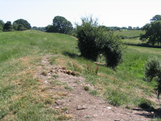
Wat's Dyke

Wat's Dyke (Welsh: Clawdd Wat) is a 40-mile (64 km) linear earthwork running through the northern Welsh Marches from Basingwerk Abbey on the River Dee...
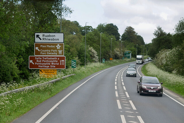
Ruabon

Ruabon (Welsh: Rhiwabon; pronounced [r̥ɪʊˈɑːbɔn]) is a village and community in Wrexham County Borough, Wales. The name comes from Rhiw Fabon, rhiw being...

Nearby Amenities

Located within 500m of 52.971909,-3.0250957
Power: tower
Lat/Long: 52.9703033/-3.0195489
Power: tower
Lat/Long: 52.9726106/-3.0180102
Power: tower
Lat/Long: 52.9732545/-3.0192976
Place: farm
Lat/Long: 52.970663/-3.0223462
Building: yes
Lat/Long: 52.9727176/-3.0221208
Building: yes
Lat/Long: 52.9719681/-3.0230221
Building: yes
Lat/Long: 52.975108/-3.0249962
Rhosymadoc
Alt Name: Rhos-y-madoc;Rhos Y Madoc
Alt Name En: Rhos-y-madoc;Rhos Y Madoc
Name Cy: Rhosymadoc
Name En: Rhosymadoc
Place: hamlet
Wikidata: Q26300792
Lat/Long: 52.9715127/-3.0233713
Direction: 165
Generator Method: photovoltaic
Generator Output Electricity: yes
Generator Solar Modules: 16
Generator Source: solar
Generator Type: solar_photovoltaic_panel
Location: roof
Power: generator
Lat/Long: 52.9718342/-3.0230105
The data included in this document is from www.openstreetmap.org. The data is made available under ODbL.

Have you been to Belan Wood?

Leave your review of Belan Wood below (or comments, questions and feedback).