Brimford Wood

Wood, Forest in Montgomeryshire

Wales

Brimford Wood

Junction on B4393 west of Crewgreen
Junction on B4393 west of Crewgreen Credit: Chris Gunns

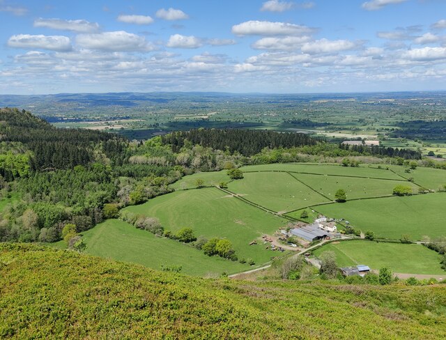
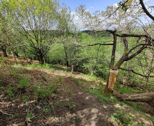
Brimford Wood is a charming forest located in Montgomeryshire, a county in central Wales. Covering an area of approximately 500 acres, this woodland is a haven for nature enthusiasts and outdoor adventurers alike. The wood is situated just a few miles outside of the small town of Brimford, which gives it its name.

The wood is known for its diverse range of tree species, including oak, beech, ash, and birch. These tall, majestic trees create a dense canopy, providing shelter and habitat for a variety of wildlife. It is not uncommon to spot squirrels, rabbits, and numerous bird species while exploring the wood.

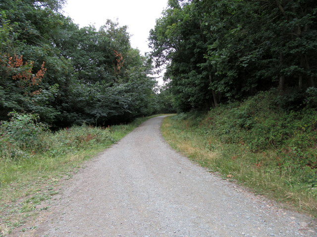
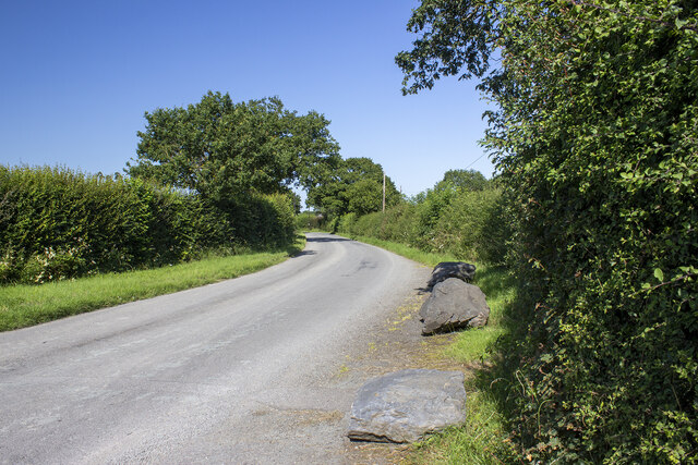
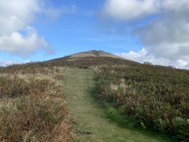
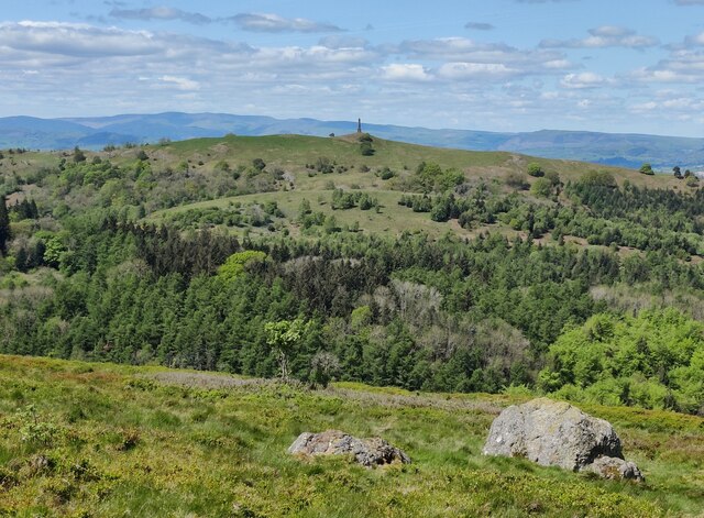
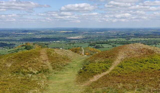
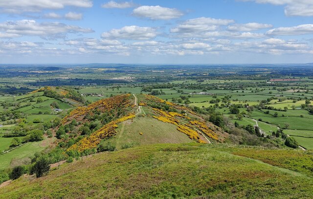
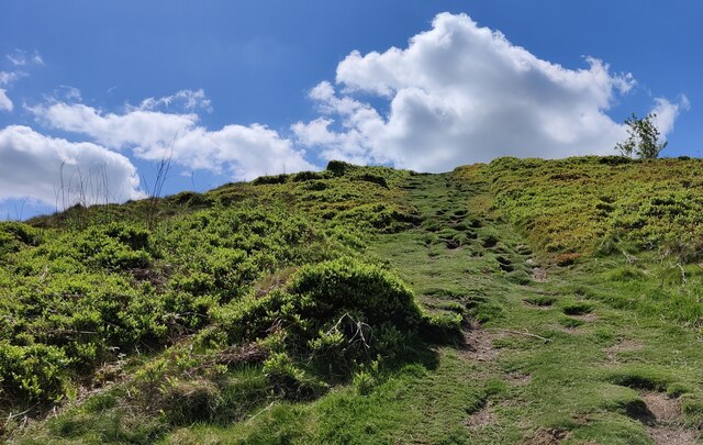
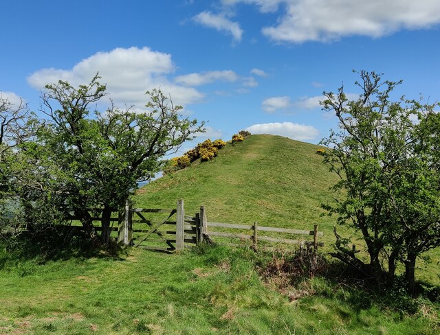
Brimford Wood is crisscrossed with a network of well-maintained walking trails, making it an ideal destination for hikers and walkers of all abilities. The trails vary in length and difficulty, offering options for both leisurely strolls and more challenging hikes. Along the way, visitors will be treated to stunning views of the surrounding countryside and may stumble upon hidden streams and picturesque clearings.

In addition to its natural beauty, Brimford Wood also has a rich history. It is believed to have been used as a hunting ground by the local nobility in medieval times. The remnants of an old deer park can still be seen within the wood, adding a touch of historical intrigue to the area.

Overall, Brimford Wood is a peaceful and enchanting destination that showcases the beauty of Montgomeryshire's natural landscape. Whether one seeks solace in nature, enjoys a leisurely walk, or wants to immerse themselves in history, this woodland offers something for everyone.

If you have any feedback on the listing, please let us know in the comments section below.

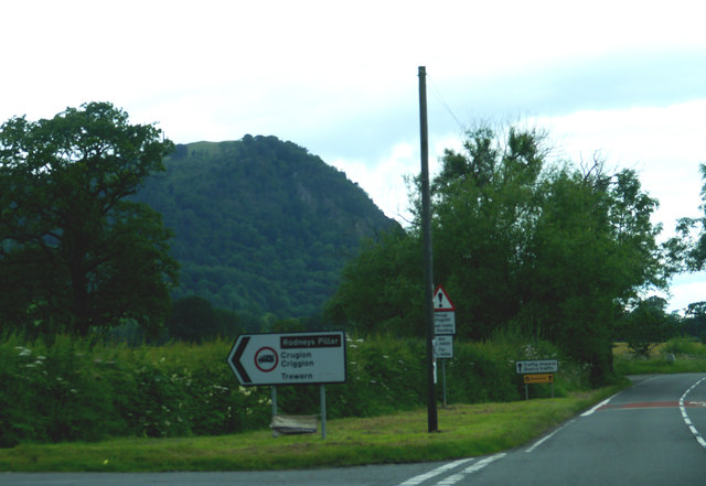
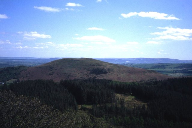
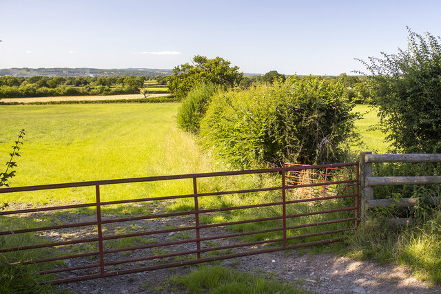
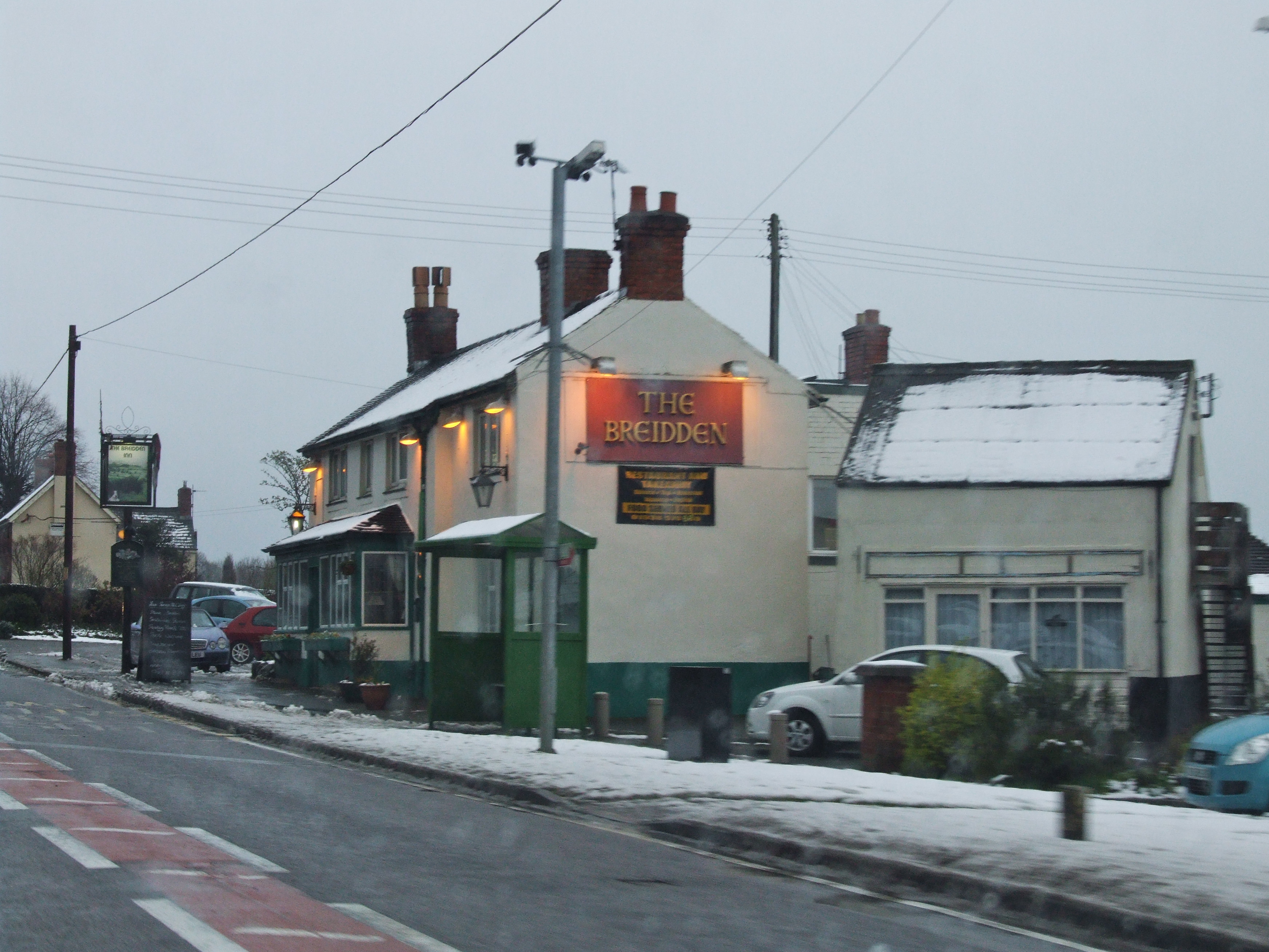
Brimford Wood Images

Images are sourced within 2km of 52.724102/-3.0275504 or Grid Reference SJ3014. Thanks to Geograph Open Source API. All images are credited.

Junction on B4393 west of Crewgreen
Track up Breidden Hill
Old Toll House by the A483, Middletown Toll House by the A483, in the parish of Middleton Scriven, Gate Farm, which is just on English side of the border between England and Wales.

To be surveyed

Milestone Society National ID: SA.MID
Old Toll House by the A483, Middletown
Toll House by the A483, in the parish of Middleton Scriven, Gate Farm, which is just on English side of the border between England and Wales. To be surveyed Milestone Society National ID: SA.MID
Middletown Hill as seen from Breidden Hill
Hedgerows and fields Hedgerows and fields off Criggion Lane
Hedgerows and fields
Hedgerows and fields off Criggion Lane
Criggion Lane Layby boulders on Criggion Lane
Criggion Lane
Layby boulders on Criggion Lane
Path up Middletown Hill
Winter colours on Middleton Hill
Bluebells on Middletown Hill Middletown Hill is part of the Breidden Hills, which are made up of Breidden Hill (365m 1,197ft), Moel y Golfa (meaning Bare or Bald Hill), the highest at (403m 1,322ft), Middletown Hill (367m 1,204ft), Kempsters Hill and Bausely Hill. They are on the border of England and Wales (Shropshire/Powys), about ten miles west of Shrewsbury.
Breidden Hill is an extinct volcano, and has Rodney's Pillar on its summit. Middletown Hill has an ancient Iron Age Hill fort on its summit.
Bluebells on Middletown Hill
Middletown Hill is part of the Breidden Hills, which are made up of Breidden Hill (365m 1,197ft), Moel y Golfa (meaning Bare or Bald Hill), the highest at (403m 1,322ft), Middletown Hill (367m 1,204ft), Kempsters Hill and Bausely Hill. They are on the border of England and Wales (Shropshire/Powys), about ten miles west of Shrewsbury. Breidden Hill is an extinct volcano, and has Rodney's Pillar on its summit. Middletown Hill has an ancient Iron Age Hill fort on its summit.
Breidden Hill viewed from Middletown Hill The Breidden Hills are made up of Breidden Hill (365m 1,197ft), Moel y Golfa (meaning Bare or Bald Hill), the highest at (403m 1,322ft), Middletown Hill (367m 1,204ft), Kempsters Hill and Bausely Hill. They are on the border of England and Wales (Shropshire/Powys), about ten miles west of Shrewsbury.
Breidden Hill is an extinct volcano, and has Rodney's Pillar on its summit. Middletown Hill has an ancient Iron Age Hill fort on its summit.
Breidden Hill viewed from Middletown Hill
The Breidden Hills are made up of Breidden Hill (365m 1,197ft), Moel y Golfa (meaning Bare or Bald Hill), the highest at (403m 1,322ft), Middletown Hill (367m 1,204ft), Kempsters Hill and Bausely Hill. They are on the border of England and Wales (Shropshire/Powys), about ten miles west of Shrewsbury. Breidden Hill is an extinct volcano, and has Rodney's Pillar on its summit. Middletown Hill has an ancient Iron Age Hill fort on its summit.
Moel y Golfa viewed from Middletown Hill Middletown Hill is part of the Breidden Hills, which are made up of Breidden Hill (365m 1,197ft), Moel y Golfa (meaning Bare or Bald Hill), the highest at (403m 1,322ft), Middletown Hill (367m 1,204ft), Kempsters Hill and Bausely Hill. They are on the border of England and Wales (Shropshire/Powys), about ten miles west of Shrewsbury.
Breidden Hill is an extinct volcano, and has Rodney's Pillar on its summit. Middletown Hill has an ancient Iron Age Hill fort on its summit.
Moel y Golfa viewed from Middletown Hill
Middletown Hill is part of the Breidden Hills, which are made up of Breidden Hill (365m 1,197ft), Moel y Golfa (meaning Bare or Bald Hill), the highest at (403m 1,322ft), Middletown Hill (367m 1,204ft), Kempsters Hill and Bausely Hill. They are on the border of England and Wales (Shropshire/Powys), about ten miles west of Shrewsbury. Breidden Hill is an extinct volcano, and has Rodney's Pillar on its summit. Middletown Hill has an ancient Iron Age Hill fort on its summit.
Breidden Hill viewed from Middletown Hill The Breidden Hills are made up of Breidden Hill (365m 1,197ft), Moel y Golfa (meaning Bare or Bald Hill), the highest at (403m 1,322ft), Middletown Hill (367m 1,204ft), Kempsters Hill and Bausely Hill. They are on the border of England and Wales (Shropshire/Powys), about ten miles west of Shrewsbury.
Breidden Hill is an extinct volcano, and has Rodney's Pillar on its summit. Middletown Hill has an ancient Iron Age Hill fort on its summit.
Breidden Hill viewed from Middletown Hill
The Breidden Hills are made up of Breidden Hill (365m 1,197ft), Moel y Golfa (meaning Bare or Bald Hill), the highest at (403m 1,322ft), Middletown Hill (367m 1,204ft), Kempsters Hill and Bausely Hill. They are on the border of England and Wales (Shropshire/Powys), about ten miles west of Shrewsbury. Breidden Hill is an extinct volcano, and has Rodney's Pillar on its summit. Middletown Hill has an ancient Iron Age Hill fort on its summit.
Earthworks on Middletown Hill Middletown Hill is part of the Breidden Hills, which are made up of Breidden Hill (365m 1,197ft), Moel y Golfa (meaning Bare or Bald Hill), the highest at (403m 1,322ft), Middletown Hill (367m 1,204ft), Kempsters Hill and Bausely Hill. They are on the border of England and Wales (Shropshire/Powys), about ten miles west of Shrewsbury.
Breidden Hill is an extinct volcano, and has Rodney's Pillar on its summit. Middletown Hill has an ancient Iron Age Hill fort on its summit.
Earthworks on Middletown Hill
Middletown Hill is part of the Breidden Hills, which are made up of Breidden Hill (365m 1,197ft), Moel y Golfa (meaning Bare or Bald Hill), the highest at (403m 1,322ft), Middletown Hill (367m 1,204ft), Kempsters Hill and Bausely Hill. They are on the border of England and Wales (Shropshire/Powys), about ten miles west of Shrewsbury. Breidden Hill is an extinct volcano, and has Rodney's Pillar on its summit. Middletown Hill has an ancient Iron Age Hill fort on its summit.
Belle Eisle Farm viewed from Middletown Hill Middletown Hill is part of the Breidden Hills, which are made up of Breidden Hill (365m 1,197ft), Moel y Golfa (meaning Bare or Bald Hill), the highest at (403m 1,322ft), Middletown Hill (367m 1,204ft), Kempsters Hill and Bausely Hill. They are on the border of England and Wales (Shropshire/Powys), about ten miles west of Shrewsbury.
Breidden Hill is an extinct volcano, and has Rodney's Pillar on its summit. Middletown Hill has an ancient Iron Age Hill fort on its summit.
Belle Eisle Farm viewed from Middletown Hill
Middletown Hill is part of the Breidden Hills, which are made up of Breidden Hill (365m 1,197ft), Moel y Golfa (meaning Bare or Bald Hill), the highest at (403m 1,322ft), Middletown Hill (367m 1,204ft), Kempsters Hill and Bausely Hill. They are on the border of England and Wales (Shropshire/Powys), about ten miles west of Shrewsbury. Breidden Hill is an extinct volcano, and has Rodney's Pillar on its summit. Middletown Hill has an ancient Iron Age Hill fort on its summit.
Bulthy Hill viewed from Middletown Hill Middletown Hill is part of the Breidden Hills, which are made up of Breidden Hill (365m 1,197ft), Moel y Golfa (meaning Bare or Bald Hill), the highest at (403m 1,322ft), Middletown Hill (367m 1,204ft), Bulthy Hill, Kempsters Hill and Bausely Hill. They are on the border of England and Wales (Shropshire/Powys), about ten miles west of Shrewsbury.
Breidden Hill is an extinct volcano, and has Rodney's Pillar on its summit. Middletown Hill has an ancient Iron Age Hill fort on its summit.
Bulthy Hill viewed from Middletown Hill
Middletown Hill is part of the Breidden Hills, which are made up of Breidden Hill (365m 1,197ft), Moel y Golfa (meaning Bare or Bald Hill), the highest at (403m 1,322ft), Middletown Hill (367m 1,204ft), Bulthy Hill, Kempsters Hill and Bausely Hill. They are on the border of England and Wales (Shropshire/Powys), about ten miles west of Shrewsbury. Breidden Hill is an extinct volcano, and has Rodney's Pillar on its summit. Middletown Hill has an ancient Iron Age Hill fort on its summit.
Steep path ascending Middletown Hill Middletown Hill is part of the Breidden Hills, which are made up of Breidden Hill (365m 1,197ft), Moel y Golfa (meaning Bare or Bald Hill), the highest at (403m 1,322ft), Middletown Hill (367m 1,204ft), Bulthy Hill, Kempsters Hill and Bausely Hill. They are on the border of England and Wales (Shropshire/Powys), about ten miles west of Shrewsbury.
Breidden Hill is an extinct volcano, and has Rodney's Pillar on its summit. Middletown Hill has an ancient Iron Age Hill fort on its summit.
Steep path ascending Middletown Hill
Middletown Hill is part of the Breidden Hills, which are made up of Breidden Hill (365m 1,197ft), Moel y Golfa (meaning Bare or Bald Hill), the highest at (403m 1,322ft), Middletown Hill (367m 1,204ft), Bulthy Hill, Kempsters Hill and Bausely Hill. They are on the border of England and Wales (Shropshire/Powys), about ten miles west of Shrewsbury. Breidden Hill is an extinct volcano, and has Rodney's Pillar on its summit. Middletown Hill has an ancient Iron Age Hill fort on its summit.
Gate and path on Bulthy Hill Bulthy Hill is part of the Breidden Hills, which are made up of Breidden Hill (365m 1,197ft), Moel y Golfa (meaning Bare or Bald Hill), the highest at (403m 1,322ft), Middletown Hill (367m 1,204ft), Bulthy Hill, Kempsters Hill and Bausely Hill. They are on the border of England and Wales (Shropshire/Powys), about ten miles west of Shrewsbury.
Breidden Hill is an extinct volcano, and has Rodney's Pillar on its summit. Middletown Hill has an ancient Iron Age Hill fort on its summit.
Gate and path on Bulthy Hill
Bulthy Hill is part of the Breidden Hills, which are made up of Breidden Hill (365m 1,197ft), Moel y Golfa (meaning Bare or Bald Hill), the highest at (403m 1,322ft), Middletown Hill (367m 1,204ft), Bulthy Hill, Kempsters Hill and Bausely Hill. They are on the border of England and Wales (Shropshire/Powys), about ten miles west of Shrewsbury. Breidden Hill is an extinct volcano, and has Rodney's Pillar on its summit. Middletown Hill has an ancient Iron Age Hill fort on its summit.
Path and woodland on the slopes of Bulthy Hill Bulthy Hill is part of the Breidden Hills, which are made up of Breidden Hill (365m 1,197ft), Moel y Golfa (meaning Bare or Bald Hill), the highest at (403m 1,322ft), Middletown Hill (367m 1,204ft), Bulthy Hill, Kempsters Hill and Bausely Hill. They are on the border of England and Wales (Shropshire/Powys), about ten miles west of Shrewsbury.
Breidden Hill is an extinct volcano, and has Rodney's Pillar on its summit. Middletown Hill has an ancient Iron Age Hill fort on its summit.
Path and woodland on the slopes of Bulthy Hill
Bulthy Hill is part of the Breidden Hills, which are made up of Breidden Hill (365m 1,197ft), Moel y Golfa (meaning Bare or Bald Hill), the highest at (403m 1,322ft), Middletown Hill (367m 1,204ft), Bulthy Hill, Kempsters Hill and Bausely Hill. They are on the border of England and Wales (Shropshire/Powys), about ten miles west of Shrewsbury. Breidden Hill is an extinct volcano, and has Rodney's Pillar on its summit. Middletown Hill has an ancient Iron Age Hill fort on its summit.
Show me another place!

Brimford Wood is located at Grid Ref: SJ3014 (Lat: 52.724102, Lng: -3.0275504)

Unitary Authority: Powys

Police Authority: Dyfed Powys

What 3 Words

///types.evenly.diverting. Near Four Crosses, Powys

Related Wikis

Bausley with Criggion

Bausley with Criggion is a community in Montgomeryshire, Powys, Wales, 87 miles (140 km) from Cardiff and 148 miles (238 km) from London. The Bausley and...

Admiral Rodney's Pillar

Admiral Rodney's Pillar (Welsh: Pilar Rodney) is a monument on Breidden Hill in Powys, Wales. It was built in 1781–82 to commemorate the naval victories...

Llandrinio Road railway station

Llandrinio Road railway station was a station to the northeast of Criggion, Powys, Wales. The station opened in 1871 and closed in 1932. The station was...

Criggion railway station

Criggion railway station was a station in Criggion, Powys, Wales. The station opened in 1871 and closed in 1932. The station house now forms two private...

Criggion

Criggion (Welsh: Crugion) is a village in Powys, Wales. Criggion Radio Station was located nearby. A branch of the now defunct Shropshire and Montgomeryshire...

Breidden Hill

Breidden Hill is an extinct volcanic hill in Powys, Wales, near the town of Welshpool. It is immediately surrounded by the villages of Trewern, Middletown...

Middletown, Powys

Middletown (Welsh: Treberfedd) is a hamlet in Powys, Wales near the border with England. It is situated on the A458 road, between the towns of Shrewsbury...

Plas-y-Court Halt railway station

Plas-y-Court Halt railway station was a railway station to the west of Wollaston, Shropshire, England. The station opened in 1934 and closed in 1960...

Nearby Amenities

Located within 500m of 52.724102,-3.0275504
Brimford House
Designation: Farmhouse B and B
Tourism: guest_house
Lat/Long: 52.7281777/-3.0259053
The data included in this document is from www.openstreetmap.org. The data is made available under ODbL.

Have you been to Brimford Wood?

Leave your review of Brimford Wood below (or comments, questions and feedback).