Coed Kemeys

Wood, Forest in Monmouthshire

Wales

Coed Kemeys

Deciduous trees in winter, Westfield Drive, Malpas, Newport Looking up Westfield Drive towards Malpas Road in January 2024.
The broken white lines are at the Westfield Avenue junction.
Deciduous trees in winter, Westfield Drive, Malpas, Newport Credit: Jaggery

Coed Kemeys is a picturesque woodland located in Monmouthshire, Wales. Covering an area of approximately 30 hectares, this enchanting forest is a haven for nature enthusiasts and those seeking tranquility amidst a lush green setting.

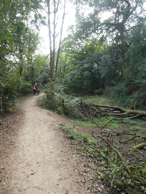
The woodland is predominantly composed of native tree species, including oak, beech, and birch, which create a diverse and vibrant ecosystem. These trees provide a habitat for a wide variety of wildlife, such as birds, squirrels, and deer, making it an ideal destination for birdwatchers and animal lovers.

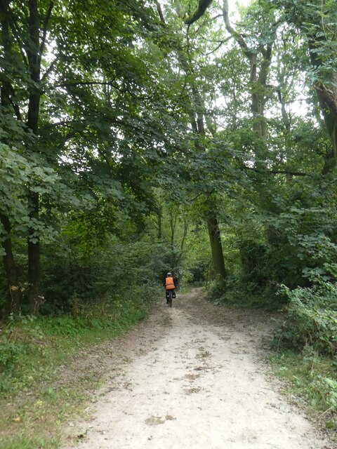
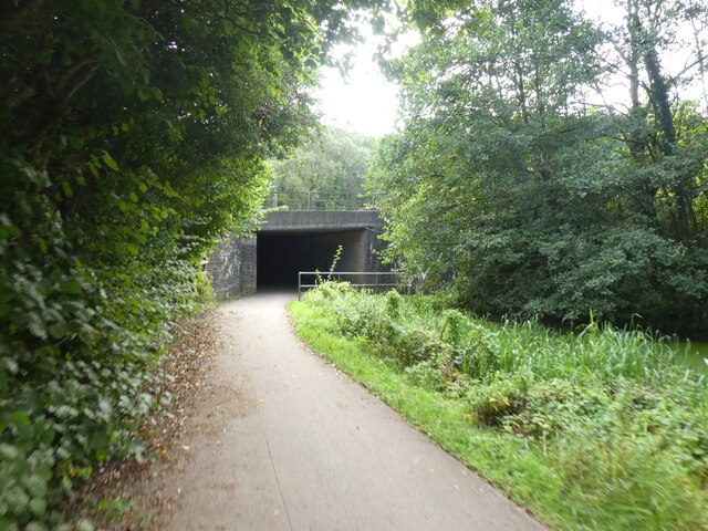
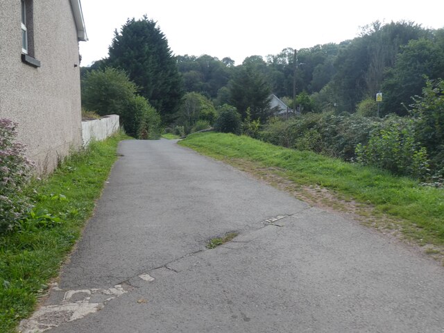
Coed Kemeys offers a network of well-maintained walking trails, allowing visitors to explore the forest and enjoy its beauty at their own pace. The paths wind through the forest, providing glimpses of sunlight filtering through the canopy and highlighting the natural beauty of the surroundings. There are also picnic areas and benches dotted throughout the woodland, inviting visitors to relax and soak in the peaceful atmosphere.

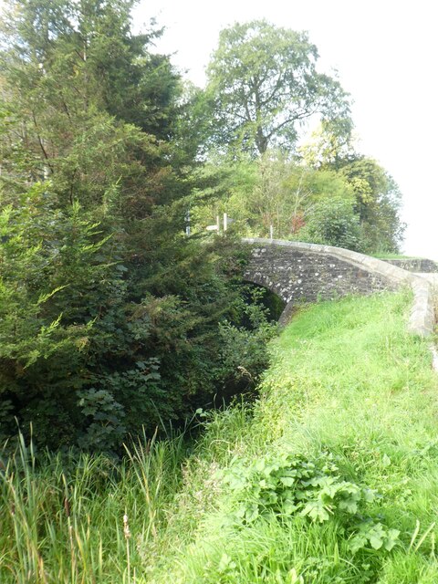
In addition to its natural charm, Coed Kemeys has historical significance. The woodland was once part of the estate of Kemeys House, a grand mansion that stood nearby. Although the house no longer exists, remnants of its past can be found in the form of old stone walls and structures within the forest, adding an element of intrigue and nostalgia to the area.

Coed Kemeys is a hidden gem in Monmouthshire, offering a serene and idyllic setting for those seeking a peaceful escape into nature. With its rich biodiversity, well-maintained trails, and historical significance, this woodland is a must-visit destination for anyone looking to reconnect with the natural world.

If you have any feedback on the listing, please let us know in the comments section below.
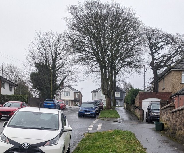
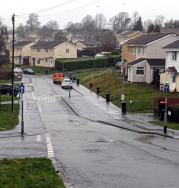
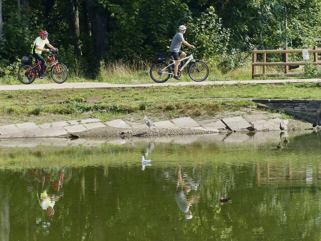
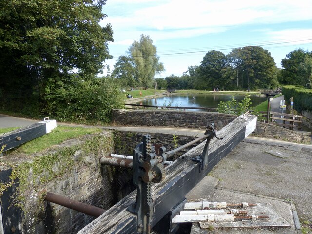
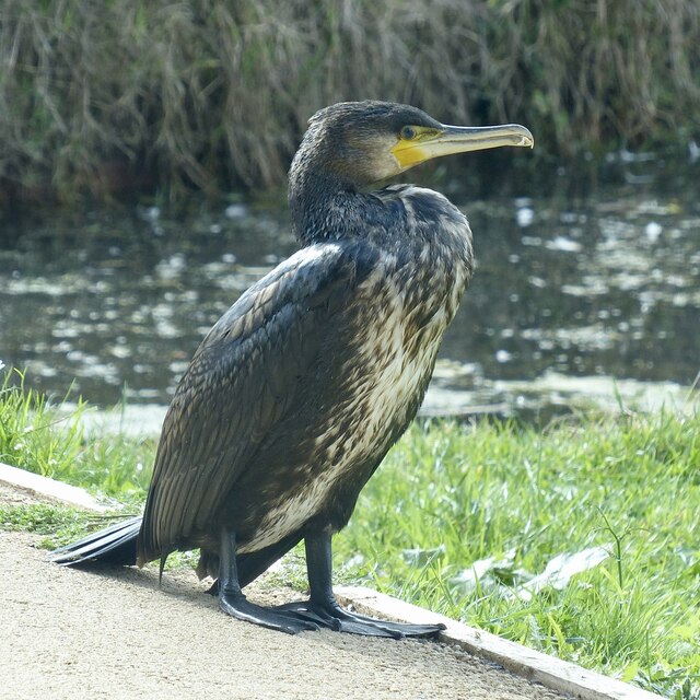
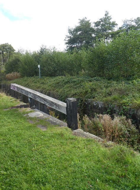
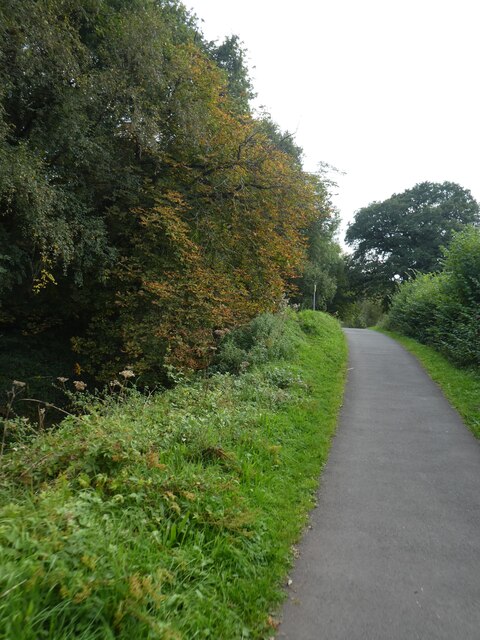
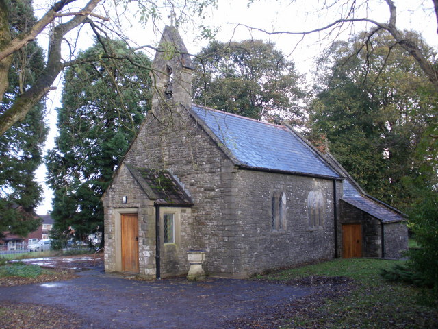
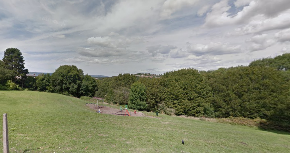
Coed Kemeys Images

Images are sourced within 2km of 51.604117/-3.0226265 or Grid Reference ST2989. Thanks to Geograph Open Source API. All images are credited.

Deciduous trees in winter, Westfield Drive, Malpas, Newport Looking up Westfield Drive towards Malpas Road in January 2024.
The broken white lines are at the Westfield Avenue junction.
Deciduous trees in winter, Westfield Drive, Malpas, Newport
Looking up Westfield Drive towards Malpas Road in January 2024. The broken white lines are at the Westfield Avenue junction.
Narrow part of Westfield Drive, Malpas, Newport Most of Westfield Drive is two-way. The narrow section ahead, between 
Westfield Way and Huxley Green is one-way (direction away from the camera).
A red-edged triangular sign indicating two-way traffic is in the background.
Narrow part of Westfield Drive, Malpas, Newport
Most of Westfield Drive is two-way. The narrow section ahead, between Westfield Way and Huxley Green is one-way (direction away from the camera). A red-edged triangular sign indicating two-way traffic is in the background.
Fourteen Locks Visitor Centre, Newport Looking over the canal pound from the small shop in the visitor centre.
Fourteen Locks Visitor Centre, Newport
Looking over the canal pound from the small shop in the visitor centre.
Warning, Blue Algae, Fourteen Locks, Newport There have been several reports of blue algae on lakes and canals in the local area this summer.
The notice says:
No animals to be allowed in the water
Avoid contact with skin
No fishing
No swimming or paddling
Warning, Blue Algae, Fourteen Locks, Newport
There have been several reports of blue algae on lakes and canals in the local area this summer. The notice says: No animals to be allowed in the water Avoid contact with skin No fishing No swimming or paddling
Cyclists, heron and reflections, Fourteen Locks, Newport Viewed across the canal pound.
Cyclists, heron and reflections, Fourteen Locks, Newport
Viewed across the canal pound.
Lock and bridge, Fourteen Locks, Newport This is lock 21 on the Crumlin Branch of the Monmouthshire and Brecon Canal.
Behind is Pensarn Bridge (No 6) which is a minor road. Beyond that, a footbridge crosses the canal as it enters the pound by Fourteen Locks Visitor Centre.
The canal itself continues between the trees on the far right, descending a hill via a number of locks.
The Sirhowy Valley Walk long distance path and Cycle Route 47 are on the right hand side of the pound.
Lock and bridge, Fourteen Locks, Newport
This is lock 21 on the Crumlin Branch of the Monmouthshire and Brecon Canal. Behind is Pensarn Bridge (No 6) which is a minor road. Beyond that, a footbridge crosses the canal as it enters the pound by Fourteen Locks Visitor Centre. The canal itself continues between the trees on the far right, descending a hill via a number of locks. The Sirhowy Valley Walk long distance path and Cycle Route 47 are on the right hand side of the pound.
An obliging cormorant, Fourteen Locks, Newport At the edge of the canal pound by the visitor centre.
This cormorant was oblivious to passers by, enabling me to approach to within a few feet to get several pictures.
Two years earlier, a heron was similarly approachable at the same spot <a title="https://www.geograph.org.uk/photo/5787658" href="https://www.geograph.org.uk/photo/5787658">Link</a> .
An obliging cormorant, Fourteen Locks, Newport
At the edge of the canal pound by the visitor centre. This cormorant was oblivious to passers by, enabling me to approach to within a few feet to get several pictures. Two years earlier, a heron was similarly approachable at the same spot Link .
Cycle route beside the Fourteen Locks
Cycle path in woodland by Fourteen Locks
Cycle route at foot of Fourteen Locks, with underpass beneath M4 The M4 is 190 miles long and runs from London to South Wales. Major centres close to the motorway include Reading, Swindon, Bristol, Newport, Cardiff and Swansea. The motorway was constructed between 1961 and 1996. The M4 originally crossed the first Severn Road Bridge. It has now been diverted to use the Second Severn Crossing and the motorway over the older bridge has been renumbered as M48.
Wikipedia: <span class="nowrap"><a title="http://en.wikipedia.org/wiki/M4_motorway" rel="nofollow ugc noopener" href="http://en.wikipedia.org/wiki/M4_motorway">Link</a><img style="margin-left:2px;" alt="External link" title="External link - shift click to open in new window" src="https://s1.geograph.org.uk/img/external.png" width="10" height="10"/></span>
Cycle route at foot of Fourteen Locks, with underpass beneath M4
The M4 is 190 miles long and runs from London to South Wales. Major centres close to the motorway include Reading, Swindon, Bristol, Newport, Cardiff and Swansea. The motorway was constructed between 1961 and 1996. The M4 originally crossed the first Severn Road Bridge. It has now been diverted to use the Second Severn Crossing and the motorway over the older bridge has been renumbered as M48. Wikipedia: LinkExternal link
Cycle route by Monmouthshire and Brecon Canal north of Allt-yr-yn
Bridge over the overgrown Monmouthshire and Brecon Canal The Monmouthshire and Brecon Canal (popularly referred to as the Mon & Brec) was originally two separate canals: the Brecknock & Abergavenny Canal, and the Monmouthshire Canal. The 35-mile navigable section seen today is mostly the former. Following discussions in the 1790s, it was decided to link the two canals at Pontymoile. The Monmouthshire Canal, including a branch from Malpas to Crumlin, was opened in 1799 with the Brecknock & Abergavenny extending from Brecon to Gilwern by 1800, finally reaching Pontymoile by 1812.

Though originally constructed to transport coal, lime and agricultural products the canal was used extensively by ironmasters and industrialists as their main transport network, bringing the raw iron ore up the canal from Newport to Llanfoist Wharf and thence by tramroads to the iron works and returning with trams loaded with iron, the finished product. 

In 1880 the Monmouthshire & Brecon Canals were taken over by the Great Western Railway. Within 35 years, commercial carrying had all but ceased. Throughout the 20th century various parts of the Monmouthshire Canal were filled in for road construction. Both canals were abandoned by the early 1960s but restoration work from Brecon to Pontymoile began in 1968 following vigorous campaigning by canal enthusiasts. Recent developments have included a complete regeneration of the terminus at Brecon, and various works continue to reclaim the navigation between Pontymoile and Newport. The Blaenavon area and a section of the canal were granted World Heritage status in 2000 in recognition of its historical significance. 
<span class="nowrap"><a title="https://canalrivertrust.org.uk/enjoy-the-waterways/canal-and-river-network/monmouthshire-and-brecon-canal" rel="nofollow ugc noopener" href="https://canalrivertrust.org.uk/enjoy-the-waterways/canal-and-river-network/monmouthshire-and-brecon-canal">Link</a><img style="margin-left:2px;" alt="External link" title="External link - shift click to open in new window" src="https://s1.geograph.org.uk/img/external.png" width="10" height="10"/></span>  Canal and River Trust
Bridge over the overgrown Monmouthshire and Brecon Canal
The Monmouthshire and Brecon Canal (popularly referred to as the Mon & Brec) was originally two separate canals: the Brecknock & Abergavenny Canal, and the Monmouthshire Canal. The 35-mile navigable section seen today is mostly the former. Following discussions in the 1790s, it was decided to link the two canals at Pontymoile. The Monmouthshire Canal, including a branch from Malpas to Crumlin, was opened in 1799 with the Brecknock & Abergavenny extending from Brecon to Gilwern by 1800, finally reaching Pontymoile by 1812. Though originally constructed to transport coal, lime and agricultural products the canal was used extensively by ironmasters and industrialists as their main transport network, bringing the raw iron ore up the canal from Newport to Llanfoist Wharf and thence by tramroads to the iron works and returning with trams loaded with iron, the finished product. In 1880 the Monmouthshire & Brecon Canals were taken over by the Great Western Railway. Within 35 years, commercial carrying had all but ceased. Throughout the 20th century various parts of the Monmouthshire Canal were filled in for road construction. Both canals were abandoned by the early 1960s but restoration work from Brecon to Pontymoile began in 1968 following vigorous campaigning by canal enthusiasts. Recent developments have included a complete regeneration of the terminus at Brecon, and various works continue to reclaim the navigation between Pontymoile and Newport. The Blaenavon area and a section of the canal were granted World Heritage status in 2000 in recognition of its historical significance. LinkExternal link Canal and River Trust
Old lock on Monmouthshire and Brecon Canal The Monmouthshire and Brecon Canal (popularly referred to as the Mon & Brec) was originally two separate canals: the Brecknock & Abergavenny Canal, and the Monmouthshire Canal. The 35-mile navigable section seen today is mostly the former. Following discussions in the 1790s, it was decided to link the two canals at Pontymoile. The Monmouthshire Canal, including a branch from Malpas to Crumlin, was opened in 1799 with the Brecknock & Abergavenny extending from Brecon to Gilwern by 1800, finally reaching Pontymoile by 1812.

Though originally constructed to transport coal, lime and agricultural products the canal was used extensively by ironmasters and industrialists as their main transport network, bringing the raw iron ore up the canal from Newport to Llanfoist Wharf and thence by tramroads to the iron works and returning with trams loaded with iron, the finished product. 

In 1880 the Monmouthshire & Brecon Canals were taken over by the Great Western Railway. Within 35 years, commercial carrying had all but ceased. Throughout the 20th century various parts of the Monmouthshire Canal were filled in for road construction. Both canals were abandoned by the early 1960s but restoration work from Brecon to Pontymoile began in 1968 following vigorous campaigning by canal enthusiasts. Recent developments have included a complete regeneration of the terminus at Brecon, and various works continue to reclaim the navigation between Pontymoile and Newport. The Blaenavon area and a section of the canal were granted World Heritage status in 2000 in recognition of its historical significance. 
<span class="nowrap"><a title="https://canalrivertrust.org.uk/enjoy-the-waterways/canal-and-river-network/monmouthshire-and-brecon-canal" rel="nofollow ugc noopener" href="https://canalrivertrust.org.uk/enjoy-the-waterways/canal-and-river-network/monmouthshire-and-brecon-canal">Link</a><img style="margin-left:2px;" alt="External link" title="External link - shift click to open in new window" src="https://s1.geograph.org.uk/img/external.png" width="10" height="10"/></span>  Canal and River Trust
Old lock on Monmouthshire and Brecon Canal
The Monmouthshire and Brecon Canal (popularly referred to as the Mon & Brec) was originally two separate canals: the Brecknock & Abergavenny Canal, and the Monmouthshire Canal. The 35-mile navigable section seen today is mostly the former. Following discussions in the 1790s, it was decided to link the two canals at Pontymoile. The Monmouthshire Canal, including a branch from Malpas to Crumlin, was opened in 1799 with the Brecknock & Abergavenny extending from Brecon to Gilwern by 1800, finally reaching Pontymoile by 1812. Though originally constructed to transport coal, lime and agricultural products the canal was used extensively by ironmasters and industrialists as their main transport network, bringing the raw iron ore up the canal from Newport to Llanfoist Wharf and thence by tramroads to the iron works and returning with trams loaded with iron, the finished product. In 1880 the Monmouthshire & Brecon Canals were taken over by the Great Western Railway. Within 35 years, commercial carrying had all but ceased. Throughout the 20th century various parts of the Monmouthshire Canal were filled in for road construction. Both canals were abandoned by the early 1960s but restoration work from Brecon to Pontymoile began in 1968 following vigorous campaigning by canal enthusiasts. Recent developments have included a complete regeneration of the terminus at Brecon, and various works continue to reclaim the navigation between Pontymoile and Newport. The Blaenavon area and a section of the canal were granted World Heritage status in 2000 in recognition of its historical significance. LinkExternal link Canal and River Trust
Lock on Monmouthshire and Brecon Canal near Cefn The Monmouthshire and Brecon Canal (popularly referred to as the Mon & Brec) was originally two separate canals: the Brecknock & Abergavenny Canal, and the Monmouthshire Canal. The 35-mile navigable section seen today is mostly the former. Following discussions in the 1790s, it was decided to link the two canals at Pontymoile. The Monmouthshire Canal, including a branch from Malpas to Crumlin, was opened in 1799 with the Brecknock & Abergavenny extending from Brecon to Gilwern by 1800, finally reaching Pontymoile by 1812.

Though originally constructed to transport coal, lime and agricultural products the canal was used extensively by ironmasters and industrialists as their main transport network, bringing the raw iron ore up the canal from Newport to Llanfoist Wharf and thence by tramroads to the iron works and returning with trams loaded with iron, the finished product. 

In 1880 the Monmouthshire & Brecon Canals were taken over by the Great Western Railway. Within 35 years, commercial carrying had all but ceased. Throughout the 20th century various parts of the Monmouthshire Canal were filled in for road construction. Both canals were abandoned by the early 1960s but restoration work from Brecon to Pontymoile began in 1968 following vigorous campaigning by canal enthusiasts. Recent developments have included a complete regeneration of the terminus at Brecon, and various works continue to reclaim the navigation between Pontymoile and Newport. The Blaenavon area and a section of the canal were granted World Heritage status in 2000 in recognition of its historical significance. 
<span class="nowrap"><a title="https://canalrivertrust.org.uk/enjoy-the-waterways/canal-and-river-network/monmouthshire-and-brecon-canal" rel="nofollow ugc noopener" href="https://canalrivertrust.org.uk/enjoy-the-waterways/canal-and-river-network/monmouthshire-and-brecon-canal">Link</a><img style="margin-left:2px;" alt="External link" title="External link - shift click to open in new window" src="https://s1.geograph.org.uk/img/external.png" width="10" height="10"/></span>  Canal and River Trust
Lock on Monmouthshire and Brecon Canal near Cefn
The Monmouthshire and Brecon Canal (popularly referred to as the Mon & Brec) was originally two separate canals: the Brecknock & Abergavenny Canal, and the Monmouthshire Canal. The 35-mile navigable section seen today is mostly the former. Following discussions in the 1790s, it was decided to link the two canals at Pontymoile. The Monmouthshire Canal, including a branch from Malpas to Crumlin, was opened in 1799 with the Brecknock & Abergavenny extending from Brecon to Gilwern by 1800, finally reaching Pontymoile by 1812. Though originally constructed to transport coal, lime and agricultural products the canal was used extensively by ironmasters and industrialists as their main transport network, bringing the raw iron ore up the canal from Newport to Llanfoist Wharf and thence by tramroads to the iron works and returning with trams loaded with iron, the finished product. In 1880 the Monmouthshire & Brecon Canals were taken over by the Great Western Railway. Within 35 years, commercial carrying had all but ceased. Throughout the 20th century various parts of the Monmouthshire Canal were filled in for road construction. Both canals were abandoned by the early 1960s but restoration work from Brecon to Pontymoile began in 1968 following vigorous campaigning by canal enthusiasts. Recent developments have included a complete regeneration of the terminus at Brecon, and various works continue to reclaim the navigation between Pontymoile and Newport. The Blaenavon area and a section of the canal were granted World Heritage status in 2000 in recognition of its historical significance. LinkExternal link Canal and River Trust
Fourteen Locks Canal Centre This is situated on Crumlin branch of the Monmouthshire and Brecon Canal on the outskirts of Newport.
The fourteen locks are part of the Cefn flight that dates from 1799 and is located to the north of the M4 motorway. These locks are numbers 8 to 21 on the Crumlin Branch.
There is a visitor centre and car park adjacent to a large canal pound with a slipway.
The four locks, numbers 17 to 20, just below the pound were restored in 2010/11.
Fourteen Locks Canal Centre
This is situated on Crumlin branch of the Monmouthshire and Brecon Canal on the outskirts of Newport. The fourteen locks are part of the Cefn flight that dates from 1799 and is located to the north of the M4 motorway. These locks are numbers 8 to 21 on the Crumlin Branch. There is a visitor centre and car park adjacent to a large canal pound with a slipway. The four locks, numbers 17 to 20, just below the pound were restored in 2010/11.
Shared path by lock at the top of Fourteen Locks This is situated on Crumlin branch of the Monmouthshire and Brecon Canal on the outskirts of Newport.
The fourteen locks are part of the Cefn flight that dates from 1799 and is located to the north of the M4 motorway. These locks are numbers 8 to 21 on the Crumlin Branch.
There is a visitor centre and car park adjacent to a large canal pound with a slipway.
The four locks, numbers 17 to 20, just below the pound were restored in 2010/11.
Shared path by lock at the top of Fourteen Locks
This is situated on Crumlin branch of the Monmouthshire and Brecon Canal on the outskirts of Newport. The fourteen locks are part of the Cefn flight that dates from 1799 and is located to the north of the M4 motorway. These locks are numbers 8 to 21 on the Crumlin Branch. There is a visitor centre and car park adjacent to a large canal pound with a slipway. The four locks, numbers 17 to 20, just below the pound were restored in 2010/11.
Trees overhanging the canal by NCN49 The Monmouthshire and Brecon Canal (popularly referred to as the Mon & Brec) was originally two separate canals: the Brecknock & Abergavenny Canal, and the Monmouthshire Canal. The 35-mile navigable section seen today is mostly the former. Following discussions in the 1790s, it was decided to link the two canals at Pontymoile. The Monmouthshire Canal, including a branch from Malpas to Crumlin, was opened in 1799 with the Brecknock & Abergavenny extending from Brecon to Gilwern by 1800, finally reaching Pontymoile by 1812.

Though originally constructed to transport coal, lime and agricultural products the canal was used extensively by ironmasters and industrialists as their main transport network, bringing the raw iron ore up the canal from Newport to Llanfoist Wharf and thence by tramroads to the iron works and returning with trams loaded with iron, the finished product. 

In 1880 the Monmouthshire & Brecon Canals were taken over by the Great Western Railway. Within 35 years, commercial carrying had all but ceased. Throughout the 20th century various parts of the Monmouthshire Canal were filled in for road construction. Both canals were abandoned by the early 1960s but restoration work from Brecon to Pontymoile began in 1968 following vigorous campaigning by canal enthusiasts. Recent developments have included a complete regeneration of the terminus at Brecon, and various works continue to reclaim the navigation between Pontymoile and Newport. The Blaenavon area and a section of the canal were granted World Heritage status in 2000 in recognition of its historical significance. 
<span class="nowrap"><a title="https://canalrivertrust.org.uk/enjoy-the-waterways/canal-and-river-network/monmouthshire-and-brecon-canal" rel="nofollow ugc noopener" href="https://canalrivertrust.org.uk/enjoy-the-waterways/canal-and-river-network/monmouthshire-and-brecon-canal">Link</a><img style="margin-left:2px;" alt="External link" title="External link - shift click to open in new window" src="https://s1.geograph.org.uk/img/external.png" width="10" height="10"/></span>  Canal and River Trust
Trees overhanging the canal by NCN49
The Monmouthshire and Brecon Canal (popularly referred to as the Mon & Brec) was originally two separate canals: the Brecknock & Abergavenny Canal, and the Monmouthshire Canal. The 35-mile navigable section seen today is mostly the former. Following discussions in the 1790s, it was decided to link the two canals at Pontymoile. The Monmouthshire Canal, including a branch from Malpas to Crumlin, was opened in 1799 with the Brecknock & Abergavenny extending from Brecon to Gilwern by 1800, finally reaching Pontymoile by 1812. Though originally constructed to transport coal, lime and agricultural products the canal was used extensively by ironmasters and industrialists as their main transport network, bringing the raw iron ore up the canal from Newport to Llanfoist Wharf and thence by tramroads to the iron works and returning with trams loaded with iron, the finished product. In 1880 the Monmouthshire & Brecon Canals were taken over by the Great Western Railway. Within 35 years, commercial carrying had all but ceased. Throughout the 20th century various parts of the Monmouthshire Canal were filled in for road construction. Both canals were abandoned by the early 1960s but restoration work from Brecon to Pontymoile began in 1968 following vigorous campaigning by canal enthusiasts. Recent developments have included a complete regeneration of the terminus at Brecon, and various works continue to reclaim the navigation between Pontymoile and Newport. The Blaenavon area and a section of the canal were granted World Heritage status in 2000 in recognition of its historical significance. LinkExternal link Canal and River Trust
A good vantage point, Fourteen Locks, Newport  A heron perched on the bronze dragonfly sculpture in the centre of the canal pound near to the visitor centre.
A good vantage point, Fourteen Locks, Newport
A heron perched on the bronze dragonfly sculpture in the centre of the canal pound near to the visitor centre.
Show me another place!

Coed Kemeys is located at Grid Ref: ST2989 (Lat: 51.604117, Lng: -3.0226265)

Unitary Authority: Newport

Police Authority: Gwent

What 3 Words

///bared.simple.speech. Near Newport

Related Wikis

Newport High School (Wales)

Newport High School (Welsh: Ysgol Uwchradd Casnewydd) is a co-educational secondary school in the Bettws district of the city of Newport, South Wales,...

Bettws, Newport

Bettws (Welsh: Betws) is a large modern housing estate, electoral ward and coterminous community (parish) of the city of Newport, South Wales. == Etymology... ==

Raglan Barracks, Newport

Raglan Barracks is a military installation at Barrack Hill in Allt-yr-yn in Newport, Wales. == History == The barracks were built as a cavalry barracks...

Malpas, Newport

Malpas is an electoral district (ward) and coterminous community (parish) of the city of Newport, South Wales. The area is governed by the Newport City...

Barrack Hill

Barrack Hill is an area in Newport, Wales, in the suburb and electoral ward and coterminous community parish of Allt-yr-yn. It is most well known for...

Allt-yr-yn

Allt-yr-yn (Welsh: Allt-yr-ynn) is a suburb of the city of Newport, south-east Wales. == Name == Pronounced by English-speaking locals as "Olt-er-reen...

Shaftesbury, Newport

Shaftesbury is a community (civil parish) and coterminous electoral district (ward) of the city of Newport, South Wales. The community is bounded by the...

Brynglas

Brynglas is an area of the city of Newport, South Wales, United Kingdom. == Location == Brynglas is situated above the M4 motorway in Newport and famous...

Nearby Amenities

Located within 500m of 51.604117,-3.0226265
Turning Circle
Lat/Long: 51.6070832/-3.0256566
Turning Circle
Lat/Long: 51.6076832/-3.0204058
Turning Circle
Lat/Long: 51.6077191/-3.023912
Turning Circle
Lat/Long: 51.6072537/-3.0274247
Place Of Worship
St David
Addr City: Newport
Addr Postcode: NP20 7RS
Addr Street: Bettws Hill
Denomination: church_in_wales
Religion: christian
Website: https://www.churchinwales.org.uk/en/structure/church/4695/
Lat/Long: 51.6069973/-3.0270236
Traffic Calming: choker
Lat/Long: 51.6071771/-3.0174347
Barrier: bollard
Lat/Long: 51.6075944/-3.0182413
Direction: 190
Generator Method: photovoltaic
Generator Output Electricity: yes
Generator Solar Modules: 6
Generator Source: solar
Generator Type: solar_photovoltaic_panel
Location: roof
Power: generator
Lat/Long: 51.6081672/-3.0218826
Direction: S
Generator Method: photovoltaic
Generator Output Electricity: yes
Generator Solar Modules: 10
Generator Source: solar
Generator Type: solar_photovoltaic_panel
Location: roof
Power: generator
Lat/Long: 51.6077753/-3.0253769
Direction: S
Generator Method: photovoltaic
Generator Output Electricity: yes
Generator Solar Modules: 10
Generator Source: solar
Generator Type: solar_photovoltaic_panel
Location: roof
Power: generator
Lat/Long: 51.6053312/-3.0178526
Direction: ESE
Generator Method: photovoltaic
Generator Output Electricity: yes
Generator Solar Modules: 12
Generator Source: solar
Generator Type: solar_photovoltaic_panel
Location: roof
Power: generator
Lat/Long: 51.6072652/-3.0218518
Direction: SSW
Generator Method: photovoltaic
Generator Output Electricity: yes
Generator Solar Modules: 8
Generator Source: solar
Generator Type: solar_photovoltaic_panel
Location: roof
Power: generator
Lat/Long: 51.608318/-3.0204543
Direction: SSW
Generator Method: photovoltaic
Generator Output Electricity: yes
Generator Solar Modules: 16
Generator Source: solar
Generator Type: solar_photovoltaic_panel
Location: roof
Power: generator
Lat/Long: 51.6079715/-3.0229595
Direction: SSW
Generator Method: photovoltaic
Generator Output Electricity: yes
Generator Solar Modules: 15
Generator Source: solar
Generator Type: solar_photovoltaic_panel
Location: roof
Power: generator
Lat/Long: 51.6079432/-3.0222635
Direction: SSW
Generator Method: photovoltaic
Generator Output Electricity: yes
Generator Solar Modules: 12
Generator Source: solar
Generator Type: solar_photovoltaic_panel
Location: roof
Power: generator
Lat/Long: 51.6078366/-3.0215675
Direction: SSW
Generator Method: photovoltaic
Generator Output Electricity: yes
Generator Solar Modules: 12
Generator Source: solar
Generator Type: solar_photovoltaic_panel
Location: roof
Power: generator
Lat/Long: 51.6078549/-3.021656
Direction: SSW
Generator Method: photovoltaic
Generator Output Electricity: yes
Generator Solar Modules: 12
Generator Source: solar
Generator Type: solar_photovoltaic_panel
Location: roof
Power: generator
Lat/Long: 51.6078774/-3.0217364
Direction: SSW
Generator Method: photovoltaic
Generator Output Electricity: yes
Generator Solar Modules: 12
Generator Source: solar
Generator Type: solar_photovoltaic_panel
Location: roof
Power: generator
Lat/Long: 51.6079015/-3.0218062
Direction: 190
Generator Method: photovoltaic
Generator Output Electricity: yes
Generator Solar Modules: 10
Generator Source: solar
Generator Type: solar_photovoltaic_panel
Location: roof
Power: generator
Lat/Long: 51.6082097/-3.0218411
Direction: 170
Generator Method: photovoltaic
Generator Output Electricity: yes
Generator Solar Modules: 10
Generator Source: solar
Generator Type: solar_photovoltaic_panel
Location: roof
Power: generator
Lat/Long: 51.6084246/-3.0228549
The data included in this document is from www.openstreetmap.org. The data is made available under ODbL.

Have you been to Coed Kemeys?

Leave your review of Coed Kemeys below (or comments, questions and feedback).