Whitepole Pool Plantation

Wood, Forest in Radnorshire

Wales

Whitepole Pool Plantation

Rhos-y-meirch One of several narrow lanes in the hills south of Knighton. Most of the farmland is grassland, no hay or silage had yet been cut due to high rainfall.
Rhos-y-meirch Credit: Richard Webb

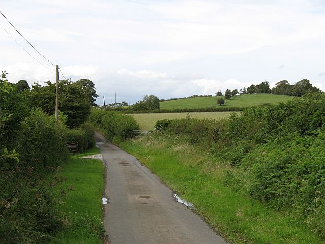
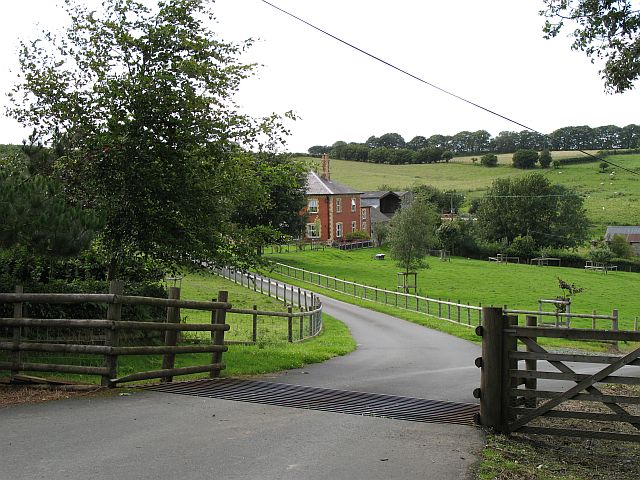
Whitepole Pool Plantation is a picturesque wooded area located in Radnorshire, a county in Wales, United Kingdom. Situated near the village of Wood, this plantation covers a vast area, primarily consisting of tall, dense trees and a serene pool at its center.

The plantation is known for its diverse range of tree species, including oak, beech, birch, and pine, which create a lush and vibrant canopy overhead. The trees provide a haven for a variety of wildlife, such as birds, squirrels, and deer, making it a popular spot for nature enthusiasts and birdwatchers.

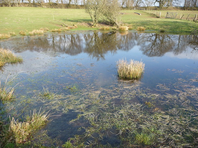
Whitepole Pool, nestled within the plantation, adds to its charm. The pool is a tranquil water body, reflecting the beauty of the surrounding trees and creating a peaceful atmosphere. It serves as a watering hole for wildlife in the area, attracting a variety of waterfowl and other aquatic creatures.

The plantation offers several walking trails, allowing visitors to explore the woodland and enjoy the natural beauty of the area. These trails meander through the trees, offering glimpses of the pool from different angles and providing opportunities to spot wildlife along the way.

Whitepole Pool Plantation is a cherished recreational spot for locals and tourists alike, offering a peaceful escape from the bustling city life. Its natural beauty, diverse flora and fauna, and the serenity of the pool make it an ideal destination for those seeking tranquility and a connection with nature in Radnorshire.

If you have any feedback on the listing, please let us know in the comments section below.

Whitepole Pool Plantation Images

Images are sourced within 2km of 52.314768/-3.0477915 or Grid Reference SO2869. Thanks to Geograph Open Source API. All images are credited.

Rhos-y-meirch One of several narrow lanes in the hills south of Knighton. Most of the farmland is grassland, no hay or silage had yet been cut due to high rainfall.
Rhos-y-meirch
One of several narrow lanes in the hills south of Knighton. Most of the farmland is grassland, no hay or silage had yet been cut due to high rainfall.
Jenkin Allis Newly laid out parkland in front of the house.
Jenkin Allis
Newly laid out parkland in front of the house.
Last section of the day Northbound walkers on Offa's Dyke Path have this section of the dyke to follow before the descent into Knighton.  The dyke, following the line of trees, is mostly in the next square east, but the fields are all in this square.
Last section of the day
Northbound walkers on Offa's Dyke Path have this section of the dyke to follow before the descent into Knighton. The dyke, following the line of trees, is mostly in the next square east, but the fields are all in this square.
Junction on Meeting House Lane
Meeting House Farm, Meeting House Lane Beyond the farm, Meeting House Lane becomes an un-made track before eventually running into Farrington Lane.
Meeting House Farm, Meeting House Lane
Beyond the farm, Meeting House Lane becomes an un-made track before eventually running into Farrington Lane.
Offa's Dyke Path south of Knighton The trail heading north towards the hill on Ffridd, before dropping down to Knighton.  The line of trees conceals a very deep section of ancient earthwork.
Offa's Dyke Path south of Knighton
The trail heading north towards the hill on Ffridd, before dropping down to Knighton. The line of trees conceals a very deep section of ancient earthwork.
Offa's Dyke on Ffridd Hawthorn grows on the ancient earthwork, with the National Trail running beside it, in parallel fashion.
Offa's Dyke on Ffridd
Hawthorn grows on the ancient earthwork, with the National Trail running beside it, in parallel fashion.
Enclosure in fields north of Rhos-y-meirch Is this a reservoir?
Enclosure in fields north of Rhos-y-meirch
Is this a reservoir?
Fields flanked by Offa's Dyke Looking south over country traversed by the Offa's Dyke Path
Fields flanked by Offa's Dyke
Looking south over country traversed by the Offa's Dyke Path
Rough ground near Rhos-y-meirch
Straight to Knighton The direct route from Rhos-y-Meirch to Garth and local metropolis of Knighton.
Straight to Knighton
The direct route from Rhos-y-Meirch to Garth and local metropolis of Knighton.
Grove Farm pasture Field at the side of the access track to Grove Farm, on the outskirts of Knighton.
Grove Farm pasture
Field at the side of the access track to Grove Farm, on the outskirts of Knighton.
Slow down for Knighton The B4355 approaches Knighton's built-up area.  Countdown markers are installed to warn drivers of the drop from 60mph to 30mph permissible speed.
Slow down for Knighton
The B4355 approaches Knighton's built-up area. Countdown markers are installed to warn drivers of the drop from 60mph to 30mph permissible speed.
Grazing land at Grove Farm Sheep grazing land south of Grove Farm, near Knighton.
Grazing land at Grove Farm
Sheep grazing land south of Grove Farm, near Knighton.
Access to Bowdler Farm
Field at Bowdler Farm
Offa's Dyke on Ffridd Hill near Knighton This is a well demarcated and striking section of the mighty earthwork, here bisected by the modern Offa's Dyke Path which switches sides at this juncture.
Offa's Dyke on Ffridd Hill near Knighton
This is a well demarcated and striking section of the mighty earthwork, here bisected by the modern Offa's Dyke Path which switches sides at this juncture.
Pond in a field beside Offa's Dyke Path This pond has the first frog spawn of the year that I have seen so far, another sure sign of Spring, hurrah! A Heron was hunting here but I disturbed him, I wonder if he got any of the frogs, who usually wait near their spawn?
Pond in a field beside Offa's Dyke Path
This pond has the first frog spawn of the year that I have seen so far, another sure sign of Spring, hurrah! A Heron was hunting here but I disturbed him, I wonder if he got any of the frogs, who usually wait near their spawn?
Show me another place!

Whitepole Pool Plantation is located at Grid Ref: SO2869 (Lat: 52.314768, Lng: -3.0477915)

Unitary Authority: Powys

Police Authority: Dyfed Powys

What 3 Words

///breathing.energetic.showcases. Near Whitton, Powys

Nearby Locations

Whitepole Pool Plantation

Related Wikis

St Andrew's Church, Presteigne

St Andrew's Church is a Church of England parish church in Presteigne, Powys, Wales. It was first constructed in the 9th century by the Anglo-Saxons and...

Norton, Powys

Norton is a village in Powys within the historic boundaries of Radnorshire, Wales. In 1086, Norton was recorded as a settlement within the hundred of Leintwardine...

Pilleth

Pilleth is a small village south of Knighton in Powys, Wales in the traditional county of Radnorshire. It is the site of the ancient church and holy well...

Knighton Hospital

Knighton Hospital (Welsh: Ysbyty Trefyclo) is a health facility in Ffrydd Road, Knighton, Powys, Wales. It is managed by the Powys Teaching Health Board...

Nearby Amenities

Located within 500m of 52.314768,-3.0477915
Barrier: stile
Lat/Long: 52.3108453/-3.0511247
Barrier: stile
Lat/Long: 52.3134049/-3.0539978
Barrier: stile
Lat/Long: 52.3151864/-3.0543289
Barrier: stile
Lat/Long: 52.3158712/-3.0544078
Barrier: stile
Lat/Long: 52.313258/-3.0539894
Bicycle: yes
Lat/Long: 52.3184218/-3.0484585
Bicycle: yes
Lat/Long: 52.3169544/-3.0446107
Bicycle: yes
Lat/Long: 52.3173074/-3.0455988
Bicycle: yes
Lat/Long: 52.3171587/-3.0451213
Bicycle: yes
Lat/Long: 52.3170332/-3.0448477
Leisure: picnic_table
Source: survey
Lat/Long: 52.310927/-3.0512918
Monument to Sir Richard Green Price
Inscription: This public monument was erected by subscription to perpetuate the memory of Sir Richard Green Price 1st baronet born 1803 - died 1887 whose services to the county of Radnor will long outlive his name.
Man Made: obelisk
Material: stone
Lat/Long: 52.3114986/-3.0502674
The data included in this document is from www.openstreetmap.org. The data is made available under ODbL.

Have you been to Whitepole Pool Plantation?

Leave your review of Whitepole Pool Plantation below (or comments, questions and feedback).