Caereithin

Settlement in Glamorgan

Wales

Caereithin

Rivet: Swansea,  1230 Carmarthen Road Cut mark and rivet benchmark at 1230 Carmarthen Road window sill.
Rivet: Swansea, 1230 Carmarthen Road Credit: John Jenkins

Caereithin is a small neighborhood located in the county of Glamorgan, Wales. Situated in the western part of Swansea, it is a residential area that offers a peaceful and picturesque setting for its residents. The neighborhood is well-known for its friendly community and welcoming atmosphere.

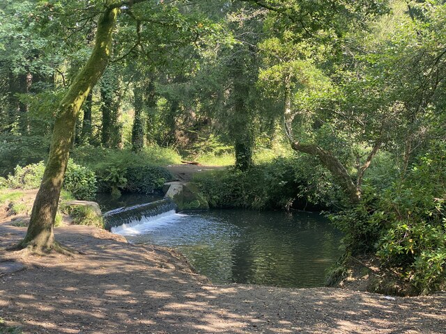
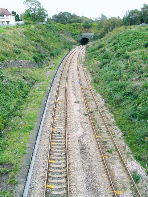
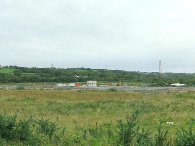
Caereithin is surrounded by stunning natural landscapes, with beautiful green spaces and parks that provide recreational opportunities for locals and visitors alike. The area is also close to the coast, offering residents the chance to enjoy the nearby beach and coastal activities.

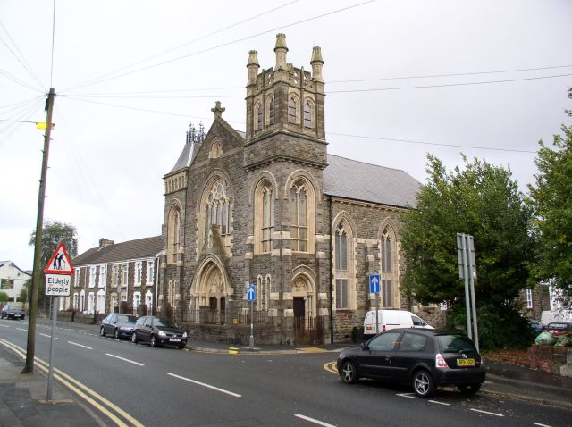
The neighborhood benefits from a range of amenities and facilities, including schools, shops, and healthcare services. It is conveniently located near the city center of Swansea, which provides residents with easy access to a wider range of amenities, such as shopping centers, restaurants, and cultural attractions.

Transportation options in Caereithin are excellent, with good road links connecting the neighborhood to other parts of Glamorgan and beyond. There are also regular bus services that provide convenient public transportation for those without access to a car.

Overall, Caereithin is a charming and well-connected neighborhood that offers a high quality of life for its residents. Its combination of natural beauty, community spirit, and convenient amenities makes it an attractive place to live in Glamorgan.

If you have any feedback on the listing, please let us know in the comments section below.
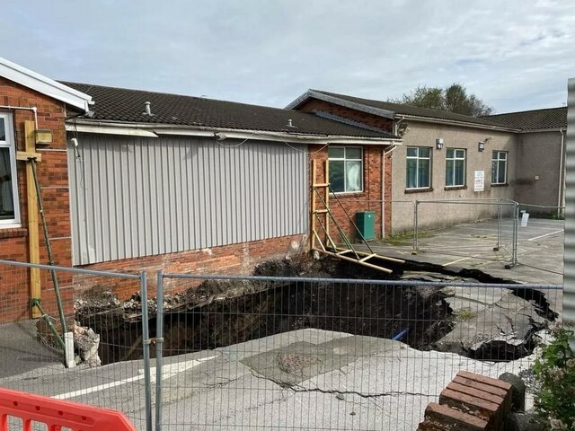
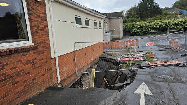
Caereithin Images

Images are sourced within 2km of 51.649475/-3.968373 or Grid Reference SS6396. Thanks to Geograph Open Source API. All images are credited.

Rivet: Swansea,  1230 Carmarthen Road Cut mark and rivet benchmark at 1230 Carmarthen Road window sill.
Rivet: Swansea, 1230 Carmarthen Road
Cut mark and rivet benchmark at 1230 Carmarthen Road window sill.
Benchmark. Cut mark, North junction of Cockett Road and Saint Peters Terrace Cut mark can be found at the junction of Cockett Road and Saint Peters Terrace on a red bricked wall surrounding steps.
Benchmark. Cut mark, North junction of Cockett Road and Saint Peters Terrace
Cut mark can be found at the junction of Cockett Road and Saint Peters Terrace on a red bricked wall surrounding steps.
Ordnance Survey Cut Mark This OS cut mark can be found on the SW angle of the school. It marks a point 153.278m above mean sea level.
Ordnance Survey Cut Mark
This OS cut mark can be found on the SW angle of the school. It marks a point 153.278m above mean sea level.
Weir on Afon Llan, Penllergaer
Cwmfelin Social Club Swansea Sinkhole Large sinkhole under the carpark and toilets of Cwmfelin Social Club. Underneath is apparently an old tramway, a sewer and a culvert (Burlais Brook)
Sinkhole believed to be around 10m deep
Cwmfelin Social Club Swansea Sinkhole
Large sinkhole under the carpark and toilets of Cwmfelin Social Club. Underneath is apparently an old tramway, a sewer and a culvert (Burlais Brook) Sinkhole believed to be around 10m deep
Cwmfelin Social Club Swansea Sinkhole Sinkhole a few days after it first appeared underneath carpark and the toilets (now demolished)
Cwmfelin Social Club Swansea Sinkhole
Sinkhole a few days after it first appeared underneath carpark and the toilets (now demolished)
Llangyfelach Road Wall, Cut Mark Swansea Cut Mark on wall at Llangyfelach Road.
Llangyfelach Road Wall, Cut Mark Swansea
Cut Mark on wall at Llangyfelach Road.
Cut Mark at Tirdeunaw Close on pillar at junction Cut mark on stone pillar at junction of Llangyfelach Road and Tirdeunaw Close, Swansea
Cut Mark at Tirdeunaw Close on pillar at junction
Cut mark on stone pillar at junction of Llangyfelach Road and Tirdeunaw Close, Swansea
Benchmark Cut Mark: Swansea,  at 27 Penfilia Road A possible Bench Mark found next to telephone style box at Penfilia Road, Swansea
Benchmark Cut Mark: Swansea, at 27 Penfilia Road
A possible Bench Mark found next to telephone style box at Penfilia Road, Swansea
Walkers Crisp Factory, Fforestfach, Swansea This was formerly the Smiths crisp factory, until Walkers took them over.
Walkers Crisp Factory, Fforestfach, Swansea
This was formerly the Smiths crisp factory, until Walkers took them over.
Ruin of former stores at Cnap Llwyd Only 2 corners of masonry remain from this building high on wasteland. This is the view south out to Swansea Bay.
Ruin of former stores at Cnap Llwyd
Only 2 corners of masonry remain from this building high on wasteland. This is the view south out to Swansea Bay.
Ruin on Cnap Llwyd, seen from below The odd corner ruins look like mysterious towers from a distance.
Ruin on Cnap Llwyd, seen from below
The odd corner ruins look like mysterious towers from a distance.
Cwmgelli Cemetery A secluded cemetery with some slightly unusual trees.
Cwmgelli Cemetery
A secluded cemetery with some slightly unusual trees.
Mynydd-bach chapel The old Independent Chapel on the common at Mynydd-bach near Llangyfelach, Swansea
Mynydd-bach chapel
The old Independent Chapel on the common at Mynydd-bach near Llangyfelach, Swansea
Clase Tower block at Clase, near Morriston, Swansea. Seen from the western edge of the grid square, looking across Mynydd-bach common.
Clase
Tower block at Clase, near Morriston, Swansea. Seen from the western edge of the grid square, looking across Mynydd-bach common.
Former Cockett railway station The line from Llanelli to Swansea is very much still in use but Cockett station has almost disappeared. 
This is the view looking east from the road bridge on station road towards Swansea central. The kerbstones on the platform edge can still be seen running from the bottom left of shot nearly all the way up to Cockett tunnel. Most of the platform and its access are now grassed over but the path down to the platform can still be made out coming in on the left side.
Cockett tunnel, which is also pictured, collapsed in 1899 but survived the Luftwaffe's heavy bombing in world war two. The collapse was thought to be due to mine work below it.
Former Cockett railway station
The line from Llanelli to Swansea is very much still in use but Cockett station has almost disappeared. This is the view looking east from the road bridge on station road towards Swansea central. The kerbstones on the platform edge can still be seen running from the bottom left of shot nearly all the way up to Cockett tunnel. Most of the platform and its access are now grassed over but the path down to the platform can still be made out coming in on the left side. Cockett tunnel, which is also pictured, collapsed in 1899 but survived the Luftwaffe's heavy bombing in world war two. The collapse was thought to be due to mine work below it.
Construction in Fforestfach Estate Corporation Road in Swansea's Fforestfach industrial estate runs through undeveloped land. Access to the road has been blocked off with huge boulders and concrete blocks. On the maps the road has many junctions leaving it that go nowhere. It must have been created with the intention of extending the estate. New signs are in place, directing visitors as if the road were already open.
This is the view southwest from one of dead end junctions, across the wastelends to where construction has started.
Construction in Fforestfach Estate
Corporation Road in Swansea's Fforestfach industrial estate runs through undeveloped land. Access to the road has been blocked off with huge boulders and concrete blocks. On the maps the road has many junctions leaving it that go nowhere. It must have been created with the intention of extending the estate. New signs are in place, directing visitors as if the road were already open. This is the view southwest from one of dead end junctions, across the wastelends to where construction has started.
Church in Landore This church, at the junction of Llangyfelach Road and Bryn Terrace, appears to be unused.  There is no name displayed outside.
Church in Landore
This church, at the junction of Llangyfelach Road and Bryn Terrace, appears to be unused. There is no name displayed outside.
Show me another place!

Caereithin is located at Grid Ref: SS6396 (Lat: 51.649475, Lng: -3.968373)

Unitary Authority: Swansea

Police Authority: South Wales

What 3 Words

///rental.notice.final. Near Landore, Swansea

Related Wikis

Penlan

Penlan is a suburban area of Swansea, Wales in the Penderry ward. The area is set on top of a hill, which overlooks Townhill, Kilvey Hill and Swansea...

Gendros

Gendros is a suburban district of the City and County of Swansea, Wales falling within the Cockett ward. Gendros approximates to the settlement northwest...

Penderry

Penderry (Welsh: Penderi) is the name of an electoral ward and a community in the City and County of Swansea, Wales, UK. Penderry does not have a community...

Ysgol Gyfun Gymraeg Bryn Tawe

Ysgol Gyfun Gymraeg Bryn Tawe is a Welsh-language comprehensive school based in Penlan, Swansea , southwest Wales. It opened in 2003 to complement Ysgol...

Portmead

Portmead (or Port Mead) (Welsh: Porthfedd [pɔrθˈveːð]) is a suburban district of Swansea, Wales which falls within the Penderry ward. Portmead is mostly...

Blaen-y-Maes

Blaen-y-Maes is a local authority maintained housing estate of the City and County Swansea, Wales. It falls within the Penderry ward.

Fforestfach

Fforestfach is a suburban district of Swansea, Wales which developed during the Victorian era as part of the expansion of Swansea, and to service several...

Foresthall House

Foresthall House (or Fforestfach House) was a mansion-like house that existeded in the Swansea suburb of Fforestfach until the 1970s, when the old and...

Related Videos

SWANSEA, WALES - UNITED KINGDOM [1 Hour Walking Tour in 4K]

Walking Tour in Swansea, Wales - United Kingdom SUBSCRIBE to see more videos like this: ...

Nearby Amenities

Located within 500m of 51.649475,-3.968373
Traffic Signals
Lat/Long: 51.6464492/-3.9719058
Bus Stop
Caereithin Cross (NE)
Bus: yes
Naptan AtcoCode: 5810AWC50977
Naptan Bearing: NE
Naptan CommonName: Caereithin Cross (NE)
Naptan Crossing: Pentregethin Road
Naptan NaptanCode: swajpwa
Naptan PlusbusZoneRef: SWANSEA
Naptan Street: Ravenhill Road
Naptan Verified: no
Public Transport: platform
Source: naptan_import
Lat/Long: 51.6461403/-3.9724091
Bus Stop
Ffordd y Brain Top (SE)
Bus: yes
Naptan AtcoCode: 5810AWC51370
Naptan Bearing: SE
Naptan CommonName: Ffordd y Brain Top (SE)
Naptan Crossing: Ffordd y Brain
Naptan NaptanCode: swamdmj
Naptan PlusbusZoneRef: SWANSEA
Naptan Street: Pentregethin Road
Naptan Verified: no
Public Transport: platform
Source: naptan_import
Lat/Long: 51.6484401/-3.9752266
Bus Stop
Stembridge Avenue (NE)
Bus: yes
Naptan AtcoCode: 5810AWC51372
Naptan Bearing: NE
Naptan CommonName: Stembridge Avenue (NE)
Naptan Crossing: Broughton Avenue
Naptan NaptanCode: swamdma
Naptan PlusbusZoneRef: SWANSEA
Naptan Street: Stembridge Avenue
Naptan Verified: no
Public Transport: platform
Source: naptan_import
Lat/Long: 51.6508787/-3.9745953
Bus Stop
Stembridge Avenue (SW)
Bus: yes
Naptan AtcoCode: 5810AWC51389
Naptan Bearing: SW
Naptan CommonName: Stembridge Avenue (SW)
Naptan Crossing: Broughton Avenue
Naptan NaptanCode: swamdmd
Naptan PlusbusZoneRef: SWANSEA
Naptan Street: Stembridge Avenue
Naptan Verified: no
Public Transport: platform
Source: naptan_import
Lat/Long: 51.6507158/-3.9746605
Bus Stop
Blaen-y-maes Family Centre(SE)
Bus: yes
Naptan AtcoCode: 5810AWC51390
Naptan Bearing: SE
Naptan CommonName: Blaen-y-maes Family Centre(SE)
Naptan Crossing: Stembridge Avenue
Naptan NaptanCode: swamdad
Naptan PlusbusZoneRef: SWANSEA
Naptan Street: Broughton Avenue
Naptan Verified: no
Public Transport: platform
Source: naptan_import
Lat/Long: 51.6511575/-3.9740581
Bus Stop
Blaen-y-maes Family Centre(NW)
Bus: yes
Naptan AtcoCode: 5810AWC51391
Naptan Bearing: NW
Naptan CommonName: Blaen-y-maes Family Centre(NW)
Naptan Crossing: Stembridge Avenue
Naptan NaptanCode: swamdag
Naptan PlusbusZoneRef: SWANSEA
Naptan Street: Broughton Avenue
Naptan Verified: no
Public Transport: platform
Source: naptan_import
Lat/Long: 51.6510679/-3.9740398
Bus Stop
Heol Pen-tir-garw (NE)
Bench: no
Bin: no
Bus: yes
Naptan AtcoCode: 5810AWC51393
Naptan Bearing: NE
Naptan CommonName: Heol Pen-tir-garw (NE)
Naptan Crossing: Heol Pen-tir-garw
Naptan NaptanCode: swamdjd
Naptan PlusbusZoneRef: SWANSEA
Naptan Street: Mynydd Newydd Road
Naptan Verified: no
Public Transport: platform
Shelter: no
Source: naptan_import
Lat/Long: 51.6518486/-3.9682477
Bus Stop
Heol Pen-tir-garw (SW)
Bus: yes
Naptan AtcoCode: 5810AWC51394
Naptan Bearing: SW
Naptan CommonName: Heol Pen-tir-garw (SW)
Naptan Crossing: Heol Pen-tir-garw
Naptan NaptanCode: swamdjg
Naptan PlusbusZoneRef: SWANSEA
Naptan Street: Mynydd Newydd Road
Naptan Verified: no
Public Transport: platform
Source: naptan_import
Lat/Long: 51.6520247/-3.9679373
Bus Stop
Marloes Court (NW)
Bus: yes
Naptan AtcoCode: 5810AWC51395
Naptan Bearing: NW
Naptan CommonName: Marloes Court (NW)
Naptan Crossing: Marloes Court
Naptan NaptanCode: swamdgw
Naptan PlusbusZoneRef: SWANSEA
Naptan Street: Milford Way
Naptan Verified: no
Public Transport: platform
Source: naptan_import
Lat/Long: 51.6528231/-3.9696633
Bus Stop
Broughton Avenue East (NE)
Bus: yes
Naptan AtcoCode: 5810AWC51397
Naptan Bearing: NE
Naptan CommonName: Broughton Avenue East (NE)
Naptan Crossing: Broughton Avenue
Naptan NaptanCode: swamdmg
Naptan PlusbusZoneRef: SWANSEA
Naptan Street: Mynydd-Newydd Road
Naptan Verified: no
Public Transport: platform
Source: naptan_import
Lat/Long: 51.6498547/-3.970243
Bus Stop
Broughton Avenue East (SW)
Bench: yes
Bin: no
Bus: yes
Naptan AtcoCode: 5810AWC51398
Naptan Bearing: SW
Naptan CommonName: Broughton Avenue East (SW)
Naptan Crossing: Broughton Avenue
Naptan NaptanCode: swamdjm
Naptan PlusbusZoneRef: SWANSEA
Naptan Street: Mynydd-Newydd Road
Naptan Verified: no
Public Transport: platform
Shelter: yes
Source: naptan_import
Lat/Long: 51.6493573/-3.9704093
Bus Stop
Toronto Place (SE)
Bus: yes
Naptan AtcoCode: 5810AWC51399
Naptan Bearing: SE
Naptan CommonName: Toronto Place (SE)
Naptan Crossing: Mynydd-Newydd Road
Naptan Landmark: Swansea First Cymru Bus Depot
Naptan NaptanCode: swajtja
Naptan PlusbusZoneRef: SWANSEA
Naptan Street: Heol Gwyosydd
Naptan Verified: no
Public Transport: platform
Source: naptan_import
Lat/Long: 51.6472237/-3.9694784
Bus Stop
Toronto Place (NW)
Bus: yes
Naptan AtcoCode: 5810AWC51400
Naptan Bearing: NW
Naptan CommonName: Toronto Place (NW)
Naptan Crossing: Mynydd-Newydd Road
Naptan Landmark: Swansea First Cymru Bus Depot
Naptan NaptanCode: swajtjd
Naptan PlusbusZoneRef: SWANSEA
Naptan Street: Heol Gwrosydd
Naptan Verified: no
Public Transport: platform
Source: naptan_import
Lat/Long: 51.6472045/-3.9700847
Bus Stop
Caereithin PO (NW)
Bus: yes
Naptan AtcoCode: 5810AWC51401
Naptan Bearing: NW
Naptan CommonName: Caereithin PO (NW)
Naptan Crossing: Ravenhill Road
Naptan Landmark: Caereithin Post Office
Naptan NaptanCode: swajpwd
Naptan PlusbusZoneRef: SWANSEA
Naptan Street: Pentregethin Road
Naptan Verified: no
Public Transport: platform
Source: naptan_import
Lat/Long: 51.646051/-3.971312
Bus Stop
Caereithin PO (SE)
Bus: yes
Naptan AtcoCode: 5810AWC51402
Naptan Bearing: SE
Naptan CommonName: Caereithin PO (SE)
Naptan Crossing: Ravenhill Road
Naptan Landmark: Caereithin Post Office
Naptan NaptanCode: swajpwg
Naptan PlusbusZoneRef: SWANSEA
Naptan Street: Pentregethin Road
Naptan Verified: no
Public Transport: platform
Source: naptan_import
Lat/Long: 51.6459416/-3.9708538
Bus Stop
Prescelli Road (NE)
Naptan AtcoCode: 5810AWC51403
Naptan Bearing: NE
Naptan CommonName: Prescelli Road (NE)
Naptan Crossing: Pentregethin Road
Naptan NaptanCode: swajtgj
Naptan PlusbusZoneRef: SWANSEA
Naptan Street: Prescelli Road
Naptan Verified: no
Source: naptan_import
Lat/Long: 51.6453985/-3.9694571
Bus Stop
Penlan Roundabout (SW)
Bus: yes
Naptan AtcoCode: 5810AWC51441
Naptan Bearing: SW
Naptan CommonName: Penlan Roundabout (SW)
Naptan Crossing: Tudno Place
Naptan NaptanCode: swajtdt
Naptan PlusbusZoneRef: SWANSEA
Naptan Street: Heol Gwrosydd
Naptan Verified: no
Public Transport: platform
Source: naptan_import
Lat/Long: 51.6472927/-3.9648268
Bus Stop
Penlan Roundabout (NE)
Bus: yes
Naptan AtcoCode: 5810AWC51442
Naptan Bearing: NE
Naptan CommonName: Penlan Roundabout (NE)
Naptan Crossing: Conway Road
Naptan NaptanCode: swajtdw
Naptan PlusbusZoneRef: SWANSEA
Naptan Street: Heol Gwrosydd
Naptan Verified: no
Public Transport: platform
Source: naptan_import
Lat/Long: 51.6479171/-3.9624398
Bus Stop
Marloes Court (SE)
Bus: yes
Naptan AtcoCode: 5810AWO26225
Naptan Bearing: SE
Naptan CommonName: Marloes Court (SE)
Naptan Crossing: Marloes Court
Naptan NaptanCode: swamdja
Naptan PlusbusZoneRef: SWANSEA
Naptan Street: Milford Way
Naptan Verified: no
Public Transport: platform
Source: naptan_import
Lat/Long: 51.6529054/-3.9695801
Bus Stop
Prescelli Roadl (SW)
Naptan AtcoCode: 5810AWO26236
Naptan Bearing: SW
Naptan CommonName: Prescelli Roadl (SW)
Naptan Crossing: Pentregethin Road
Naptan NaptanCode: swajtgm
Naptan PlusbusZoneRef: SWANSEA
Naptan Street: Prescelli Road
Naptan Verified: no
Source: naptan_import
Lat/Long: 51.6453636/-3.9693978
Bus Stop
Eppynt Road (S)
Bus: yes
Naptan AtcoCode: 5810AWO26315
Naptan Bearing: S
Naptan CommonName: Eppynt Road (S)
Naptan Crossing: Prescelli Road
Naptan NaptanCode: swajtag
Naptan PlusbusZoneRef: SWANSEA
Naptan Street: Eppynt Road
Naptan Verified: no
Public Transport: platform
Source: naptan_import
Lat/Long: 51.6460694/-3.9664507
Turning Circle
Lat/Long: 51.6476642/-3.9717511
Post Office
Caereithin Post Office
Lat/Long: 51.6459624/-3.9715121
Post Box
Collection Times: Mo-Fr 17:00; Sa 11:30
Post Box Type: pillar
Ref: SA5 216
Royal Cypher: GVIR
Royal Cypher Wikidata: Q33102169
Lat/Long: 51.6460296/-3.9714107
Place Of Worship
Cornerstone Church
Religion: christian
Lat/Long: 51.6486921/-3.9703531
Direction: 165
Generator Method: photovoltaic
Generator Output Electricity: yes
Generator Solar Modules: 11
Generator Source: solar
Generator Type: solar_photovoltaic_panel
Location: roof
Power: generator
Lat/Long: 51.6466156/-3.9638516
Direction: 165
Generator Method: photovoltaic
Generator Output Electricity: yes
Generator Solar Modules: 8
Generator Source: solar
Generator Type: solar_photovoltaic_panel
Location: roof
Power: generator
Lat/Long: 51.646762/-3.9645403
Direction: 165
Generator Method: photovoltaic
Generator Output Electricity: yes
Generator Solar Modules: 12
Generator Source: solar
Generator Type: solar_photovoltaic_panel
Location: roof
Power: generator
Lat/Long: 51.6465402/-3.9657666
Penlan
Place: suburb
Wikidata: Q7163075
Lat/Long: 51.6476785/-3.9633315
Portmead
Place: suburb
Wikidata: Q7232124
Lat/Long: 51.6507701/-3.973497
Direction: 215
Generator Method: photovoltaic
Generator Output Electricity: yes
Generator Solar Modules: 8
Generator Source: solar
Generator Type: solar_photovoltaic_panel
Location: roof
Power: generator
Lat/Long: 51.6512558/-3.9739304
Direction: 215
Generator Method: photovoltaic
Generator Output Electricity: yes
Generator Solar Modules: 14
Generator Source: solar
Generator Type: solar_photovoltaic_panel
Location: roof
Power: generator
Lat/Long: 51.6490769/-3.9752454
Direction: SW
Generator Method: photovoltaic
Generator Output Electricity: yes
Generator Solar Modules: 16
Generator Source: solar
Generator Type: solar_photovoltaic_panel
Location: roof
Power: generator
Lat/Long: 51.6483344/-3.9747637
Direction: SSW
Generator Method: photovoltaic
Generator Output Electricity: yes
Generator Solar Modules: 14
Generator Source: solar
Generator Type: solar_photovoltaic_panel
Location: roof
Power: generator
Lat/Long: 51.6484729/-3.9737145
Direction: 215
Generator Method: photovoltaic
Generator Output Electricity: yes
Generator Solar Modules: 15
Generator Source: solar
Generator Type: solar_photovoltaic_panel
Location: roof
Power: generator
Lat/Long: 51.6508732/-3.9727528
Direction: 195
Generator Method: photovoltaic
Generator Output Electricity: yes
Generator Solar Modules: 18
Generator Source: solar
Generator Type: solar_photovoltaic_panel
Location: roof
Power: generator
Lat/Long: 51.6506563/-3.9721611
Direction: 195
Generator Method: photovoltaic
Generator Output Electricity: yes
Generator Solar Modules: 14
Generator Source: solar
Generator Type: solar_photovoltaic_panel
Location: roof
Power: generator
Lat/Long: 51.6503694/-3.9722337
Direction: 170
Generator Method: photovoltaic
Generator Output Electricity: yes
Generator Solar Modules: 16
Generator Source: solar
Generator Type: solar_photovoltaic_panel
Location: roof
Note: look to be smaller panels beneath main panel (not counted)
Power: generator
Lat/Long: 51.6514342/-3.9709654
Direction: 190
Generator Method: photovoltaic
Generator Output Electricity: yes
Generator Solar Modules: 14
Generator Source: solar
Generator Type: solar_photovoltaic_panel
Location: roof
Power: generator
Lat/Long: 51.6513602/-3.9718839
Direction: 165
Generator Method: photovoltaic
Generator Output Electricity: yes
Generator Solar Modules: 10
Generator Source: solar
Generator Type: solar_photovoltaic_panel
Location: roof
Power: generator
Lat/Long: 51.6480665/-3.9653051
Direction: 175
Generator Method: photovoltaic
Generator Output Electricity: yes
Generator Solar Modules: 14
Generator Source: solar
Generator Type: solar_photovoltaic_panel
Location: roof
Power: generator
Lat/Long: 51.6461462/-3.9672584
Direction: 165
Generator Method: photovoltaic
Generator Output Electricity: yes
Generator Solar Modules: 13
Generator Source: solar
Generator Type: solar_photovoltaic_panel
Location: roof
Power: generator
Lat/Long: 51.6473026/-3.9638867
Direction: 195
Generator Method: photovoltaic
Generator Output Electricity: yes
Generator Solar Modules: 16
Generator Source: solar
Generator Type: solar_photovoltaic_panel
Location: roof
Power: generator
Lat/Long: 51.6487403/-3.9735946
Direction: SW
Generator Method: photovoltaic
Generator Output Electricity: yes
Generator Solar Modules: 13
Generator Source: solar
Generator Type: solar_photovoltaic_panel
Location: roof
Power: generator
Lat/Long: 51.64729/-3.9737869
Direction: SW
Generator Method: photovoltaic
Generator Output Electricity: yes
Generator Solar Modules: 11
Generator Source: solar
Generator Type: solar_photovoltaic_panel
Location: roof
Power: generator
Lat/Long: 51.6455828/-3.970808
First Cymru
Addr Postcode: SA5 7BN
Addr Street: Heol Gwyrosydd
Internet Access: wlan
Opening Hours: Mo-Su 08:00-18:00
Phone: +44 01792 582233
Shop: car_repair
Website: http://firstbus.co.uk/south-west-wales
Lat/Long: 51.6468013/-3.9706532
Reception
Addr Postcode: SA5 7BN
Addr Street: Heol Gwyrosydd
Internet Access: wlan
Name Cy: Derbynfa
Office: company
Lat/Long: 51.6469705/-3.9698779
Defibrillator
Access: yes
Defibrillator Location: Care Home
Emergency: defibrillator
Indoor: yes
Lat/Long: 51.6509993/-3.9698524
The data included in this document is from www.openstreetmap.org. The data is made available under ODbL.

Have you been to Caereithin?

Leave your review of Caereithin below (or comments, questions and feedback).