Port Mead

Settlement in Glamorgan

Wales

Port Mead

Rivet: Swansea,  1230 Carmarthen Road Cut mark and rivet benchmark at 1230 Carmarthen Road window sill.
Rivet: Swansea, 1230 Carmarthen Road Credit: John Jenkins

Port Mead is a picturesque coastal village located in the county of Glamorgan, Wales. Situated on the eastern shore of Swansea Bay, it enjoys a prime position with stunning views of the bay and the nearby Mumbles Head. The village is part of the City and County of Swansea and is approximately 5 miles west of Swansea city center.

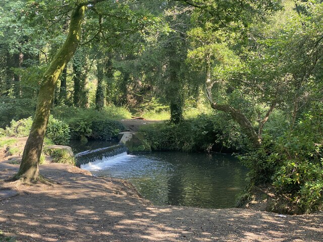
Port Mead is known for its natural beauty and serene atmosphere. It boasts a long stretch of sandy beach, which is popular among locals and visitors alike for its clean waters and scenic surroundings. The beach offers ample opportunities for sunbathing, picnicking, and various water activities such as swimming, surfing, and windsurfing.

The village itself is a close-knit community with a friendly and welcoming atmosphere. It is primarily residential, with a mix of charming cottages, modern houses, and a few local shops and amenities. The streets are lined with trees and well-maintained gardens, creating a pleasant and tranquil environment for residents.

For nature enthusiasts, Port Mead provides easy access to the nearby Clyne Gardens, a renowned botanical garden known for its impressive collection of rare plants and vibrant flowers. The village is also a gateway to the Gower Peninsula, a designated Area of Outstanding Natural Beauty, offering breathtaking coastal walks, rugged cliffs, and hidden coves.

Overall, Port Mead is an idyllic coastal village that offers a peaceful retreat from the hustle and bustle of city life. With its stunning beach, natural surroundings, and friendly community, it is a haven for those seeking a slower pace of life and a connection with nature.

If you have any feedback on the listing, please let us know in the comments section below.
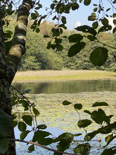
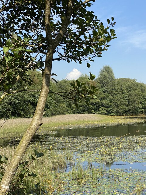
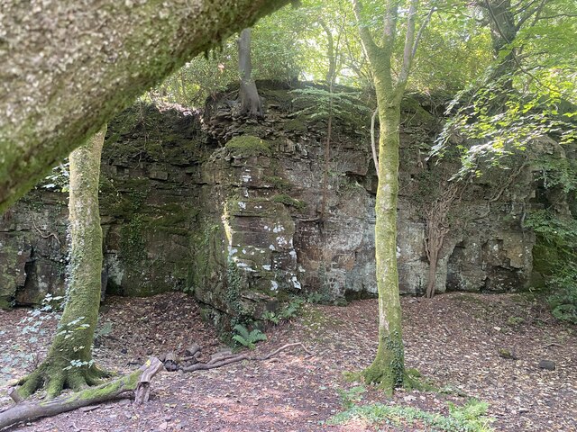
Port Mead Images

Images are sourced within 2km of 51.654232/-3.979567 or Grid Reference SS6396. Thanks to Geograph Open Source API. All images are credited.

Rivet: Swansea,  1230 Carmarthen Road Cut mark and rivet benchmark at 1230 Carmarthen Road window sill.
Rivet: Swansea, 1230 Carmarthen Road
Cut mark and rivet benchmark at 1230 Carmarthen Road window sill.
Benchmark. Cut mark, North junction of Cockett Road and Saint Peters Terrace Cut mark can be found at the junction of Cockett Road and Saint Peters Terrace on a red bricked wall surrounding steps.
Benchmark. Cut mark, North junction of Cockett Road and Saint Peters Terrace
Cut mark can be found at the junction of Cockett Road and Saint Peters Terrace on a red bricked wall surrounding steps.
Ordnance Survey Cut Mark This OS cut mark can be found on the SW angle of the school. It marks a point 153.278m above mean sea level.
Ordnance Survey Cut Mark
This OS cut mark can be found on the SW angle of the school. It marks a point 153.278m above mean sea level.
Western Red Cedars Majestic trees in Valley Wood, Penllergaer.
Western Red Cedars
Majestic trees in Valley Wood, Penllergaer.
Pond in Graig-neddfwch Wood
Spider’s web on Western Red Cedar
Woodland pond
Woodland pond
Quarry near Middle Lodge
Weir on Afon Llan, Penllergaer
Western Red Cedars Specimen trees on the Penllergaer estate.
Western Red Cedars
Specimen trees on the Penllergaer estate.
Walkers Crisp Factory, Fforestfach, Swansea This was formerly the Smiths crisp factory, until Walkers took them over.
Walkers Crisp Factory, Fforestfach, Swansea
This was formerly the Smiths crisp factory, until Walkers took them over.
Mynydd-bach chapel The old Independent Chapel on the common at Mynydd-bach near Llangyfelach, Swansea
Mynydd-bach chapel
The old Independent Chapel on the common at Mynydd-bach near Llangyfelach, Swansea
Cockett Community: greyhound stadium near Mynydd-bach-y-glo Looking north-north-west
Cockett Community: greyhound stadium near Mynydd-bach-y-glo
Looking north-north-west
Commemoration of the Battle of Gower This stone commemorates the Battle of Gower 1st January 1136.
Commemoration of the Battle of Gower
This stone commemorates the Battle of Gower 1st January 1136.
Former Cockett railway station The line from Llanelli to Swansea is very much still in use but Cockett station has almost disappeared. 
This is the view looking east from the road bridge on station road towards Swansea central. The kerbstones on the platform edge can still be seen running from the bottom left of shot nearly all the way up to Cockett tunnel. Most of the platform and its access are now grassed over but the path down to the platform can still be made out coming in on the left side.
Cockett tunnel, which is also pictured, collapsed in 1899 but survived the Luftwaffe's heavy bombing in world war two. The collapse was thought to be due to mine work below it.
Former Cockett railway station
The line from Llanelli to Swansea is very much still in use but Cockett station has almost disappeared. This is the view looking east from the road bridge on station road towards Swansea central. The kerbstones on the platform edge can still be seen running from the bottom left of shot nearly all the way up to Cockett tunnel. Most of the platform and its access are now grassed over but the path down to the platform can still be made out coming in on the left side. Cockett tunnel, which is also pictured, collapsed in 1899 but survived the Luftwaffe's heavy bombing in world war two. The collapse was thought to be due to mine work below it.
Construction in Fforestfach Estate Corporation Road in Swansea's Fforestfach industrial estate runs through undeveloped land. Access to the road has been blocked off with huge boulders and concrete blocks. On the maps the road has many junctions leaving it that go nowhere. It must have been created with the intention of extending the estate. New signs are in place, directing visitors as if the road were already open.
This is the view southwest from one of dead end junctions, across the wastelends to where construction has started.
Construction in Fforestfach Estate
Corporation Road in Swansea's Fforestfach industrial estate runs through undeveloped land. Access to the road has been blocked off with huge boulders and concrete blocks. On the maps the road has many junctions leaving it that go nowhere. It must have been created with the intention of extending the estate. New signs are in place, directing visitors as if the road were already open. This is the view southwest from one of dead end junctions, across the wastelends to where construction has started.
Pontarddulais Road Retail Park Although this area has been a retail park for many years, this row of buildings has recently been rebuilt to reflect modern building styles and structures.

It's obvious from the main road which shop is which, as can be seen from this picture, but once you've parked you have to walk way out into the car park to look at the big signs to work out which shop you're entering, that's how bad the shop door identification is in this retail park.
Pontarddulais Road Retail Park
Although this area has been a retail park for many years, this row of buildings has recently been rebuilt to reflect modern building styles and structures. It's obvious from the main road which shop is which, as can be seen from this picture, but once you've parked you have to walk way out into the car park to look at the big signs to work out which shop you're entering, that's how bad the shop door identification is in this retail park.
The Poplars. Wedi cau? 

Closed?
The Poplars.
Wedi cau? Closed?
Show me another place!

Port Mead is located at Grid Ref: SS6396 (Lat: 51.654232, Lng: -3.979567)

Unitary Authority: Swansea

Police Authority: South Wales

What 3 Words

///rocket.radar.accent. Near Landore, Swansea

Related Wikis

Blaen-y-Maes

Blaen-y-Maes is a local authority maintained housing estate of the City and County Swansea, Wales. It falls within the Penderry ward.

Portmead

Portmead (or Port Mead) (Welsh: Porthfedd [pɔrθˈveːð]) is a suburban district of Swansea, Wales which falls within the Penderry ward. Portmead is mostly...

Penlan

Penlan is a suburban area of Swansea, Wales in the Penderry ward. The area is set on top of a hill, which overlooks Townhill, Kilvey Hill and Swansea...

Penderry

Penderry (Welsh: Penderi) is the name of an electoral ward and a community in the City and County of Swansea, Wales, UK. Penderry does not have a community...

Related Videos

Hiking Trails | Waterfalls | Lake | beautiful viewpoints | Swansea | Wales #uk #shorts

Penllergare Valley Woods is a secret and magical place situated near swansea in southwest wales. Beautiful view and nice hiking ...

Health benefits of walking.

Walking has many health benefits. This video was filmed at Penllergare Valley Woods in Swansea, South Wales, UK. This is such ...

Easter Camp 2023

Explorers on Easter Camp at Silver Cross Wales 2023.

Nearby Amenities

Located within 500m of 51.654232,-3.979567
Mini Roundabout
Direction: clockwise
Lat/Long: 51.6536999/-3.9746856
Bus Stop
Broughton Avenue Shops (SE)
Bus: yes
Naptan AtcoCode: 5810AWC51373
Naptan Bearing: SE
Naptan CommonName: Broughton Avenue Shops (SE)
Naptan Crossing: Ty`r Felin
Naptan NaptanCode: swamdap
Naptan PlusbusZoneRef: SWANSEA
Naptan Street: Broughton Avenue
Naptan Verified: no
Public Transport: platform
Source: naptan_import
Lat/Long: 51.6532183/-3.9745091
Bus Stop
Broughton Avenue Shops (NW)
Bus: yes
Naptan AtcoCode: 5810AWC51374
Naptan Bearing: NW
Naptan CommonName: Broughton Avenue Shops (NW)
Naptan Crossing: Mewslade Avenue
Naptan NaptanCode: swamdat
Naptan PlusbusZoneRef: SWANSEA
Naptan Street: Broughton Avenue
Naptan Verified: no
Public Transport: platform
Source: naptan_import
Lat/Long: 51.6533055/-3.9746719
Bus Stop
Blaen-y-maes Primary School
Bus: yes
Naptan AtcoCode: 5810AWC51375
Naptan Bearing: S
Naptan CommonName: Blaen-y-maes Primary School
Naptan Crossing: Knelston Place
Naptan Landmark: Blaen-y-maes Primary School
Naptan NaptanCode: swamdaj
Naptan PlusbusZoneRef: SWANSEA
Naptan Street: Broughton Avenue
Naptan Verified: no
Public Transport: platform
Source: naptan_import
Lat/Long: 51.65642/-3.9739543
Bus Stop
Blaen-y-maes Roundabout
Bus: yes
Naptan AtcoCode: 5810AWC51376
Naptan Bearing: NW
Naptan CommonName: Blaen-y-maes Roundabout
Naptan Crossing: Pittsburgh Court
Naptan NaptanCode: swadjaw
Naptan PlusbusZoneRef: SWANSEA
Naptan Street: Woodford Road
Naptan Verified: no
Public Transport: platform
Source: naptan_import
Lat/Long: 51.6572008/-3.974581
Bus Stop
Woodford Road Top
Bus: yes
Naptan AtcoCode: 5810AWC51377
Naptan Bearing: NE
Naptan CommonName: Woodford Road Top
Naptan Crossing: Portmead Avenue
Naptan NaptanCode: swadjdt
Naptan PlusbusZoneRef: SWANSEA
Naptan Street: Woodford Road
Naptan Verified: no
Public Transport: platform
Source: naptan_import
Lat/Long: 51.6572749/-3.9771289
Bus Stop
Bardsey Avenue
Bus: yes
Naptan AtcoCode: 5810AWC51379
Naptan Bearing: SW
Naptan CommonName: Bardsey Avenue
Naptan Crossing: Bardsey Avenue
Naptan NaptanCode: swadjat
Naptan PlusbusZoneRef: SWANSEA
Naptan Street: Woodford Road
Naptan Verified: no
Public Transport: platform
Source: naptan_import
Lat/Long: 51.6570043/-3.9777099
Bus Stop
Woodford Road Shops (NE)
Bus: yes
Naptan AtcoCode: 5810AWC51380
Naptan Bearing: NE
Naptan CommonName: Woodford Road Shops (NE)
Naptan Crossing: Blaen-y-maes Drive
Naptan NaptanCode: swadjdw
Naptan PlusbusZoneRef: SWANSEA
Naptan Street: Woodford Road
Naptan Verified: no
Public Transport: platform
Source: naptan_import
Lat/Long: 51.6561777/-3.9803342
Bus Stop
Woodford Road Shops (SW)
Bus: yes
Naptan AtcoCode: 5810AWC51381
Naptan Bearing: SW
Naptan CommonName: Woodford Road Shops (SW)
Naptan Crossing: Penplas Road
Naptan NaptanCode: swadjga
Naptan PlusbusZoneRef: SWANSEA
Naptan Street: Woodford Road
Naptan Verified: no
Public Transport: platform
Source: naptan_import
Lat/Long: 51.6555537/-3.9816082
Bus Stop
Woodford Road Bottom (SW)
Bus: yes
Naptan AtcoCode: 5810AWC51382
Naptan Bearing: SW
Naptan CommonName: Woodford Road Bottom (SW)
Naptan Crossing: Pentregethin Road
Naptan NaptanCode: swadjda
Naptan PlusbusZoneRef: SWANSEA
Naptan Street: Woodford Road
Naptan Verified: no
Public Transport: platform
Source: naptan_import
Lat/Long: 51.6541904/-3.9851197
Bus Stop
Woodford Road Bottom (NE)
Bus: yes
Naptan AtcoCode: 5810AWC51383
Naptan Bearing: NE
Naptan CommonName: Woodford Road Bottom (NE)
Naptan Crossing: Pentregethin Road
Naptan NaptanCode: swadjdg
Naptan PlusbusZoneRef: SWANSEA
Naptan Street: Woodford Road
Naptan Verified: no
Public Transport: platform
Source: naptan_import
Lat/Long: 51.6543893/-3.9850561
Bus Stop
Brookfield Place
Bus: yes
Naptan AtcoCode: 5810AWC51384
Naptan Bearing: SW
Naptan CommonName: Brookfield Place
Naptan Crossing: Cadle-wood Road
Naptan NaptanCode: swamdam
Naptan PlusbusZoneRef: SWANSEA
Naptan Street: Pentregethin Road
Naptan Verified: no
Public Transport: platform
Source: naptan_import
Lat/Long: 51.6529664/-3.9819869
Bus Stop
Cadle Crescent (NW)
Bus: yes
Naptan AtcoCode: 5810AWC51385
Naptan Bearing: NW
Naptan CommonName: Cadle Crescent (NW)
Naptan Crossing: Cadle Crescent
Naptan NaptanCode: swamdaw
Naptan PlusbusZoneRef: SWANSEA
Naptan Street: Pentregethin Road
Naptan Verified: no
Public Transport: platform
Source: naptan_import
Lat/Long: 51.6520314/-3.9803703
Bus Stop
Cadle Crescent (SE)
Bus: yes
Naptan AtcoCode: 5810AWC51386
Naptan Bearing: SE
Naptan CommonName: Cadle Crescent (SE)
Naptan Crossing: Cadle Crescent
Naptan NaptanCode: swamdga
Naptan PlusbusZoneRef: SWANSEA
Naptan Street: Pentregethin Road
Naptan Verified: no
Public Transport: platform
Source: naptan_import
Lat/Long: 51.6518857/-3.9799447
Bus Stop
Farm Shop (SE)
Bus: yes
Naptan AtcoCode: 5810AWC51388
Naptan Bearing: SE
Naptan CommonName: Farm Shop (SE)
Naptan Landmark: Farm Shop
Naptan NaptanCode: swamdgj
Naptan PlusbusZoneRef: SWANSEA
Naptan Street: Pentregethin Road
Naptan Verified: no
Public Transport: platform
Source: naptan_import
Lat/Long: 51.6509957/-3.9783302
Mini Roundabout
Direction: clockwise
Lat/Long: 51.6551333/-3.9833712
Power: tower
Lat/Long: 51.6574977/-3.9840521
Turning Circle
Lat/Long: 51.6546736/-3.9772013
Barrier: kissing_gate
Foot: yes
Lat/Long: 51.6508796/-3.9835639
Fixme: continue
Lat/Long: 51.6523682/-3.98417
Barrier: kissing_gate
Foot: yes
Lat/Long: 51.6507219/-3.98324
Blaen-Y-Maes
Place: suburb
Wikidata: Q4923787
Lat/Long: 51.653793/-3.9747282
Direction: 235
Generator Method: photovoltaic
Generator Output Electricity: yes
Generator Solar Modules: 2
Generator Source: solar
Generator Type: solar_photovoltaic_panel
Location: roof
Power: generator
Lat/Long: 51.6557187/-3.9804931
Direction: 235
Generator Method: photovoltaic
Generator Output Electricity: yes
Generator Solar Modules: 15
Generator Source: solar
Generator Type: solar_photovoltaic_panel
Location: roof
Power: generator
Lat/Long: 51.6556719/-3.9804728
Direction: 125
Generator Method: photovoltaic
Generator Output Electricity: yes
Generator Solar Modules: 12
Generator Source: solar
Generator Type: solar_photovoltaic_panel
Location: roof
Power: generator
Lat/Long: 51.6570496/-3.9804676
Direction: 100
Generator Method: photovoltaic
Generator Output Electricity: yes
Generator Solar Modules: 8
Generator Source: solar
Generator Type: solar_photovoltaic_panel
Location: roof
Power: generator
Lat/Long: 51.6576089/-3.9757801
Direction: 165
Generator Method: photovoltaic
Generator Output Electricity: yes
Generator Solar Modules: 8
Generator Source: solar
Generator Type: solar_photovoltaic_panel
Location: roof
Power: generator
Lat/Long: 51.6575215/-3.9764673
Direction: 195
Generator Method: photovoltaic
Generator Output Electricity: yes
Generator Solar Modules: 6
Generator Source: solar
Generator Type: solar_photovoltaic_panel
Location: roof
Power: generator
Lat/Long: 51.6536508/-3.9737021
Direction: SSW
Generator Method: photovoltaic
Generator Output Electricity: yes
Generator Solar Modules: 8
Generator Source: solar
Generator Type: solar_photovoltaic_panel
Location: roof
Power: generator
Lat/Long: 51.6521859/-3.9762394
Direction: SW
Generator Method: photovoltaic
Generator Output Electricity: yes
Generator Solar Modules: 18
Generator Source: solar
Generator Type: solar_photovoltaic_panel
Location: roof
Power: generator
Lat/Long: 51.6514963/-3.9796944
Direction: SSE
Generator Method: photovoltaic
Generator Output Electricity: yes
Generator Solar Modules: 7
Generator Source: solar
Generator Type: solar_photovoltaic_panel
Location: roof
Power: generator
Lat/Long: 51.654149/-3.983508
Direction: WSW
Generator Method: photovoltaic
Generator Output Electricity: yes
Generator Solar Modules: 5
Generator Source: solar
Generator Type: solar_photovoltaic_panel
Location: roof
Power: generator
Lat/Long: 51.6541482/-3.9835708
Direction: 145
Generator Method: photovoltaic
Generator Output Electricity: yes
Generator Solar Modules: 12
Generator Source: solar
Generator Type: solar_photovoltaic_panel
Location: roof
Power: generator
Lat/Long: 51.654027/-3.9837773
Direction: 145
Generator Method: photovoltaic
Generator Output Electricity: yes
Generator Solar Modules: 12
Generator Source: solar
Generator Type: solar_photovoltaic_panel
Location: roof
Power: generator
Lat/Long: 51.6544549/-3.9835664
Direction: SE
Generator Method: photovoltaic
Generator Output Electricity: yes
Generator Solar Modules: 18
Generator Source: solar
Generator Type: solar_photovoltaic_panel
Location: roof
Power: generator
Lat/Long: 51.6547091/-3.9848095
Direction: 185
Generator Method: photovoltaic
Generator Output Electricity: yes
Generator Solar Modules: 9
Generator Source: solar
Generator Type: solar_photovoltaic_panel
Location: roof
Power: generator
Lat/Long: 51.6566296/-3.9809686
Direction: 305
Generator Method: photovoltaic
Generator Output Electricity: yes
Generator Solar Modules: 8
Generator Source: solar
Generator Type: solar_photovoltaic_panel
Location: roof
Power: generator
Lat/Long: 51.6540351/-3.9770739
Direction: 125
Generator Method: photovoltaic
Generator Output Electricity: yes
Generator Solar Modules: 8
Generator Source: solar
Generator Type: solar_photovoltaic_panel
Location: roof
Power: generator
Lat/Long: 51.6540187/-3.9770257
Direction: 285
Generator Method: photovoltaic
Generator Output Electricity: yes
Generator Solar Modules: 8
Generator Source: solar
Generator Type: solar_photovoltaic_panel
Location: roof
Power: generator
Lat/Long: 51.655026/-3.9785484
Direction: 105
Generator Method: photovoltaic
Generator Output Electricity: yes
Generator Solar Modules: 8
Generator Source: solar
Generator Type: solar_photovoltaic_panel
Location: roof
Power: generator
Lat/Long: 51.6550146/-3.9784912
Direction: SSW
Generator Method: photovoltaic
Generator Output Electricity: yes
Generator Solar Modules: 13
Generator Source: solar
Generator Type: solar_photovoltaic_panel
Location: roof
Power: generator
Lat/Long: 51.6538478/-3.9758525
Direction: 215
Generator Method: photovoltaic
Generator Output Electricity: yes
Generator Solar Modules: 10
Generator Source: solar
Generator Type: solar_photovoltaic_panel
Location: roof
Power: generator
Lat/Long: 51.6537946/-3.9765326
Direction: 195
Generator Method: photovoltaic
Generator Output Electricity: yes
Generator Solar Modules: 8
Generator Source: solar
Generator Type: solar_photovoltaic_panel
Location: roof
Power: generator
Lat/Long: 51.6545004/-3.9820887
The data included in this document is from www.openstreetmap.org. The data is made available under ODbL.

Have you been to Port Mead?

Leave your review of Port Mead below (or comments, questions and feedback).