Coedcae Tyle

Wood, Forest in Monmouthshire

Wales

Coedcae Tyle

Cows on Darren Ddu
Cows on Darren Ddu Credit: Peter Dean

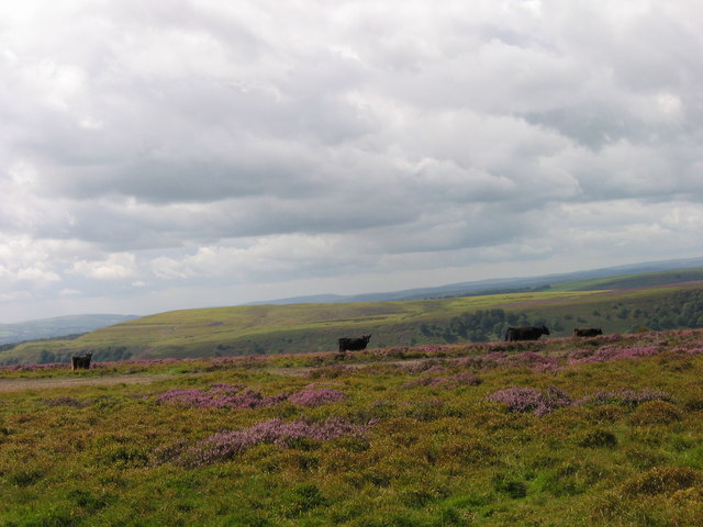
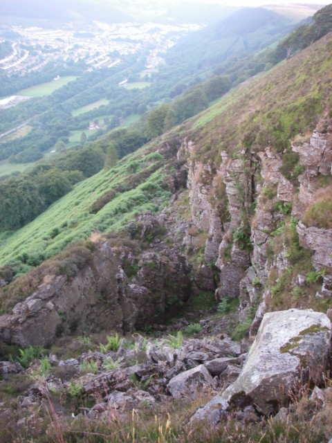
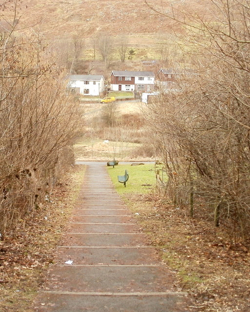
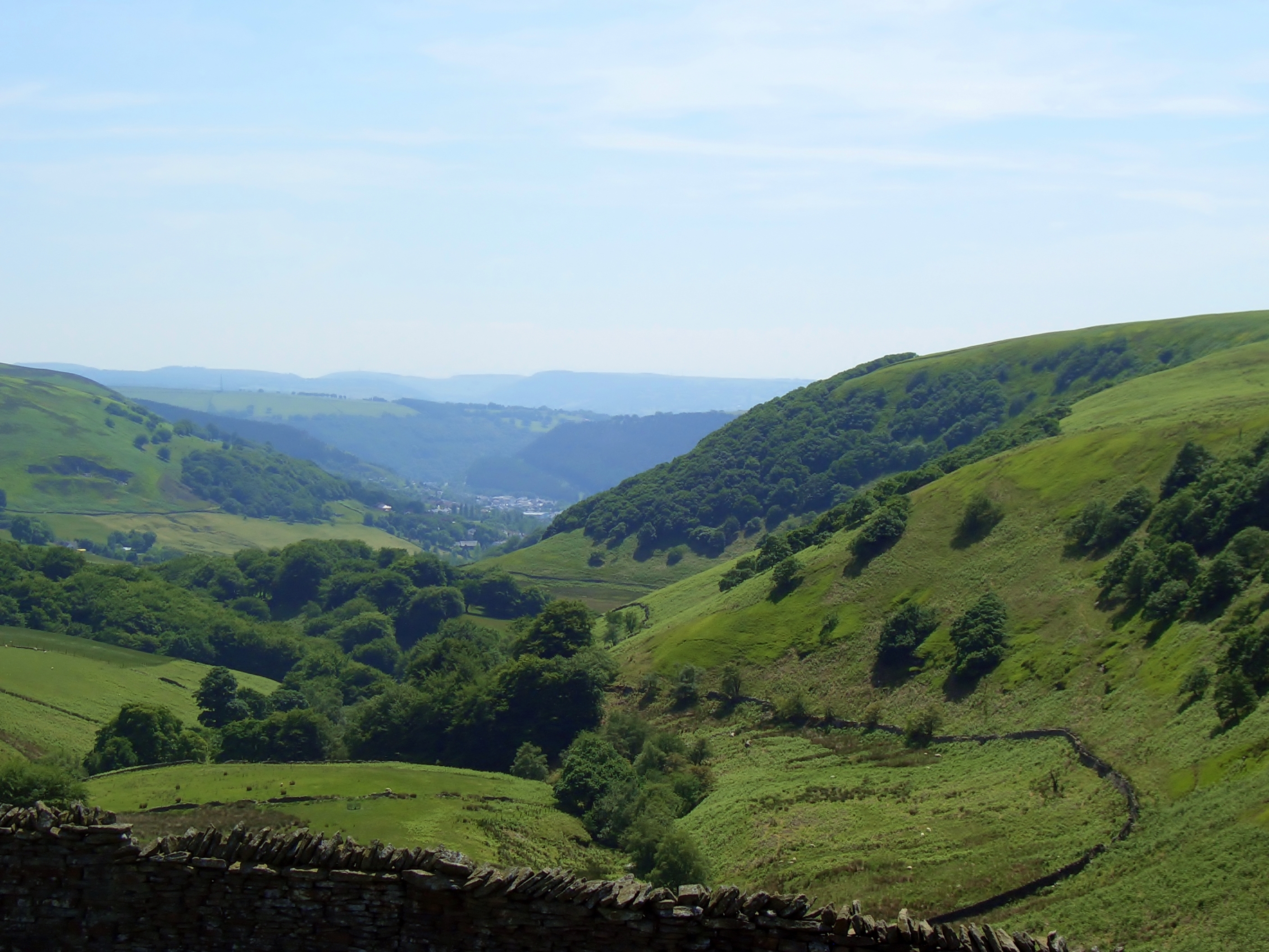
Coedcae Tyle is a beautiful woodland area located in Monmouthshire, Wales. Covering an approximate area of several hectares, this woodland is a serene and picturesque destination for nature enthusiasts and outdoor lovers. The name "Coedcae Tyle" translates to "Wood, Forest" in English, accurately representing the essence of this charming location.

The woodland is predominantly composed of a variety of native tree species, including oak, beech, and ash. These tall and majestic trees provide a dense canopy that filters the sunlight, creating a peaceful and shaded atmosphere within the woodland. The forest floor is adorned with a carpet of lush green moss and ferns, giving it a mystical and enchanting appearance.

Coedcae Tyle is home to a diverse range of wildlife, including numerous bird species, squirrels, and rabbits. It serves as an important habitat for these animals, offering them shelter and a source of food. Birdwatchers will be delighted by the opportunity to spot woodpeckers, thrushes, and other songbirds in their natural habitat.

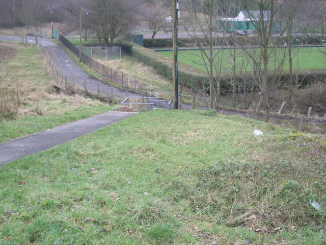
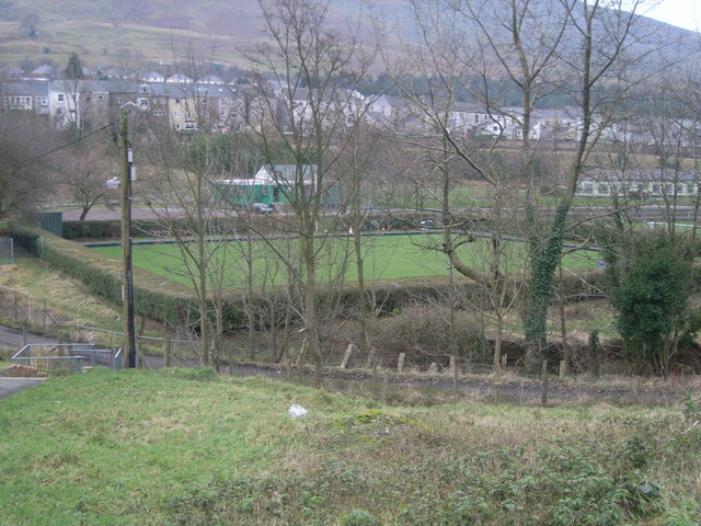
Visitors to Coedcae Tyle can enjoy a tranquil walk along the well-maintained footpaths that wind through the woodland. These paths provide easy access to explore the area, allowing visitors to immerse themselves in the natural beauty of the surroundings. The peaceful ambiance and the gentle rustling of leaves make it the perfect place for relaxation and contemplation.

Coedcae Tyle is a true gem in Monmouthshire, offering a sanctuary of beauty and tranquility. Whether it's for a leisurely stroll, birdwatching, or simply escaping the hustle and bustle of everyday life, this woodland provides an idyllic setting to connect with nature.

If you have any feedback on the listing, please let us know in the comments section below.
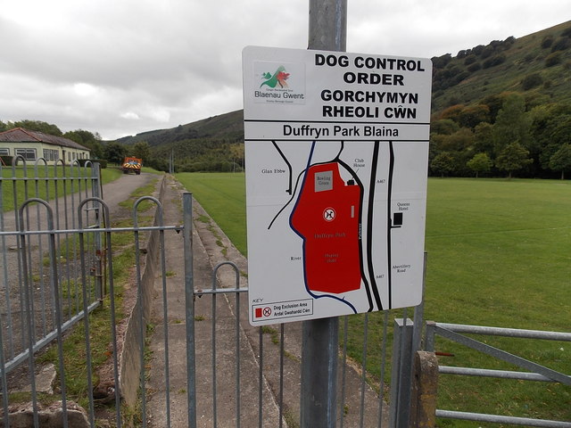
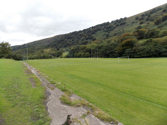
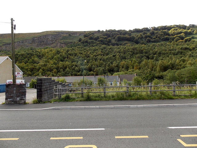
Coedcae Tyle Images

Images are sourced within 2km of 51.747492/-3.1484803 or Grid Reference SO2006. Thanks to Geograph Open Source API. All images are credited.

Cows on Darren Ddu
Cows on Darren Ddu
Footpath towards bowling green
Unstable flanks of Cefn yr Arail This is one of a series of chasms which run diagonally down the steep eastern side of this hill.  Up to 20m deep it runs for several hundred metres both across the flat top of the hill and these slopes which were over-steepened by glaciers 20,000 years ago.  More recent undermining by man in the search for coal during the 19th and 20th centuries has reactivated many ancient landslides.
Unstable flanks of Cefn yr Arail
This is one of a series of chasms which run diagonally down the steep eastern side of this hill. Up to 20m deep it runs for several hundred metres both across the flat top of the hill and these slopes which were over-steepened by glaciers 20,000 years ago. More recent undermining by man in the search for coal during the 19th and 20th centuries has reactivated many ancient landslides.
Blaina : Victoria Street houses viewed from edge of footbridge Viewed from steps descending from a footbridge above the A467. The opposite side of the bridge leads to Abertillery Road.
Blaina : Victoria Street houses viewed from edge of footbridge
Viewed from steps descending from a footbridge above the A467. The opposite side of the bridge leads to Abertillery Road.
Victoria Street lockup garages, Blaina In this part of Victoria Street, houses on the west side face lockup garages on the east side.
Victoria Street lockup garages, Blaina
In this part of Victoria Street, houses on the west side face lockup garages on the east side.
From Victoria Street to Glan Ebbw, Blaina Older houses on the camera side are in Victoria Street. The newer houses ahead are in Glan Ebbw.
From Victoria Street to Glan Ebbw, Blaina
Older houses on the camera side are in Victoria Street. The newer houses ahead are in Glan Ebbw.
Glan Ebbw houses, Blaina Houses on the east side of the street.
Glan Ebbw houses, Blaina
Houses on the east side of the street.
Side arm of Glan Ebbw, Blaina Looking eastwards from the main part of Glan Ebbw.
Side arm of Glan Ebbw, Blaina
Looking eastwards from the main part of Glan Ebbw.
Southern end of Glan Ebbw, Blaina The houses ahead on the west bank of the Ebbw Fach river.
Southern end of Glan Ebbw, Blaina
The houses ahead on the west bank of the Ebbw Fach river.
Old-style and a new-style British Gas vans in Blaina Parked in Glan Ebbw are a turquoise new-style British Gas van and a dark blue van in the older-style livery.
Old-style and a new-style British Gas vans in Blaina
Parked in Glan Ebbw are a turquoise new-style British Gas van and a dark blue van in the older-style livery.
Steps down from Glan Ebbw, Blaina The steps descend from houses in Glan Ebbw into the valley of the Ebbw Fach river and Duffryn Park.
Steps down from Glan Ebbw, Blaina
The steps descend from houses in Glan Ebbw into the valley of the Ebbw Fach river and Duffryn Park.
Ebbw Fach river, Blaina Viewed from a path between Glan Ebbw and the northern entrance to Duffryn Park.
The Ebbw Fach (Little Ebbw) is one of two rivers which meet at Aberbeeg to form the Ebbw River. 
The other one is the Ebbw Fawr (Big Ebbw).
Ebbw Fach river, Blaina
Viewed from a path between Glan Ebbw and the northern entrance to Duffryn Park. The Ebbw Fach (Little Ebbw) is one of two rivers which meet at Aberbeeg to form the Ebbw River. The other one is the Ebbw Fawr (Big Ebbw).
Northern entrance to Duffryn Park Blaina The dark blue notice on the wall shows the symbols of the Welsh Assembly Government and the European Regional Development Fund. The motto is

Europe & Wales: Investing in your Future.
Northern entrance to Duffryn Park Blaina
The dark blue notice on the wall shows the symbols of the Welsh Assembly Government and the European Regional Development Fund. The motto is Europe & Wales: Investing in your Future.
Bowling green in Duffryn Park, Blaina The Blaina Bowls Club pavilion <a title="https://www.geograph.org.uk/photo/3662373" href="https://www.geograph.org.uk/photo/3662373">Link</a> is nearby.
Bowling green in Duffryn Park, Blaina
The Blaina Bowls Club pavilion Link is nearby.
Dog control order notice in Duffryn Park Blaina The dog exclusion area is shown in red.
Dog control order notice in Duffryn Park Blaina
The dog exclusion area is shown in red.
Sports pitches in Duffryn Park Blaina In many locations in the South Wales valleys, the scarcity of flat sites big enough for a sports field means that river valleys are often used for this purpose, as here, where the pitches are on the east bank of the Ebbw Fach river. The pitch nearer the camera is for football. The other one has both rugby goalposts and football goalposts.
Sports pitches in Duffryn Park Blaina
In many locations in the South Wales valleys, the scarcity of flat sites big enough for a sports field means that river valleys are often used for this purpose, as here, where the pitches are on the east bank of the Ebbw Fach river. The pitch nearer the camera is for football. The other one has both rugby goalposts and football goalposts.
Wooded hillside viewed from Bournville Viewed from Bournville in Blaenau Gwent looking towards Darren Ddu.
Wooded hillside viewed from Bournville
Viewed from Bournville in Blaenau Gwent looking towards Darren Ddu.
Show me another place!

Coedcae Tyle is located at Grid Ref: SO2006 (Lat: 51.747492, Lng: -3.1484803)

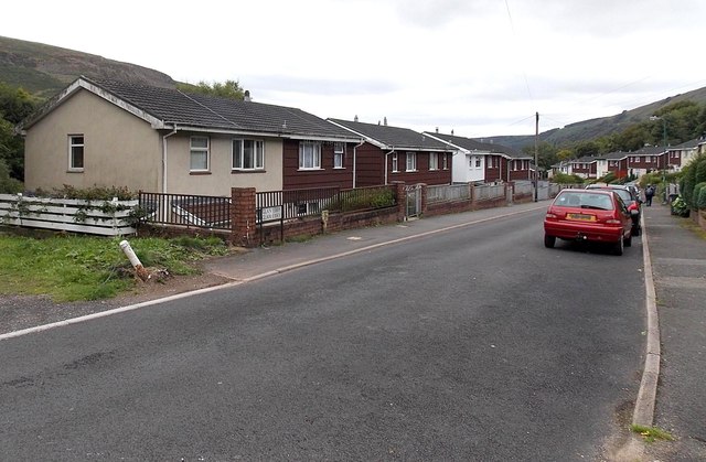
Unitary Authority: Blaenau Gwent

Police Authority: Gwent

What 3 Words

///hovered.pipe.recorders. Near Abertillery, Blaenau Gwent

Related Wikis

Bournville (Mon) Halt railway station

Bournville (Mon) Halt railway station was a station which served Ty'r-Cecil near Blaina Abertillery in the Welsh county of Monmouthshire. == History... ==

Cwmtillery

Cwmtillery (from Welsh Cwmtyleri) (population 2011. 4800) is a ward of Abertillery. Located within the historic boundaries of Monmouthshire, it is part...

Abertillery Excelsiors A.F.C.

Abertillery Excelsiors A.F.C. are a Welsh football club from the town of Abertillery, Blaenau Gwent in South Wales. Formed in 2000 as Tillery FC, they...

Abertillery Learning Community

Abertillery Learning Community is an all-through school in Abertillery, Wales. The school was formed by merging several schools in 2016. Abertillery Comprehensive...

Abertillery railway station

Abertillery railway station was a station which served Abertillery, in the Welsh county of Monmouthshire. == History == Among the lines built by the Monmouthshire...

Blaina railway station

Blaina railway station was a station which served the small town of Blaina in the Welsh county of Monmouthshire. == History == Among the lines built by...

Abertillery

Abertillery (; Welsh: Abertyleri) is a town and a community of the Ebbw Fach valley in the historic county of Monmouthshire, Wales. Following local government...

Cwm, Blaenau Gwent

Cwm (from Welsh: Y Cwm, transl. The Valley) is a former coal mining village, community and electoral ward three miles (4.8 km) south of Ebbw Vale in the...

Nearby Amenities

Located within 500m of 51.747492,-3.1484803
Turning Loop
Lat/Long: 51.7482135/-3.154905
Turning Loop
Lat/Long: 51.7455978/-3.154039
Direction: ESE
Generator Method: photovoltaic
Generator Output Electricity: yes
Generator Solar Modules: 16
Generator Source: solar
Generator Type: solar_photovoltaic_panel
Location: roof
Power: generator
Lat/Long: 51.7443904/-3.1498428
Addr Housenumber: Unit 11
Addr Place: Abertillery
Addr Postcode: NP13 1SP
Lat/Long: 51.7438181/-3.1521075
Addr Housenumber: Unit 12
Addr Place: Abertillery
Addr Postcode: NP13 1SP
Lat/Long: 51.7438806/-3.1521522
Addr Housenumber: Unit 14
Addr Place: Abertillery
Addr Postcode: NP13 1SP
Lat/Long: 51.7441158/-3.1525152
Addr Housenumber: Unit 13
Addr Place: Abertillery
Addr Postcode: NP13 1SP
Lat/Long: 51.7440706/-3.152479
Addr Housenumber: Unit A
Addr Place: Abertillery
Addr Postcode: NP13 1SX
Lat/Long: 51.7460805/-3.1542077
Addr Housenumber: Unit B
Addr Place: Abertillery
Addr Postcode: NP13 1SX
Lat/Long: 51.7463197/-3.1542911
Addr Housenumber: Unit C
Addr Place: Abertillery
Addr Postcode: NP13 1SX
Lat/Long: 51.7467476/-3.1544333
Addr Housenumber: Unit D
Addr Place: Abertillery
Addr Postcode: NP13 1SX
Lat/Long: 51.7468973/-3.1544964
Addr Housenumber: Unit E
Addr Place: Abertillery
Addr Postcode: NP13 1SX
Lat/Long: 51.7472178/-3.1545975
Addr Housenumber: Unit F
Addr Place: Abertillery
Addr Postcode: NP13 1SX
Lat/Long: 51.7473447/-3.1546391
Addr Housenumber: Unit G
Addr Place: Abertillery
Addr Postcode: NP13 1SX
Lat/Long: 51.7476861/-3.1547624
Addr Housenumber: Unit H
Addr Place: Abertillery
Addr Postcode: NP13 1SX
Lat/Long: 51.7478616/-3.1548209
Addr City: Abertillery
Addr Housenumber: 78
Addr Postcode: NP13 1SU
Addr Street: Arael View
Lat/Long: 51.7443451/-3.1479673
Addr City: Abertillery
Addr Housenumber: 77
Addr Postcode: NP13 1SU
Addr Street: Arael View
Lat/Long: 51.7442817/-3.1479202
Addr City: Abertillery
Addr Housenumber: 76
Addr Postcode: NP13 1SU
Addr Street: Arael View
Lat/Long: 51.7442202/-3.1478706
Addr City: Abertillery
Addr Housenumber: 75
Addr Postcode: NP13 1SU
Addr Street: Arael View
Lat/Long: 51.7441579/-3.1478264
Addr City: Abertillery
Addr Housenumber: 79
Addr Postcode: NP13 1SU
Addr Street: Arael View
Lat/Long: 51.7442376/-3.1473925
Addr City: Abertillery
Addr Housenumber: 80
Addr Postcode: NP13 1SU
Addr Street: Arael View
Lat/Long: 51.7441842/-3.1473494
Addr City: Abertillery
Addr Housenumber: 74
Addr Postcode: NP13 1SU
Addr Street: Arael View
Lat/Long: 51.7440238/-3.147718
Addr City: Abertillery
Addr Housenumber: 73
Addr Postcode: NP13 1SU
Addr Street: Arael View
Lat/Long: 51.7439508/-3.1476617
Addr City: Abertillery
Addr Housenumber: 72
Addr Postcode: NP13 1SU
Addr Street: Arael View
Lat/Long: 51.7438719/-3.1476067
Addr City: Abertillery
Addr Housenumber: 71
Addr Postcode: NP13 1SU
Addr Street: Arael View
Lat/Long: 51.7438096/-3.1475517
Addr City: Abertillery
Addr Housenumber: 70
Addr Postcode: NP13 1SU
Addr Street: Arael View
Lat/Long: 51.7439908/-3.1479963
Addr City: Abertillery
Addr Housenumber: 69
Addr Postcode: NP13 1SU
Addr Street: Arael View
Lat/Long: 51.7439155/-3.1479378
Addr City: Abertillery
Addr Housenumber: 68
Addr Postcode: NP13 1SU
Addr Street: Arael View
Lat/Long: 51.7438506/-3.1478823
Addr City: Abertillery
Addr Housenumber: 67
Addr Postcode: NP13 1SU
Addr Street: Arael View
Lat/Long: 51.7437896/-3.1478361
Addr City: Abertillery
Addr Housenumber: 66
Addr Postcode: NP13 1SU
Addr Street: Arael View
Lat/Long: 51.7437123/-3.147773
Addr City: Abertillery
Addr Housenumber: 65
Addr Postcode: NP13 1SU
Addr Street: Arael View
Lat/Long: 51.7436369/-3.147719
Addr City: Abertillery
Addr Housenumber: 64
Addr Postcode: NP13 1SU
Addr Street: Arael View
Lat/Long: 51.743573/-3.1476697
Addr Housenumber: Unit 16
Addr Place: Abertillery
Addr Postcode: NP13 1SP
Lat/Long: 51.7443398/-3.1526954
Traffic Signals
Lat/Long: 51.745158/-3.1545261
Addr Housenumber: Unit 15
Addr Place: Abertillery
Addr Postcode: NP13 1SP
Lat/Long: 51.7442851/-3.1526606
Addr Housenumber: Unit 6
Addr Place: Abertillery
Addr Postcode: NP13 1SP
Lat/Long: 51.7444295/-3.1535081
Traffic Calming: choker
Lat/Long: 51.7452892/-3.1519323
Addr Housenumber: Unit 7
Addr Place: Abertillery
Addr Postcode: NP13 1SP
Lat/Long: 51.7442783/-3.1533687
Addr Housenumber: Unit 3
Addr Place: Abertillery
Addr Postcode: NP13 1SP
Lat/Long: 51.7449211/-3.1538783
Addr Housenumber: Unit 2
Addr Place: Abertillery
Addr Postcode: NP13 1SP
Lat/Long: 51.7449725/-3.15302
Addr Housenumber: Unit 4
Addr Place: Abertillery
Addr Postcode: NP13 1SP
Lat/Long: 51.7448049/-3.1538032
Post Box
Brand: Royal Mail
Brand Wikidata: Q638098
Operator: Royal Mail
Operator Wikidata: Q638098
Post Box Mounting: pier
Post Box Type: lamp
Lat/Long: 51.7431648/-3.1501177
Addr Housenumber: Unit 1
Addr Place: Abertillery
Addr Postcode: NP13 1SP
Lat/Long: 51.7448546/-3.1529315
Addr Housenumber: Unit 8
Addr Place: Abertillery
Addr Postcode: NP13 1SP
Lat/Long: 51.7441356/-3.1532694
Addr Housenumber: Unit 5
Addr Place: Abertillery
Addr Postcode: NP13 1SP
Lat/Long: 51.7445656/-3.153602
Traffic Signals
Lat/Long: 51.7450518/-3.1544787
Fixme: continue
Lat/Long: 51.7467229/-3.1465971
The data included in this document is from www.openstreetmap.org. The data is made available under ODbL.

Have you been to Coedcae Tyle?

Leave your review of Coedcae Tyle below (or comments, questions and feedback).