Coed John-Hywel

Wood, Forest in Monmouthshire

Wales

Coed John-Hywel

Railway bridge A disused railway line between Bedwas and Machen.
Railway bridge Credit: Alan Hughes

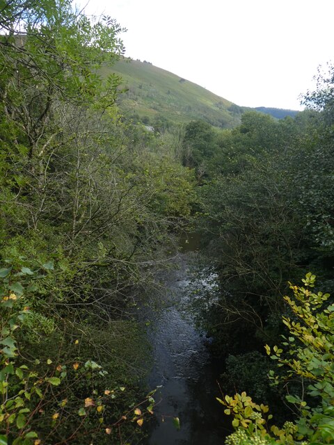
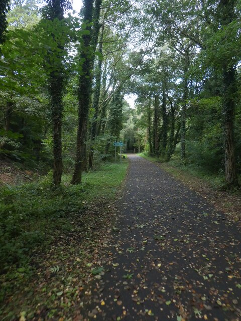
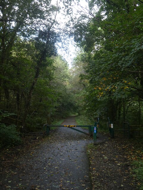
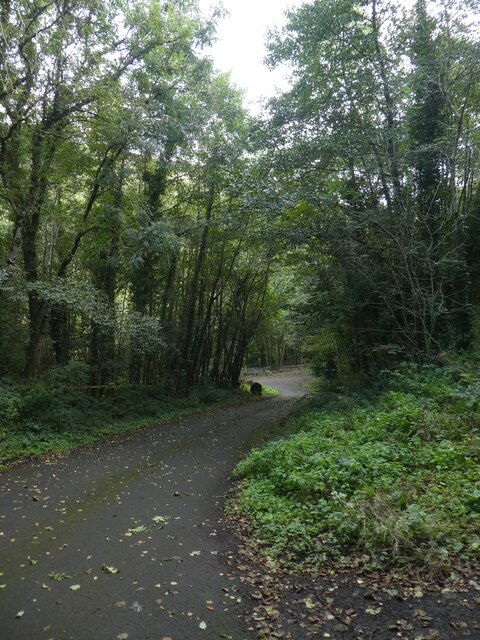
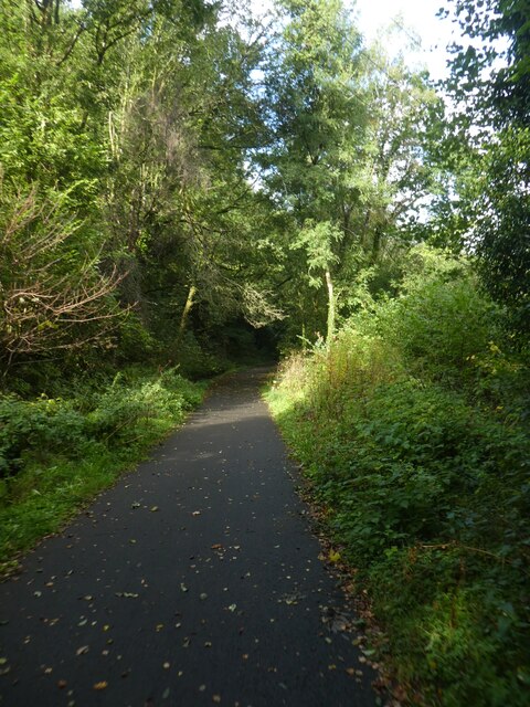
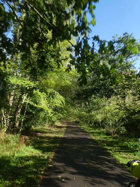
Coed John-Hywel is a picturesque woodland located in Monmouthshire, Wales. Situated in the heart of the county, it covers an area of approximately 200 acres and is known for its stunning natural beauty. The woodland is part of the larger Forest of Dean, which spans across the border between England and Wales.

Coed John-Hywel boasts a diverse range of tree species, including oak, beech, ash, and birch. These trees create a dense canopy, providing shade and shelter for a variety of wildlife. The woodland is home to numerous bird species, such as the great spotted woodpecker, nuthatch, and tawny owl. Other animals that can be spotted in the area include badgers, foxes, and various species of bats.

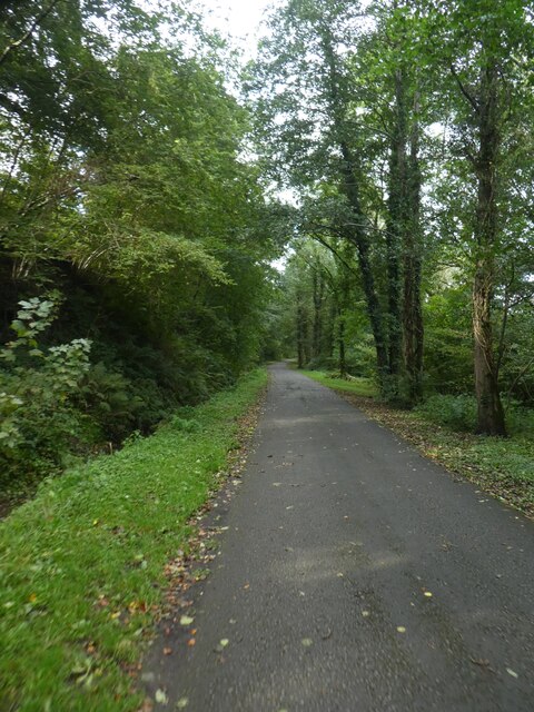
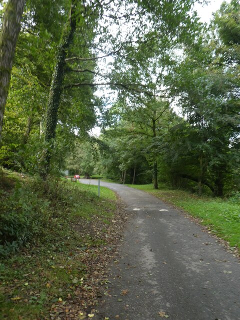
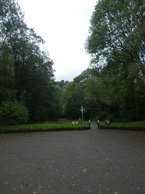
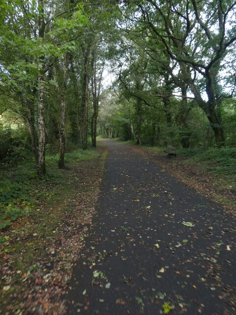
Visitors to Coed John-Hywel can enjoy a network of well-maintained trails that wind through the woodland. These trails offer opportunities for walking, jogging, and cycling, allowing visitors to explore the area at their own pace. The woodland also features several picnic areas, providing a perfect spot for families and friends to enjoy a relaxing outdoor meal surrounded by nature.

Coed John-Hywel is a popular destination for nature enthusiasts and those seeking a peaceful retreat from the hustle and bustle of everyday life. Its tranquil atmosphere and stunning scenery make it an ideal location for photography, birdwatching, or simply immersing oneself in the beauty of the natural world.

If you have any feedback on the listing, please let us know in the comments section below.

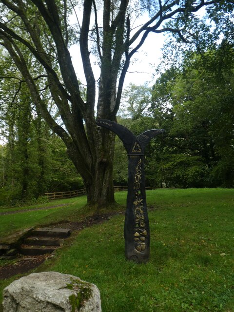
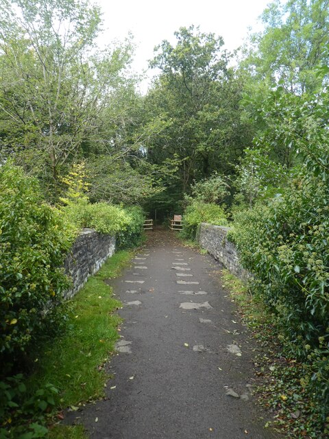
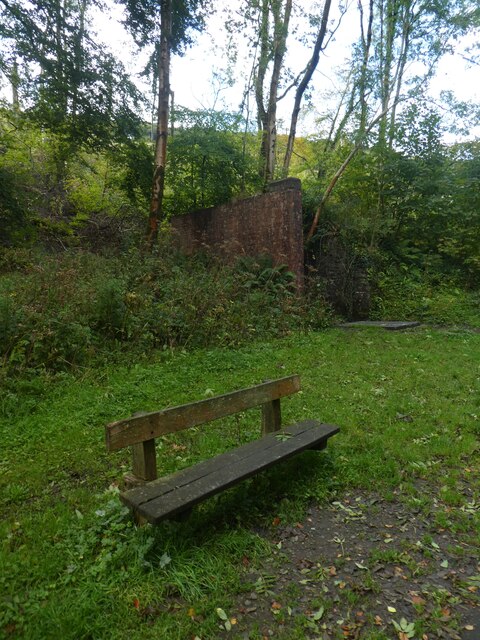
Coed John-Hywel Images

Images are sourced within 2km of 51.609221/-3.154749 or Grid Reference ST2090. Thanks to Geograph Open Source API. All images are credited.

Railway bridge A disused railway line between Bedwas and Machen.
Railway bridge
A disused railway line between Bedwas and Machen.
Houses at the end of Wyndham Street
Ebenezer Chapel, Machen
St John’s Church, Machen
Sirhowy River from Penllywn Tramway Bridge
Shared path in Sirhowy Valley Country Park
Track in Sirhowy Valley Country Park
Speed bump on track in Sirhowy Valley Country Park
Path to tramway bridge, Sirhowy Valley Country Park The 1824 tramway bridge is described in <a href="https://www.geograph.org.uk/photo/1506835">ST2091 : Penllywn Tramway Bridge (Pont Dramffordd Penllywn)</a>
Path to tramway bridge, Sirhowy Valley Country Park
The 1824 tramway bridge is described in ST2091 : Penllywn Tramway Bridge (Pont Dramffordd Penllywn)
Sustrans path marker, Sirhowy Valley Country Park
Path across Penllywn Tramway Bridge
Seat by the track, Sirhowy Valley Country Park A 26 mile walk in the west of the former county of Gwent from the Aneurin Bevan Memorial, Tredegar to Tredegar House, Newport. The route follows the ridgeways and valley floors through three counties, mainly off road and never far from the Sirhowy or Ebbw Rivers or the Monmouthshire & Brecon Canal (Crumlin Arm). 
The route has been extended from Tredegar House south eastwards to join the Wales Coast Path at Lighthouse Road and follows the Path on the Wentlooge Levels as far as West Usk Lighthouse.
Seat by the track, Sirhowy Valley Country Park
A 26 mile walk in the west of the former county of Gwent from the Aneurin Bevan Memorial, Tredegar to Tredegar House, Newport. The route follows the ridgeways and valley floors through three counties, mainly off road and never far from the Sirhowy or Ebbw Rivers or the Monmouthshire & Brecon Canal (Crumlin Arm). The route has been extended from Tredegar House south eastwards to join the Wales Coast Path at Lighthouse Road and follows the Path on the Wentlooge Levels as far as West Usk Lighthouse.
Shared path in Sirhowy Valley Country Park A 26 mile walk in the west of the former county of Gwent from the Aneurin Bevan Memorial, Tredegar to Tredegar House, Newport. The route follows the ridgeways and valley floors through three counties, mainly off road and never far from the Sirhowy or Ebbw Rivers or the Monmouthshire & Brecon Canal (Crumlin Arm). 
The route has been extended from Tredegar House south eastwards to join the Wales Coast Path at Lighthouse Road and follows the Path on the Wentlooge Levels as far as West Usk Lighthouse.
Shared path in Sirhowy Valley Country Park
A 26 mile walk in the west of the former county of Gwent from the Aneurin Bevan Memorial, Tredegar to Tredegar House, Newport. The route follows the ridgeways and valley floors through three counties, mainly off road and never far from the Sirhowy or Ebbw Rivers or the Monmouthshire & Brecon Canal (Crumlin Arm). The route has been extended from Tredegar House south eastwards to join the Wales Coast Path at Lighthouse Road and follows the Path on the Wentlooge Levels as far as West Usk Lighthouse.
Barrier across path in Sirhowy Valley Country Park The shared use path for walkers and cyclists is a temptation for motorcyclists and therefore there are several barriers to limit access
Barrier across path in Sirhowy Valley Country Park
The shared use path for walkers and cyclists is a temptation for motorcyclists and therefore there are several barriers to limit access
Road in Sirhowy Valley Country Park One of the roads that cross the park, looking downhill to the river
Road in Sirhowy Valley Country Park
One of the roads that cross the park, looking downhill to the river
Shared path in Sirhowy Valley Country Park A 26 mile walk in the west of the former county of Gwent from the Aneurin Bevan Memorial, Tredegar to Tredegar House, Newport. The route follows the ridgeways and valley floors through three counties, mainly off road and never far from the Sirhowy or Ebbw Rivers or the Monmouthshire & Brecon Canal (Crumlin Arm). 
The route has been extended from Tredegar House south eastwards to join the Wales Coast Path at Lighthouse Road and follows the Path on the Wentlooge Levels as far as West Usk Lighthouse.
Shared path in Sirhowy Valley Country Park
A 26 mile walk in the west of the former county of Gwent from the Aneurin Bevan Memorial, Tredegar to Tredegar House, Newport. The route follows the ridgeways and valley floors through three counties, mainly off road and never far from the Sirhowy or Ebbw Rivers or the Monmouthshire & Brecon Canal (Crumlin Arm). The route has been extended from Tredegar House south eastwards to join the Wales Coast Path at Lighthouse Road and follows the Path on the Wentlooge Levels as far as West Usk Lighthouse.
NCN47 in Sirhowy Valley Country Park A 26 mile walk in the west of the former county of Gwent from the Aneurin Bevan Memorial, Tredegar to Tredegar House, Newport. The route follows the ridgeways and valley floors through three counties, mainly off road and never far from the Sirhowy or Ebbw Rivers or the Monmouthshire & Brecon Canal (Crumlin Arm). 
The route has been extended from Tredegar House south eastwards to join the Wales Coast Path at Lighthouse Road and follows the Path on the Wentlooge Levels as far as West Usk Lighthouse.
NCN47 in Sirhowy Valley Country Park
A 26 mile walk in the west of the former county of Gwent from the Aneurin Bevan Memorial, Tredegar to Tredegar House, Newport. The route follows the ridgeways and valley floors through three counties, mainly off road and never far from the Sirhowy or Ebbw Rivers or the Monmouthshire & Brecon Canal (Crumlin Arm). The route has been extended from Tredegar House south eastwards to join the Wales Coast Path at Lighthouse Road and follows the Path on the Wentlooge Levels as far as West Usk Lighthouse.
Show me another place!

Coed John-Hywel is located at Grid Ref: ST2090 (Lat: 51.609221, Lng: -3.154749)

Unitary Authority: Caerphilly

Police Authority: Gwent

What 3 Words

///scrapped.owners.reconnect. Near Machen, Caerphilly

Nearby Locations

Coed John-Hywel

Related Wikis

Nine Mile Point railway station

Nine Mile Point railway station was a halt on the Newport to Tredegar line of the Sirhowy Railway. It served the village of Wattsville. It marked the...

Wattsville

Wattsville is a small village in the Sirhowy Valley, eight miles north west of Newport, built in the 20th century for accommodation for mine workers....

Nine Mile Point Colliery

Nine Mile Point colliery was a coal mine at Cwmfelinfach in the South Wales Valleys, originally known as "Coronation Colliery", and constructed between...

White Hart Halt railway station

White Hart Halt was a short-lived railway halt in South Wales. The halt was situated near the White Hart Inn. It was on both the 'up' and 'down' sections...

Machen railway station

Machen railway station was an interchange junction in Caerphilly County Borough, South Wales. It was large and substantial compared with many other stations...
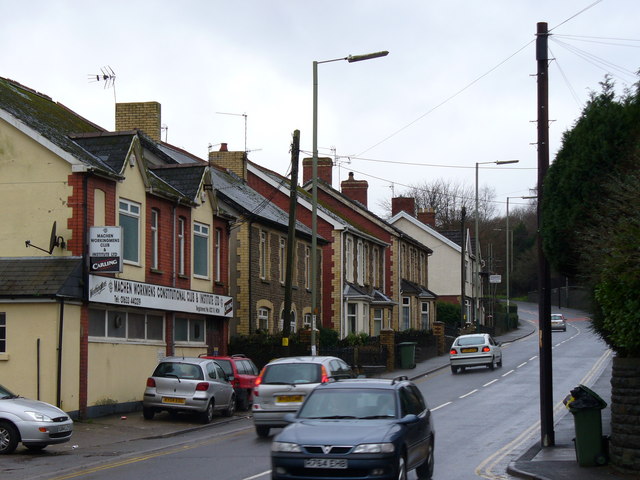
Machen

Machen (from Welsh ma "place (of)" + Cein, a personal name) is a large village three miles east of Caerphilly, south Wales. It is situated in the Caerphilly...

Graig-y-Rhacca

Graig-y-Rhacca is a housing estate bordering Trethomas, Bedwas and Machen in the borough of Caerphilly, southeastern Wales. The town is about 8 miles to...

Cwmfelinfach

Cwmfelinfach is a small village located in the Sirhowy valley of south-east Wales. It is part of the district of Caerphilly within the historic boundaries...

Nearby Amenities

Located within 500m of 51.609221,-3.154749
Ncn Milepost: mills
Source: survey
Sustrans Ref: MP38
Lat/Long: 51.6126899/-3.1510206
Nine Mile Point
Historic Railway: station
Railway: site
Wikidata: Q15262366
Wikipedia: en:Nine Mile Point railway station
Lat/Long: 51.6128494/-3.1505445
Barrier: stile
Lat/Long: 51.6128977/-3.1536705
Barrier: cattle_grid
Lat/Long: 51.6075788/-3.1529535
Barrier: cycle_barrier
Lat/Long: 51.6126476/-3.1509172
Barrier: stile
Lat/Long: 51.6131654/-3.157182
Direction: 165
Generator Method: photovoltaic
Generator Output Electricity: yes
Generator Solar Modules: 12
Generator Source: solar
Generator Type: solar_photovoltaic_panel
Location: roof
Power: generator
Lat/Long: 51.6133299/-3.1564048
The data included in this document is from www.openstreetmap.org. The data is made available under ODbL.

Have you been to Coed John-Hywel?

Leave your review of Coed John-Hywel below (or comments, questions and feedback).