Cae Clyd

Settlement in Merionethshire

Wales

Cae Clyd

Class 150 DMU at Blaenau Ffestiniog The station at Blaenau is served by only a few trains per day running down the Conwy valley from Llandudno. The Ffestiniog railway also runs narrow gauge steam heritage services to Porthmadog, however these were suspended at the start of the Covid-19 pandemic and as of summer 2021 were still not operating as far as Blaenau.
Class 150 DMU at Blaenau Ffestiniog Credit: David Robinson

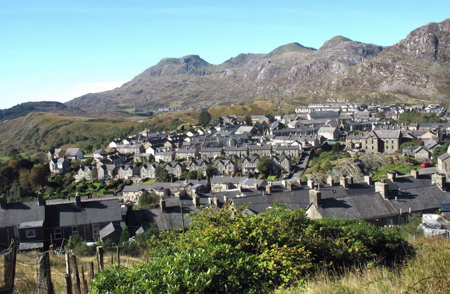
Cae Clyd is a charming village located in the county of Merionethshire, Wales. Nestled amidst the picturesque landscapes of the Snowdonia National Park, this tranquil hamlet offers a serene retreat for nature lovers and outdoor enthusiasts. With a population of around 200 residents, Cae Clyd exudes a close-knit community atmosphere.

The village is known for its stunning natural beauty, surrounded by rolling hills, lush meadows, and enchanting woodlands. It provides an ideal base for exploring the breathtaking scenery and numerous hiking trails that crisscross the region. Outdoor activities such as hillwalking, mountain biking, and birdwatching are popular among visitors and locals alike.

Cae Clyd boasts a rich history, with several historic landmarks and sites of interest. The village church, St. Mary's, is a notable architectural gem, dating back to the 13th century. Its medieval stone structure and intricate stained glass windows attract history enthusiasts and art aficionados.

Despite its small size, Cae Clyd offers essential amenities to cater to the needs of its residents. The village has a local convenience store, a post office, and a cozy pub where locals gather to socialize and enjoy a pint.

The village's peaceful ambiance and scenic surroundings make it an idyllic destination for those seeking respite from the hustle and bustle of city life. Whether exploring the natural wonders of Snowdonia or immersing oneself in the rich heritage of the area, Cae Clyd offers a warm welcome to all who visit.

If you have any feedback on the listing, please let us know in the comments section below.

Cae Clyd Images

Images are sourced within 2km of 52.981069/-3.923948 or Grid Reference SH7044. Thanks to Geograph Open Source API. All images are credited.

Class 150 DMU at Blaenau Ffestiniog The station at Blaenau is served by only a few trains per day running down the Conwy valley from Llandudno. The Ffestiniog railway also runs narrow gauge steam heritage services to Porthmadog, however these were suspended at the start of the Covid-19 pandemic and as of summer 2021 were still not operating as far as Blaenau.
Class 150 DMU at Blaenau Ffestiniog
The station at Blaenau is served by only a few trains per day running down the Conwy valley from Llandudno. The Ffestiniog railway also runs narrow gauge steam heritage services to Porthmadog, however these were suspended at the start of the Covid-19 pandemic and as of summer 2021 were still not operating as far as Blaenau.
View from A470 The Stwlan Dam is just visible in the centre - white image.
View from A470
The Stwlan Dam is just visible in the centre - white image.
Blaenau Ffestiniog Co-op Everywhere you look in Blaenau, there are mountains of slate waste beyond the village.
Blaenau Ffestiniog Co-op
Everywhere you look in Blaenau, there are mountains of slate waste beyond the village.
View from Blaenau Ffestiniog station The rocky outcrop in the background is an unnamed igneous intrusion of rhyolite, being igneous bedrock formed between 485.4 and 443.8 million years ago during the Ordovician period.
View from Blaenau Ffestiniog station
The rocky outcrop in the background is an unnamed igneous intrusion of rhyolite, being igneous bedrock formed between 485.4 and 443.8 million years ago during the Ordovician period.
A470 in Blaenau Ffestiniog
Manod Mawr The peaks (L to R) Manod Bach (511m) and Manod Mawr (661m), Ffestiniog, Merionethshire, Wales.

Viewed from Bryn Coed, Llan Ffestiniog.
Manod Mawr
The peaks (L to R) Manod Bach (511m) and Manod Mawr (661m), Ffestiniog, Merionethshire, Wales. Viewed from Bryn Coed, Llan Ffestiniog.
Afon Teigl in October Afon Teigl yn lliwiau mis hydref.

The River Teigl in the Vale of Ffestiniog, in October colours. Ref:PA280076a.
Afon Teigl in October
Afon Teigl yn lliwiau mis hydref. The River Teigl in the Vale of Ffestiniog, in October colours. Ref:PA280076a.
Afon Teigl in November Afon Teigl yn lliwiau mis tachwedd.

The River Teigl in the Vale of Ffestiniog, in November colours. Ref:PB140276a.
Afon Teigl in November
Afon Teigl yn lliwiau mis tachwedd. The River Teigl in the Vale of Ffestiniog, in November colours. Ref:PB140276a.
Afon Teigl in December Afon Teigl yn lliwiau mis rhagfyr.

The River Teigl in the Vale of Ffestiniog, in December colours. Ref:PC200010a.
Afon Teigl in December
Afon Teigl yn lliwiau mis rhagfyr. The River Teigl in the Vale of Ffestiniog, in December colours. Ref:PC200010a.
Disused incline above Bethania, Blaenau Ffestiniog
Ruins at old slate workings below Manod Mawr, Blaenau Ffestiniog
Manod Mawr South summit cairn Only the base of the trig point remains within the enclosure.
Manod Mawr South summit cairn
Only the base of the trig point remains within the enclosure.
Hammered Shield Lichen The Hammered Shield Lichen (Parmelia sulcata), photographed on a wall in the Vale of Ffestiniog, Gwynedd, in Parc Cenedlaethol Eryri (Snowdonia National Park). Ref:P3260232ag.
Hammered Shield Lichen
The Hammered Shield Lichen (Parmelia sulcata), photographed on a wall in the Vale of Ffestiniog, Gwynedd, in Parc Cenedlaethol Eryri (Snowdonia National Park). Ref:P3260232ag.
Garreg Ddu and Caffi Bont, Blaenau Ffestiniog Garreg Ddu and Caffi Bont seen from Church Street.
Garreg Ddu and Caffi Bont, Blaenau Ffestiniog
Garreg Ddu and Caffi Bont seen from Church Street.
Hunslet 2207 at Blaenau Ffestiniog Hunslet 2207 is a 2ft gauge 4wDM of the 'Hudson-Hunslet' type. It was purchased by the Trefor (Yr Eifl) Granite Quarry on the Llyn Peninsula in 1941. It was delivered by rail to Llanwnda, where it was then transported by road to the wharf at Trefor, where it worked until 1965.

More detailed information on the Ffestpedia <span class="nowrap"><a title="https://www.festipedia.org.uk/wiki/Hunslet_2207" rel="nofollow ugc noopener" href="https://www.festipedia.org.uk/wiki/Hunslet_2207">Link</a><img style="margin-left:2px;" alt="External link" title="External link - shift click to open in new window" src="https://s1.geograph.org.uk/img/external.png" width="10" height="10"/></span>
Hunslet 2207 at Blaenau Ffestiniog
Hunslet 2207 is a 2ft gauge 4wDM of the 'Hudson-Hunslet' type. It was purchased by the Trefor (Yr Eifl) Granite Quarry on the Llyn Peninsula in 1941. It was delivered by rail to Llanwnda, where it was then transported by road to the wharf at Trefor, where it worked until 1965. More detailed information on the Ffestpedia LinkExternal link
Afon Teigl yn mis Awst Afon Teigl in August.
Afon Teigl yn lliwiau mis Awst.

Temperate Rainforest. The River Teigl in the Vale of Ffestiniog, in August colours. Philbhu image ref:PA280076a.
Eryri :: SH5646
Parc Cenedlaethol Eryri (Snowdonia National Park) lies within two counties of Wales (Gwynedd And Conwy) and was created in 1951.
Afon Teigl yn mis Awst
Afon Teigl in August. Afon Teigl yn lliwiau mis Awst. Temperate Rainforest. The River Teigl in the Vale of Ffestiniog, in August colours. Philbhu image ref:PA280076a. Eryri :: SH5646 Parc Cenedlaethol Eryri (Snowdonia National Park) lies within two counties of Wales (Gwynedd And Conwy) and was created in 1951.
Show me another place!

Cae Clyd is located at Grid Ref: SH7044 (Lat: 52.981069, Lng: -3.923948)

Unitary Authority: Gwynedd

Police Authority: North Wales

What 3 Words

///goal.supply.gong. Near Blaenau-Ffestiniog, Gwynedd

Related Wikis

Blaenau Ffestiniog Amateur F.C.

Blaenau Ffestiniog Amateur Football Club are a Welsh football club from Blaenau Ffestiniog, Gwynedd. They play in the North Wales Coast East Football League...

Manod railway station

Manod railway station served the village of Manod which then stood on the southern edge of Blaenau Ffestiniog in Gwynedd, Wales. == Origins == The 1 ft...

Tyddyngwyn railway station

Tyddyngwyn railway station was immediately north of the later Manod station in what was then Merionethshire, now Gwynedd, Wales. Tyddyngwyn was an intermediate...

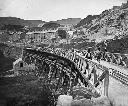
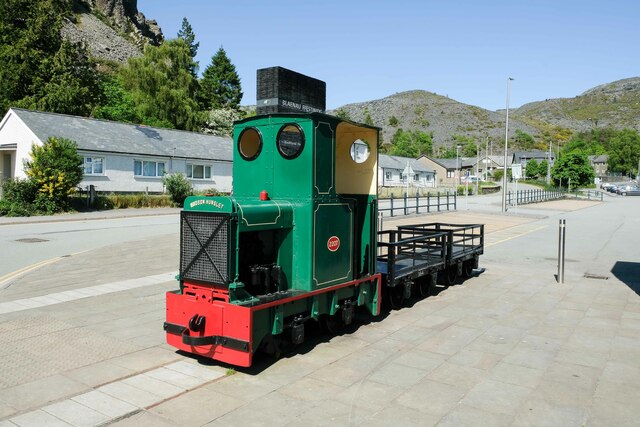
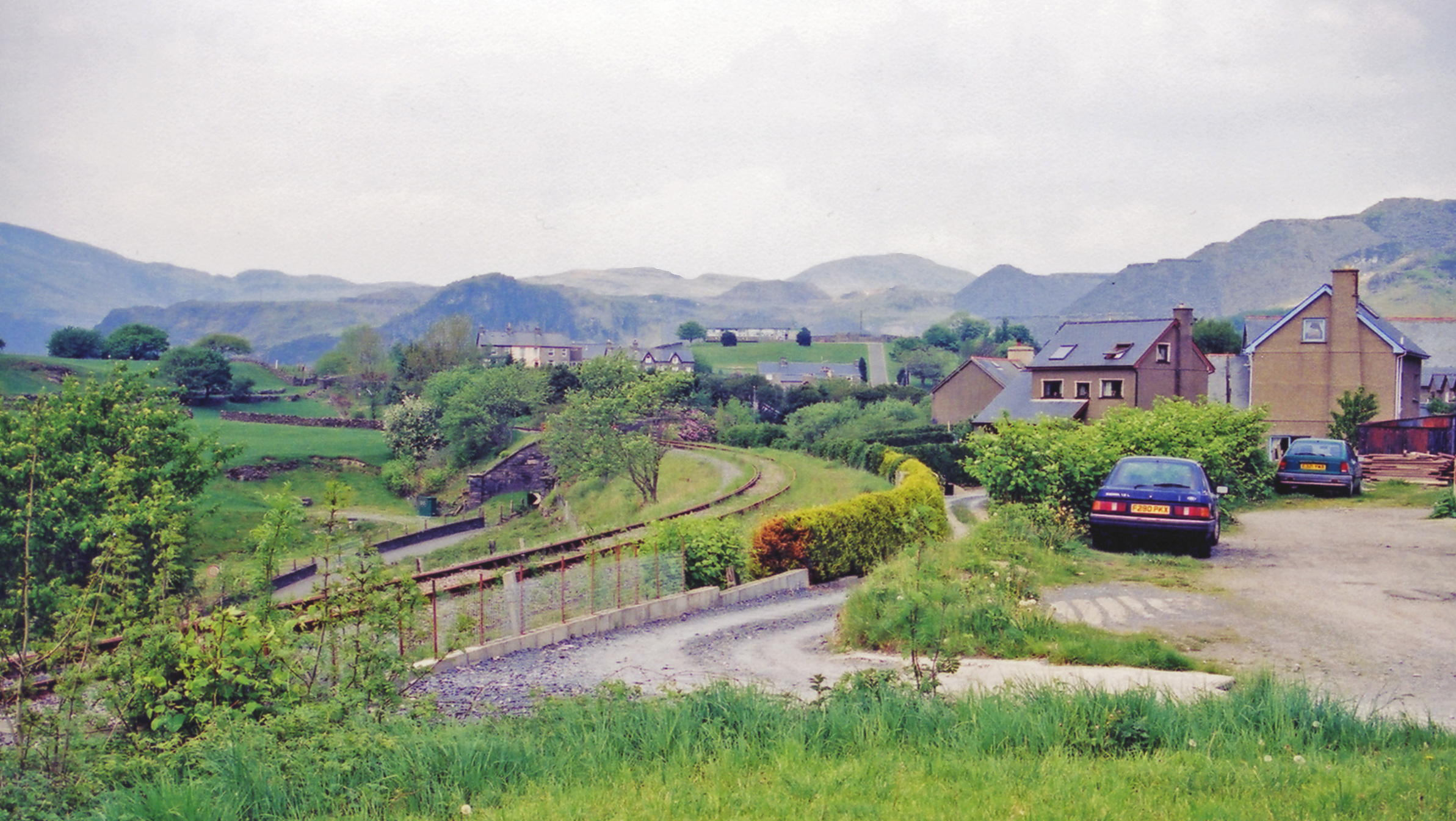
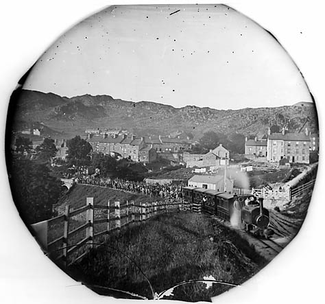
Festiniog and Blaenau Railway

The Festiniog & Blaenau Railway (F&BR) was a narrow gauge railway built in 1868 to connect the town of Blaenau Ffestiniog in Wales with the slate quarries...

Tan-y-Manod railway station

Tan-y-Manod railway station was a railway station approximately 1 mile (1.6 km) south of Blaenau Ffestiniog, in Gwynedd (formerly Merionethshire), North...

Ffestiniog

Ffestiniog () is a community in Gwynedd in Wales, containing several villages, in particular the settlements of Llan Ffestiniog and Blaenau Ffestiniog...

Car gwyllt

The car gwyllt ("wild car"; plural: ceir gwyllt) is a Welsh invention used by quarrymen to ride downhill on the steep inclined planes of a slate quarry...

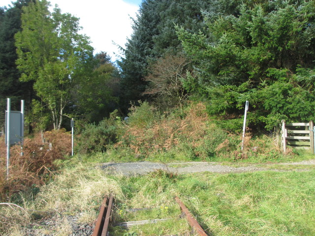
Teigl Halt railway station

Teigl Halt was a solely passenger railway station which served the rural area of Cwm Teigl, south of Blaenau Ffestiniog, Wales. == Origins == The line...

Nearby Amenities

Located within 500m of 52.981069,-3.923948
Manod
Abandoned Railway: station
Railway: site
Wikidata: Q6751104
Wikipedia: en:Manod railway station
Lat/Long: 52.9816222/-3.9313608
Disused Railway: level_crossing
Lat/Long: 52.9779008/-3.9288428
Barrier: cattle_grid
Lat/Long: 52.9774485/-3.9257756
Crossing
Lat/Long: 52.9814311/-3.9298323
Bus Stop
Naptan AtcoCode: 5400AWD70732
Naptan NaptanCode: gwndmap
Lat/Long: 52.9815511/-3.9298884
Bus Stop
Naptan AtcoCode: 5400AWQ26347
Naptan NaptanCode: gwndjwp
Lat/Long: 52.981216/-3.929812
Congl-y-wal
Place: neighbourhood
Lat/Long: 52.9792299/-3.9296989
Power: pole
Lat/Long: 52.9772655/-3.9214978
Power: pole
Lat/Long: 52.9777342/-3.9228996
Power: pole
Lat/Long: 52.9768395/-3.9227119
Power: pole
Lat/Long: 52.9778239/-3.9237763
Power: pole
Lat/Long: 52.9771415/-3.9260692
Power: pole
Lat/Long: 52.9772304/-3.9252725
Cae Clyd
Place: neighbourhood
Lat/Long: 52.9789601/-3.9233598
Power: pole
Lat/Long: 52.9780678/-3.9206701
Power: pole
Lat/Long: 52.9778053/-3.921346
Power: pole
Lat/Long: 52.9766653/-3.9252886
Telephone
Lat/Long: 52.9819381/-3.9304865
Power: pole
Lat/Long: 52.9849598/-3.9275388
Power: pole
Lat/Long: 52.9844649/-3.9279844
Power: pole
Lat/Long: 52.9831719/-3.9289536
Power: pole
Lat/Long: 52.9838288/-3.9285427
Barrier: kissing_gate
Lat/Long: 52.9805219/-3.9261252
Power: pole
Lat/Long: 52.9806706/-3.924973
Power: pole
Lat/Long: 52.9807432/-3.9249341
Power: pole
Lat/Long: 52.980308/-3.9256749
Power: pole
Lat/Long: 52.9798888/-3.9264843
Power: pole
Lat/Long: 52.9796347/-3.9278867
Power: pole
Lat/Long: 52.9792552/-3.9284151
Power: pole
Lat/Long: 52.9779673/-3.926569
Power: pole
Lat/Long: 52.9784439/-3.9273273
Power: pole
Lat/Long: 52.9789824/-3.9282572
Power: pole
Lat/Long: 52.9797242/-3.9286955
Power: pole
Lat/Long: 52.977492/-3.9257602
Power: pole
Lat/Long: 52.9776325/-3.9219723
Power: pole
Lat/Long: 52.9772373/-3.9223149
Power: pole
Lat/Long: 52.9772201/-3.9232187
Power: pole
Lat/Long: 52.9772819/-3.9204227
Power: substation
Lat/Long: 52.9833/-3.930264
Post Box
Post Box Type: lamp
Source: survey (from car)
Lat/Long: 52.9812665/-3.9299393
Direction: 280
Generator Method: photovoltaic
Generator Output Electricity: yes
Generator Solar Modules: 8
Generator Source: solar
Generator Type: solar_photovoltaic_panel
Location: roof
Power: generator
Lat/Long: 52.979703/-3.9305949
Direction: 280
Generator Method: photovoltaic
Generator Output Electricity: yes
Generator Solar Modules: 8
Generator Source: solar
Generator Type: solar_photovoltaic_panel
Location: roof
Power: generator
Lat/Long: 52.9797692/-3.9305694
Direction: SSW
Generator Method: photovoltaic
Generator Output Electricity: yes
Generator Solar Modules: 14
Generator Source: solar
Generator Type: solar_photovoltaic_panel
Location: roof
Power: generator
Lat/Long: 52.980814/-3.9247477
Direction: SSW
Generator Method: photovoltaic
Generator Output Electricity: yes
Generator Solar Modules: 10
Generator Source: solar
Generator Type: solar_photovoltaic_panel
Location: roof
Power: generator
Lat/Long: 52.9812888/-3.9273414
Direction: SSW
Generator Method: photovoltaic
Generator Output Electricity: yes
Generator Solar Modules: 6
Generator Source: solar
Generator Type: solar_photovoltaic_panel
Location: roof
Power: generator
Lat/Long: 52.9812194/-3.9271644
Direction: SSW
Generator Method: photovoltaic
Generator Output Electricity: yes
Generator Solar Modules: 16
Generator Source: solar
Generator Type: solar_photovoltaic_panel
Location: roof
Power: generator
Lat/Long: 52.9818879/-3.9308578
Information: route_marker
Tourism: information
Lat/Long: 52.9783843/-3.920196
Information: route_marker
Tourism: information
Lat/Long: 52.9785016/-3.9208682
Information: guidepost
Tourism: information
Lat/Long: 52.9793525/-3.9221849
Bench
Lat/Long: 52.979466/-3.9228309
Information: guidepost
Tourism: information
Lat/Long: 52.9805552/-3.9261049
Defibrillator
Defibrillator Location: on fence
Emergency: defibrillator
Indoor: no
Ref: LL41 4AU
Lat/Long: 52.9811572/-3.9280314
The data included in this document is from www.openstreetmap.org. The data is made available under ODbL.

Have you been to Cae Clyd?

Leave your review of Cae Clyd below (or comments, questions and feedback).