Manod
Settlement in Merionethshire
Wales
Manod

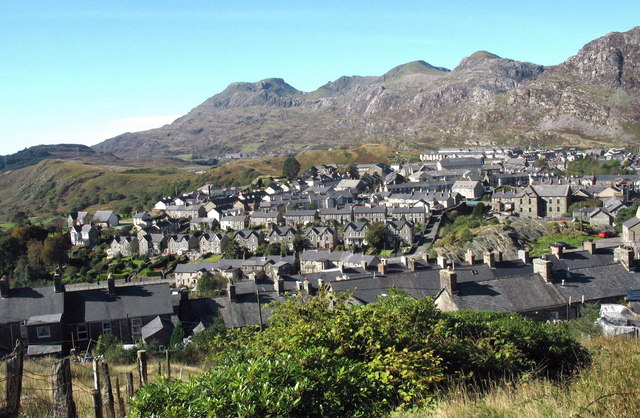
Manod is a small village located in the historic county of Merionethshire, in northwest Wales. Situated in the southern part of the Snowdonia National Park, Manod is surrounded by stunning natural beauty, including the majestic peaks of the Rhinogydd mountain range to the east. The village lies about 2 miles southeast of the town of Blaenau Ffestiniog.
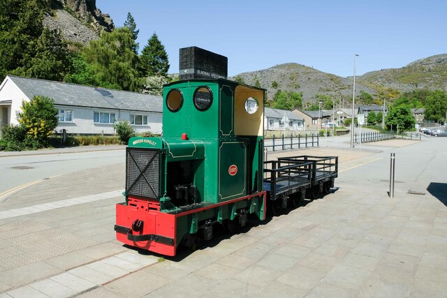
Manod has a rich mining heritage that dates back to the 19th century. The village was once home to the Manod slate quarry, which was a significant source of employment for the local community. Today, the quarry is no longer operational, but its remains serve as a reminder of the area's industrial past.
In addition to its mining history, Manod offers visitors a range of outdoor activities. The nearby mountains provide ample opportunities for hiking, climbing, and mountain biking. The village is also close to Llyn Manod, a picturesque lake that is popular for fishing and boating.
Manod is a close-knit community with a small population. It boasts a village hall, a primary school, and a few local shops. For more amenities, residents can easily access the larger town of Blaenau Ffestiniog, which offers a wider range of services.
Overall, Manod is a tranquil and picturesque village, perfect for those seeking a peaceful retreat in the heart of the Welsh countryside. Its mining history, natural beauty, and proximity to Snowdonia National Park make it an appealing destination for both locals and tourists alike.
If you have any feedback on the listing, please let us know in the comments section below.
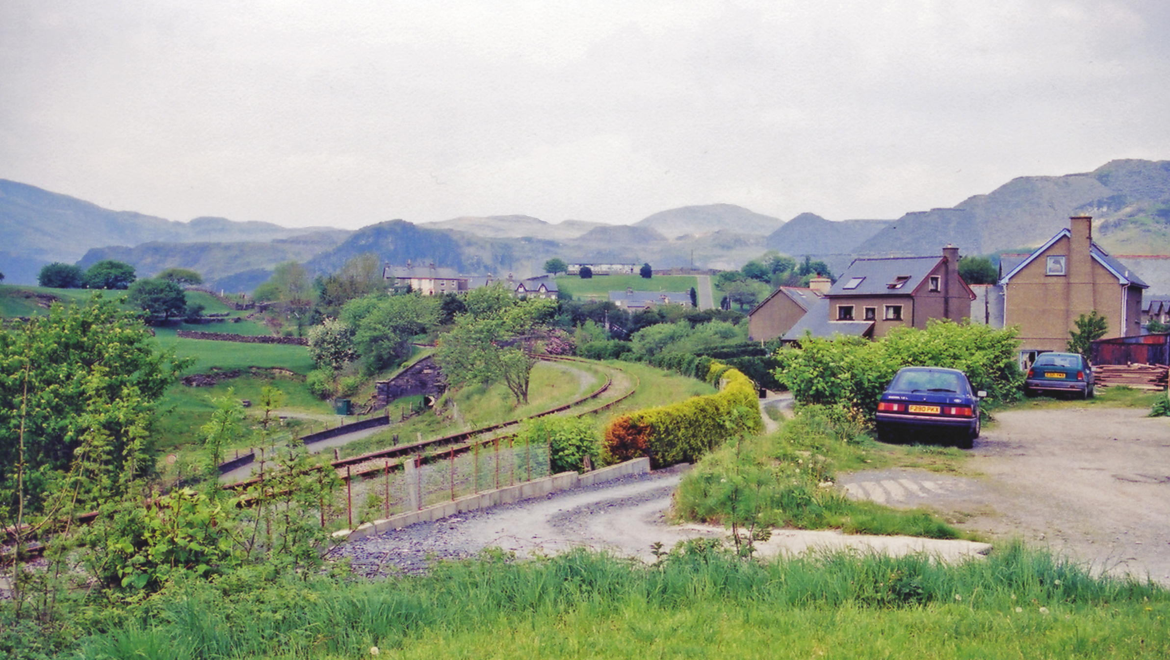
Manod Images
Images are sourced within 2km of 52.984508/-3.928123 or Grid Reference SH7044. Thanks to Geograph Open Source API. All images are credited.


Manod is located at Grid Ref: SH7044 (Lat: 52.984508, Lng: -3.928123)
Unitary Authority: Gwynedd
Police Authority: North Wales
What 3 Words
///craters.reclined.shackles. Near Blaenau-Ffestiniog, Gwynedd
Nearby Locations
Related Wikis

Tyddyngwyn railway station
Tyddyngwyn railway station was immediately north of the later Manod station in what was then Merionethshire, now Gwynedd, Wales. Tyddyngwyn was an intermediate...
Manod railway station
Manod railway station served the village of Manod which then stood on the southern edge of Blaenau Ffestiniog in Gwynedd, Wales. == Origins == The 1 ft...
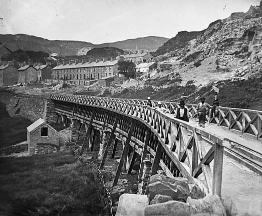
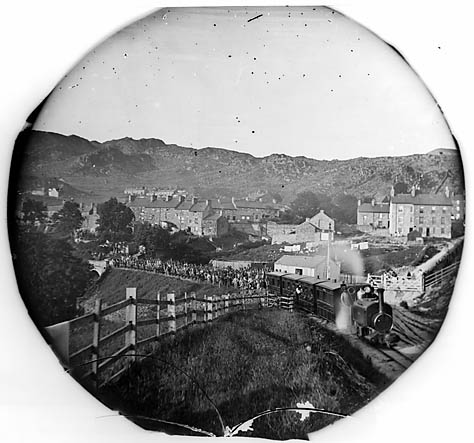
Festiniog and Blaenau Railway
The Festiniog & Blaenau Railway (F&BR) was a narrow gauge railway built in 1868 to connect the town of Blaenau Ffestiniog in Wales with the slate quarries...
Blaenau Ffestiniog Amateur F.C.
Blaenau Ffestiniog Amateur Football Club are a Welsh football club from Blaenau Ffestiniog, Gwynedd. They play in the North Wales Coast East Football League...
Tan-y-Manod railway station
Tan-y-Manod railway station was a railway station approximately 1 mile (1.6 km) south of Blaenau Ffestiniog, in Gwynedd (formerly Merionethshire), North...
Ffestiniog
Ffestiniog () is a community in Gwynedd in Wales, containing several villages, in particular the settlements of Llan Ffestiniog and Blaenau Ffestiniog...

Ffestiniog Memorial Hospital
Ffestiniog Memorial Hospital (Welsh: Ysbyty Coffa Ffestiniog) was a hospital in Blaenau Ffestiniog, Gwynedd, Wales. Closed in 2013, it was managed by the...
Glynllifon Street railway station
Glynllifon Street railway station was a temporary northern terminus station of the Festiniog and Blaenau Railway (F&BR), sited between the street of the...
Nearby Amenities
Located within 500m of 52.984508,-3.928123Have you been to Manod?
Leave your review of Manod below (or comments, questions and feedback).