Coed Llwybr-y-bi

Wood, Forest in Flintshire

Wales

Coed Llwybr-y-bi

St Peter's Church, Holywell A modern, multi-purpose church building. The grid-line bisects the church and only the left-hand side of the building is in the square.
St Peter's Church, Holywell Credit: John H Darch

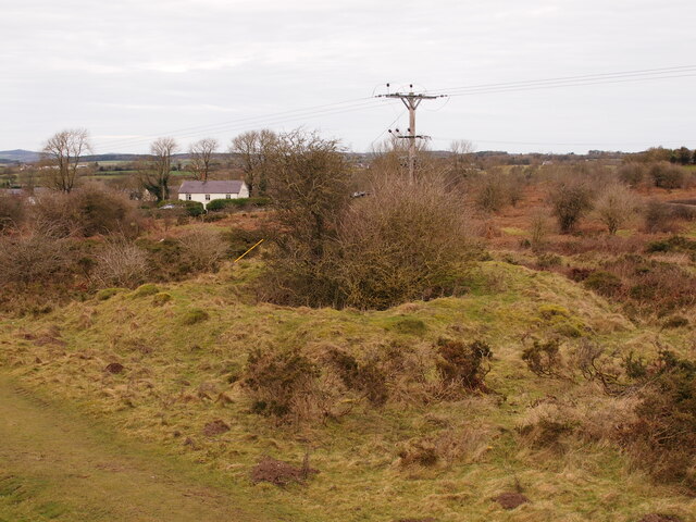
Coed Llwybr-y-bi, located in Flintshire, Wales, is a picturesque wood or forest that offers visitors a tranquil and scenic experience. Covering an area of approximately 220 hectares, the woodland is a haven for nature enthusiasts and those seeking a peaceful retreat.

The wood is known for its diverse range of flora and fauna, with a variety of tree species including oak, beech, and ash creating a vibrant and lush environment. The forest floor is adorned with an array of wildflowers during the spring and summer months, adding bursts of color to the landscape.

Numerous walking trails wind their way through Coed Llwybr-y-bi, allowing visitors to explore its enchanting beauty at their own pace. The paths are well-maintained and provide easy access for all abilities, making it a popular spot for families, hikers, and dog walkers alike.

Wildlife enthusiasts will be delighted by the abundance of creatures that call this forest home. Avid birdwatchers can spot a variety of bird species, including woodpeckers, owls, and various songbirds. Squirrels are a common sight, darting through the treetops, while lucky visitors may even catch a glimpse of deer or foxes that roam the area.

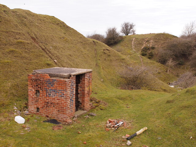
Coed Llwybr-y-bi is not only a natural oasis but also a place of historical significance. The woodland has remnants of ancient settlements, with archaeological evidence suggesting human activity in the area dating back thousands of years. These historical features add an extra layer of intrigue and make it an ideal destination for those interested in both natural and cultural heritage.

Overall, Coed Llwybr-y-bi is a captivating woodland retreat that offers visitors a chance to immerse themselves in nature, explore its rich biodiversity, and uncover its fascinating history.

If you have any feedback on the listing, please let us know in the comments section below.

Coed Llwybr-y-bi Images

Images are sourced within 2km of 53.265688/-3.2095274 or Grid Reference SJ1974. Thanks to Geograph Open Source API. All images are credited.

St Peter's Church, Holywell A modern, multi-purpose church building. The grid-line bisects the church and only the left-hand side of the building is in the square.
St Peter's Church, Holywell
A modern, multi-purpose church building. The grid-line bisects the church and only the left-hand side of the building is in the square.
St Winefride's Chapel View from south in 1980.
St Winefride's Chapel
View from south in 1980.
St Winefride's Well & Chapel in 1995 View from the north
St Winefride's Well & Chapel in 1995
View from the north
St Winefride's Well, Holywell A religious site popular with European Roman Catholics. There is an outdoor bathing pool but this indoor well within St Winefride's Chapel is strictly not for bathing. You can see the water rising within it.
St Winefride's Well, Holywell
A religious site popular with European Roman Catholics. There is an outdoor bathing pool but this indoor well within St Winefride's Chapel is strictly not for bathing. You can see the water rising within it.
St James's Church, Holywell The edge of St Winefride's Chapel is seen on the left.
St James's Church, Holywell
The edge of St Winefride's Chapel is seen on the left.
Holway Level Mine, Holywell This is the entrance to the Holway Level, a two mile tunnel that lead to one of the most productive lead mines in Britain. The Level drained the water from the mine and also allowed the ore to be brought out by boat. The tunnel was developed into a tourist attraction in 1788. The galena in the mine contained up to 80% lead and 12% silver. Since 1917 this level has supplied St Winefride's well as the original supply was interrupted by the construction of the Milwr Tunnel.
Holway Level Mine, Holywell
This is the entrance to the Holway Level, a two mile tunnel that lead to one of the most productive lead mines in Britain. The Level drained the water from the mine and also allowed the ore to be brought out by boat. The tunnel was developed into a tourist attraction in 1788. The galena in the mine contained up to 80% lead and 12% silver. Since 1917 this level has supplied St Winefride's well as the original supply was interrupted by the construction of the Milwr Tunnel.
St Winefride's Chapel. Holywell This covers St Winefride's Well and is very popular with European Catholics. The access is from the other side at a lower level.
St Winefride's Chapel. Holywell
This covers St Winefride's Well and is very popular with European Catholics. The access is from the other side at a lower level.
St Winefride's Well, Holywell This is the outdoor bathing area where visitors are allowed to bathe at specified times. The source is inside the chapel behind the photographer and bathing is not allowed in there.
St Winefride's Well, Holywell
This is the outdoor bathing area where visitors are allowed to bathe at specified times. The source is inside the chapel behind the photographer and bathing is not allowed in there.
Old Shaft Bryn-Sannan
Disused Quarry Building, Pant y Pydew
Bryn Mawr Quarry
Bryn Mawr Quarry
Pub and beer garden
Pub and beer garden
Ordnance Survey Cut Mark This OS cut mark can be found on the wall of the chapel on Whitford Street. It marks a point 113.201m above mean sea level.
Ordnance Survey Cut Mark
This OS cut mark can be found on the wall of the chapel on Whitford Street. It marks a point 113.201m above mean sea level.
Ordnance Survey Cut Mark This OS cut mark can be found on the wall of No32 Whitford Street. It marks a point 367.5ft above mean sea level.
Ordnance Survey Cut Mark
This OS cut mark can be found on the wall of No32 Whitford Street. It marks a point 367.5ft above mean sea level.
Ordnance Survey Cut Mark This OS cut mark can be found on the Town Hall, High Street. It marks a point 107.675m above mean sea level.
Ordnance Survey Cut Mark
This OS cut mark can be found on the Town Hall, High Street. It marks a point 107.675m above mean sea level.
Ordnance Survey Cut Mark This OS cut mark can be found on the old bank, High Street. It marks a point 109.746m above mean sea level.
Ordnance Survey Cut Mark
This OS cut mark can be found on the old bank, High Street. It marks a point 109.746m above mean sea level.
Ordnance Survey Cut Mark This OS cut mark can be found on the NW buttress of the school. It marks a point 372.23ft above mean sea level.
Ordnance Survey Cut Mark
This OS cut mark can be found on the NW buttress of the school. It marks a point 372.23ft above mean sea level.
Ordnance Survey Cut Mark This OS cut mark can be found on the old Court House, Halkyn Street. It marks a point 112.872m above mean sea level.
Ordnance Survey Cut Mark
This OS cut mark can be found on the old Court House, Halkyn Street. It marks a point 112.872m above mean sea level.
Show me another place!

Coed Llwybr-y-bi is located at Grid Ref: SJ1974 (Lat: 53.265688, Lng: -3.2095274)

Unitary Authority: Flintshire

Police Authority: North Wales

What 3 Words

///limits.skimmers.ocean. Near Holywell, Flintshire

Related Wikis

Lluesty Hospital

Lluesty Hospital (Welsh: Ysbyty Lluesty) was a community hospital in Holywell, Flintshire, Wales. It was managed by the Betsi Cadwaladr University Health...

Holywell Workhouse Chapel

Holywell Workhouse Chapel was built in association with Holywell Workhouse in Old Chester Road, Holywell, Flintshire, Wales (grid reference SJ189750)....

Holywell Town F.C.

Holywell Town Football Club (Welsh: Clwb Pêl-droed Treffynnon) is a Welsh football club from Holywell, Flintshire. They are nicknamed 'The Wellmen', and...

Holywell Community Hospital

Holywell Community Hospital (Welsh: Ysbyty Cymuned Treffynnon) is a community hospital in Halkyn Road, Holywell, Flintshire, Wales. It is managed by the...

Holywell Town Hall

Holywell Town Hall (Welsh: Neuadd y Dref Treffynnon) is a municipal structure in the High Street in Holywell, Wales. The façade of the town hall, which...

Holywell Town railway station

Holywell Town railway station was a station in Holywell, Flintshire, Wales. The station was opened on 1 July 1912 and closed on 6 September 1954. There...

Holywell, Flintshire

Holywell ( HOLL-ee-wel; Welsh: Treffynnon) is a market town and community in Flintshire, Wales. It lies to the west of the estuary of the River Dee. The...

Holywell Rural District

Holywell was a rural district in the administrative county of Flintshire, Wales, from 1894 to 1974. The district was created by the Local Government Act...

Related Videos

Safety First: Understanding When to Abandon Your Mountain Climb

Our twelth mountain of twelve months of mountains and it was a hard one. We headed back to where we started twelve months ...

The Pilgrims Way - A Welsh Camino - Intro

The Pilgrims Way - A Welsh Camino – Introduction The North Wales Pilgrims Way is a 134 mile long-distance walking route in ...

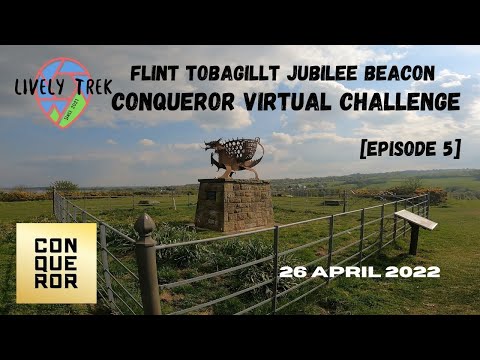
Flint to Bagillt Beacon Walking Wales l Coastal Path for Conqueror Virtual Challenge Episode 5

Join me as I walk to get my miles in for my Romantic Road Challenge and explore more of the Wales Costal Path from the edge of ...

Holywell North Wales

Walking In Holywell.

Nearby Amenities

Located within 500m of 53.265688,-3.2095274
Mini Roundabout
Direction: clockwise
Lat/Long: 53.2660316/-3.2162846
Stamford Gate Hotel
Addr Postcode: CH8 7SJ
Addr Street: Halkyn Road
Fhrs Id: 119461
Source Postcode: FHRS Open Data
Tourism: hotel
Wikidata: Q80577797
Lat/Long: 53.2658389/-3.2149184
Fuel
Shell
Addr Postcode: CH8 7SG
Brand: Shell
Brand Wikidata: Q110716465
Name Cy: Shell
Opening Hours: Mo-Su 06:00-23:00
Phone: +44 1352 710343
Ref Navads: NVDS353_10019680
Website: https://find.shell.com/gb/fuel/10019680-eg-treffynnon-service-station
Lat/Long: 53.2655558/-3.2155888
Milwr
Place: village
Lat/Long: 53.2621409/-3.2118931
Power: pole
Lat/Long: 53.2698905/-3.207215
Man Made: adit
Lat/Long: 53.2638309/-3.2084251
Historic: mine_shaft
Lat/Long: 53.2617801/-3.2128601
Power: pole
Lat/Long: 53.2617264/-3.2113081
Power: pole
Lat/Long: 53.262163/-3.2111039
Power: pole
Lat/Long: 53.262765/-3.211216
Power: pole
Lat/Long: 53.2629676/-3.2117516
Man Made: mineshaft
Lat/Long: 53.2618995/-3.2104348
Direction: 195
Generator Method: photovoltaic
Generator Output Electricity: yes
Generator Solar Modules: 12
Generator Source: solar
Generator Type: solar_photovoltaic_panel
Location: roof
Power: generator
Lat/Long: 53.262827/-3.2124723
Direction: 195
Generator Method: photovoltaic
Generator Output Electricity: yes
Generator Solar Modules: 12
Generator Source: solar
Generator Type: solar_photovoltaic_panel
Location: roof
Power: generator
Lat/Long: 53.2626831/-3.2130416
Direction: SSE
Generator Method: photovoltaic
Generator Output Electricity: yes
Generator Solar Modules: 16
Generator Source: solar
Generator Type: solar_photovoltaic_panel
Location: roof
Power: generator
Lat/Long: 53.2623225/-3.2130671
Direction: WSW
Generator Method: photovoltaic
Generator Output Electricity: yes
Generator Solar Modules: 10
Generator Source: solar
Generator Type: solar_photovoltaic_panel
Location: roof
Power: generator
Lat/Long: 53.2637404/-3.2146449
Milwr Lead Mine
Place: locality
Lat/Long: 53.2615593/-3.2100768
Direction: SW
Generator Method: photovoltaic
Generator Output Electricity: yes
Generator Solar Modules: 11
Generator Source: solar
Generator Type: solar_photovoltaic_panel
Location: roof
Power: generator
Lat/Long: 53.2660195/-3.2158305
Direction: ENE
Generator Method: photovoltaic
Generator Output Electricity: yes
Generator Solar Modules: 10
Generator Source: solar
Generator Type: solar_photovoltaic_panel
Location: roof
Power: generator
Lat/Long: 53.2637679/-3.2145651
The data included in this document is from www.openstreetmap.org. The data is made available under ODbL.

Have you been to Coed Llwybr-y-bi?

Leave your review of Coed Llwybr-y-bi below (or comments, questions and feedback).