Cadwell

Settlement in Bedfordshire North Hertfordshire

England

Cadwell

Lavender, Cadwell Farm, Hitchin Cadwell Farm is given over to growing lavender and sunflowers.
Lavender, Cadwell Farm, Hitchin Credit: Christine Matthews

Cadwell is a small village located in the county of Bedfordshire, England. Situated approximately 10 miles west of the county town of Bedford, Cadwell is nestled in a rural area surrounded by picturesque countryside.

With a population of around 300 residents, Cadwell is a close-knit community where the pace of life is peaceful and tranquil. The village is characterized by its charming, traditional architecture, consisting mainly of well-preserved cottages and farmhouses. The local church, St. Peter's, is a notable landmark, dating back to the 12th century and showcasing beautiful medieval architecture.

Despite its small size, Cadwell offers several amenities for its residents. These include a local pub, providing a gathering place for locals and visitors alike, as well as a village hall which serves as a hub for community events and activities. The village also benefits from a primary school, ensuring that local children have access to education within their immediate vicinity.

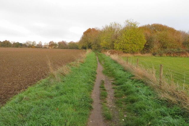
Cadwell's location within the Bedfordshire countryside provides ample opportunities for outdoor activities. The surrounding area is dotted with scenic walking and cycling trails, allowing residents to explore the natural beauty of the region. Additionally, the nearby River Great Ouse offers opportunities for boating and fishing.

In terms of transport links, Cadwell is conveniently located near major road networks, with the A428 passing close by, providing easy access to nearby towns and cities. The village is also served by bus routes, connecting it to surrounding areas.

Overall, Cadwell is a charming and peaceful village, offering a close-knit community, traditional architecture, and access to the natural beauty of Bedfordshire's countryside.

If you have any feedback on the listing, please let us know in the comments section below.
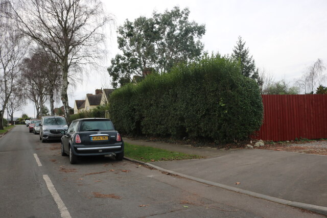
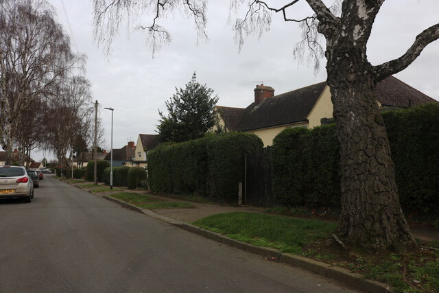
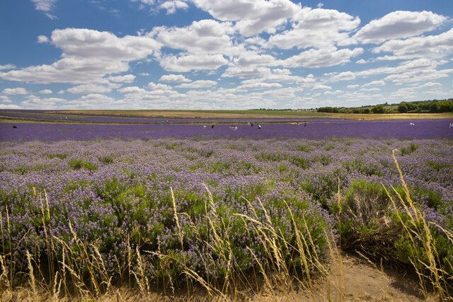
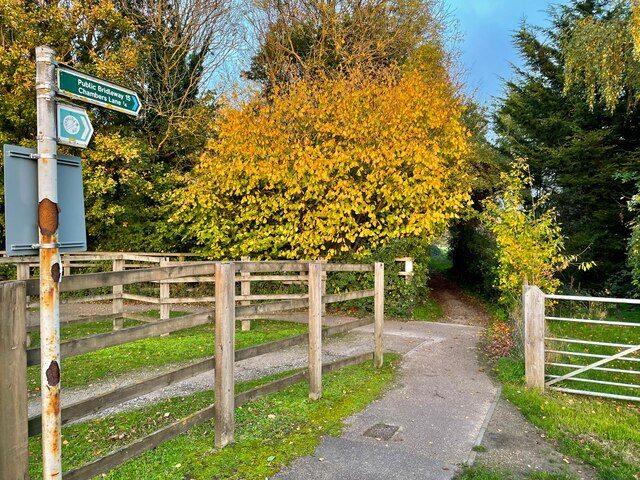
Cadwell Images

Images are sourced within 2km of 51.977663/-0.269841 or Grid Reference TL1832. Thanks to Geograph Open Source API. All images are credited.

Lavender, Cadwell Farm, Hitchin Cadwell Farm is given over to growing lavender and sunflowers.
Lavender, Cadwell Farm, Hitchin
Cadwell Farm is given over to growing lavender and sunflowers.
Lavender, Cadwell Farm, Hitchin Cadwell Farm is given over to growing lavender and sunflowers.
Lavender, Cadwell Farm, Hitchin
Cadwell Farm is given over to growing lavender and sunflowers.
Wild Flowers, Cadwell Farm, Hitchin Cadwell Farm is given over to growing lavender and sunflowers.  It also has a wild flower meadow.
Wild Flowers, Cadwell Farm, Hitchin
Cadwell Farm is given over to growing lavender and sunflowers. It also has a wild flower meadow.
Wild Flowers, Cadwell Farm, Hitchin Cadwell Farm is given over to growing lavender and sunflowers.  It also has a wild flower meadow.
Wild Flowers, Cadwell Farm, Hitchin
Cadwell Farm is given over to growing lavender and sunflowers. It also has a wild flower meadow.
Wild Flowers, Cadwell Farm, Hitchin Cadwell Farm is given over to growing lavender and sunflowers.  It also has a wild flower meadow.
Wild Flowers, Cadwell Farm, Hitchin
Cadwell Farm is given over to growing lavender and sunflowers. It also has a wild flower meadow.
Lavender, Cadwell Farm, Hitchin Cadwell Farm is given over to growing lavender and sunflowers.  It also has a wild flower meadow.
Lavender, Cadwell Farm, Hitchin
Cadwell Farm is given over to growing lavender and sunflowers. It also has a wild flower meadow.
Lavender, Cadwell Farm, Hitchin Cadwell Farm is given over to growing lavender and sunflowers.  It also has a wild flower meadow.
Lavender, Cadwell Farm, Hitchin
Cadwell Farm is given over to growing lavender and sunflowers. It also has a wild flower meadow.
Lavender, Cadwell Farm, Hitchin Cadwell Farm is given over to growing lavender and sunflowers.  It also has a wild flower meadow.
Lavender, Cadwell Farm, Hitchin
Cadwell Farm is given over to growing lavender and sunflowers. It also has a wild flower meadow.
Wheat Field, Cadwell Farm, Hitchin Cadwell Farm is mainly given over to growing lavender and sunflowers.  It also has a wild flower meadow.
Wheat Field, Cadwell Farm, Hitchin
Cadwell Farm is mainly given over to growing lavender and sunflowers. It also has a wild flower meadow.
Lavender Field, Cadwell Farm, Hitchin Cadwell Farm is mainly given over to growing lavender and sunflowers.  It also has a wild flower meadow.
Lavender Field, Cadwell Farm, Hitchin
Cadwell Farm is mainly given over to growing lavender and sunflowers. It also has a wild flower meadow.
Lavender Field, Cadwell Farm, Hitchin Cadwell Farm is mainly given over to growing lavender and sunflowers.  It also has a wild flower meadow.
Lavender Field, Cadwell Farm, Hitchin
Cadwell Farm is mainly given over to growing lavender and sunflowers. It also has a wild flower meadow.
Lavender Field, Cadwell Farm, Hitchin Cadwell Farm is mainly given over to growing lavender and sunflowers.  It also has a wild flower meadow.
Lavender Field, Cadwell Farm, Hitchin
Cadwell Farm is mainly given over to growing lavender and sunflowers. It also has a wild flower meadow.
Lavender Field, Cadwell Farm, Hitchin Cadwell Farm is mainly given over to growing lavender and sunflowers.  It also has a wild flower meadow.
Lavender Field, Cadwell Farm, Hitchin
Cadwell Farm is mainly given over to growing lavender and sunflowers. It also has a wild flower meadow.
Ryder Avenue, Ickleford
Cadwell Farm Lavender Fields All kinds lavender are grown at this farm.
Cadwell Farm Lavender Fields
All kinds lavender are grown at this farm.
Bridleway to Chambers Lane
Icknield Way Ickleford
Show me another place!

Cadwell is located at Grid Ref: TL1832 (Lat: 51.977663, Lng: -0.269841)

Administrative County: Hertfordshire

District: North Hertfordshire

Police Authority: Hertfordshire

What 3 Words

///lunching.chucks.appealed. Near Letchworth, Hertfordshire

Related Wikis

Hitchin Flyover

The Hitchin Flyover is a grade-separated single-track railway viaduct near Hitchin, Hertfordshire, England, which carries the Down Cambridge Flyover line...

Church of St Katharine, Ickleford

The Church of St Katharine of Alexandria is the Church of England parish church for Ickleford in Hertfordshire. It comes under the diocese of St Albans...

River Oughton

The River Oughton is a two mile long tributary of the River Hiz in Hitchin, Hertfordshire. It rises at Oughtonhead and flows north-east between Oughtonhead...

Ickleford

Ickleford is a large village situated on the northern outskirts of Hitchin in North Hertfordshire in England. It lies on the west bank of the River Hiz...

Wilbury Hill Camp

Wilbury Hill Camp is a late Bronze Age (about 700 BC) hill fort west of Letchworth in Hertfordshire. It and Arbury Banks near Ashwell are two of a line...
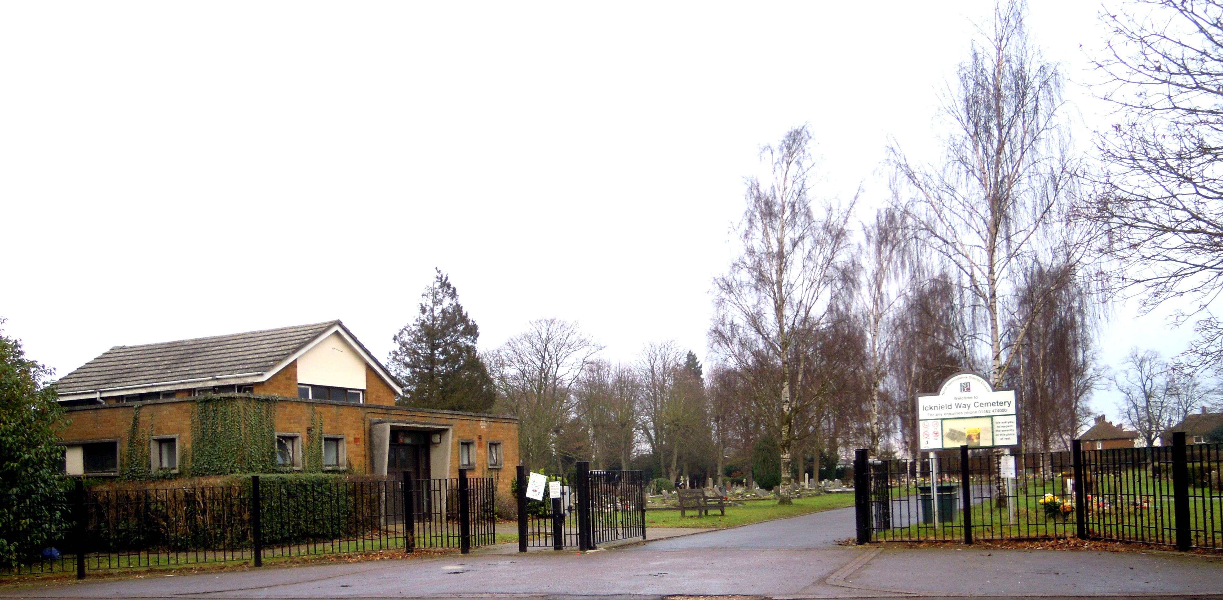
Letchworth Cemetery

Letchworth Cemetery (properly the Icknield Way Cemetery) was the first burial ground for Letchworth Garden City in Hertfordshire. Letchworth's first cemetery...
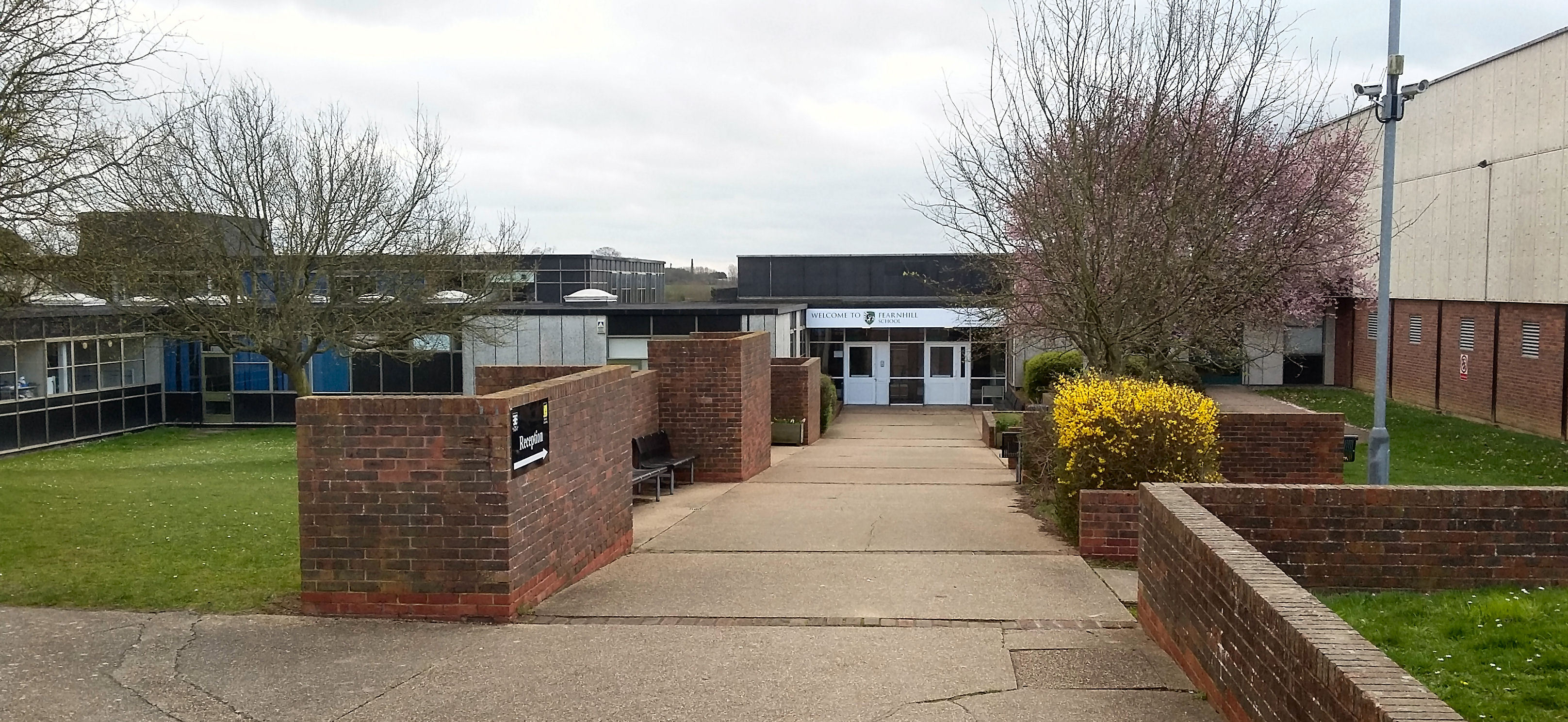
Fearnhill School

Fearnhill School is a mixed secondary school and sixth form located in Letchworth, Hertfordshire, England. == Admissions == Fearnhill School (formerly...

River Purwell

The River Purwell is a chalk stream in Hertfordshire, England. The entire course of the stream is near Hitchin. Its source is springs which rise out of...

Nearby Amenities

Located within 500m of 51.977663,-0.269841
Bus Stop
The Green
Bus: yes
Naptan AtcoCode: 210021108540
Naptan Bearing: NW
Naptan CommonName: The Green
Naptan Crossing: opp Lower Green Farm
Naptan Indicator: adj
Naptan Landmark: opp Lower Green Farm
Naptan NaptanCode: hrtgjawm
Naptan PlusbusZoneRef: HITCHIN
Naptan ShortCommonName: NA
Naptan Street: Arlesey Road
Naptan Verified: no
Public Transport: platform
Source: naptan_import
Lat/Long: 51.9771708/-0.2730673
Bus Stop
The Green
Naptan AtcoCode: 210021111080
Naptan Bearing: SE
Naptan CommonName: The Green
Naptan Crossing: Lower Green Farm
Naptan Indicator: opp
Naptan Landmark: Lower Green Farm
Naptan NaptanCode: hrtgdpjd
Naptan PlusbusZoneRef: HITCHIN
Naptan ShortCommonName: NA
Naptan Street: Arlesey Road
Naptan Verified: no
Source: naptan_import
Lat/Long: 51.9772331/-0.2730213
Barrier: kissing_gate
Foot: yes
Lat/Long: 51.9759443/-0.2719335
Barrier: kissing_gate
Foot: yes
Lat/Long: 51.9765005/-0.2717538
Post Box
Post Box Design: type_m
Post Box Type: lamp
Ref: SG5 129
Lat/Long: 51.97714/-0.2751584
Railway: switch
Lat/Long: 51.9743738/-0.2715548
Railway: switch
Lat/Long: 51.9751457/-0.2714193
Cafe
Cadwell Farm Lavender Fields & Café
Addr City: Hitchin
Addr Postcode: SG5 3UA
Addr Village: Ickleford
Website: https://www.hitchinlavender.com/
Lat/Long: 51.9770132/-0.2694021
Barrier: kissing_gate
Foot: yes
Lat/Long: 51.9759553/-0.2719429
Barrier: kissing_gate
Foot: yes
Source: GPS, observation
Lat/Long: 51.9795979/-0.2749237
Hicca Way
Information: board
Source: GPS, observation
Tourism: information
Lat/Long: 51.9786298/-0.2753073
Communication Mobile Phone: yes
Man Made: mast
Tower Type: communication
Lat/Long: 51.9759704/-0.2719139
Cadwell
Railway: crossover
Ref: ARLSCAD
Ref Tiploc: ARLSCAD
Lat/Long: 51.9747595/-0.2714872
The data included in this document is from www.openstreetmap.org. The data is made available under ODbL.

Have you been to Cadwell?

Leave your review of Cadwell below (or comments, questions and feedback).