Bodynfoel Wood

Wood, Forest in Montgomeryshire

Wales

Bodynfoel Wood

Entrance to Twll From Pen-Llys road
Entrance to Twll Credit: John Firth

Bodynfoel Wood is a picturesque woodland located in Montgomeryshire, Wales. Covering an area of approximately 100 acres, this ancient forest is home to a diverse range of flora and fauna, making it a popular destination for nature lovers and hikers alike.

The wood is predominantly made up of native oak and beech trees, creating a dense canopy that provides shelter for a variety of wildlife, including deer, squirrels, and numerous species of birds. The forest floor is carpeted with bluebells and wildflowers in the spring, creating a stunning display of color.

There are a number of well-maintained walking trails that wind their way through the woodland, offering visitors the opportunity to explore the beauty of the forest at their own pace. The tranquil atmosphere of Bodynfoel Wood makes it the perfect place for a peaceful stroll or a relaxing picnic.

Overall, Bodynfoel Wood is a hidden gem in Montgomeryshire, offering visitors a chance to escape the hustle and bustle of everyday life and immerse themselves in the natural beauty of the Welsh countryside.

If you have any feedback on the listing, please let us know in the comments section below.

Bodynfoel Wood Images

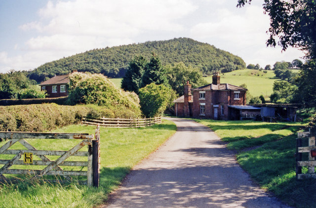
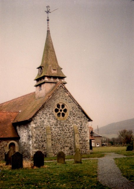
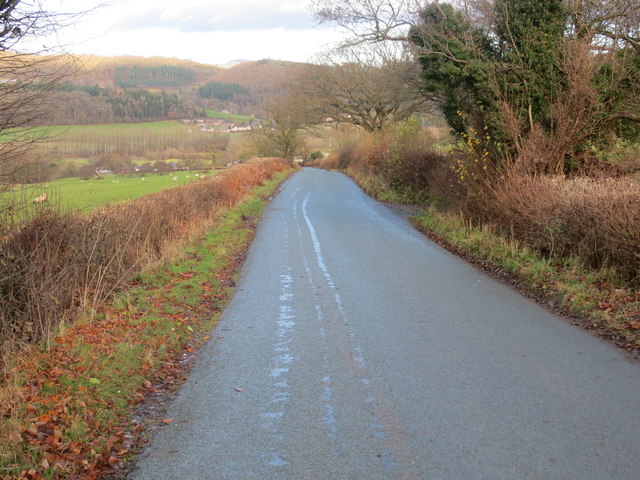
Images are sourced within 2km of 52.787059/-3.2104577 or Grid Reference SJ1821. Thanks to Geograph Open Source API. All images are credited.

Entrance to Twll From Pen-Llys road
Entrance to Twll
From Pen-Llys road
Road junction at Wern-y-Glyn Viewed from road to Pen-Llys
Road junction at Wern-y-Glyn
Viewed from road to Pen-Llys
Bodynfoel Hall
Bodynfoel Hall
Old church in Llanfechain Yet another church looking unloved, under utilised and under an uncertain future.
Old church in Llanfechain
Yet another church looking unloved, under utilised and under an uncertain future.
Llanfechain: former station, 1999 View SE to the former station, now a private house, on the ex-Cambrian Railways Llanymynech (to left) - (to right) Llanfyllin branch, closed 18/1/65. The hill ahead is Long Hill (286 ft.).
Llanfechain: former station, 1999
View SE to the former station, now a private house, on the ex-Cambrian Railways Llanymynech (to left) - (to right) Llanfyllin branch, closed 18/1/65. The hill ahead is Long Hill (286 ft.).
Ordnance Survey Cut Mark This OS cut mark can be found on the west face of the old Bethesda Chapel. It marks a point 283.805m above mean sea level.
Ordnance Survey Cut Mark
This OS cut mark can be found on the west face of the old Bethesda Chapel. It marks a point 283.805m above mean sea level.
Church of St. Garmon, Llanfechain
Track entering the woodland of Mynydd Jaram Looking south-eastward.
Track entering the woodland of Mynydd Jaram
Looking south-eastward.
Hedge enclosed country lane near Jaram Looking westward.
Hedge enclosed country lane near Jaram
Looking westward.
Road and former Bethseda Chapel in Bwlchyddar Looking north-eastward,
Road and former Bethseda Chapel in Bwlchyddar
Looking north-eastward,
High Road and Low Road Forestry track joining the road near Coed y Wern-ddu-uchaf. Looking south-westward.
High Road and Low Road
Forestry track joining the road near Coed y Wern-ddu-uchaf. Looking south-westward.
Country lane near Ty'n-y-fedw Looking north-eastward.
Country lane near Ty'n-y-fedw
Looking north-eastward.
Plas yn Dinas, Llanfechain This is rather an upmarket pub for a small village where the emphasis is on food and the menu is certainly several notches above standard pub grub. The building was originally a courthouse probably dating from the 16th century - the name translates literally into English as 'City Halls'.
Plas yn Dinas, Llanfechain
This is rather an upmarket pub for a small village where the emphasis is on food and the menu is certainly several notches above standard pub grub. The building was originally a courthouse probably dating from the 16th century - the name translates literally into English as 'City Halls'.
Llanfechain Church The church is dedicated to Garmon, a 9th century Celtic saint who is believed to have been the first Bishop of Man; it is said that a mound in the churchyard was used by Garmon for preaching. Parts of the building date from the 13th century and it is grade II* listed.
Llanfechain Church
The church is dedicated to Garmon, a 9th century Celtic saint who is believed to have been the first Bishop of Man; it is said that a mound in the churchyard was used by Garmon for preaching. Parts of the building date from the 13th century and it is grade II* listed.
Llanfechain Churchyard Showing one corner of St Garmon's church.
Llanfechain Churchyard
Showing one corner of St Garmon's church.
Old Milestone northeast of Bwlchyddar, Llangedwyn parish Wrexham Plate by the UC road, in parish of Llangedwyn (Powys District), Bwlchyddar, Coed y Wern-ddu-uchaf, on verge, North side of road.

Inscription reads:-
WREXHAM DISTRICT
1894
DCC
........M
WREXHAM 26
OSWESTRY 11
LLANSILIN 5
LLANFYLLIN 3

Grade II listed by Cadw.
Reference Number: 81946 <span class="nowrap"><a title="https://cadwpublic-api.azurewebsites.net/reports/listedbuilding/FullReport?lang=&id=81946" rel="nofollow ugc noopener" href="https://cadwpublic-api.azurewebsites.net/reports/listedbuilding/FullReport?lang=&id=81946">Link</a><img style="margin-left:2px;" alt="External link" title="External link - shift click to open in new window" src="https://s1.geograph.org.uk/img/external.png" width="10" height="10"/></span>

Surveyed 

Milestone Society National ID: DEN_LFOWa03
Old Milestone northeast of Bwlchyddar, Llangedwyn parish
Wrexham Plate by the UC road, in parish of Llangedwyn (Powys District), Bwlchyddar, Coed y Wern-ddu-uchaf, on verge, North side of road. Inscription reads:- WREXHAM DISTRICT 1894 DCC ........M WREXHAM 26 OSWESTRY 11 LLANSILIN 5 LLANFYLLIN 3 Grade II listed by Cadw. Reference Number: 81946 LinkExternal link Surveyed Milestone Society National ID: DEN_LFOWa03
Ordnance Survey Cut Mark This OS cut mark can be found on the milestone north side of the road. It marks a point 249.545m above mean sea level. <a title="https://www.geograph.org.uk/photo/7102298" href="https://www.geograph.org.uk/photo/7102298">Link</a>
Ordnance Survey Cut Mark
This OS cut mark can be found on the milestone north side of the road. It marks a point 249.545m above mean sea level. Link
Milestone - Oswestry 11 There is an OS cut mark on the side of the stone. <a title="https://www.geograph.org.uk/photo/7102297" href="https://www.geograph.org.uk/photo/7102297">Link</a>
Milestone - Oswestry 11
There is an OS cut mark on the side of the stone. Link
Show me another place!

Bodynfoel Wood is located at Grid Ref: SJ1821 (Lat: 52.787059, Lng: -3.2104577)

Unitary Authority: Powys

Police Authority: Dyfed Powys

What 3 Words

///sprouting.emails.educates. Near Llanfechain, Powys

Related Wikis

Battle of Mechain

The Battle of Mechain was fought in Powys, Wales, in 1070, for rule of the Welsh kingdoms of Gwynedd and Powys. The battlefield may be near Llanfechain...

St Garmon's Church, Llanfechain

St Garmon's Church, Llanfechain, is in the village of Llanfechain, Powys, Wales. It is an active Anglican parish church in the deanery of Llanfyllin, the...

Llanfechain

Llanfechain is a village and community in Powys, Wales, on the B4393 road between Llanfyllin and Llansantffraid-ym-Mechain. Historically it belonged to...

Llanfechain railway station

Llanfechain railway station is a former station in Llanfechain, Powys, Wales. The station opened in 1865 and closed in 1965. The station site is now a...

Nearby Amenities

Located within 500m of 52.787059,-3.2104577
Mynydd Jaram
Ele: 336
Natural: peak
Lat/Long: 52.7889903/-3.2109411
Place: farm
Lat/Long: 52.7843934/-3.2134473
The data included in this document is from www.openstreetmap.org. The data is made available under ODbL.

Have you been to Bodynfoel Wood?

Leave your review of Bodynfoel Wood below (or comments, questions and feedback).