Cabus

Settlement in Lancashire Wyre

England

Cabus

Station Lane at Scorton View from West Coast Main Line Railway
Station Lane at Scorton Credit: Raymond Knapman

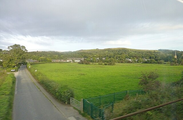
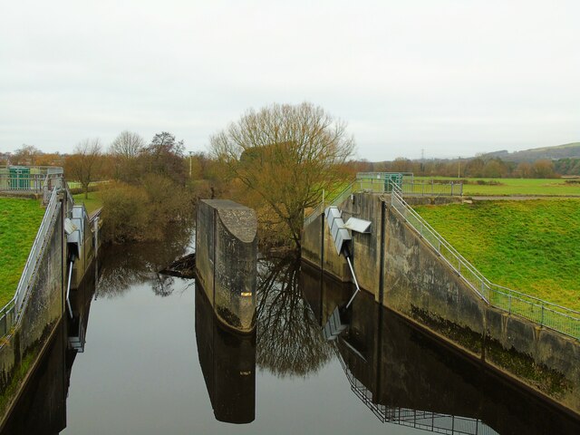
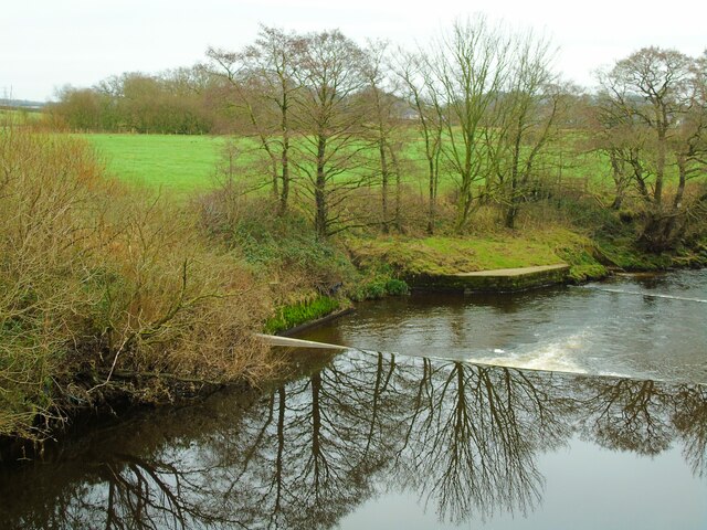
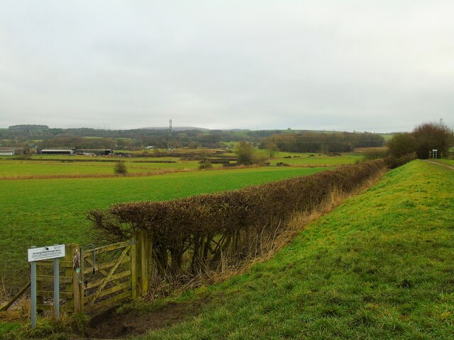
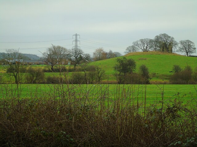
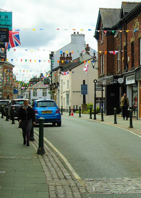
Cabus is a small village located in the district of Wyre, Lancashire, England. Situated on the banks of the River Wyre, it is situated approximately 4 miles southeast of the market town of Garstang. The village is surrounded by picturesque countryside, offering residents and visitors stunning views of the surrounding landscape.

Cabus has a population of around 500 people and is primarily a residential area. The village is known for its peaceful and rural atmosphere, making it an ideal place for those seeking a tranquil lifestyle away from the hustle and bustle of larger towns and cities. The community in Cabus is close-knit, with a friendly and welcoming atmosphere.

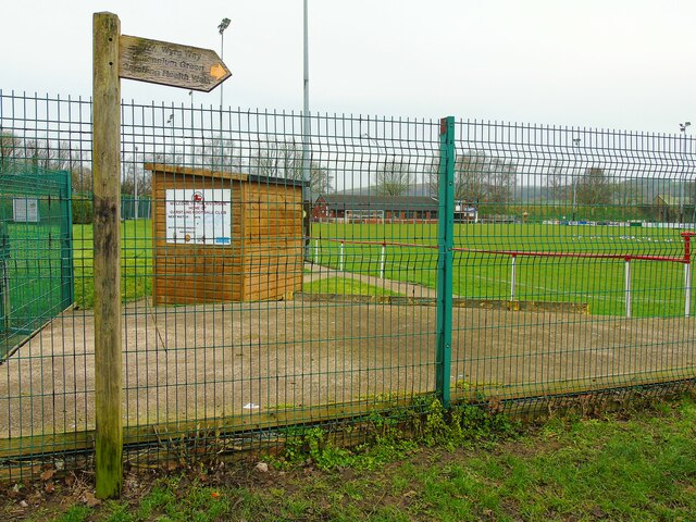
Though small, Cabus offers a range of amenities to its residents. There is a local primary school, providing education for children in the area. The village also has a village hall, which serves as a community hub for various events and gatherings. Additionally, there is a small convenience store, ensuring that residents have access to basic necessities without needing to travel far.

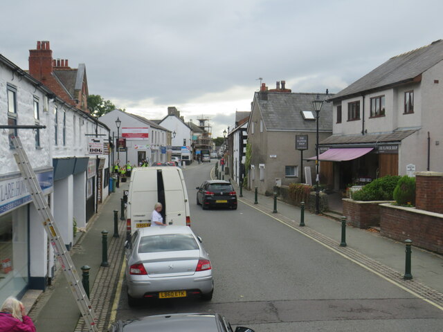
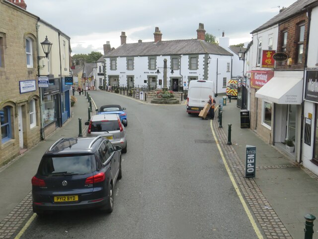
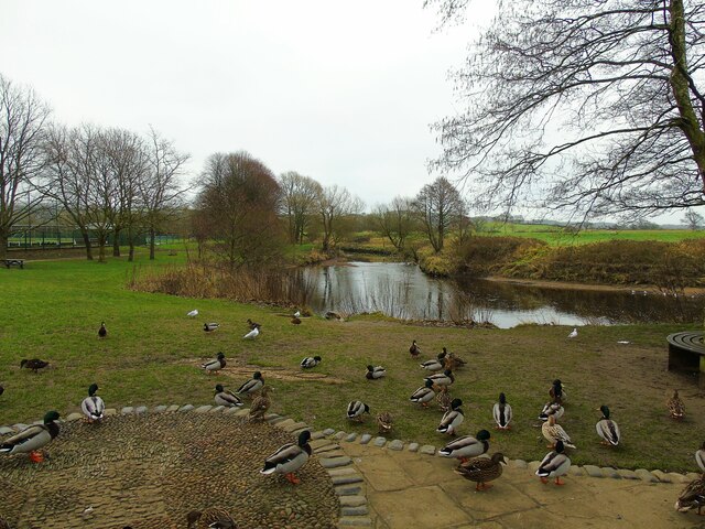
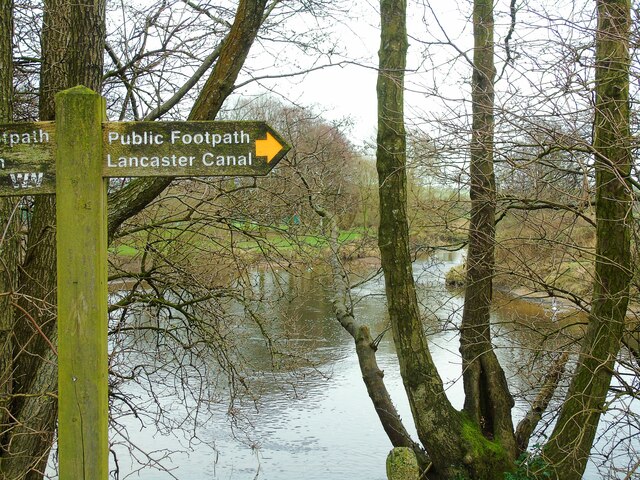
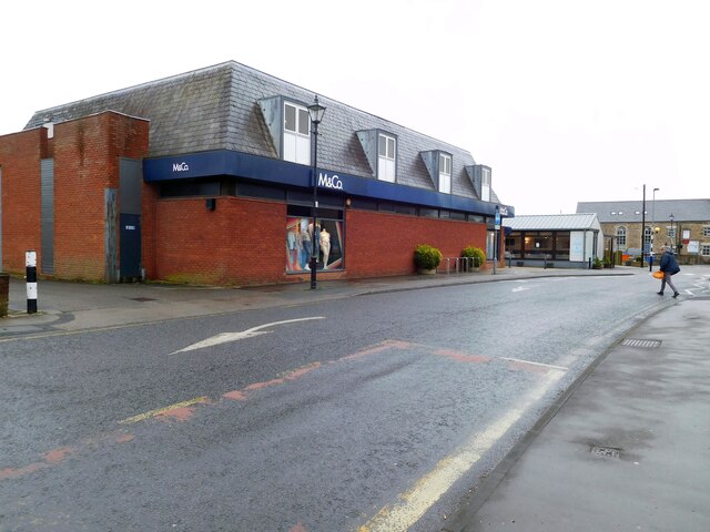
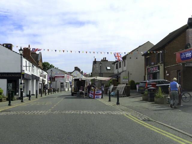
Cabus benefits from its proximity to the River Wyre, providing opportunities for outdoor activities such as fishing and boating. The surrounding countryside also offers excellent walking and cycling routes, allowing residents to enjoy the natural beauty of the area. For those seeking more amenities and services, the nearby town of Garstang provides a wider range of options.

In summary, Cabus is a peaceful and picturesque village in Lancashire, offering a close-knit community and a rural way of life. With its beautiful countryside and range of amenities, it provides a charming place to live or visit.

If you have any feedback on the listing, please let us know in the comments section below.

Cabus Images

Images are sourced within 2km of 53.918242/-2.773636 or Grid Reference SD4947. Thanks to Geograph Open Source API. All images are credited.

Station Lane at Scorton View from West Coast Main Line Railway
Station Lane at Scorton
View from West Coast Main Line Railway
Croston Road, Garstang Croston Road in the small town of Garstang in Lancashire.  A small parade of local shops stands on the right hand side of the road.
Croston Road, Garstang
Croston Road in the small town of Garstang in Lancashire. A small parade of local shops stands on the right hand side of the road.
High Street, Garstang High Street in the centre of the small town of Garstang in Lancashire.
High Street, Garstang
High Street in the centre of the small town of Garstang in Lancashire.
High Street, Garstang A view of the High Street in the small town of Garstang, in Lancashire.
High Street, Garstang
A view of the High Street in the small town of Garstang, in Lancashire.
River Wyre at High Street car park This is the River Wyre as it meanders by the High Street car park in Garstang, Lancashire.
River Wyre at High Street car park
This is the River Wyre as it meanders by the High Street car park in Garstang, Lancashire.
Garstang Football Club Taken on the Wyre Way at the ground of Garstang Football, Rugby and Cricket Clubs. Garstang, Lancashire.
Garstang Football Club
Taken on the Wyre Way at the ground of Garstang Football, Rugby and Cricket Clubs. Garstang, Lancashire.
Garstang Flood Storage Basin dam This is the dam whose gates are raised to control the flow of water along the River Wyre as it passes Garstang and Catterall at times of flood. Garstang, Lancashire.
Garstang Flood Storage Basin dam
This is the dam whose gates are raised to control the flow of water along the River Wyre as it passes Garstang and Catterall at times of flood. Garstang, Lancashire.
Weirs on the River Wyre These weirs are south of the footbridge beside the Flood Storage Basin which controls water flow on the River Wyre as it passes Garstang, Lancashire.
Weirs on the River Wyre
These weirs are south of the footbridge beside the Flood Storage Basin which controls water flow on the River Wyre as it passes Garstang, Lancashire.
Garstang Flood Storage Basin Taken baside the Garstang Flood Storage Basin, Garstang, Lancashire, I am looking east towards Calder Vale. The traffic flow on the M6 can be discerned in the distance.
Garstang Flood Storage Basin
Taken baside the Garstang Flood Storage Basin, Garstang, Lancashire, I am looking east towards Calder Vale. The traffic flow on the M6 can be discerned in the distance.
Greenhalgh Castle Farm This is Greenhalgh Castle Farm, taken from the riverside path along the River Wyre in Garstang. On the hillock is what remains of Greenhalgh Castle which was built in the late 15th century by Thomas Stanley, 1st Earl of Derby, to protect lands which are said to have been gifted to him by Henry Tudor.
Greenhalgh Castle Farm
This is Greenhalgh Castle Farm, taken from the riverside path along the River Wyre in Garstang. On the hillock is what remains of Greenhalgh Castle which was built in the late 15th century by Thomas Stanley, 1st Earl of Derby, to protect lands which are said to have been gifted to him by Henry Tudor.
The Wyre Way to Lancaster Canal This is the section of the Wyre Way at the High Street car park in Garstang, Lancashire, which takes the walker to Lancaster Canal as it passes to the south of the town.
The Wyre Way to Lancaster Canal
This is the section of the Wyre Way at the High Street car park in Garstang, Lancashire, which takes the walker to Lancaster Canal as it passes to the south of the town.
OS Bench Mark OS rivet bench mark on top of old milestone. 23.53 m above datum. This one seems to have acquired an extra stroke on its arrow.
OS Bench Mark
OS rivet bench mark on top of old milestone. 23.53 m above datum. This one seems to have acquired an extra stroke on its arrow.
OS Bench Mark OS flush bracket bench mark (no. G2784) on old town hall in High Street. 20.91 m above datum.
OS Bench Mark
OS flush bracket bench mark (no. G2784) on old town hall in High Street. 20.91 m above datum.
M&Co, Garstang
M&Co, Garstang
High Street, Garstang I am looking south along High Street, Garstang, Lancashire, which is decked out in bunting and Union flags to mark the Queen's Platinum Jubilee.
High Street, Garstang
I am looking south along High Street, Garstang, Lancashire, which is decked out in bunting and Union flags to mark the Queen's Platinum Jubilee.
Garstang Dental Referral Practice by Park Hill Road
Houses on Croston Road
High Street in Garstang
Show me another place!

Cabus is located at Grid Ref: SD4947 (Lat: 53.918242, Lng: -2.773636)

Administrative County: Lancashire

District: Wyre

Police Authority: Lancashire

What 3 Words

///maker.seducing.examiner. Near Garstang, Lancashire

Nearby Locations

Horse Coppy Wood Cabus

Related Wikis

Cabus

Cabus is a village and civil parish in Lancashire, England. It lies 12 miles north of Preston, 9 miles south of Lancaster and 16 miles north east of Blackpool...

Garstang F.C.

Garstang Football Club is a football club based in Garstang, Lancashire, England. They are currently members of the North West Counties League Division...

Wyre and Preston North (UK Parliament constituency)

Wyre and Preston North is a county constituency represented in the House of Commons of the Parliament of the United Kingdom. Created in the most recent...

Garstang Rural District

Garstang Rural District was a rural district in the county of Lancashire, England from 1894 to 1974. == Origins == The district had its origins in the...

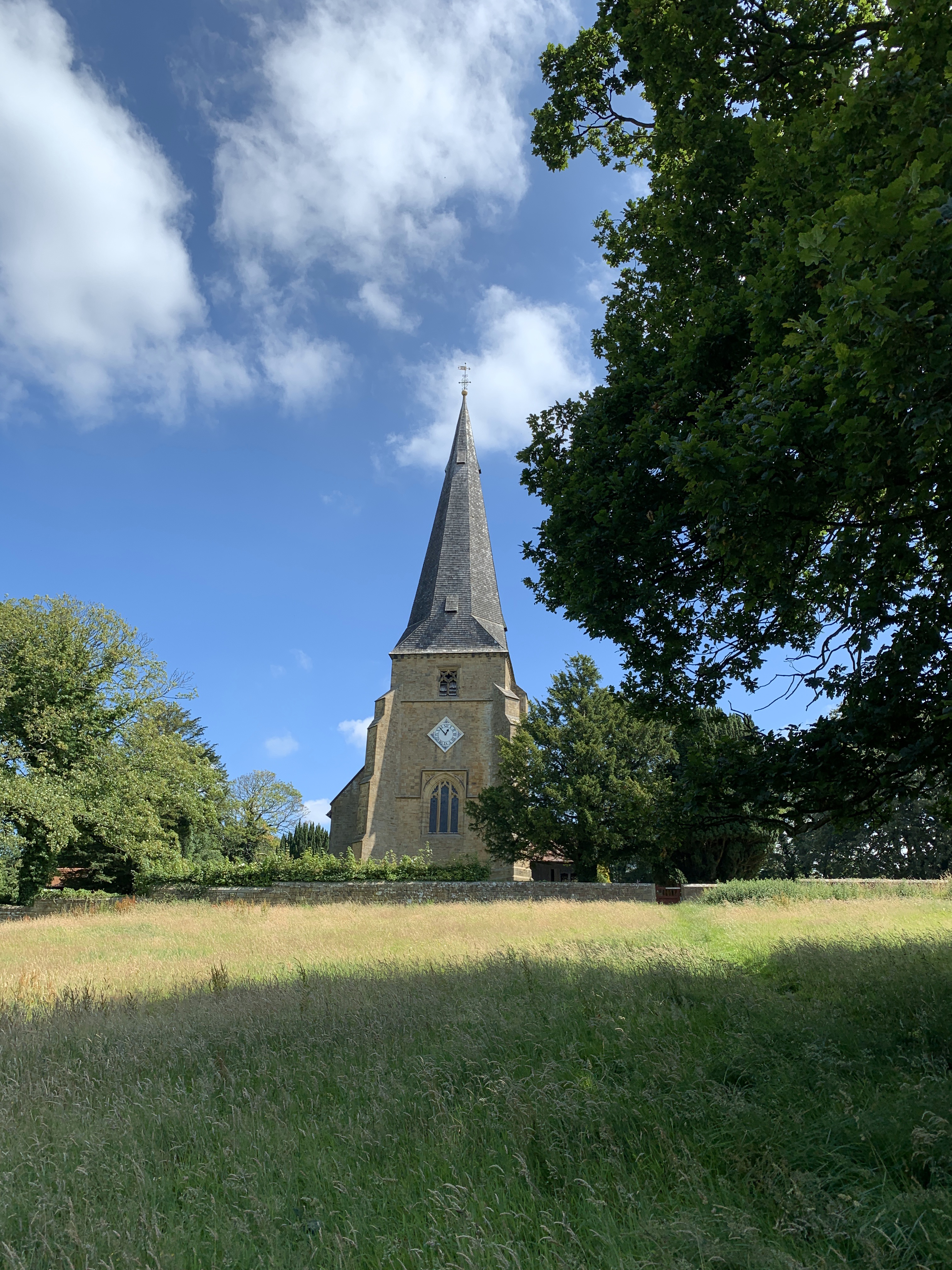
St Peter's Church, Scorton

St Peter's Church is in the village of Scorton, Lancashire, England. It is an active Anglican parish church in the deanery of Garstang, the archdeaconry...

Garstang

Garstang is an ancient market town and civil parish within the Wyre borough of Lancashire, England. It is 10 miles (16 km) north of the city of Preston...

Scorton railway station (Lancashire)

Scorton railway station served the village of Scorton, Lancashire, England, from 1840 to 1939 on the Lancaster and Preston Junction Railway. == History... ==

Scorton, Lancashire

Scorton is a small village near the River Wyre, in the Wyre district of Lancashire, England. It is located north of Garstang. The name means "farmstead...

Nearby Amenities

Located within 500m of 53.918242,-2.773636
Fuel
Houghtons Filling Station
Addr City: Preston
Addr Country: GB
Addr Suburb: Garstang
Brand: Gulf
Toilets Wheelchair: no
Wheelchair: yes
Lat/Long: 53.9144678/-2.7766313
Fuel
Redline Garage
Brand: Texaco
Brand Wikidata: Q775060
Website: https://locations.valero.com/en-gb/LocationDetails/Index/GARSTANG-BY-PASS-ROAD/0000887380
Lat/Long: 53.9142672/-2.7770113
Post Box
Operator: Royal Mail
Post Box Type: lamp
Ref: PR3 323
Lat/Long: 53.9182233/-2.7771419
Speed Camera
Maxspeed: 50 mph
Lat/Long: 53.9210712/-2.7787995
Gubberford Lane
Bus: yes
Public Transport: stop_position
Lat/Long: 53.9177502/-2.7771906
Snapewood Lane
Bus: yes
Public Transport: stop_position
Lat/Long: 53.9204894/-2.7784588
Snape Wood Lane
Bus: yes
Public Transport: stop_position
Public Transport Version: 2
Lat/Long: 53.921171/-2.7790012
Gubberford Lane
Bus: yes
Naptan AtcoCode: 250015195
Naptan Bearing: N
Naptan BusStopType: MKD
Naptan CommonName: Gubberford Lane
Naptan Indicator: opp
Naptan Landmark: Gubberford Lane
Naptan LocalityCode: E0047565
Naptan NaptanCode: lanapgpt
Naptan Street: Lancaster New Road
Naptan Verified: no
Public Transport: stop_position
Public Transport Version: 2
Ref: lanapgpt
Lat/Long: 53.9169855/-2.7770937
Bus Stop
Snapewood Lane
Bench: no
Naptan AtcoCode: 250010980
Naptan Bearing: SE
Naptan BusStopType: MKD
Naptan CommonName: Snapewood Lane
Naptan Indicator: by
Naptan Landmark: Holme Garth Farm
Naptan LocalityCode: E0047565
Naptan NaptanCode: lanadtjd
Naptan Street: Lancaster New Road
Naptan Verified: yes
Public Transport: platform
Ref: lanadtjd
Shelter: no
Lat/Long: 53.9205036/-2.7783857
Bus Stop
Snape Wood Lane
Bench: no
Naptan AtcoCode: 250014098
Naptan Bearing: N
Naptan BusStopType: MKD
Naptan CommonName: Snape Wood Lane
Naptan Indicator: by
Naptan Landmark: Snape Wood Lane
Naptan LocalityCode: E0047565
Naptan NaptanCode: lanamjdm
Naptan Street: Lancaster New Road
Naptan Verified: yes
Public Transport: platform
Ref: lanamjdm
Shelter: yes
Lat/Long: 53.9211415/-2.7790907
Bus Stop
Gubberford Lane
Bench: no
Naptan AtcoCode: 250020057
Naptan Bearing: S
Naptan BusStopType: MKD
Naptan CommonName: Gubberford Lane
Naptan Indicator: by
Naptan Landmark: Gubberford Lane/A6 (South)
Naptan LocalityCode: E0047565
Naptan NaptanCode: lanatmpw
Naptan Street: lancaster New Road
Naptan Verified: yes
Public Transport: platform
Ref: lanatmpw
Shelter: yes
Lat/Long: 53.9177497/-2.7771182
Bus Stop
Gubberford Lane
Bus: yes
Naptan AtcoCode: 250015195
Naptan Bearing: N
Naptan CommonName: Gubberford Lane
Naptan Indicator: opp
Naptan NaptanCode: lanapgpt
Naptan Street: Lancaster New Road
Public Transport: platform
Lat/Long: 53.9170158/-2.7771876
Barrier: bollard
Bicycle: yes
Foot: yes
Motor Vehicle: no
Lat/Long: 53.9143931/-2.7733558
Direction: west
Generator Method: photovoltaic
Generator Output Electricity: yes
Generator Source: solar
Generator Type: solar_photovoltaic_panel
Location: roof
Power: generator
Lat/Long: 53.9185625/-2.7737799
Direction: s
Generator Method: photovoltaic
Generator Output Electricity: yes
Generator Source: solar
Generator Type: solar_photovoltaic_panel
Location: roof
Power: generator
Lat/Long: 53.9187094/-2.7733256
Direction: s
Generator Method: photovoltaic
Generator Output Electricity: yes
Generator Source: solar
Generator Type: solar_photovoltaic_panel
Location: roof
Power: generator
Lat/Long: 53.9187053/-2.7731417
Give Way
Direction: backward
Lat/Long: 53.9182773/-2.773386
Direction: s
Generator Method: photovoltaic
Generator Output Electricity: yes
Generator Source: solar
Generator Type: solar_photovoltaic_panel
Location: roof
Power: generator
Lat/Long: 53.9184208/-2.7731783
Direction: south
Generator Method: photovoltaic
Generator Output Electricity: yes
Generator Source: solar
Generator Type: solar_photovoltaic_panel
Location: roof
Power: generator
Lat/Long: 53.9184108/-2.7726455
Direction: south
Generator Method: photovoltaic
Generator Output Electricity: yes
Generator Source: solar
Generator Type: solar_photovoltaic_panel
Location: roof
Power: generator
Lat/Long: 53.9184243/-2.772901
Direction: s
Generator Method: photovoltaic
Generator Output Electricity: yes
Generator Source: solar
Generator Type: solar_photovoltaic_panel
Location: roof
Power: generator
Lat/Long: 53.9188074/-2.7728418
The data included in this document is from www.openstreetmap.org. The data is made available under ODbL.

Have you been to Cabus?

Leave your review of Cabus below (or comments, questions and feedback).