Coed y Ffrith

Wood, Forest in Flintshire

Wales

Coed y Ffrith

A55 eastbound near Gorsedd
A55 eastbound near Gorsedd Credit: Colin Pyle

Coed y Ffrith is a picturesque woodland located in the county of Flintshire, in northeast Wales. Spanning approximately 230 acres, this enchanting forest offers visitors a serene and natural escape from the hustle and bustle of everyday life.

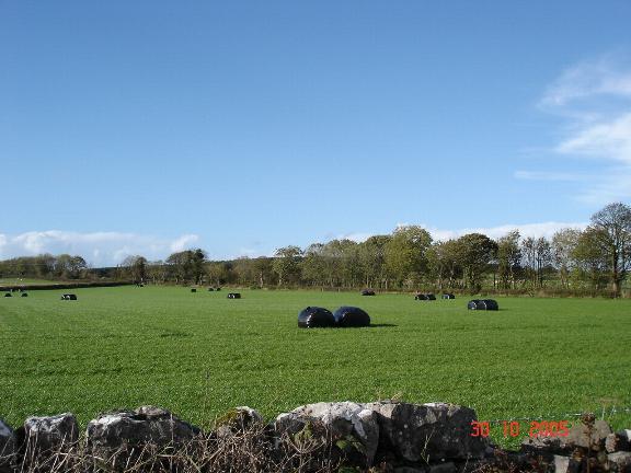
The woodland is characterized by its diverse mix of tree species, including oak, beech, birch, and pine, which create a rich and vibrant tapestry of colors throughout the seasons. The forest floor is carpeted with a variety of native flora, such as bluebells, wood anemones, and ferns, adding to its natural beauty.

Coed y Ffrith is a haven for wildlife, attracting a wide range of bird species, including woodpeckers, nuthatches, and tawny owls. Nature enthusiasts can also spot small mammals like squirrels, foxes, and badgers, as well as a plethora of insects and butterflies.

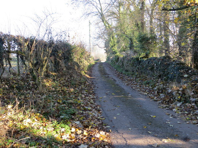
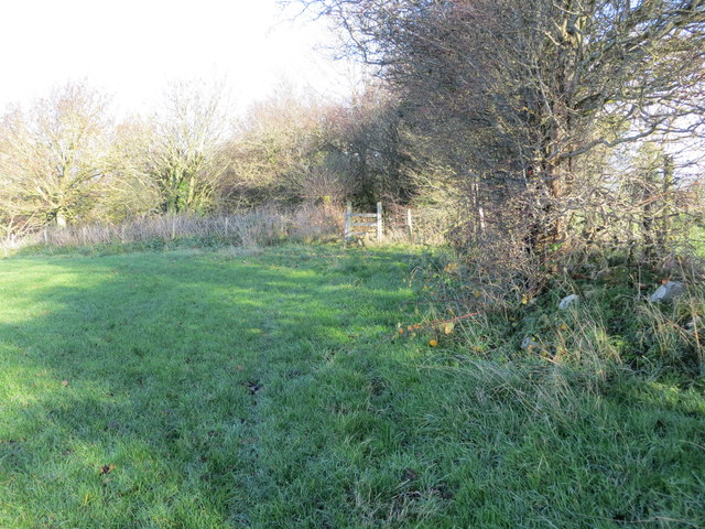
The woodland offers a network of well-maintained walking trails, which meander through the forest, allowing visitors to explore its hidden gems. These trails cater to different abilities, ranging from gentle strolls to more challenging hikes, ensuring that there is something for everyone to enjoy.

In addition to its natural wonders, Coed y Ffrith also boasts convenient facilities, including a visitor center, picnic areas, and ample parking. The visitor center provides information on the forest's history, ecology, and the various activities available.

Coed y Ffrith is not only a beautiful woodland but also an important conservation area, managed by the local authorities to protect its unique flora and fauna. It is a beloved destination for nature lovers, families, and outdoor enthusiasts, offering a tranquil and immersive experience in the heart of Flintshire.

If you have any feedback on the listing, please let us know in the comments section below.

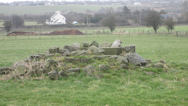
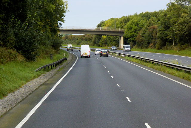
Coed y Ffrith Images

Images are sourced within 2km of 53.264323/-3.29417 or Grid Reference SJ1374. Thanks to Geograph Open Source API. All images are credited.

A55 eastbound near Gorsedd
Pant Y Wacco Welcome to Pant Y Wacco, just off the A5026 near Gorsedd.
Pant Y Wacco
Welcome to Pant Y Wacco, just off the A5026 near Gorsedd.
A55 westbound nears junction 31
A5026 at Holywell Tyres
The remains of the Holywell Racecourse Grandstand I believe that the wood and stone structure was evident until a few years ago but all that is left is a couple of piles of stones.
The remains of the Holywell Racecourse Grandstand
I believe that the wood and stone structure was evident until a few years ago but all that is left is a couple of piles of stones.
Lloc village sign on the A5026
Westbound A55 near to Gorsedd The A55, also known as the North Wales Expressway (Gwibffordd Gogledd Cymru), is the major road in North Wales running for 88 miles between Chester and Holyhead via Conwy and Bangor. 

The A55 is a very high quality road, much of it rebuilt since the 1970s in response to traffic problems in Colwyn Bay, Colwyn and Llandudno caused by traffic having to pass through town centres on totally unsuitable streets, (especially in Conwy where lorries often scraped their paintwork as they passed through 12th century arches in the town's walls), leading to the construction of an east-west expressway bypassing the urban centres. It is a dual carriageway primary route for its entire length with the exception of the point where it crosses the Britannia Bridge over the Menai Strait. All of its junctions are grade separated except for two roundabouts; one east of Penmaenmawr and one in Llanfairfechan. The road originally ran from Chester to Bangor but was extended parallel to the A5 across Anglesey right into Holyhead Docks in 2001.

<span class="nowrap"><a title="http://www.sabre-roads.org.uk/wiki/index.php?title=A55" rel="nofollow ugc noopener" href="http://www.sabre-roads.org.uk/wiki/index.php?title=A55">Link</a><img style="margin-left:2px;" alt="External link" title="External link - shift click to open in new window" src="https://s1.geograph.org.uk/img/external.png" width="10" height="10"/></span>  SABRE
Westbound A55 near to Gorsedd
The A55, also known as the North Wales Expressway (Gwibffordd Gogledd Cymru), is the major road in North Wales running for 88 miles between Chester and Holyhead via Conwy and Bangor. The A55 is a very high quality road, much of it rebuilt since the 1970s in response to traffic problems in Colwyn Bay, Colwyn and Llandudno caused by traffic having to pass through town centres on totally unsuitable streets, (especially in Conwy where lorries often scraped their paintwork as they passed through 12th century arches in the town's walls), leading to the construction of an east-west expressway bypassing the urban centres. It is a dual carriageway primary route for its entire length with the exception of the point where it crosses the Britannia Bridge over the Menai Strait. All of its junctions are grade separated except for two roundabouts; one east of Penmaenmawr and one in Llanfairfechan. The road originally ran from Chester to Bangor but was extended parallel to the A5 across Anglesey right into Holyhead Docks in 2001. LinkExternal link SABRE
North Wales Expressway near to Gorsedd The A55, also known as the North Wales Expressway (Gwibffordd Gogledd Cymru), is the major road in North Wales running for 88 miles between Chester and Holyhead via Conwy and Bangor. 

The A55 is a very high quality road, much of it rebuilt since the 1970s in response to traffic problems in Colwyn Bay, Colwyn and Llandudno caused by traffic having to pass through town centres on totally unsuitable streets, (especially in Conwy where lorries often scraped their paintwork as they passed through 12th century arches in the town's walls), leading to the construction of an east-west expressway bypassing the urban centres. It is a dual carriageway primary route for its entire length with the exception of the point where it crosses the Britannia Bridge over the Menai Strait. All of its junctions are grade separated except for two roundabouts; one east of Penmaenmawr and one in Llanfairfechan. The road originally ran from Chester to Bangor but was extended parallel to the A5 across Anglesey right into Holyhead Docks in 2001.

<span class="nowrap"><a title="http://www.sabre-roads.org.uk/wiki/index.php?title=A55" rel="nofollow ugc noopener" href="http://www.sabre-roads.org.uk/wiki/index.php?title=A55">Link</a><img style="margin-left:2px;" alt="External link" title="External link - shift click to open in new window" src="https://s1.geograph.org.uk/img/external.png" width="10" height="10"/></span>  SABRE
North Wales Expressway near to Gorsedd
The A55, also known as the North Wales Expressway (Gwibffordd Gogledd Cymru), is the major road in North Wales running for 88 miles between Chester and Holyhead via Conwy and Bangor. The A55 is a very high quality road, much of it rebuilt since the 1970s in response to traffic problems in Colwyn Bay, Colwyn and Llandudno caused by traffic having to pass through town centres on totally unsuitable streets, (especially in Conwy where lorries often scraped their paintwork as they passed through 12th century arches in the town's walls), leading to the construction of an east-west expressway bypassing the urban centres. It is a dual carriageway primary route for its entire length with the exception of the point where it crosses the Britannia Bridge over the Menai Strait. All of its junctions are grade separated except for two roundabouts; one east of Penmaenmawr and one in Llanfairfechan. The road originally ran from Chester to Bangor but was extended parallel to the A5 across Anglesey right into Holyhead Docks in 2001. LinkExternal link SABRE
North Wales Expressway, Junction 31 The A55, also known as the North Wales Expressway (Gwibffordd Gogledd Cymru), is the major road in North Wales running for 88 miles between Chester and Holyhead via Conwy and Bangor. 

The A55 is a very high quality road, much of it rebuilt since the 1970s in response to traffic problems in Colwyn Bay, Colwyn and Llandudno caused by traffic having to pass through town centres on totally unsuitable streets, (especially in Conwy where lorries often scraped their paintwork as they passed through 12th century arches in the town's walls), leading to the construction of an east-west expressway bypassing the urban centres. It is a dual carriageway primary route for its entire length with the exception of the point where it crosses the Britannia Bridge over the Menai Strait. All of its junctions are grade separated except for two roundabouts; one east of Penmaenmawr and one in Llanfairfechan. The road originally ran from Chester to Bangor but was extended parallel to the A5 across Anglesey right into Holyhead Docks in 2001.

<span class="nowrap"><a title="http://www.sabre-roads.org.uk/wiki/index.php?title=A55" rel="nofollow ugc noopener" href="http://www.sabre-roads.org.uk/wiki/index.php?title=A55">Link</a><img style="margin-left:2px;" alt="External link" title="External link - shift click to open in new window" src="https://s1.geograph.org.uk/img/external.png" width="10" height="10"/></span>  SABRE
North Wales Expressway, Junction 31
The A55, also known as the North Wales Expressway (Gwibffordd Gogledd Cymru), is the major road in North Wales running for 88 miles between Chester and Holyhead via Conwy and Bangor. The A55 is a very high quality road, much of it rebuilt since the 1970s in response to traffic problems in Colwyn Bay, Colwyn and Llandudno caused by traffic having to pass through town centres on totally unsuitable streets, (especially in Conwy where lorries often scraped their paintwork as they passed through 12th century arches in the town's walls), leading to the construction of an east-west expressway bypassing the urban centres. It is a dual carriageway primary route for its entire length with the exception of the point where it crosses the Britannia Bridge over the Menai Strait. All of its junctions are grade separated except for two roundabouts; one east of Penmaenmawr and one in Llanfairfechan. The road originally ran from Chester to Bangor but was extended parallel to the A5 across Anglesey right into Holyhead Docks in 2001. LinkExternal link SABRE
Footbridge over the North Wales Expressway near to Pen-y-Cefn
Bridge over the A55 near to Gorsedd The A55, also known as the North Wales Expressway (Gwibffordd Gogledd Cymru), is the major road in North Wales running for 88 miles between Chester and Holyhead via Conwy and Bangor. 

The A55 is a very high quality road, much of it rebuilt since the 1970s in response to traffic problems in Colwyn Bay, Colwyn and Llandudno caused by traffic having to pass through town centres on totally unsuitable streets, (especially in Conwy where lorries often scraped their paintwork as they passed through 12th century arches in the town's walls), leading to the construction of an east-west expressway bypassing the urban centres. It is a dual carriageway primary route for its entire length with the exception of the point where it crosses the Britannia Bridge over the Menai Strait. All of its junctions are grade separated except for two roundabouts; one east of Penmaenmawr and one in Llanfairfechan. The road originally ran from Chester to Bangor but was extended parallel to the A5 across Anglesey right into Holyhead Docks in 2001.

<span class="nowrap"><a title="http://www.sabre-roads.org.uk/wiki/index.php?title=A55" rel="nofollow ugc noopener" href="http://www.sabre-roads.org.uk/wiki/index.php?title=A55">Link</a><img style="margin-left:2px;" alt="External link" title="External link - shift click to open in new window" src="https://s1.geograph.org.uk/img/external.png" width="10" height="10"/></span>  SABRE
Bridge over the A55 near to Gorsedd
The A55, also known as the North Wales Expressway (Gwibffordd Gogledd Cymru), is the major road in North Wales running for 88 miles between Chester and Holyhead via Conwy and Bangor. The A55 is a very high quality road, much of it rebuilt since the 1970s in response to traffic problems in Colwyn Bay, Colwyn and Llandudno caused by traffic having to pass through town centres on totally unsuitable streets, (especially in Conwy where lorries often scraped their paintwork as they passed through 12th century arches in the town's walls), leading to the construction of an east-west expressway bypassing the urban centres. It is a dual carriageway primary route for its entire length with the exception of the point where it crosses the Britannia Bridge over the Menai Strait. All of its junctions are grade separated except for two roundabouts; one east of Penmaenmawr and one in Llanfairfechan. The road originally ran from Chester to Bangor but was extended parallel to the A5 across Anglesey right into Holyhead Docks in 2001. LinkExternal link SABRE
Y ffordd i Ffyddion / The road to Ffyddion
Cottage Farm Rather large for a Cottage!
Cottage Farm
Rather large for a Cottage!
Arwyddion ffordd yn troi / Bend in road signs
Pwll wedi  ei or-dyfu / An overgrown pond
Pwll wedi ei or-dyfu / An overgrown pond
Hollywell Road leaving Caerwys Looking north-eastward.
Hollywell Road leaving Caerwys
Looking north-eastward.
A section of hedge and tree-lined minor road near Coed y Carreg Looking eastward.
A section of hedge and tree-lined minor road near Coed y Carreg
Looking eastward.
Field edge path and stile near Bryn Glas Looking northward.
Field edge path and stile near Bryn Glas
Looking northward.
Show me another place!

Coed y Ffrith is located at Grid Ref: SJ1374 (Lat: 53.264323, Lng: -3.29417)

Unitary Authority: Flintshire

Police Authority: North Wales

What 3 Words

///headlight.luring.grudges. Near Whitford, Flintshire

Related Wikis

Lloc

Lloc is a small village in Flintshire, north Wales. It is located within the community of Whitford. It lies north of the Clwydian Range, just east of the...

Caerwys

Caerwys is a town in Flintshire, Wales. It is just under two miles from the A55 North Wales Expressway and one mile from the A541 Mold-Denbigh road. At...

Gorsedd, Flintshire

Gorsedd is a village in Flintshire, Wales, in the community of Whitford, with a population of 391 in the 2011 census. == References ==

Pantasaph

Pantasaph is a small village in Flintshire, north-east Wales, two miles south of Holywell in the community of Whitford. Its name translates into English...

Nearby Amenities

Located within 500m of 53.264323,-3.29417
Power: tower
Lat/Long: 53.2611124/-3.294023
Power: tower
Lat/Long: 53.2620609/-3.2881088
Power: pole
Lat/Long: 53.260695/-3.2921284
Power: pole
Lat/Long: 53.2612282/-3.293158
Power: pole
Lat/Long: 53.2615495/-3.2945698
Power: pole
Lat/Long: 53.2617262/-3.2952144
Power: pole
Lat/Long: 53.2620659/-3.2966295
Power: pole
Lat/Long: 53.2623791/-3.297971
Power: pole
Lat/Long: 53.2626395/-3.2990154
Power: pole
Lat/Long: 53.2629879/-3.300298
Power: pole
Lat/Long: 53.2635652/-3.3003276
Power: pole
Lat/Long: 53.2631698/-3.2988593
Power: pole
Lat/Long: 53.2628455/-3.2976645
Power: pole
Lat/Long: 53.2624228/-3.2960139
Power: pole
Lat/Long: 53.2620323/-3.2944659
Power: pole
Lat/Long: 53.2616095/-3.2928617
Power: pole
Lat/Long: 53.2613067/-3.2916219
Power: pole
Lat/Long: 53.2611604/-3.2903723
Power: pole
Lat/Long: 53.2610493/-3.2894748
Power: pole
Lat/Long: 53.2614281/-3.2904432
Power: pole
Lat/Long: 53.2615773/-3.2913309
Power: pole
Lat/Long: 53.2619342/-3.2925463
Power: pole
Lat/Long: 53.2622721/-3.294126
Power: pole
Lat/Long: 53.2626963/-3.2963269
Power: pole
Lat/Long: 53.2634335/-3.2974469
Power: pole
Lat/Long: 53.264276/-3.2986965
Power: pole
Lat/Long: 53.2648553/-3.2999779
Power: pole
Lat/Long: 53.265961/-3.3005722
Power: pole
Lat/Long: 53.2636155/-3.287001
Power: pole
Lat/Long: 53.2641789/-3.2877765
Power: pole
Lat/Long: 53.2648943/-3.2887188
Power: pole
Lat/Long: 53.265504/-3.2894394
Power: pole
Lat/Long: 53.2665152/-3.2905797
Power: pole
Lat/Long: 53.2673655/-3.2915798
Power: pole
Lat/Long: 53.2683382/-3.2912609
Leisure: horse_riding
Lat/Long: 53.2678204/-3.2906829
Power: pole
Lat/Long: 53.2609045/-3.2894688
The data included in this document is from www.openstreetmap.org. The data is made available under ODbL.

Have you been to Coed y Ffrith?

Leave your review of Coed y Ffrith below (or comments, questions and feedback).