Aber-main Wood

Wood, Forest in Radnorshire

Wales

Aber-main Wood

Cefn Cynfal A hill with arable land and a wind turbine.
Cefn Cynfal Credit: Richard Webb

Aber-main Wood is a beautiful woodland located in Radnorshire, Wales. Covering an area of approximately 200 acres, it is a prime example of a well-preserved forest ecosystem. The wood is situated near the village of Aber-main, nestled in the rolling hills of Radnorshire.

This ancient woodland boasts a diverse range of native tree species, including oak, beech, birch, and ash. The dense canopy formed by these trees creates a cool and shaded environment, perfect for a leisurely stroll or a peaceful picnic. The forest floor is adorned with a rich carpet of wildflowers, such as bluebells and wood anemones, which add to the wood's magical charm.

Aber-main Wood is home to a variety of wildlife. Birds, including woodpeckers and owls, can be spotted among the treetops, while small mammals like squirrels and rabbits scurry through the undergrowth. The wood is also a haven for insects, with butterflies and bees fluttering from flower to flower.

The wood is crisscrossed by a network of trails and footpaths, allowing visitors to explore its hidden corners and discover its natural beauty. There is also a designated picnic area, where visitors can relax and enjoy the tranquil surroundings.

Aber-main Wood is not only a haven for nature enthusiasts but also an important habitat for wildlife conservation. Its serene atmosphere and breathtaking scenery make it a popular destination for those seeking solace in nature's embrace.

If you have any feedback on the listing, please let us know in the comments section below.

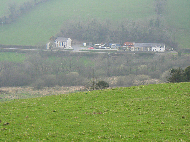
Aber-main Wood Images

Images are sourced within 2km of 52.298028/-3.2736392 or Grid Reference SO1367. Thanks to Geograph Open Source API. All images are credited.

Cefn Cynfal A hill with arable land and a wind turbine.
Cefn Cynfal
A hill with arable land and a wind turbine.
Near Pant-y-ffin A patch of ground which once had a building upon it according to older maps.
Near Pant-y-ffin
A patch of ground which once had a building upon it according to older maps.
Remote control nailed to a tree At the end of this green lane: <a href="https://www.geograph.org.uk/photo/839035">SO1368 : Green lane</a>
Remote control nailed to a tree
At the end of this green lane: SO1368 : Green lane
Green lane, Cefncynfal
Seats near Heartsease
Yellow road, Heartsease
Egg stall, Trevol road end
Black Nursery Recently felled woodland now with a good showing of young birches.
Black Nursery
Recently felled woodland now with a good showing of young birches.
Road to Lower Swydd Near Penybont, Radnorshire.
Road to Lower Swydd
Near Penybont, Radnorshire.
Penybont Common, Swydd
Dolau railway station
Old Milestone by the A488, White House, Penybont By the A488, in parish of Penybont (Powys District), White House, 250m North of lay-by, West end of bend on verge.

Inscription reads:-
KNIGHTON
12
MILES
PENYBONT
1½
Carved bench mark and rivet on top.

Grade II listed by Cadw. Reference Number: 9329
<span class="nowrap"><a title="https://cadwpublic-api.azurewebsites.net/reports/listedbuilding/FullReport?lang=&id=9329" rel="nofollow ugc noopener" href="https://cadwpublic-api.azurewebsites.net/reports/listedbuilding/FullReport?lang=&id=9329">Link</a><img style="margin-left:2px;" alt="External link" title="External link - shift click to open in new window" src="https://s1.geograph.org.uk/img/external.png" width="10" height="10"/></span>

Surveyed

Milestone Society National ID: RAD_KNPB12.
Old Milestone by the A488, White House, Penybont
By the A488, in parish of Penybont (Powys District), White House, 250m North of lay-by, West end of bend on verge. Inscription reads:- KNIGHTON 12 MILES PENYBONT 1½ Carved bench mark and rivet on top. Grade II listed by Cadw. Reference Number: 9329 LinkExternal link Surveyed Milestone Society National ID: RAD_KNPB12.
Old Milestone by the A488, Craffryn, Llanfihangel Rhydithon Parish By the A488, in parish of Llanfihangel Rhydithon (Powys District), Craffryn, West side of junction on verge.

Inscription reads:-
KNIGHTON
11
MILES
PENYBONT
2½

Grade II listed by Cadw. Reference Number: 9278
<span class="nowrap"><a title="https://cadwpublic-api.azurewebsites.net/reports/listedbuilding/FullReport?lang=&id=9278" rel="nofollow ugc noopener" href="https://cadwpublic-api.azurewebsites.net/reports/listedbuilding/FullReport?lang=&id=9278">Link</a><img style="margin-left:2px;" alt="External link" title="External link - shift click to open in new window" src="https://s1.geograph.org.uk/img/external.png" width="10" height="10"/></span>

Surveyed

Milestone Society National ID: RAD_KNPB11.
Old Milestone by the A488, Craffryn, Llanfihangel Rhydithon Parish
By the A488, in parish of Llanfihangel Rhydithon (Powys District), Craffryn, West side of junction on verge. Inscription reads:- KNIGHTON 11 MILES PENYBONT 2½ Grade II listed by Cadw. Reference Number: 9278 LinkExternal link Surveyed Milestone Society National ID: RAD_KNPB11.
Copse of trees A copse of trees on the banks of the River Aran, a tributary of the Ithon.
Copse of trees
A copse of trees on the banks of the River Aran, a tributary of the Ithon.
Tree stumps It appears that the machine has been clearing trees from a field boundary, perhaps with a view to removing the old hedge line altogether.
Tree stumps
It appears that the machine has been clearing trees from a field boundary, perhaps with a view to removing the old hedge line altogether.
Feeding racks Mobile animal feeding racks in a field near Llanfihangel Rhydithon.
Feeding racks
Mobile animal feeding racks in a field near Llanfihangel Rhydithon.
Dolau railway station Train at Dolau railway station.
Dolau railway station
Train at Dolau railway station.
Dolau House Farmhouse Farmhouse adjacent to the Dolau railway.
Dolau House Farmhouse
Farmhouse adjacent to the Dolau railway.
Show me another place!

Aber-main Wood is located at Grid Ref: SO1367 (Lat: 52.298028, Lng: -3.2736392)

Unitary Authority: Powys

Police Authority: Dyfed Powys

What 3 Words

///openings.finalists.prawn. Near Penybont, Powys

Nearby Locations

Aber-main Wood

Related Wikis

Dolau railway station

Dolau railway station is an unstaffed railway station with one platform serving the small village of Dolau in Powys, mid Wales. It is located on the Heart...

Llanddewi Ystradenny

Llanddewi Ystradenni is a community in Radnorshire, Powys, Wales. The population of the Community at the 2011 census was 310.Centred on the village of...

Llanfihangel Rhydithon

Llanfihangel Rhydithon is a community in the county of Powys, (Radnorshire) Wales, and is 56.1 miles (90.3 km) from Cardiff and 143.5 miles (231.0 km)...

Heartsease, Llanddewi Ystradenni

Heartsease is a small settlement or hamlet in the parish and community of Llanddewi Ystradenni in Powys, Wales. It should not be confused with Heartsease...

Buddugre Castle

Buddugre Castle (sometimes referred to as Tomen Bedd-Ugre, Castell Cwm Aran, Tomen Bedd Turc and Bedd-y-gre) was a motte and bailey defensive fortification...

Penybont

Penybont (also sometimes spelled Pen-y-Bont) is a small village in Radnorshire, Powys, Wales. The population of the community at the 2011 census was 428...

Pen-y-Bont railway station

Pen-y-Bont railway station is a railway station serving the village of Penybont, in mid Wales. It is situated on the Heart of Wales Line 48+1⁄2 miles...

Llandegley International Airport

Llandegley International Airport is a spoof in the region of the village of Llandegley (Welsh: Llandeglau), near Llandrindod Wells, in mid Wales. No such...

Have you been to Aber-main Wood?

Leave your review of Aber-main Wood below (or comments, questions and feedback).