Allt yr Esgair

Wood, Forest in Brecknockshire

Wales

Allt yr Esgair

Allt yr Esgair Near the summit of this elongated sandstone hill above Llangorse. A ruined stone wall encloses land later planted with conifers by the Forestry Commission. Looking southeast down the ridge.
Allt yr Esgair Credit: Richard Webb

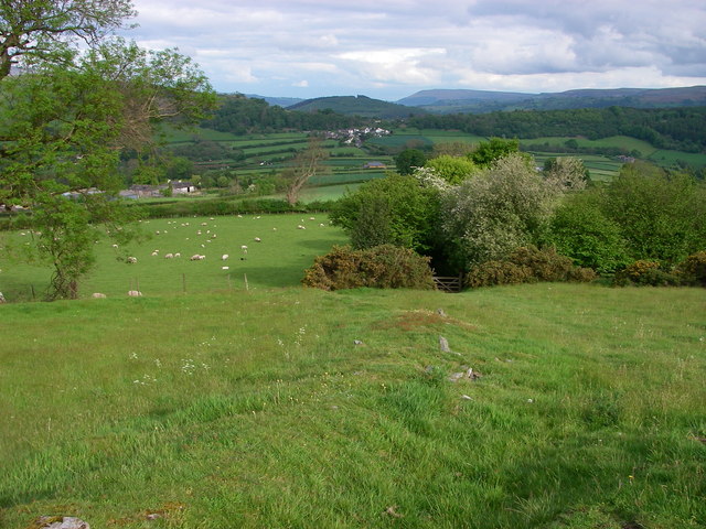
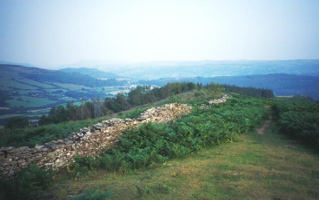
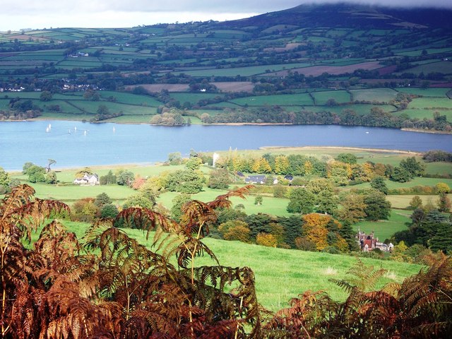
Allt yr Esgair is a picturesque wood located in Brecknockshire, Wales. Situated within the Brecon Beacons National Park, this forested area spans approximately 200 acres and offers a tranquil retreat for nature lovers and outdoor enthusiasts alike.

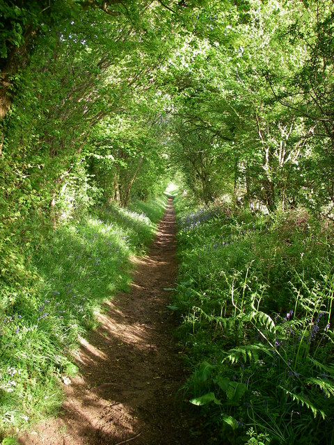
The woodland is characterized by its diverse range of trees, including oak, beech, and ash, creating a rich and varied ecosystem. The forest floor is adorned with an array of wildflowers, mosses, and ferns, adding to the natural beauty of the surroundings.

Visitors to Allt yr Esgair can explore the forest through a network of well-maintained footpaths and trails, which cater to different levels of difficulty and length. These paths lead through the heart of the woodland, providing opportunities to spot an array of wildlife such as deer, squirrels, and a variety of bird species.

The wood is also home to a small stream that meanders through the trees, adding to the tranquility of the area. The babbling brook provides a peaceful backdrop for picnics and leisurely walks.

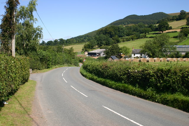
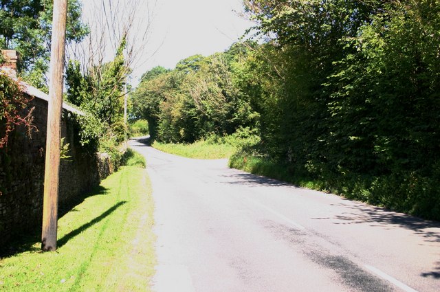
In addition to its natural attractions, Allt yr Esgair offers various amenities for visitors. There are picnic areas with benches and tables, allowing visitors to enjoy a packed lunch amidst the beautiful surroundings. Additionally, there is ample car parking available, making it easily accessible for day trips.

Allt yr Esgair is a haven for nature enthusiasts, providing a peaceful retreat and a chance to reconnect with the natural world. Whether it's a leisurely stroll through the trees or a more adventurous hike, this woodland offers something for everyone.

If you have any feedback on the listing, please let us know in the comments section below.

Allt yr Esgair Images

Images are sourced within 2km of 51.911885/-3.2689628 or Grid Reference SO1224. Thanks to Geograph Open Source API. All images are credited.

Allt yr Esgair Near the summit of this elongated sandstone hill above Llangorse. A ruined stone wall encloses land later planted with conifers by the Forestry Commission. Looking southeast down the ridge.
Allt yr Esgair
Near the summit of this elongated sandstone hill above Llangorse. A ruined stone wall encloses land later planted with conifers by the Forestry Commission. Looking southeast down the ridge.
Church of St Bridget Church of St Bridget, Llansantffraed. A victorian re-build of an earlier church to the south east of Brecon on the A40.
Church of St Bridget
Church of St Bridget, Llansantffraed. A victorian re-build of an earlier church to the south east of Brecon on the A40.
Llangasty Tal-y-Llyn Church Llangasty Tal-y-Llyn Church. South of Llangorse lake. 19C re-build. The base of the tower is thought to be medieval.
Llangasty Tal-y-Llyn Church
Llangasty Tal-y-Llyn Church. South of Llangorse lake. 19C re-build. The base of the tower is thought to be medieval.
Tow path and canal between Pencelli and Talybont Upon Usk This part of the tow path is also a section of the Taff cycle trail.
Tow path and canal between Pencelli and Talybont Upon Usk
This part of the tow path is also a section of the Taff cycle trail.
Llangors Lake - south end As viewed from Cathedine.  The church at Llangasty Talyllyn is to the right and the peaks of Pen y Fan and Corn Du are clearly visible to the right
Llangors Lake - south end
As viewed from Cathedine. The church at Llangasty Talyllyn is to the right and the peaks of Pen y Fan and Corn Du are clearly visible to the right
Former culvert/ cattle creep
Former railway line The former Brecon & Merthyr Railway line between Talybont-on-Usk and Brecon.
Former railway line
The former Brecon & Merthyr Railway line between Talybont-on-Usk and Brecon.
Newton Farm Between the A40 and the former railway line.
Newton Farm
Between the A40 and the former railway line.
Debris from the flooding Usk The Afon Wysg/River usk rises and falls rapidly in response to heavy rain.  This field beside the A40 Abergavenny/Brecon road is littered with debris from earlier in the day when the swollen river extended across the full width of its floodplain.  The Romans avoided flooding problems by building their road over the top of the hill known as Yr Allt in the background.
Debris from the flooding Usk
The Afon Wysg/River usk rises and falls rapidly in response to heavy rain. This field beside the A40 Abergavenny/Brecon road is littered with debris from earlier in the day when the swollen river extended across the full width of its floodplain. The Romans avoided flooding problems by building their road over the top of the hill known as Yr Allt in the background.
Roman Road A modern-day bridleway follows the course of the former Roman Road leading down from Allt yr Esgair towards the village of Bwlch in the distance.
Roman Road
A modern-day bridleway follows the course of the former Roman Road leading down from Allt yr Esgair towards the village of Bwlch in the distance.
Roman Road The straight line of the Roman Road is followed by this green track (bridleway) heading from Allt yr Esgair towards the col at Bwlch.
Roman Road
The straight line of the Roman Road is followed by this green track (bridleway) heading from Allt yr Esgair towards the col at Bwlch.
Reservoir on Allt-yr-Esgair overlooking Usk valley
Paragon Tower ruins Believed to be a folly or hunting lodge
Paragon Tower ruins
Believed to be a folly or hunting lodge
The B4560 approaches Nant-y-felin B4560 approaches Nant-y-felin towards Llangorse
The B4560 approaches Nant-y-felin
B4560 approaches Nant-y-felin towards Llangorse
The B4560 passes Pendre The B4560 passes Pendre towards Llangorse
The B4560 passes Pendre
The B4560 passes Pendre towards Llangorse
Road junction by Point cottage (for sale) Road junction to Cathedine by Point cottage (for sale)
Road junction by Point cottage (for sale)
Road junction to Cathedine by Point cottage (for sale)
Neuadd farm Neuadd farm on the road to Pennorth
Neuadd farm
Neuadd farm on the road to Pennorth
The summit of Allt yr Esgair The summit of Allt yr Esgair with panorama board
The summit of Allt yr Esgair
The summit of Allt yr Esgair with panorama board
Show me another place!

Allt yr Esgair is located at Grid Ref: SO1224 (Lat: 51.911885, Lng: -3.2689628)

Unitary Authority: Powys

Police Authority: Dyfed Powys

What 3 Words

///investor.manuals.punctuate. Near Llangynidr, Powys

Related Wikis

Allt yr Esgair

Allt yr Esgair is a hill in the Brecon Beacons National Park in Powys, Wales. It is commonly referred to locally as simply 'The Allt'. The Welsh name signifies...

Treberfydd

Treberfydd House is a Gothic Revival house, built in 1847–50 just south of Llangorse Lake in the Brecon Beacons National Park in South Wales, to the designs...

Llansantffraed

Llansantffraed (Llansantffraed-juxta-Usk) is a parish in the community of Talybont-on-Usk in Powys, Wales, near Brecon. The benefice of Llansantffraed...

Newton, Brecknockshire

Newton (Welsh name Trenewydd) is a hamlet located between the market town of Brecon and the village of Llansantffraed, mid Wales, on the A40 road. It was...

Nearby Amenities

Located within 500m of 51.911885,-3.2689628
Allt yr Esgair
Direction: both
Tourism: viewpoint
Lat/Long: 51.9108638/-3.2717988
Allt yr Esgair
Alt Name: The Allt
Ele: 393
Natural: peak
Wikidata: Q4733313
Wikipedia: en:Allt yr Esgair
Lat/Long: 51.9120007/-3.2725226
Paragon Tower
Historic: archaeological_site
Lat/Long: 51.9135781/-3.2756018
The data included in this document is from www.openstreetmap.org. The data is made available under ODbL.

Have you been to Allt yr Esgair?

Leave your review of Allt yr Esgair below (or comments, questions and feedback).