Dôl-y-dre-Wood

Wood, Forest in Radnorshire

Wales

Dôl-y-dre-Wood

Yew tree at St. David's church (Llanddewi Ystradenni)
Yew tree at St. David's church (Llanddewi Ystradenni) Credit: Fabian Musto

Dôl-y-dre Wood is a picturesque forest located in the county of Radnorshire, Wales. Known for its natural beauty and diverse wildlife, this woodland is a popular destination for nature enthusiasts and outdoor adventurers alike.

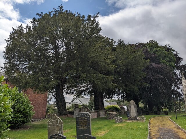
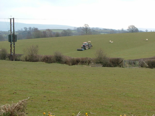
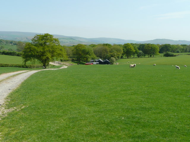
Covering an area of approximately 200 acres, Dôl-y-dre Wood is characterized by its dense canopy of ancient oak and beech trees, which create a tranquil and enchanting atmosphere. The forest is situated on the southern slopes of the Radnor Forest, offering stunning views of the surrounding countryside.

Visitors to Dôl-y-dre Wood can explore a network of well-maintained trails that wind through the forest, providing opportunities for leisurely walks, jogging, or cycling. The paths are lined with a variety of wildflowers and ferns, adding to the area's natural charm.

The woodland is home to a wide range of wildlife, including red kites, buzzards, and woodpeckers, making it a haven for birdwatchers. Additionally, squirrels, deer, and other small mammals can often be spotted darting between the trees.

For those interested in the history of the area, Dôl-y-dre Wood is also home to the remains of an Iron Age hillfort, known as Castle Bank. Archaeological excavations have revealed evidence of human activity dating back thousands of years, adding an extra layer of intrigue to this ancient woodland.

Overall, Dôl-y-dre Wood offers visitors a chance to immerse themselves in the natural beauty of Radnorshire, providing a peaceful retreat from the hustle and bustle of modern life.

If you have any feedback on the listing, please let us know in the comments section below.

Dôl-y-dre-Wood Images

Images are sourced within 2km of 52.301065/-3.3091878 or Grid Reference SO1067. Thanks to Geograph Open Source API. All images are credited.

Yew tree at St. David's church (Llanddewi Ystradenni)
The Walsh (Llanddewi Ystradenni) Opposite St. David parish church is a former coaching inn, known as the Walsh.
The Walsh (Llanddewi Ystradenni)
Opposite St. David parish church is a former coaching inn, known as the Walsh.
War memorial at St. David's church (Llanddewi Ystradenni) This is situated east of the parish church.
War memorial at St. David's church (Llanddewi Ystradenni)
This is situated east of the parish church.
Trees at St. David's church (Llanddewi Ystradenni) These trees are situated south from the parish church, and I think the two trees closest to the camera are yew trees.
Trees at St. David's church (Llanddewi Ystradenni)
These trees are situated south from the parish church, and I think the two trees closest to the camera are yew trees.
St. David's church (Llanddewi Ystradenni) The parish church at Llanddewi Ystradenni was built on the site of a medieval church in 1890, and the late-medieval font and monuments from the old church are present in the Victorian building. This was grade II listed in November 2004.
St. David's church (Llanddewi Ystradenni)
The parish church at Llanddewi Ystradenni was built on the site of a medieval church in 1890, and the late-medieval font and monuments from the old church are present in the Victorian building. This was grade II listed in November 2004.
Sundial at St. David's church (Llanddewi Ystradenni) The sundial is framed by the south porch and west bellcote in this viewpoint, the former of which is northwest from the sundial.
Sundial at St. David's church (Llanddewi Ystradenni)
The sundial is framed by the south porch and west bellcote in this viewpoint, the former of which is northwest from the sundial.
St. David's church (Llanddewi Ystradenni) The parish church at Llanddewi Ystradenni was built on the site of a medieval church in 1890, and the late-medieval font and monuments from the old church are present in the Victorian building. This was grade II listed in November 2004.
St. David's church (Llanddewi Ystradenni)
The parish church at Llanddewi Ystradenni was built on the site of a medieval church in 1890, and the late-medieval font and monuments from the old church are present in the Victorian building. This was grade II listed in November 2004.
War memorial at St. David's church (Llanddewi Ystradenni) The stone building in the distance (centre) is Llanddewi Hall, which is grade II* listed.
War memorial at St. David's church (Llanddewi Ystradenni)
The stone building in the distance (centre) is Llanddewi Hall, which is grade II* listed.
Rolling the land near Sunnybank
New pond or Quarry
New pond or Quarry
Mid-Wales pasture land Sheep on an unnamed farm near Crossgates have a fine view east towards the Radnor Hills.
Mid-Wales pasture land
Sheep on an unnamed farm near Crossgates have a fine view east towards the Radnor Hills.
Wood at Cefn-penarth View east over sheep pasture.
Wood at Cefn-penarth
View east over sheep pasture.
Lane to Castle Mount
A Llandewi Yew A rare instance of a Churchyard that is carefully managing its yew Trees and a pleasure to see. A lovely little Church as well.
A Llandewi Yew
A rare instance of a Churchyard that is carefully managing its yew Trees and a pleasure to see. A lovely little Church as well.
Road junction Junction with the road leading from Llanddewi to Heartsease.
Road junction
Junction with the road leading from Llanddewi to Heartsease.
Old Milestone by the A483, Dol-wen Wood, Llandewi Ystradenny Milestone by the A483, in parish of Llanddewi Ystradenni (Powys District), Dol-wen Wood, on verge against woods. Broken.

Inscription reads:-
BUILTH
14
MILES
NEWTOWN
20

Grade II listed by Cadw.
Reference Number: 83361 <span class="nowrap"><a title="https://cadwpublic-api.azurewebsites.net/reports/listedbuilding/FullReport?lang=&id=83361" rel="nofollow ugc noopener" href="https://cadwpublic-api.azurewebsites.net/reports/listedbuilding/FullReport?lang=&id=83361">Link</a><img style="margin-left:2px;" alt="External link" title="External link - shift click to open in new window" src="https://s1.geograph.org.uk/img/external.png" width="10" height="10"/></span>

Surveyed

Milestone Society National ID: RAD_NTBU20
Old Milestone by the A483, Dol-wen Wood, Llandewi Ystradenny
Milestone by the A483, in parish of Llanddewi Ystradenni (Powys District), Dol-wen Wood, on verge against woods. Broken. Inscription reads:- BUILTH 14 MILES NEWTOWN 20 Grade II listed by Cadw. Reference Number: 83361 LinkExternal link Surveyed Milestone Society National ID: RAD_NTBU20
Old Milestone by the A483, Llanddewi Bridge Milestone by the A483, in parish of Llandewi Ystradenny (Powys District), Llanddewi, 100m South Llanddewi Bridge opposite The Retreat, on verge.

Inscription once read:-
BUILTH
13
MILES
NEWTOWN
21

Grade II listed by Cadw.
Reference Number: 83359 <span class="nowrap"><a title="https://cadwpublic-api.azurewebsites.net/reports/listedbuilding/FullReport?lang=&id=83359" rel="nofollow ugc noopener" href="https://cadwpublic-api.azurewebsites.net/reports/listedbuilding/FullReport?lang=&id=83359">Link</a><img style="margin-left:2px;" alt="External link" title="External link - shift click to open in new window" src="https://s1.geograph.org.uk/img/external.png" width="10" height="10"/></span>

Surveyed

Milestone Society National ID: RAD_NTBU21
Old Milestone by the A483, Llanddewi Bridge
Milestone by the A483, in parish of Llandewi Ystradenny (Powys District), Llanddewi, 100m South Llanddewi Bridge opposite The Retreat, on verge. Inscription once read:- BUILTH 13 MILES NEWTOWN 21 Grade II listed by Cadw. Reference Number: 83359 LinkExternal link Surveyed Milestone Society National ID: RAD_NTBU21
Ordnance Survey 1GL Bolt This OS Bolt can be found on the east face of St David's Church. It marks a point 236.980m above mean sea level.
Ordnance Survey 1GL Bolt
This OS Bolt can be found on the east face of St David's Church. It marks a point 236.980m above mean sea level.
Show me another place!

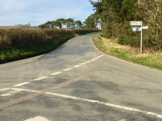
Dôl-y-dre-Wood is located at Grid Ref: SO1067 (Lat: 52.301065, Lng: -3.3091878)

Unitary Authority: Powys

Police Authority: Dyfed Powys

What 3 Words

///towels.rationing.announced. Near Penybont, Powys

Related Wikis

Llanddewi Ystradenny

Llanddewi Ystradenni is a community in Radnorshire, Powys, Wales. The population of the Community at the 2011 census was 310.Centred on the village of...

Buddugre Castle

Buddugre Castle (sometimes referred to as Tomen Bedd-Ugre, Castell Cwm Aran, Tomen Bedd Turc and Bedd-y-gre) was a motte and bailey defensive fortification...

Fron, Powys

Fron (Welsh: Y Groes) is a small village in Powys, Wales, within the community of Llanbadarn Fawr. Fron lies northeast of Llandrindod Wells and east of...

Pen-y-Bont railway station

Pen-y-Bont railway station is a railway station serving the village of Penybont, in mid Wales. It is situated on the Heart of Wales Line 48+1⁄2 miles...

Dolau railway station

Dolau railway station is an unstaffed railway station with one platform serving the small village of Dolau in Powys, mid Wales. It is located on the Heart...

Llandegley International Airport

Llandegley International Airport is a spoof in the region of the village of Llandegley (Welsh: Llandeglau), near Llandrindod Wells, in mid Wales. No such...

Heartsease, Llanddewi Ystradenni

Heartsease is a small settlement or hamlet in the parish and community of Llanddewi Ystradenni in Powys, Wales. It should not be confused with Heartsease...

Rhwng Gwy a Hafren

Rhwng Gwy a Hafren (English: Between Wye and Severn) was a region of medieval Wales, located in the Welsh Marches between Powys to the north and Brycheiniog...

Nearby Amenities

Located within 500m of 52.301065,-3.3091878
Place: farm
Lat/Long: 52.3011724/-3.3120512
Place: farm
Lat/Long: 52.2974982/-3.3105277
The data included in this document is from www.openstreetmap.org. The data is made available under ODbL.

Have you been to Dôl-y-dre-Wood?

Leave your review of Dôl-y-dre-Wood below (or comments, questions and feedback).